

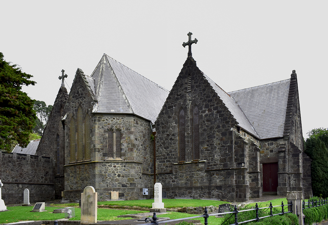
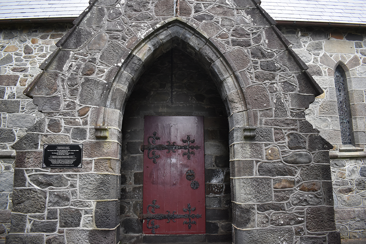
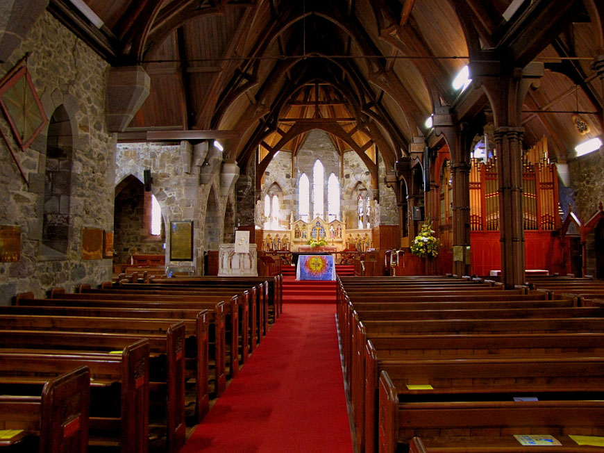
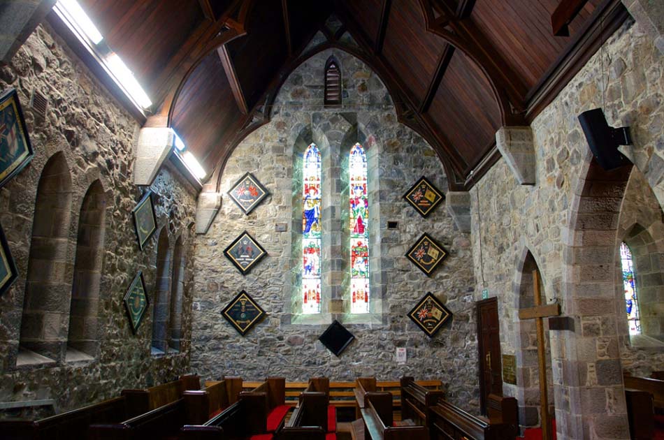
This historic place was registered under the Historic Places Act 1980. The following text is the original citation considered by the NZHPT Board at the time of registration. With the original portion built between 1845 and 1846, St Mary's is one of the earliest stone churches in New Zealand. Although it has been very considerably enlarged and modified, the various sections blend into a harmonious whole. The original church was a simple design by Frederick Thatcher, approximately 15m by 9m, with an open Rimu roof. The steeply pitched roof, lanced windows, plain rubble walls and exposed timber beams reflect Selwyn's principals of Gothic Revival architecture. Between 1859 and 1862 the nave was lengthened and a porch added. Two years later an aisle, designed by George Robinson, the chief builder of the original part of the church, was added. In 1893 further enlargements were made to the chancel, sanctuary, apse and organ chamber by Benjamin Mountfort, a leading ecclesiastical architect. Finally, in 1915 All Saints side chapel was added and the northern transept enlarged. The adjoining cemetery contains the graves of William Bolland, who opened the church, the Rev Henry Govett the second vicar, Captain H King, a prominent early settler and other notable historic figures. St Mary's Church is a fine building in an attractive setting of mature trees and spacious grounds making a noteworthy contribution to the city's townscape.
Location
List Entry Information
Overview
Detailed List Entry
Status
Listed
List Entry Status
Historic Place Category 1
Access
Able to Visit
List Number
148
Date Entered
6th June 1984
Date of Effect
6th June 1984
City/District Council
New Plymouth District
Region
Taranaki Region
Extent of List Entry
Extent includes the land described as Lot 1 DP 10494 and the balance of land bounded by Vivian, Brougham, Fulford and Robe Streets shown on the plan of part of the Town of New Plymouth lodged in the office of the Chief Surveyor as SO 7745 after excluding therefrom Lot 1 on DP 8706 (RT TNC2/698), Taranaki Land District, and the building known as Taranaki Cathedral Church of St Mary (Anglican) thereon, and the surrounding grounds including graveyard and mature trees, as shown in the extent map tabled at the Rarangi Korero Committee meeting on 29 September 2016.
Legal description
Lot 1 DP 10494 and the balance of land bounded by Vivian, Brougham, Fulford and Robe Streets shown on the plan of part of the Town of New Plymouth lodged in the office of the Chief Surveyor as SO 7745 after excluding therefrom Lot 1 on DP 8706 (RT TNC2/698), Taranaki Land District.
Location Description
St Mary's Church (Anglican) is located on a parcel of land to the south of the commercial centre of New Plymouth. The site is bounded by Vivian Street to the north, Brougham Street to the east and Robe Street to the west. To the south of the church are the northern slopes of Pukaka or Marsland Hill.The church is located approximately half way along the Vivian Street boundary with the north transept coming to within 2.3 metres of the fence line. The church is surrounded by a churchyard which contains a number of significant trees and historic gravesites.
Stay up to date with Heritage this month
