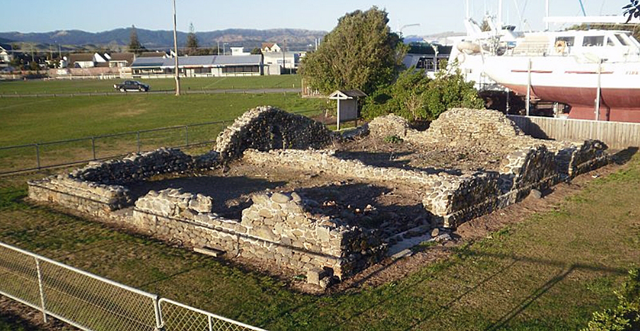
The Paremata Barracks was once part of a large fortification established in 1846 to house Imperial troops. The fortification was built as part of Governor George Grey's campaign to quell remaining Maori resistance to New Zealand Company immigrants taking up lands in the Wellington area. It is one of only a few structures remaining in the Wellington region dating to Imperial military activities of the 1840s.
In 1839 the New Zealand Company undertook to acquire large areas of land in the lower North Island and top of the South Island, including Porirua. Although a number of leading chiefs signed these deeds many, such as the two Ngati Toa leaders Te Rauparaha and Te Rangihaeata, were unaware of their intent or consequence. Others were unaware that their land had been included in such deeds. In 1840 the newly formed Colonial Government promised that all claims to land acquired before the signing of the Treaty of Waitangi, including those of the New Zealand Company, would be investigated. In Wellington, the Land Claims Commissioner, William Spain, took several years to carry out his investigations. In the meantime surveyors, disregarding protests from Maori, marked out new boundaries for settlement, and members of the increasing settler population were permitted to 'squat' on disputed lands. In Porirua, Te Rangihaeatea threw settlers of the land he believed they were not entitled to, and disrupted the construction of the Porirua Road. At Wairau, in 1843, New Zealand Company surveyors came into conflict with Ngati Toa, with disastrous results.
Although the investigations eventually found that many of the New Zealand Company claims to land were invalid, Spain could do little more than offer compensation to Maori and ask that they leave their land. Angry at the outcome, a number of Maori, particularly in the Hutt Valley, continued to cultivate their lands, and eventually came into conflict with local settlers. Their actions were supported by Te Rangihaeatea. Settlers, fearing attack, formed militia and constructed fortifications, and were later joined by imperial troops. The situation was brought to a head in 1846 when the newly appointed Governor, George Grey, arrived in Wellington armed with fresh troops and money. Grey embarked on a new strategy, part of which was the construction of a barracks at Paremata.
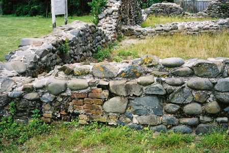
Located at the head of the Porirua Harbour, the site of the proposed barracks occupied a strategic position, cutting off a route of escape from the Hutt Valley, while at the same time defend the 'back' entry into Wellington from Porirua Harbour. In April 1846 Grey sent troops to occupy the site ahead of its construction. The new barracks were designed by T. H. Fitzgerald, a surveyor who had also been responsible for the design of Fort Richmond, in the Hutt Valley. The largely double-storey stone structure was built by James Wilson. Construction was slow, hindered by a lack of labour and tools. Shells from the nearby beach were used to provide the lime for the mortar. Unfortunately it appears that the process by which the mortar was made was hurried and provided an imperfect result with predictably detrimental consequences.
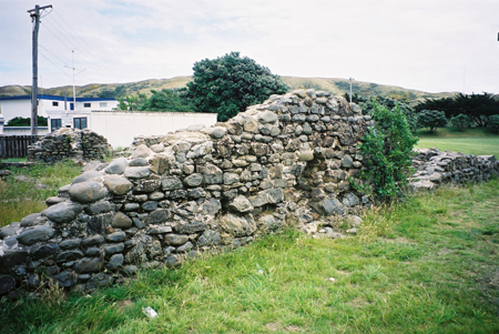
By the time the barracks were completed in August 1847, the fighting in the Hutt Valley and surrounding areas had all but ended. However troops from the 65th remained at stationed at the barracks. In October 1848 a series of earthquakes damaged the structure to the extent that the building had to be abandoned, except for use as a powder magazine. In 1851 troops left the area and in June 1852 the Ordnance Department officially handed over to the civilian authorities. In January 1855 another series of earthquakes further damaged the building. The area was eventually turned into farmland, and the barracks became used for farm buildings. By the 1950s the barracks were all but a ruin. To help protect the site, the National Historic Places Trust built a fence around the building. This fence was removed in 1980. By 1983, as a result of further vandalism, the Ministry of Works and the Historic Places Trust undertook to stabilise the site. The Porirua City Council now manages the ruins as part of a recreation reserve.
Although today reduced to little more than foundations, Paremata Barracks is an important, discernible link with the earliest years of organised Pakeha settlement in Wellington, and its somewhat turbulent relationship with local Maori. The remains are also an important archaeological site and offer the potential to investigate human activity in the area in the 1840s and earlier. They are also the only remains of a series of fortifications constructed in the 1840s for occupation by Imperial troops.
In 1839 the New Zealand Company undertook to acquire large areas of land in the lower North Island and top of the South Island, including Porirua. Although a number of leading chiefs signed these deeds many, such as the two Ngati Toa leaders Te Rauparaha and Te Rangihaeata, were unaware of their intent or consequence. Others were unaware that their land had been included in such deeds. In 1840 the newly formed Colonial Government promised that all claims to land acquired before the signing of the Treaty of Waitangi, including those of the New Zealand Company, would be investigated. In Wellington, the Land Claims Commissioner, William Spain, took several years to carry out his investigations. In the meantime surveyors, disregarding protests from Maori, marked out new boundaries for settlement, and members of the increasing settler population were permitted to 'squat' on disputed lands. In Porirua, Te Rangihaeatea threw settlers of the land he believed they were not entitled to, and disrupted the construction of the Porirua Road. At Wairau, in 1843, New Zealand Company surveyors came into conflict with Ngati Toa, with disastrous results.
Although the investigations eventually found that many of the New Zealand Company claims to land were invalid, Spain could do little more than offer compensation to Maori and ask that they leave their land. Angry at the outcome, a number of Maori, particularly in the Hutt Valley, continued to cultivate their lands, and eventually came into conflict with local settlers. Their actions were supported by Te Rangihaeatea. Settlers, fearing attack, formed militia and constructed fortifications, and were later joined by imperial troops. The situation was brought to a head in 1846 when the newly appointed Governor, George Grey, arrived in Wellington armed with fresh troops and money. Grey embarked on a new strategy, part of which was the construction of a barracks at Paremata.
Located at the head of the Porirua Harbour, the site of the proposed barracks occupied a strategic position, cutting off a route of escape from the Hutt Valley, while at the same time defend the 'back' entry into Wellington from Porirua Harbour. In April 1846 Grey sent troops to occupy the site ahead of its construction. The new barracks were designed by T. H. Fitzgerald, a surveyor who had also been responsible for the design of Fort Richmond, in the Hutt Valley. The largely double-storey stone structure was built by James Wilson. Construction was slow, hindered by a lack of labour and tools. Shells from the nearby beach were used to provide the lime for the mortar. Unfortunately it appears that the process by which the mortar was made was hurried and provided an imperfect result with predictably detrimental consequences.
By the time the barracks were completed in August 1847, the fighting in the Hutt Valley and surrounding areas had all but ended. However troops from the 65th remained at stationed at the barracks. In October 1848 a series of earthquakes damaged the structure to the extent that the building had to be abandoned, except for use as a powder magazine. In 1851 troops left the area and in June 1852 the Ordnance Department officially handed over to the civilian authorities. In January 1855 another series of earthquakes further damaged the building. The area was eventually turned into farmland, and the barracks became used for farm buildings. By the 1950s the barracks were all but a ruin. To help protect the site, the National Historic Places Trust built a fence around the building. This fence was removed in 1980. By 1983, as a result of further vandalism, the Ministry of Works and the Historic Places Trust undertook to stabilise the site. The Porirua City Council now manages the ruins as part of a recreation reserve.
Although today reduced to little more than foundations, Paremata Barracks is an important, discernible link with the earliest years of organised Pakeha settlement in Wellington, and its somewhat turbulent relationship with local Maori. The remains are also an important archaeological site and offer the potential to investigate human activity in the area in the 1840s and earlier. They are also the only remains of a series of fortifications constructed in the 1840s for occupation by Imperial troops.