

Iwi history and archaeological evidence show Māori occupation in the Ōtākou / Otago region since the 12th century. Today, Kāi Tahu mana whenua is recognised over a large part of Te Wai Pounamu. Kāti Māmoe and Waitaha shared occupation are always acknowledged. The hapū Kai Te Pahi, Kāti Moki, and Kāti Taoka still maintain their presence and responsibility as kaitiaki in this region. Traditional Māori place names include Ōwheo (the Water of Leith), a river that runs directly in front of the Clock Tower building and though campus, would have facilitated travel by waka from the coast to places further inland and the mouth of Ōwheo, known as Te Tutai o Te Matauira, was likely a valuable settlement area for accessing kaimoana and other resources. Roberts (1909) states that Ōwheo, the name of a Kāti Māmoe chief, resided on the bank of the river where Howe Street joins Leith Street.
The Otago Provincial Council established New Zealand’s first university in 1869. By 1877 the University had outgrown that space and requested the government for use of the northern half of the land assigned for botanical gardens which was granted.
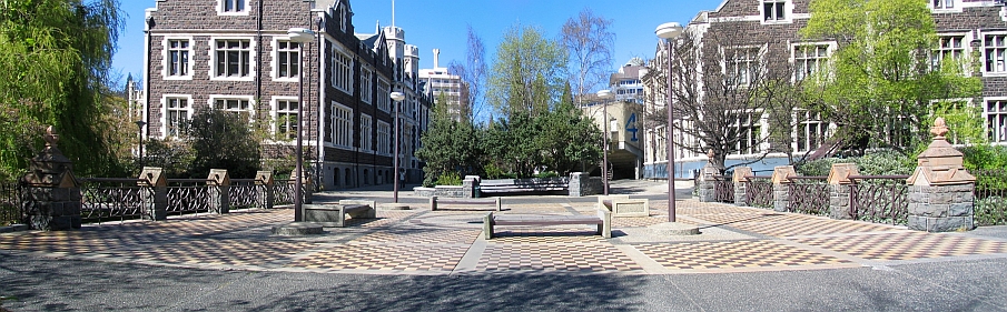
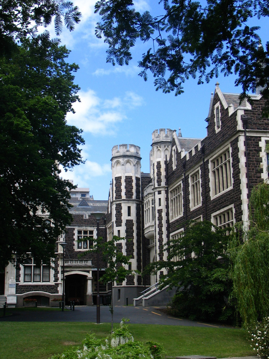
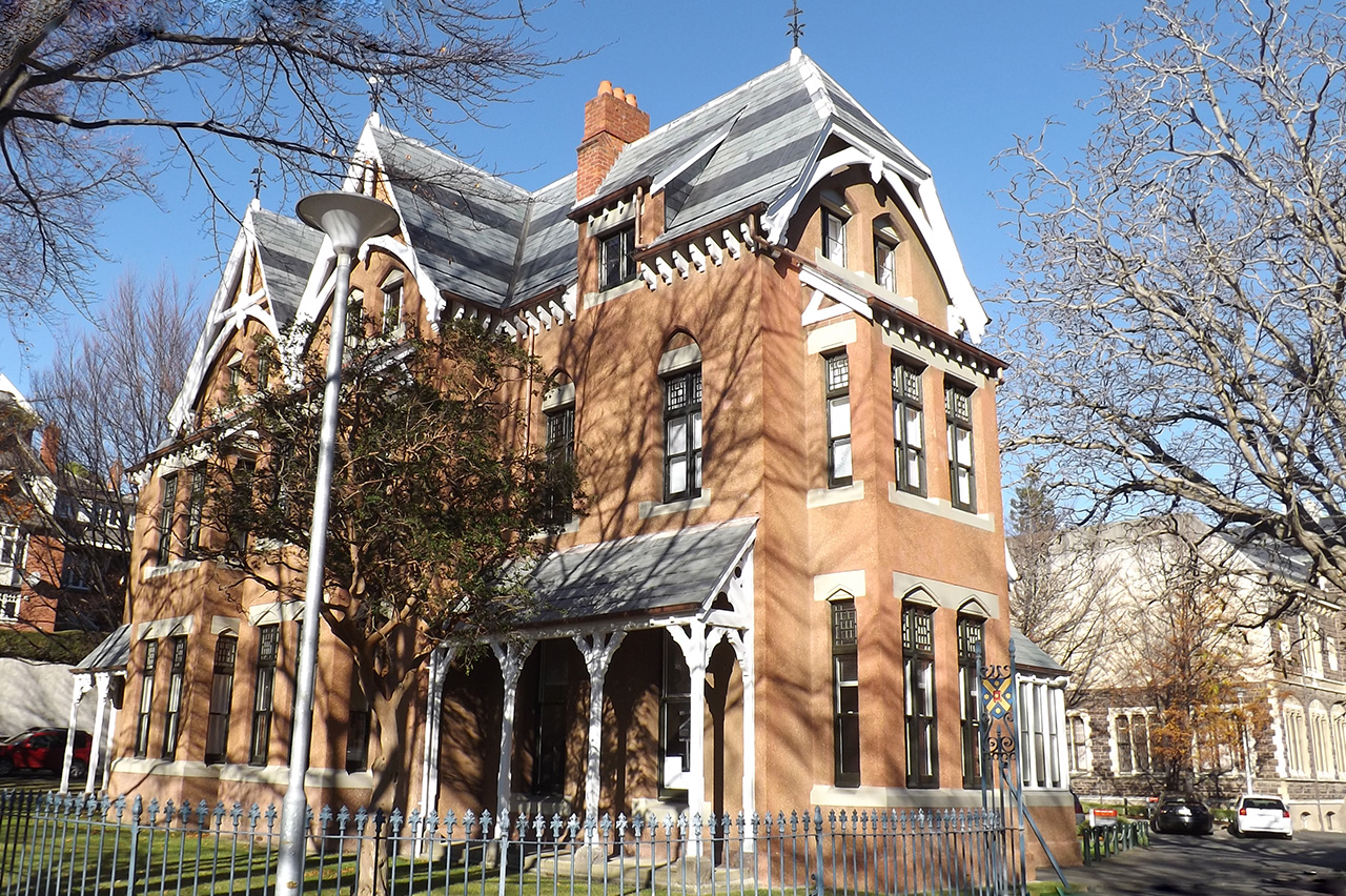
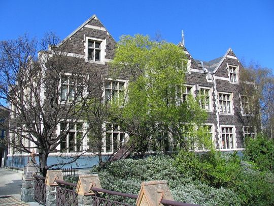
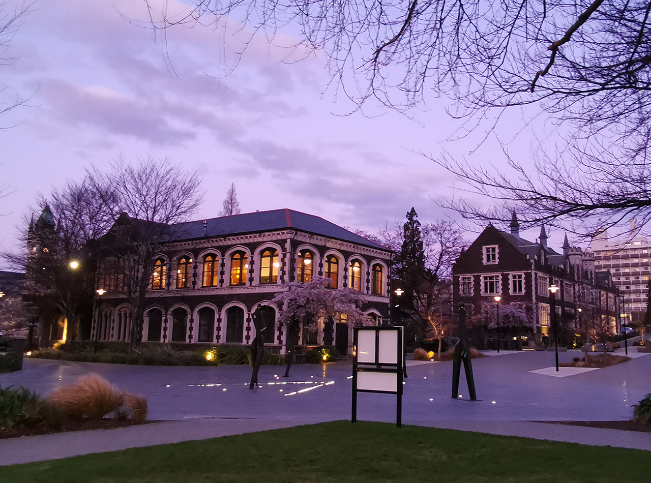
The complex of university buildings built between 1878 and the 1920s constitutes a major example of nineteenth and early twentieth century gothic in New Zealand. Architect Maxwell Bury (1825-1912) won the competition for the design of the Clock Tower (List No. 62) and Geology (List No. 4765) Professorial Houses (List No. 4406) buildings for the University of Otago in 1877. Architect Edmund Anscombe (1874-1948) followed the style set by Bury as the campus continued to grow over the decades.
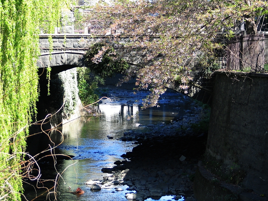
The Union Street bridge was constructed in 1924 and replaced an earlier timber one which was damaged by the large flooding event in 1923. Although the bridge is now used solely by pedestrians, this portion of Union Street was originally constructed as a road bridge. The surrounding concrete walls were also built to connect to the bridge as permanent protection against further water encroachment.
The Dunedin City Council Departmental Reports for 1923-1924 details the materials used for the bridge:
“The new Bridge, now in course of construction, has a span between abutments of 40 feet (12 m). The deck is to be of 24 inch steel beams and concrete, and the balustrade piers of squared bluestone and sandstone with iron railing. The bridge is to be faced on each side by an arch of squared bluestone to harmonise with the University buildings alongside”.
John Hodson and Co. received the contract for the construction work. He sublet the masonry construction to HS Bingham and Co. Ltd. Hodson then further developed a Co-Operative Working Party to complete the bridge in April 1924. The bridge received its fair share of criticism when it was under construction with members of the community believing it to be an overly costly structure.
The bridge with its stone facings and decorative iron railings is particularly attractive. The span forms a pointed arch, which combined with the gable-topped balustrade piers, gives the bridge a gothic look. At either end of the bridge, where the abutments are, the balustrade piers are capped with fleur-de-lis finnials.
The portion of Union Street containing the bridge was closed to road traffic in 1973 as part of the plan to make the University of Otago campus traffic free. A public sculpture, Crown:Land:Crown by David McLeod (1992) was moved to the bridge in 2016. On the east side of the Water of the Leith is a Memorial Walk dedicated to those members of the University of Otago who served in the Great War which is acknowledged with a plaque.
List Entry Information
Status
Listed
List Entry Status
Historic Place Category 2
Access
Able to Visit
List Number
2231
Date Entered
2nd July 1982
Date of Effect
2nd July 1982
City/District Council
Dunedin City
Region
Otago Region
Extent of List Entry
Extent includes the land described as Sec 1 SO 17773, Secs 2- 3 Block LXXI, Town of Dunedin (RT OT13D/591 and OT13C/12), Otago Land District and the structure known as University of Otago Union Street Bridge, thereon.
Legal description
Sec 1 SO 17773, Secs 2-3 Blk LXXI, Town of Dunedin (RTs OT13D/591 and OT13C/12), Otago Land District.
Construction Professional
Name
John Hodson and Party
Type
Builder
Biography
Name
Fletcher Construction Company
Type
Builder
Biography
Fletcher Construction Company was founded by Scottish-born James Fletcher (1886 - 1974), the son of a builder. Six months after his arrival in Dunedin in 1908, Fletcher formed a house-building partnership with Bert Morris. They soon moved into larger-scale construction work, building the St Kilda Town Hall (1911), and the main dormitory block and Ross Chapel at Knox College (1912). Fletcher's brothers, William, Andrew and John joined the business in 1911, which then became known as Fletcher Brothers. A branch was opened in Invercargill. While holidaying in Auckland in 1916, James tendered for the construction of the the Auckland City Markets. By 1919 the company, then known as Fletcher Construction, was firmly established in Auckland and Wellington. Notable landmarks constructed by the company during the Depression included the Auckland University College Arts Building (completed 1926); Landmark House (the former Auckland Electric Power Board Building, 1927); Auckland Civic Theatre (1929); the Chateau Tongariro (1929); and the Dominion Museum, Wellington (1934). Prior to the election of the first Labour Government, Fletcher (a Reform supporter) had advised the Labour Party on housing policy as hbe believed in large-scale planning and in the inter-dependence of government and business. However, he declined an approach by Prime Minister Michael Joseph Savage in December 1935 to sell the company to the government, when the latter wanted to ensure the large-scale production of rental state housing. Although Fletchers ultimately went on to build many of New Zealand's state houses, for several years Residential Construction Ltd (the subsidiary established to undertake their construction) sustained heavy financial losses. Fletcher Construction became a public company, Fletcher Holdings, in 1940. Already Fletchers' interests were wide ranging: brickyards, engineering shops, joinery factories, marble quarries, structural steel plants and other enterprises had been added the original construction firm. Further expansion could only be undertaken with outside capital. During the Second World War James Fletcher, having retired as chairman of Fletcher Holdings, was seconded to the newly created position of Commissioner of State Construction which he held during 1942 and 1943. Directly responsible to Prime Minister Peter Fraser, Fletcher had almost complete control over the deployment of workers and resources. He also became the Commissioner of the Ministry of Works, set up in 1943, a position he held until December 1945. In 1981 Fletcher Holdings; Tasman Pulp and Paper; and Challenge Corporation amalgamated to form Fletcher Challenge Ltd, at that time New Zealand's largest company. Williamson Construction Company - main contract
Name
H S Bingham & Co.
Type
Stonemason
Biography
Stonemason Henry Sydney Bingham formed H.S. Bingham Monumental Masons about 1911. Later the company was known as H.S. Bingham and Co. The company was involved in many of Dunedin’s major building projects, including the renovation of First Church in 1933 and Knox College. The company also built a number of memorials including the cenotaph at Queens Gardens, the North East Valley War Memorial, the war memorial gates at High Street School and the McKenzie Memorial Cairn on Puketapu hill above Palmerston. (Source: Information Upgrade Report, Heather Bauchop, Apr 2014)
Construction Details
Start Year
1973
Type
Other
Description
Bridge closed to traffic
Start Year
1924
Type
Original Construction
Historical and Associated Iwi / Hapū / Whānau
Completion Date
2nd November 2023
Report Written By
Alison Breese
Information Sources
Clarke, 2018
Alison Clarke, Otago: 150 Years of New Zealand’s First University, Otago University Press, Dunedin, 2018.
Bowron, 2013
Bowron, Greg, 'Anscombe, Edmund', Dictionary of New Zealand Biography, first published in 1998, updated July 2013, Te Ara - the Encyclopedia of New Zealand, https://teara.govt.nz/en/biographies/4a17/anscombe-edmund (accessed 24 May 2023)
Marchant, 1993
Marchant, Anne, 'Bury, Maxwell', Dictionary of New Zealand Biography, first published in 1993. Te Ara - the Encyclopedia of New Zealand, https://teara.govt.nz/en/biographies/2b52/bury-maxwell (accessed 24 May 2023)
Nathan, Simon and Hayward, Bruce, 2023
Nathan, Simon and Hayward, Bruce, 'Building stone - Igneous rocks', Te Ara - the Encyclopedia of New Zealand, http://www.TeAra.govt.nz/en/photograph/8085/otago-university-clock-tower (accessed 16 May 2023)
Russell, Tristan and Greig, Karen, 2020
Russell, Tristan and Greig, Karen,’ Archaeological Assessment: Proposed landscaping between Castle Theatre and Information Services Building’, University of Otago, 2020.
Wilson, 2023
Wilson, John, 'Scots - Education', Te Ara - the Encyclopedia of New Zealand, http://www.TeAra.govt.nz/en/artwork/190/clock-tower-block-university-of-otago (accessed 16 May 2023)
Other Information
This place was identified as significant under previous legislation with different information requirements. It remains significant under the current legislation. There is opportunity under our legislation and policies to add to this information. Further information about this place may be available from the Otago/Southland Office of Heritage New Zealand Pouhere Taonga. A fully referenced copy of the Upgrade Report is available upon request from the Otago/Southland Area Office of Heritage New Zealand Pouhere Taonga. Please note that entry on the New Zealand Heritage List/Rarangi Korero identifies only the heritage values of the property concerned, and should not be construed as advice on the state of the property, or as a comment of its soundness or safety, including in regard to earthquake risk, safety in the event of fire, or insanitary conditions.
Former Usages
General Usage: Transport
Specific Usage: Bridge/ Viaduct
Former Usages
General Usage: Transport
Specific Usage: Bridge/ Viaduct
Location
Related listings

Sign up to hear more
Get the latest heritage news, features and events delivered
straight to your inbox.
