

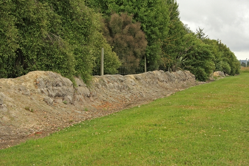
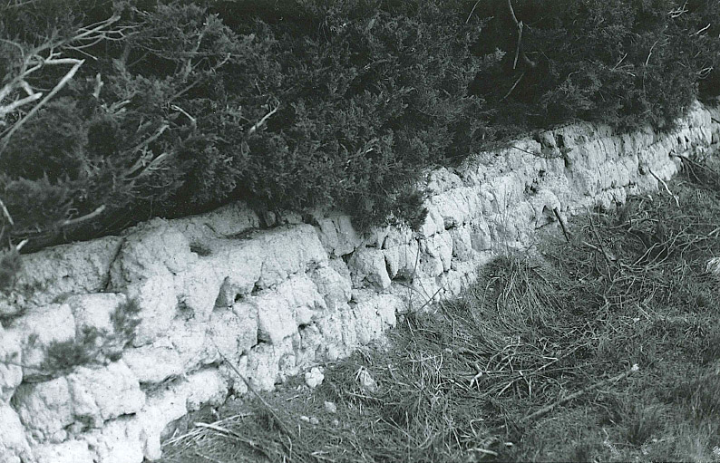
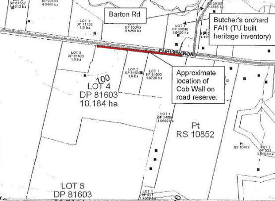
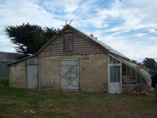
Constructed around the 1870-80s, the Sod Wall bordering along part of Fairview Road in rural Fairview has historical and archaeological significance as a tangible reminder of one of the earliest horticultural endeavours in South Canterbury and of a type of building earth construction often used by pioneer settlers but is now a relatively rare survivor. The Sod Wall forms part of a wider historical complex, being close to three surviving cob buildings on a property located diagonally opposite, on the corner of Fairview and Barton Roads. Edwin Butchers was born in Kent, England, in 1840 and was brought up as a farmer. He arrived in Lyttelton by the ship Canterbury in 1864 and worked for about 18 months on Longbeach Station in South Canterbury. Sometime after this, he was employed in the formation of the West Coast road. In 1871 Butchers married and the following year, in 1872, he took up land in the area now known as Fairview and established a commercial orchard, the trees for which had come from Australia. The orchard is thought to have been one of the earliest in South Canterbury. A cob house was built in the 1870s, and by the 1880s the Butchers had built a complex of cob buildings, namely the Cob Cool Store, as well as a cob stables building and a cob wash house. Around this time, Butchers built a Sod Wall alongside Fairview Road, bordering the orchard. Now in various states of ruin, the Sod Wall is constructed of blocks of earth which was cut. Whereas cob buildings are constructed using a wet mix made of clay, tempered with chopped straw and dung, sod construction varies in that it utilises blocks of earth or clay cut straight out of the ground and used as building blocks. Although very much weathered, many of the sod blocks on the Sod Wall running alongside Fairview Road remain in place and in parts the wall stands three or four blocks high. The wall extends just over 300 metres in length, although in some parts the wall has collapsed. The survival of the Sod Wall on Fairview Road, when almost all others have disappeared, is thought to be due to the fact that it has not suffered stock rubbing and pushing against it, which is the reason many other examples of this early type of fencing have been destroyed.
Location
List Entry Information
Overview
Detailed List Entry
Status
Listed
List Entry Status
Historic Place Category 2
Access
Private/No Public Access
List Number
3147
Date Entered
6th June 1983
Date of Effect
6th June 1983
City/District Council
Timaru District
Region
Canterbury Region
Extent of List Entry
Extent includes part of the land described as Lots 2-4 DP 81603 (RTs CB46C/769, CB46C/770 and CB46C/771) and part of the land described as Legal Road, Canterbury Land District, and the structure known as Sod Wall thereon. Refer to the extent map tabled at the Rārangi Kōrero Committee meeting on 6 September 2017.
Legal description
Lots 2-4 DP 81603 (RTs CB46C/769, CB46C/770 and CB46C/771), and Legal Road, Canterbury Land District
Related listings
Stay up to date with Heritage this month
