

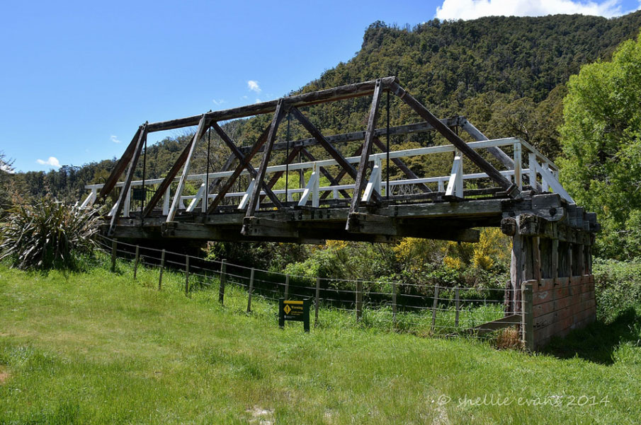
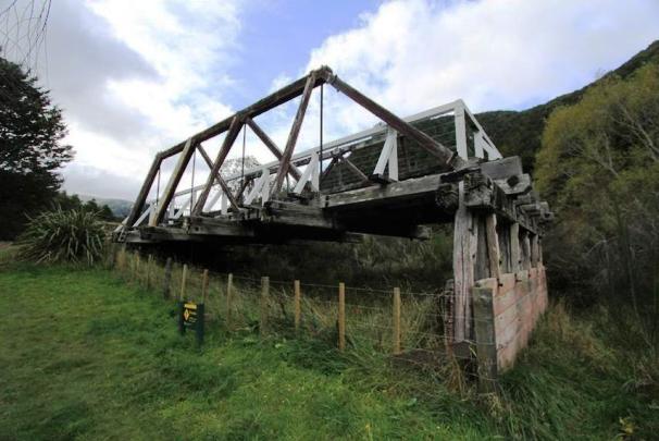
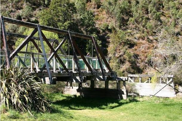
The Hope River Road Bridge (Former) is in an area that Te Tau Ihu iwi, such as Ngāti Tumatakokiri and Ngāti Apa ki te Rā Tō, are known to have lived in and travelled through. Well-travelled routes were also established between the east and west coasts of Te Waipounamu / the South Island along rivers such as the Kawatiri / Buller River. Early Pākehā later constructed roads along similar routes. Located near the junction of the Kawatiri / Buller and Hope Rivers as well as State Highways 6 and 63, the Hope River Road Bridge (Former), constructed in 1923, has historic significance because it is linked to determined efforts to upgrade transport routes in the upper South Island in the early and late twentieth century, including the ill-fated Nelson railway. The remnants of the timber structure include a truss and piers that have technological significance because timber bridges were a predominant New Zealand type in the nineteenth and early twentieth century, but are now rare. After the New Zealand Company’s Nelson settlement was established in the early 1840s, Europeans gradually began to spread inland, building rudimentary roads as they went. The future site of Kawatiri Railway Station, beside Hope River Bridge (Former), featured the Hope Junction accommodation house, used by late nineteenth century travellers. By the early twentieth century local farmers were advocating for a bridge to connect the road from Blenheim to the Nelson-West Coast road, and the Public Works Department eventually got approval in 1922. This coincided with the construction of the nearby railway structures, as part of the Nelson / Midland Railway extension, which got no further south than Kawatiri. There were thousands of timber truss bridges built in New Zealand up until the early decades of the twentieth century. The Hope River Road Bridge’s superstructure originally consisted of three pony trusses. Like many of its counterparts, by the 1970s time had taken its toll on the Hope River Road Bridge’s timber fabric. It could not cope with the loading demands of heavier vehicles and single-lane structures were also increasingly being replaced to cater to for intensified traffic on New Zealand’s highways. Therefore, construction of a new highway bridge, just south of Hope River Road Bridge, was underway in 1973 and completed in 1974. This appears to have been part of the general road improvements in the area in response to local demand, after the railway to Nelson was closed in 1954 and as private car ownership grew. The replacement structure left the Hope River Road Bridge (Former) with no purpose, other than a means of pedestrian access to both sides of the river from the adjoining picnic area and as an unsanctioned diving platform in summer. By 1989 the bridge was assessed as being on the verge of collapse and ‘very dangerous for public use’, so demolition was proposed. However, characteristic timber truss bridges were becoming rare by this time and to recognise its heritage values the Hope River Road Bridge (Former) was added to the New Zealand Heritage List / Rārangi Kōrero in early 1990. Subsequently the bridge’s southern two trusses, spanning the river, were demolished but the piers retained. The remaining land-based truss and the piers continue to be a feature of historic interest near the starting point of the Kawatiri Historic Railway Walk and associated rest area.
Location
List Entry Information
Overview
Detailed List Entry
Status
Listed
List Entry Status
Historic Place Category 2
Access
Able to Visit
List Number
5148
Date Entered
2nd February 1990
Date of Effect
2nd February 1990
City/District Council
Tasman District
Region
Tasman Region
Extent of List Entry
Extent includes part of the land described as Riverbed and Sec 1 SO 15625 (New Zealand Gazette 2001, 353), Nelson Land District, and the parts of the structure known as Hope River Road Bridge (Former) thereon. The extent includes the northern truss, central pier and abutments. Refer to extent map tabled at the RKC meeting 29 July 2021.
Legal description
Part riverbed; Sec 1 SO 15625 (New Zealand Gazette 2001, 353), Nelson Land District
Stay up to date with Heritage this month
