

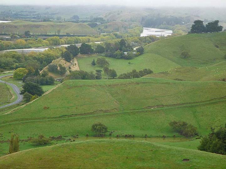
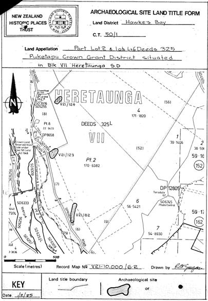
New Zealand Heritage List site no. 6420 (NZAA site V21/123) is a small pā on farmland on the east side of Springfield Road, located to the west of Taradale and northeast of Waiohiki. The pā has cultural, traditional and historical significance and is one of a series of archaeological sites on the high ground above the terrace of the Tūtaekurī River. Two other pā sites lie to the north and south respectively of pā V21/123. These sites are all on the western side of the hills where they have elevated views of the surrounding landscape and have utilised the natural defences of the topography. While pā V21/123 is not rare it has important archaeological contextual and information value as an element of Māori occupation and settlement of the inland Tūtaekurī River valley area. This settlement pattern is directly related to the resources and attributes of the Tūtaekurī River. The river carries silt and gravel down a narrow valley through low hill country. In its natural state swamps on the river terrace would have absorbed floodwaters and served to provide eels and other resources to sustain the nearby settlements. The pits on the pā indicate that iwi were also gardening the fertile soil of the area and storing their produce within the protective perimeter of the pā defences. The need to protect these crops suggests they were built during a time of conflict, or in preparation for conflict. While the date of initial construction for the pā has not yet been determined it may have been constructed during a period of widespread pā building and occupation that was undertaken in the vicinity of Te Whanganui-a-Orotu and the Tūtaekurī area from 1550 to 1700, around the time that Ngāti Kahungunu iwi moved into the Hawkes’s Bay. Archaeological evidence and Māori oral history points to the initial settlement of Hawke’s Bay around 1250–1300 AD. Different hapū gradually settled the area from Māhia to Pōrangahau in a variety of diverse landscapes. About 1550 to 1625, Taraia, great grandson of Kahungunu, and his followers established themselves at Ōtātara, to the south of pā V21/123, to secure access to and control over Te Whanganui-a-Orotu and the Tūtaekurī River. The pā is on a low flat-topped knoll, approximately 30 metres above the flat, west of the yards of Springfield Station. The pā has a well-defined defensive scarp 120 paces along the northeast side. There are two terraces on the south west side. The site is in fair condition however at the northwest end the only indication of the former ditch is a shallow depression. The six pits within the perimeter of the site have all been in-filled. At this point in time the pā has not been identified with a specific Māori name nor is there currently access to kōrero for this site.
Location
List Entry Information
Overview
Detailed List Entry
Status
Listed
List Entry Status
Historic Place Category 2
Access
Private/No Public Access
List Number
6420
Date Entered
7th July 1985
Date of Effect
7th July 1985
City/District Council
Hastings District
Region
Hawke's Bay Region
Extent of List Entry
Extent includes part of the land described as Area W on Lot 2 DP 430264 (RT 517758), Hawke’s Bay Land District, and the archaeological site known as Pa (V21/123) thereon. Refer to the extent map tabled at the Heritage New Zealand Board meeting on 25 June 2015.
Legal description
Area W on Lot 2 DP 430264 (RT 517758), Hawke’s Bay Land District
Stay up to date with Heritage this month
