Setting: On ridge above Waioho Stream, western flanks of Whakatane Valley. Archaeological Features: A large ridge pa in two segments; the upper in two levels, about 50 x 10 metres, the lower about 60 x 10 metres. The upper segment has massive transverse ditch and bank (banks about 8 metres high) joined by lateral ditches. The lower segment is terraced in part, with midden; the sides are naturally very steep. Rua occue on both segments. Supporting Evidence: Site is part of a discrete complex of pa in this area. Condition: Excellent condition; site in felled and burnt hard wood forest 1981. Some slumping of lower north-eastern segment. Site excluded from pine planting, and will re-generate. Assessment: An example of a large ring ditch pa with multiple defences. One of a group of pa in this part of the Whakatane Valley.

Location
List Entry Information
Overview
Detailed List Entry
Status
Listed
List Entry Status
Historic Place Category 2
Access
Private/No Public Access
List Number
6440
Date Entered
2nd February 1985
Date of Effect
2nd February 1985
City/District Council
Whakatāne District
Region
Bay of Plenty Region
Extent of List Entry
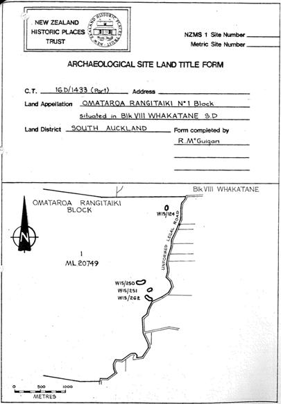
Extent includes part of the land described as Omataroa Rangitaiki 2 (RT SA37D/850), South Auckland Land District and the archaeological site known as Pa (W15/250) thereon (refer to Archaeological Site Land Title Form for further information).
Legal description
Omataroa Rangitaiki 2 (RT SA37D/850), South Auckland Land District
Stay up to date with Heritage this month
