

Tiromoana Pa had spectacular surface evidence when it was excavated in 1974-75 under the direction of Lady Aileen Fox. This pa and the excavation carried out on the site provided, and can still provide, valuable archaeological information regarding the Maori occupation and settlement of the Hawke’s Bay and the Maraetotara River area.
Archaeological evidence and Maori oral history point to the initial settlement of Hawke’s Bay around 1250–1300 AD. Different hapu gradually settled the area from Mahia to Porangahau in a variety of diverse landscapes. The excavation and radiocarbon dates for Tiromoana Pa indicate that the development of the initial fortification of the site, when it was a small work of 450m² at the tip of the spur, was done in c. 1500AD. The construction of these fortifications coincides with the arrival of Ngati Kahungunu iwi into the Hawke’s Bay. Archaeological evidence from this site and others suggests that between 1550 to 1700 there was a period of widespread pa building and occupation that was undertaken in the Hawke’s Bay.
Tiromoana pa was a strongly defended site with a rampart fronted with a palisade and ditch, with a five metres long fighting stage built in two tiers on the highest point. A strong palisade with 22 large uprights covered the weaker eastern side. A second ditch 40 metres up the spur was dug to cover that line of approach. In the later period a third rampart was built 150 metres up the spur, and the pa was enlarged to take up 1.5 hectares. In the late 18th or early 19th century the second palisade was taken down and replaced with a long house (12 x 4 metres), rendering some of the internal defences ineffectual. Occupation of the site extended to the lower terraces. In one case a storage pit was modified into a hangi, and a new large raised rim was constructed. When the pa was abandoned the massive posts of the lateral palisade were dug out, presumably for use elsewhere.
In its present condition the three lines of defence across the spur are visible as are the two banks and three ditches at intervals of 150 and 50 metres. The interior contains fourteen raised rim storage pits, house platforms and terraces. The plateau within the outer defences is level and has no visible features besides the ditch and bank defining it. The outer plateau is grazed, while the section within the second defensive ditch is under scrub. The site is in good condition.
List Entry Information
Status
Listed
List Entry Status
Historic Place Category 2
Access
Private/No Public Access
List Number
6506
Date Entered
8th February 1985
Date of Effect
9th February 1985
City/District Council
Hastings District
Region
Hawke's Bay Region
Extent of List Entry
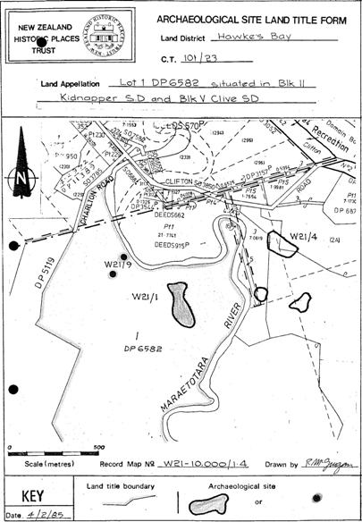
Extent includes part of the land described as Lot 4 DP 327818 (RT 113051), Hawkes Bay Land District and the archaeological site known as Pa (W21/1) thereon (refer to the Archaeological Site Land Title Form for further information).
Legal description
Lot 4 DP 327818 (RT 113051), Hawkes Bay Land District
Status
Listed
List Entry Status
Historic Place Category 2
Access
Private/No Public Access
List Number
6506
Date Entered
8th February 1985
Date of Effect
9th February 1985
City/District Council
Hastings District
Region
Hawke's Bay Region
Extent of List Entry
Extent includes part of the land described as Lot 4 DP 327818 (RT 113051), Hawkes Bay Land District and the archaeological site known as Pa (W21/1) thereon (refer to the Archaeological Site Land Title Form for further information).
Legal description
Lot 4 DP 327818 (RT 113051), Hawkes Bay Land District
Historical and Associated Iwi / Hapū / Whānau
Public NZAA Number
W21/1
Completion Date
28th May 2015
Report Written By
Christine Barnett
Information Sources
Jones, 1994
Kevin L. Jones, Nga Tohuwhenua mai te Rangi: A New Zealand Archaeology in Aerial Photographs, Wellington, 1994
New Zealand Archaeological Association (NZAA)
New Zealand Archaeological Association
Fox, 1974
Fox, Aileen. 1974. Tiromoana Pa, Te Awanga, Hawke’s Bay: interim report. NZAA newsletter 17(4)
Fox, 1976
Fox, Aileen. 1976. Prehistoric Maori Fortifications in the North Island of New Zealand. Auckland. Longman Paul
Fox, 1976
Fox, Aileen. 1976. Tiromoana Pa, Te Awanga, Hawke’s Bay, Excavations 1974-5 (Studies in Prehistoric Anthropology (Otago University), 11/ New Zealand Archaeological association Monograph, 8.
Other Information
This place was identified as significant under previous legislation with different information requirements. It remains significant under the current legislation. There is opportunity under our legislation and policies to add to this information. Further information about this place may be available from the Central Regional Office of Heritage New Zealand Pouhere Taonga. Information in this report is from the citation prepared for the NZHPT Archaeology Committee at the time of the registration. Please note that entry on the New Zealand Heritage List/Rarangi Korero identifies only the heritage values of the property concerned, and should not be construed as advice on the state of the property, or as a comment of its soundness or safety, including in regard to earthquake risk, safety in the event of fire, or insanitary conditions. A fully referenced upgrade report is available on request from the Central Region Office of Heritage New Zealand
Former Usages
General Usage: Maori
Specific Usage: Pā
General Usage: Maori
Specific Usage: Pit
General Usage: Maori
Specific Usage: Terrace
Themes
Of Significance to Maori
Archaeological Site (HPA 1980)
Former Usages
General Usage: Maori
Specific Usage: Pā
General Usage: Maori
Specific Usage: Pit
General Usage: Maori
Specific Usage: Terrace
Themes
Of Significance to Maori
Archaeological Site (HPA 1980)
Location
Sign up to hear more
Get the latest heritage news, features and events delivered
straight to your inbox.
