

While pa W21/4 is not rare it is has important archaeological contextual and information value as an element of Maori occupation and settlement in this archaeologically rich setting on the fringe of Cape Kidnappers / Mataupo Maui. The settlement pattern of this area is directly linked to the resources and geography of the Maraetotara River and the coastal environment of Hawke’s Bay.
Archaeological evidence and Maori oral history points to the initial settlement of Hawke’s Bay around 1250–1300 AD. Different hapu gradually settled the area from Mahia to Porangahau in a variety of diverse landscapes from the coast to the inland forests. The tangata whenua of the Te Awanga (Clifton) area can trace permanent occupation back to the Te Kakano or archaic period of Polynesian settlement. Isolated pockets of Kupe people settled along the Wairarapa coast and came into contact with the descendant of Whatonga who had migrated south from Mahia. Whatonga’s son Tara was born at Te Awanga and is the ancestor for Ngai Tara.
The sites in the area are associated with the descendants of Te Aomatarahi. Mahangapuhua, a son of Whiringarakau, established a pa called Te Pa o Mahanga at Te Awanga. Tama-ariki and Hine-te-ao also occupied this area. Later the area was under the influence of Te Whatui-a-piti through his son Hikawera. Through strategic marriage of the descendants of Ngati Kahungunu, Te Whatui-a-piti and Te Aomatarahi merged the people into the hapu of today. The main hapu interests in Te Awanga are Ngati Kurukuru, Ngati Hikatoa, Ngati Whakaiti, Ngati Ura ki te ao and Ngati Hawea.
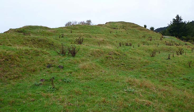
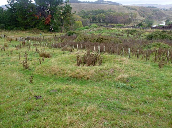
When the site was recorded in 1973 the defences of this pa were fairly well preserved, though there was some erosion due to the gravel matrix in which the defences were constructed. These defences consisted of a substantial rampart and ditch across the neck of the ridge, which continued as a low bank along the north side facing the coast. A short length of ditch and bank cuts off the track up the end of the spur from the beachfront to the east. The interior of the pa had many irregular terraces and platforms and six – ten raised rim pits, with external drain systems. In 2013 site damage to a portion of the defensive wall by logging operators was reported. In 2014 the ditches of the pa were not visible and only the eastern bank remained. A large undefended terrace was located to the north of the cliff and has visible midden and oven stones on it. Most remaining features are still definable, although substantial damage has occurred in some areas due to stock and farm tracks. The ground in this area is prone to slipping and erosion.
At this point in time the location has not been identified with a specific Maori name.
List Entry Information
Status
Listed
List Entry Status
Historic Place Category 2
Access
Private/No Public Access
List Number
6508
Date Entered
22nd April 1985
Date of Effect
22nd April 1985
City/District Council
Hastings District
Region
Hawke's Bay Region
Extent of List Entry
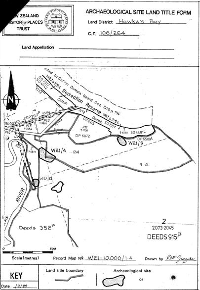
Extent includes part of the land described as Lot 8 DP 27414 (RT HBW4/33), Hawkes Bay Land District, part of the land described as Lot 2 Deed 915 (RT 30997), Hawkes Bay Land District, and part of the land described as Lot 3 Deed 915 (RT HBW4/33), Hawkes Bay Land District, and the archaeological site known as Pa (W21/4) thereon, as shown on the location map appended to the notification letter dated 22 April 1985.
Legal description
Lot 8 DP 27414 (RT HBW4/33), Lot 2 Deed 915 (RT 30997) and Lot 3 Deed 915 (RT HBW4/33), Hawkes Bay Land District
Status
Listed
List Entry Status
Historic Place Category 2
Access
Private/No Public Access
List Number
6508
Date Entered
22nd April 1985
Date of Effect
22nd April 1985
City/District Council
Hastings District
Region
Hawke's Bay Region
Extent of List Entry
Extent includes part of the land described as Lot 8 DP 27414 (RT HBW4/33), Hawkes Bay Land District, part of the land described as Lot 2 Deed 915 (RT 30997), Hawkes Bay Land District, and part of the land described as Lot 3 Deed 915 (RT HBW4/33), Hawkes Bay Land District, and the archaeological site known as Pa (W21/4) thereon, as shown on the location map appended to the notification letter dated 22 April 1985.
Legal description
Lot 8 DP 27414 (RT HBW4/33), Lot 2 Deed 915 (RT 30997) and Lot 3 Deed 915 (RT HBW4/33), Hawkes Bay Land District
Historical and Associated Iwi / Hapū / Whānau
Public NZAA Number
W21/4
Completion Date
3rd June 2015
Report Written By
Christine Barnett
Information Sources
Jones, 1994
Kevin L. Jones, Nga Tohuwhenua mai te Rangi: A New Zealand Archaeology in Aerial Photographs, Wellington, 1994
Pollock, 2012
'Hawke’s Bay region - Māori settlement and occupation', Te Ara - the Encyclopedia of New Zealand, updated 13-Jul-12
Other Information
This place was identified as significant under previous legislation with different information requirements. It remains significant under the current legislation. There is opportunity under our legislation and policies to add to this information. Further information about this place may be available from the Central Regional Office of Heritage New Zealand Pouhere Taonga. Please note that entry on the New Zealand Heritage List/Rarangi Korero identifies only the heritage values of the property concerned, and should not be construed as advice on the state of the property, or as a comment of its soundness or safety, including in regard to earthquake risk, safety in the event of fire, or insanitary conditions. A fully referenced upgrade report is available on request from the Central Region Office of Heritage New Zealand
Historical and Associated Iwi / Hapū / Whānau
Public NZAA Number
W21/4
Completion Date
3rd June 2015
Report Written By
Christine Barnett
Information Sources
Jones, 1994
Kevin L. Jones, Nga Tohuwhenua mai te Rangi: A New Zealand Archaeology in Aerial Photographs, Wellington, 1994
Pollock, 2012
'Hawke’s Bay region - Māori settlement and occupation', Te Ara - the Encyclopedia of New Zealand, updated 13-Jul-12
Other Information
This place was identified as significant under previous legislation with different information requirements. It remains significant under the current legislation. There is opportunity under our legislation and policies to add to this information. Further information about this place may be available from the Central Regional Office of Heritage New Zealand Pouhere Taonga. Please note that entry on the New Zealand Heritage List/Rarangi Korero identifies only the heritage values of the property concerned, and should not be construed as advice on the state of the property, or as a comment of its soundness or safety, including in regard to earthquake risk, safety in the event of fire, or insanitary conditions. A fully referenced upgrade report is available on request from the Central Region Office of Heritage New Zealand
Former Usages
General Usage: Maori
Specific Usage: Midden
General Usage: Maori
Specific Usage: Pā
General Usage: Maori
Specific Usage: Pit
General Usage: Maori
Specific Usage: Terrace
Themes
Of Significance to Maori
Former Usages
General Usage: Maori
Specific Usage: Midden
General Usage: Maori
Specific Usage: Pā
General Usage: Maori
Specific Usage: Pit
General Usage: Maori
Specific Usage: Terrace
Themes
Of Significance to Maori
Location
Sign up to hear more
Get the latest heritage news, features and events delivered
straight to your inbox.
