

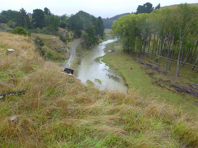
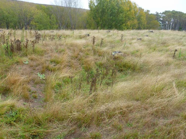
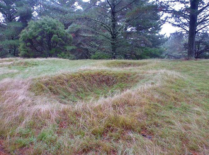
NZAA site W21/12 (New Zealand Heritage List no. 6511) is a pit complex in pasture on the east side of the Maraetotara River off Clifton Road, Clifton. There are a number of these pit/terrace sites on this uplifted marine terrace through which the Maraetotara River flows. The presence of these pits indicates that the area was extensively used for horticulture. The pits are predominantly of the raised rim variety. The pit/terrace site is of cultural, traditional, archaeological and historical significance. Archaeological evidence and Maori oral history points to the settlement of Hawke’s Bay around 1250–1300 AD. Different hapu gradually settled the area from Mahia to Porangahau in a variety of different landscapes from the coast to the inland forests. Access to these inland areas was often via rivers like the Maraetotara. The tangata whenua of the Te Awanga (Clifton) area can trace permanent occupation back to the Te Kakano or archaic period of Polynesian settlement. Isolated pockets of Kupe people settled along the Wairarapa coast and came into contact with the descendant of Whatonga who had migrated south from Mahia. Whatonga’s son Tara was born at Te Awanga and is the ancestor for Ngai Tara. The sites in the area are associated with the descendants of Te Aomatarahi. Mahangapuhua, a son of Whiringarakau, established a pa called Te Pa o Mahanga at Te Awanga. Tama-ariki and Hine-te-ao also occupied this area. Later the area was under the influence of Te Whatui-a-piti through his son Hikawera. Through strategic marriage of the descendants of Ngati Kahungunu, Te Whatui-a-piti and Te Aomatarahi merged the people into the hapu of today. The main hapu interests in Te Awanga are Ngati Kurukuru, Ngati Hikatoa, Ngati Whakaiti, Ngati Ura ki te ao and Ngati Hawea. While pit complex W21/12 is not rare in this area the pit and terrace site reflects the importance of horticultural production (kumara) to sustain tangata whenua in this archaeologically rich setting inland of Cape Kidnappers / Mataupo Maui. The terraces of this area provided fertile, flat land on which to grow crops which were then stored in specifically designed raised rim pits. This site was initially recorded in 1985 as a group of eight pits scattered on a triangular river terrace remnant. During a site visit in March 2014 only four pits were recorded. All were approximately 4 x 2 metres. The area was heavily overgrown so the other four pits were not relocated due to vegetation cover. It is likely that the pits are a remnant of a village/kainga site. At this point in time the location has not been identified with a specific Maori name.
Location
List Entry Information
Overview
Detailed List Entry
Status
Listed
List Entry Status
Historic Place Category 2
Access
Private/No Public Access
List Number
6511
Date Entered
4th April 1985
Date of Effect
4th April 1985
City/District Council
Hastings District
Region
Hawke's Bay Region
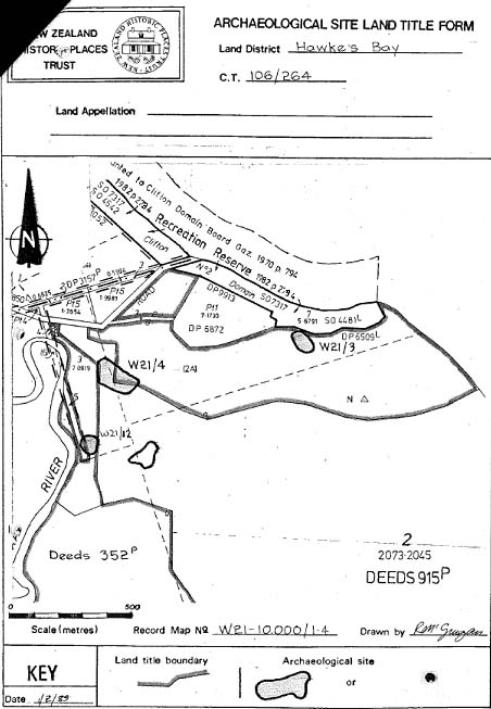
Extent of List Entry
Extent includes part of the land described as Lot 3 Deeds 915 (RT HBW4/33) and part of the land described as Sec 5 Blk II Kidnapper SD (RT HBM4/866), Hawkes Bay Land District, and the archaeological site known as Pit Complex (W21/12) thereon. Refer to the extent map tabled at the Heritage New Zealand Board meeting on 25 June 2015.
Legal description
Lot 3 Deeds 915 (RT HBW4/33) and Sec 5 Blk II Kidnapper SD (RT HBM4/866), Hawkes Bay Land District
Stay up to date with Heritage this month
