

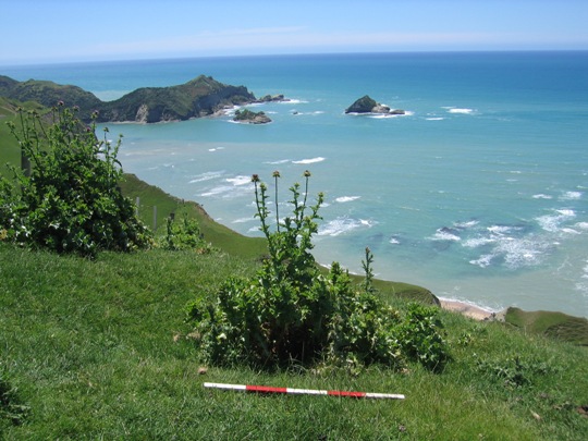
Terraces and many other recorded archaeological sites including pits, pa, midden, gardens and urupa reflect intensive Maori occupation of the Tolaga Bay area from the time of initial Polynesian settlement approximately 700 years ago. Access to abundant food resources from the sea, rivers, inland forests and horticultural production (kumara) meant that a large population could be sustained. It has been estimated that the early Maori population of Tolaga Bay totalled approximately 1200; and the main iwi was Te Aitanga a Hauiti.
Terraces are discrete areas that were deliberately levelled by Maori to create a flat surface for activities or buildings. The presence of terraces on Titirangi therefore indicates past Maori activity at the summit area, a place that many tangata whenua regard as the sacred mountain of Te Aitanga a Hauiti. Others within Te Aitanga a Hauiti have described Titirangi and the summit area in particular as a tuahu (ceremonial altar) and wahi tapu.
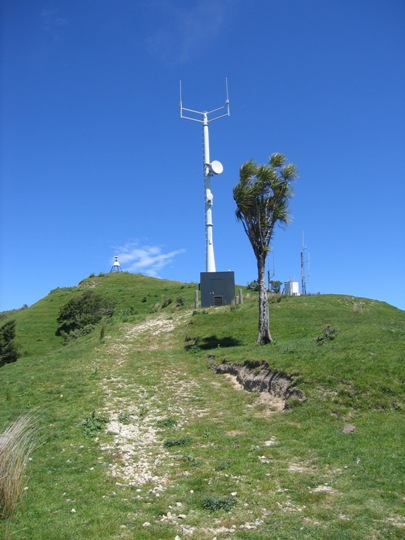
In 2001 the New Zealand Historic Places Trust declined an archaeological authority application from Telecom New Zealand Limited to erect a mobile phone site on the summit of Titirangi, in recognition of its traditional, spiritual and cultural values to many tangata whenua. Further extensive consultation ensued and an archaeological authority (2004-163) was subsequently granted for the mobile phone site in March 2004. The mobile phone tower and associated equipment container have now been erected.
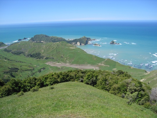
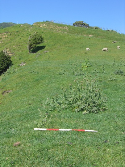
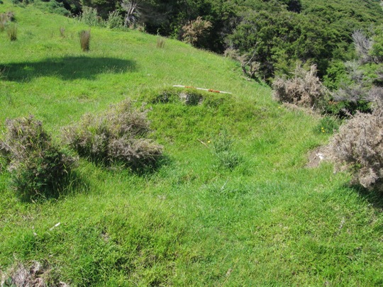
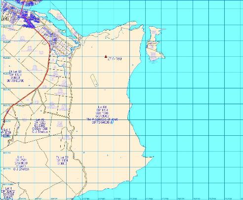
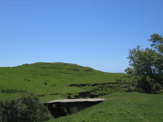
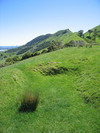
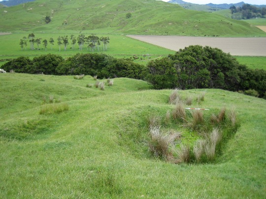
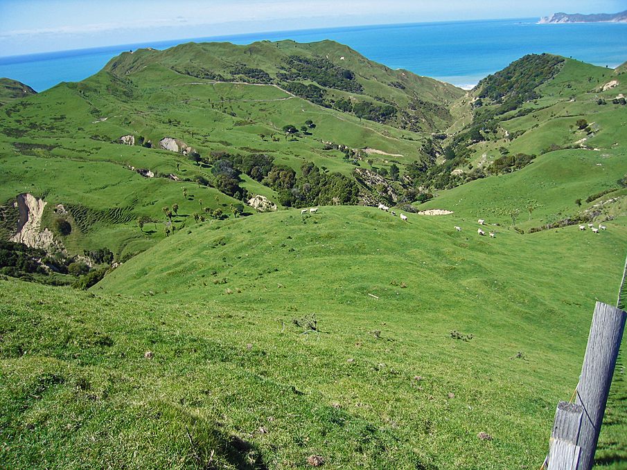
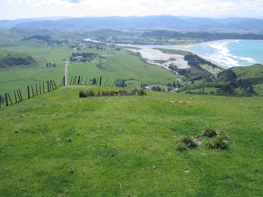
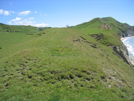
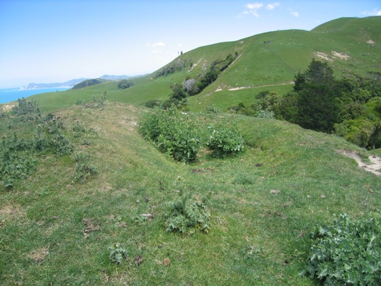
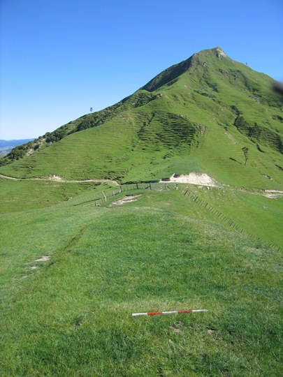
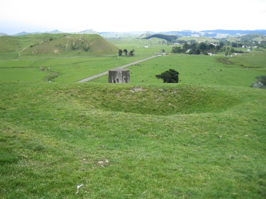
The terraces (Z17/193) are located in pasture on the summit of Titirangi ridgeline, where there are a number of masts (telephone and television) and associated buildings. A stock pond is also located to the north of the terraces. A farm track leads directly to the summit from the north, and Titirangi trig is located at the southern end of the summit.
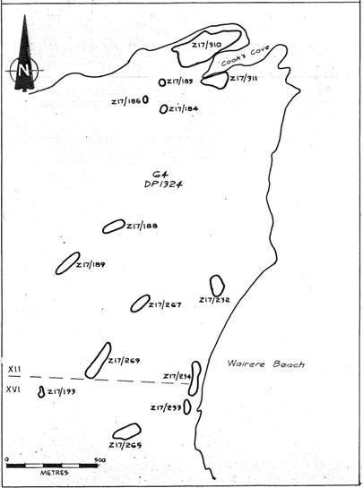
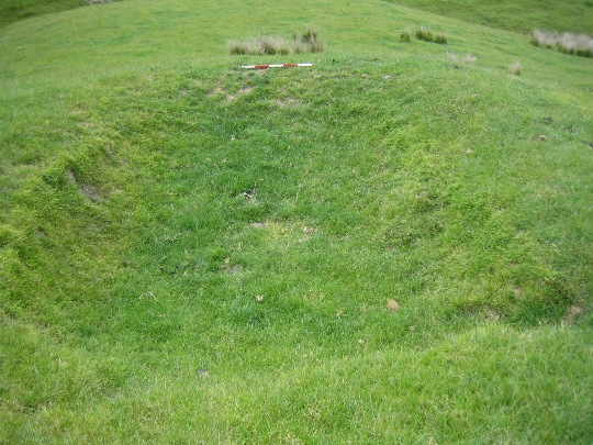
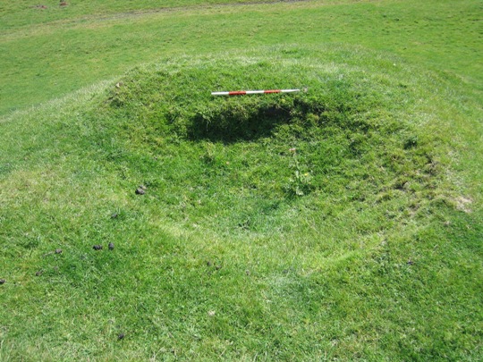
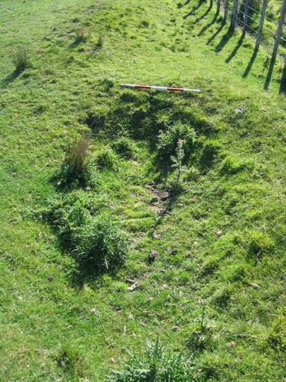
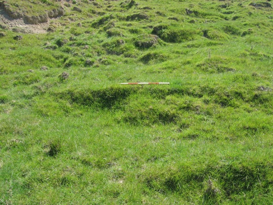
Terrace site Z17/193 was first recorded by archaeologist Kevin Jones during his archaeological survey work in the Whangara, Tolaga Bay and Uawa Catchment areas in 1982-1983. This survey work was undertaken to gain information about the nature of prehistoric settlement in this locality, and also to evaluate specific sites for registration under the Historic Places Act 1980. Jones recorded three terraces along the summit, between the trig and the stock pond. The terraces measured 8 metres x 4 metres, 3 metres x 3 metres and 4 metres x 2 metres from north to south. From the sketch plan completed by Jones, it appears that there was only one television mast on the summit at the time of recording.
Z17/193 was revisited by archaeologist Vanessa Tanner in 1999 as part of the New Zealand Archaeological Association Site Recording Scheme Upgrade Project. Tanner observed that the site was in 'poor condition', being damaged by stock and at risk of further damage through the erection of more masts. A revised site plan was completed, showing a number of additional terraces to the east, which were not recorded by Jones. Two large terraces are shown just to the south of the three recorded by Jones in the centre of the summit, and a possible pit is depicted in one the originally recorded terraces (the southernmost). A series of five terraces are illustrated to the northeast of the trig, running down slope towards an area of manuka, and two further small terraces are depicted just west of these. The sketch plan also indicates that a number of additional masts had been erected since the site was first recorded, and an area of disturbed ground (marked with two pegs) is shown amongst the terraces at the centre of the site. No reference was made to this disturbed area of ground in the original site record form, but it is believed to have been bulldozed as early as the 1960s.
The New Zealand Historic Places Trust undertook a site visit in November 2007, and inspected the area where the Telecom Mobile facility had been constructed. It appears that the three northern-most terraces have been damaged by the construction of the access track along the eastern edge of the summit.
Z17/193 is part of a dense archaeological landscape that reflects the intensive Maori occupation and settlement of the Tolaga Bay area since the 14th - 15th centuries AD. It is also of considerable spiritual, traditional and cultural value to Te Aitanga a Hauiti, many of whom regard Titirangi and the summit area in particular as a sacred mountain.
List Entry Information
Status
Listed
List Entry Status
Historic Place Category 2
Access
Private/No Public Access
List Number
6636
Date Entered
10th March 1986
Date of Effect
10th March 1986
City/District Council
Gisborne District
Region
Gisborne Region
Extent of List Entry
The registration includes part of the land described as Lot 1 DP 317992 and Lot 64 DP 1324, Gisborne Land District and the archaeological site Z17/193 (New Zealand Archaeological Association Site Record Number).
Legal description
Lot 1 DP 317992 and Lot 64 DP 1324 (RT GS126/62), Gisborne Land District.
Historical and Associated Iwi / Hapū / Whānau
Public NZAA Number
Z17/193
Completion Date
9th March 2008
Report Written By
Joanna Wylie
Information Sources
Department of Conservation
Department of Conservation
New Zealand Historic Places Trust (NZHPT)
New Zealand Historic Places Trust
New Zealand Archaeological Association (NZAA)
New Zealand Archaeological Association
Other Information
This place was identified as significant under previous legislation with different information requirements. It remains significant under the current legislation. There is opportunity under our legislation and policies to add to this information. Further information about this place may be available from the Lower Northern Office of Heritage New Zealand Pouhere Taonga. Iwi/ Hapu/ Whanau: Te Aitanga a Hauiti A fully referenced upgrade report is available from the NZHPT Lower Northern Area Office Please note that entry on the New Zealand Heritage List/Rarangi Korero identifies only the heritage values of the property concerned, and should not be construed as advice on the state of the property, or as a comment of its soundness or safety, including in regard to earthquake risk, safety in the event of fire, or insanitary conditions.
Current Usages
Uses: Agriculture
Specific Usage: Farm
Uses: Communication
Specific Usage: Television/Radio Mast /Tower
Themes
Of Significance to Maori
Current Usages
Uses: Agriculture
Specific Usage: Farm
Uses: Communication
Specific Usage: Television/Radio Mast /Tower
Themes
Of Significance to Maori
Location
Related listings
Sign up to hear more
Get the latest heritage news, features and events delivered
straight to your inbox.
