

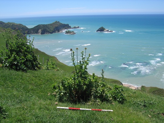
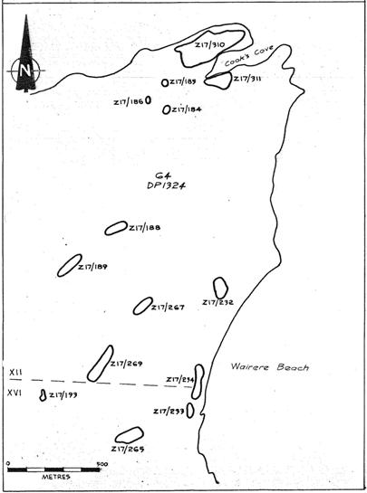
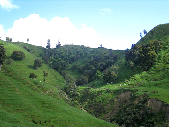
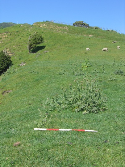
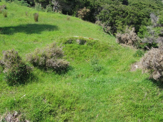
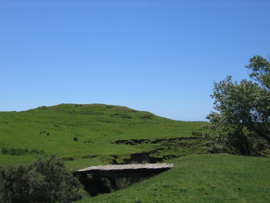
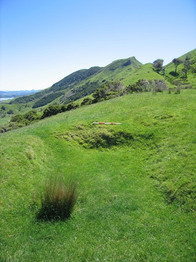
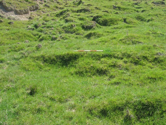
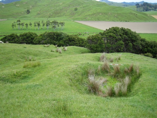
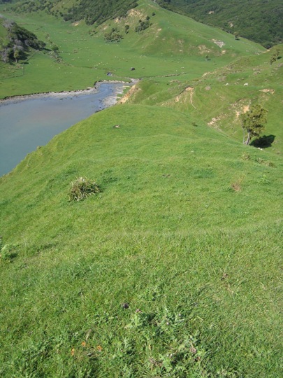
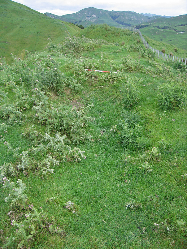
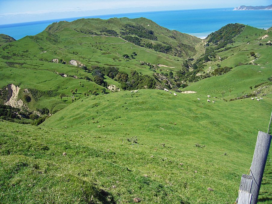
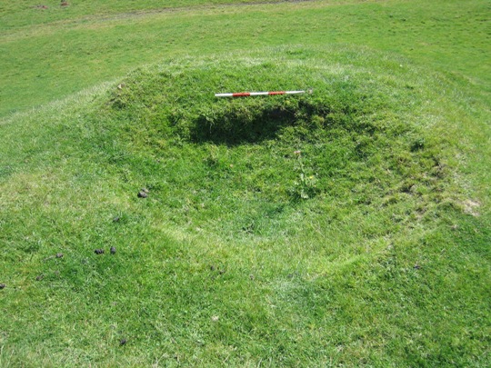
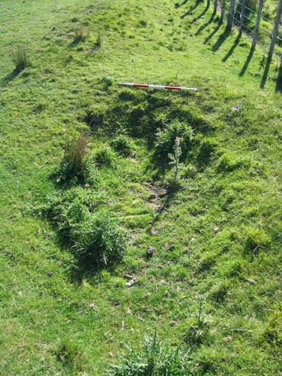
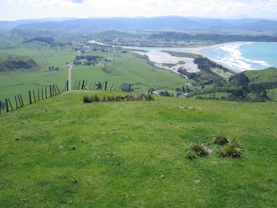
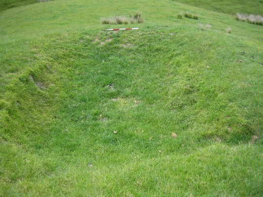
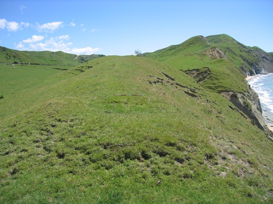
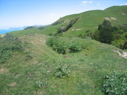
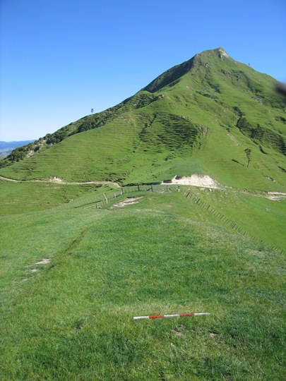
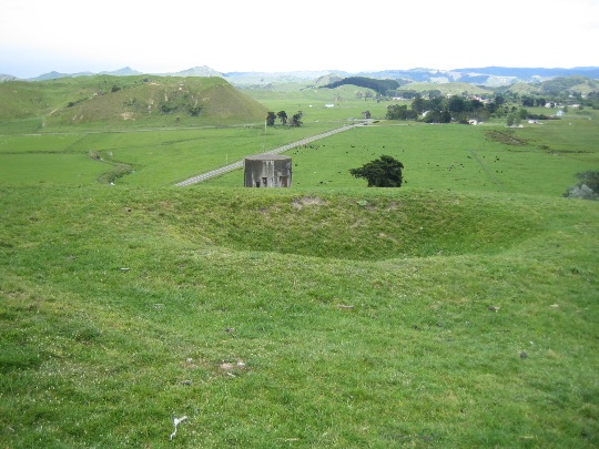
New Zealand Archaeological Association Site Record Number Z17/265 is a small ridge top pa that forms part of the dense archaeological landscape of the Tolaga Bay (Uawa) area. It is located on Titirangi Station, to the south-east of the Tolaga Bay township. Pa site Z17/265 is one of the numerous pa that have been recorded in the Tolaga Bay area, mostly located on the prominent hills and ridgelines which afforded excellent natural defences and provided commanding views of the surrounding landscape. These pa and the many other archaeological sites recorded in the Uawa region such as pit and terrace complexes, midden, gardens and urupa reflect the intensive occupation of this landscape by Maori from the time of initial Polynesian settlement approximately 700 years ago. Access to abundant food resources from the sea, rivers, inland forests and horticultural production (kumara) meant that a large population could be sustained. It has been estimated that the early Maori population of Tolaga Bay totalled approximately 1200; and the main iwi was Te Aitanga a Hauiti. Pa site Z17/265 is located at the northern end of a prominent ridgeline, to the southwest of where the Whakamarino Stream enters the sea at Wairere Beach. It is in pasture, with quite extensive thistle coverage, and is currently grazed by cattle (and possibly sheep). A farm track runs along the flat beneath site, following the course of the Whakamarino Stream. This pa was first recorded by archaeologist Kevin Jones during his archaeological survey work in the Whangara, Tolaga Bay and Uawa Catchment areas in 1982-1983. This survey work was undertaken to gain information about the nature of prehistoric settlement in this locality, and also to evaluate specific sites for registration under the Historic Places Act 1980. Jones described the site as a small pa, approximately 60 metres long, with artificial defences to the southern end (a distinct ditch and bank). A number of mostly raised rim pits (for storing kumara) were recorded in the pa's interior, of varying sizes from 1m x 1m, to 4m x 2m. A sketch plan was drawn of the site, which was considered by Jones to be 'heavily stock eroded'. Jones later estimated that the pa could have sustained a population of 31 individuals. In 2000, Z17/265 was revisited by archaeologist Vanessa Tanner as part of the New Zealand Archaeological Association Site Recording Scheme Upgrade Project. Tanner found the site to be as originally recorded, although the features at the southern end of the pa were 'vague and eroded'. However, particular note was made of the clearly visible raised rim pit and terrace at the northern end of the pa. Tanner concluded that the site was in poor condition, and under threat of continued stock erosion. A photograph attached to the updated site record form also appears to indicate that weed clearance had recently been undertaken. The archaeological features of the pa were difficult to identify during a NZHPT site visit in 2007 due to dense thistle coverage along the ridge top. Some of the pits were still visible, but were filled with thistle and other weeds. A fence line had very recently been erected along the ridge top (the spoil heaps from the excavation of the post holes were still visible), which may also have caused some damage to archaeological features. Z17/265 is one of the numerous pa recorded in the Tolaga Bay area, and is part of a much wider archaeological and cultural landscape that is of considerable significance to Te Aitanga a Hauiti. This landscape reflects the intensive Maori occupation and settlement of the Tolaga Bay area since the 14th - 15th centuries AD.

Location
List Entry Information
Overview
Detailed List Entry
Status
Listed
List Entry Status
Historic Place Category 2
Access
Private/No Public Access
List Number
6647
Date Entered
3rd March 1986
Date of Effect
3rd March 1986
City/District Council
Gisborne District
Region
Gisborne Region
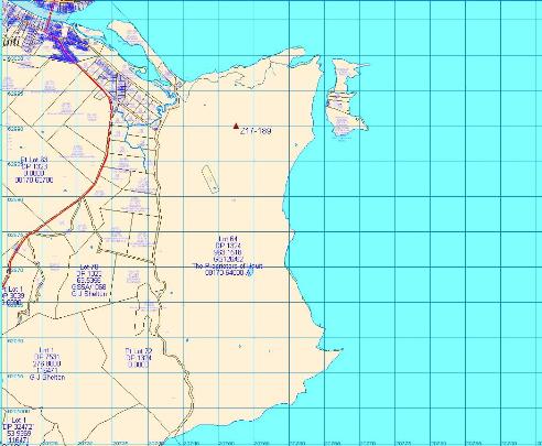
Extent of List Entry
Registration includes part of the land described as Lot 64 DP 1324, Gisborne Land District and the structure known as Pa (New Zealand Archaeological Association Site Record Number Z17/265) thereon.
Legal description
Lot 64 DP 1324 (RT GS126/62), Gisborne Land District
Related listings

Stay up to date with Heritage this month
