

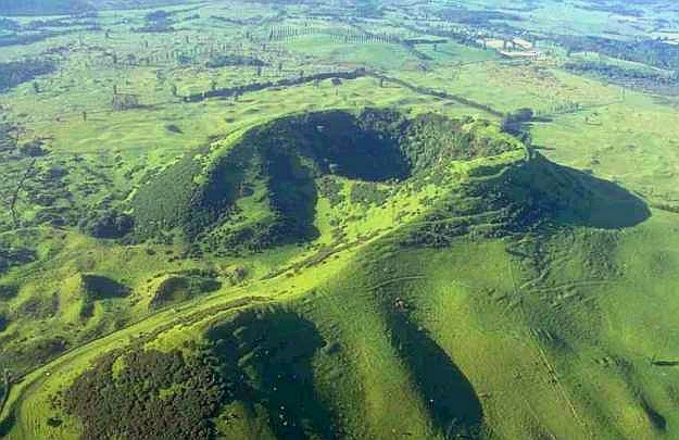
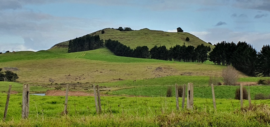
The application to have Pou e rua declared a traditional site was submitted on behalf of the Ngapuhi runanga and all its hapu: Ngati Hine, Ngati Whakaeke, Ngati Maoerewa, Ngati Rahiri, Ngati Kawa, Ngati Kopaki, Ngati Teara, and all others around the Taiamai area. For these people and their tupuna before them, Pou e rua is a prominent terraced pa of great significance. The pa and the surrounding stonefields have been investigated in recent times by a team of Auckland University archaeologists (refer to Historic Places in New Zealand, vol, 14, September 1986). The site and its connecting landscape includes the pa Pouerua; stonefield areas gardened by Maori using traditional methods; stonefield systems created by the missionary Williams in his training of Maori in British farming practices; and the lake Owhareiti.
Pouerua was reassessed by the Maori Heritage Council on 2 June 1994 under the transitional provisions of the Historic Places Act 1993 (HPA 1993), and re-entered onto the Register as a Category I historic place. The text below is an extract from the original paper considered by the NZHPT Board at the time of the reassessment of the registration (MHC 1994/6/31).
Pouerua is considered to be an archaeological site of special and outstanding historical and cultural heritage significance and value. Pouerua is considered the origin and the watershed or pou of the two tribal areas of Ngapuhi, at the Hokianga in the west and Taumarere in the east.
List Entry Information
Status
Listed
List Entry Status
Historic Place Category 1
Access
Private/No Public Access
List Number
6711
Date Entered
2nd June 1994
Date of Effect
2nd June 1994
City/District Council
Far North District
Region
Northland Region
Status
Listed
List Entry Status
Historic Place Category 1
Access
Private/No Public Access
List Number
6711
Date Entered
2nd June 1994
Date of Effect
2nd June 1994
City/District Council
Far North District
Region
Northland Region
Historical and Associated Iwi / Hapū / Whānau
Public NZAA Number
P05/195
Information Sources
Historic Places in New Zealand
Historic Places in New Zealand
Other Information
This place was identified as significant under previous legislation with different information requirements. It remains significant under the current legislation. There is opportunity under our legislation and policies to add to this information. Further information about this place may be available from the Northland Office of Heritage New Zealand Pouhere Taonga. Please note that entry on the New Zealand Heritage List/Rarangi Korero identifies only the heritage values of the property concerned, and should not be construed as advice on the state of the property, or as a comment of its soundness or safety, including in regard to earthquake risk, safety in the event of fire, or insanitary conditions.
Former Usages
General Usage: Maori
Specific Usage: Pā
Themes
Of Significance to Maori
Traditional Site (HPA 1980)
Former Usages
General Usage: Maori
Specific Usage: Pā
Themes
Of Significance to Maori
Traditional Site (HPA 1980)
Location
Related listings

Sign up to hear more
Get the latest heritage news, features and events delivered
straight to your inbox.
