The North Island Main Trunk Line
In 1870, prompted by the then Colonial Treasurer Julius Vogel (1835-1899), the Government adopted bold, expansionist policies to bring thousands of assisted immigrants to New Zealand to construct roads, railway, bridges and telegraph lines. Part of his vision was to create a 'North Island Main Trunk Line' that would connect the country's two main cities, Auckland and Wellington, by rail. At a time when there had been virtually no Pakeha penetration of the North Island Central Plateau, and the King Country remained part of the colony over which the government had 'no practical control', Vogel's vision was more of dream than a practical suggestion.
By 1880, existing railway lines had been extended in both the north and the south of the Island. A railway had been opened from Palmerston North via Marton to Wanganui, and further lines opened in Taranaki, and in the Auckland district the line through Mercer had been extended into the Waikato as far to Te Awamutu on the border of the King Country. To achieve Vogel's vision, approximately 200 miles (322 kilometres) of rail would have to be constructed between Marton and Te Awamutu, to connect the lines that were already in operation. In 1882 the government enacted the North Island Main Trunk Railway Loan Act to raise the finance (£1,000,000) for closing the gap between the railheads, and began negotiations with Maniapoto chiefs for permission to survey a route for the line through the King Country.
In 1883 chiefs Rewi Manga Maniapoto (?-1894) and Wahanui Huatare (?-1897) agreed to allow surveyors to map the railway route through the King Country. While the pair remained strongly opposed to the sale of Maori land, they recognised that the King Country would eventually be opened to Pakeha, and chose to control the process by imposing conditions on the construction of the line. In September 1884, Wahanui declared that he would co-operate with the government over the railway on certain conditions, and he outlined these at the House of Representatives on 1 November 1884. The conditions included the right of the King movement to manage their own affairs, the banning of liquor from Waikato-Ngati Maniapoto territory, and the right of his people to have sole responsibility for administering their ancestral lands.
The Work of John Rochfort (1832-1893)
In June 1883, surveyor and engineer John Rochfort set out to inspect the territory through which the proposed line would be laid. During his journeys, Rochfort met with strong resistance from Maori opposed to the construction of the line, and for three days was held prisoner at Papatupu, near Ohakune. Rochfort surveyed a route through the North Island's mountainous Ruapehu region and in February 1884 confidently reported to the Engineer in Charge of the Public Works Department that 'the central route from Marton to Te Awamutu [w]as the best for the North Island Main Trunk Railway'. Following the completion of Rochfort's survey, a government commission of enquiry was held to ensure that no serious problems would surface if this route was selected. One of the questions raised at this enquiry was the gradient required to traverse the mountainous central plateau region. When asked whether the steepest gradient would be no more than 1 in 70, Rochfort responded 'Yes, I feel confident of that, and can prove it on plans I possess'. The commission took Rochfort at his word. Parliament approved the central route and, on 15 April 1885, a ceremony for the turning of the first sod on the new line was held near Puniu, 2 miles (3.2 kilometres) south of the northern railhead at Te Awamutu.
The Descent from the Central Plateau
Travelling north from the Rangitikei region, Rochfort's proposed line crossed through the Central Plateau in the Ruapehu region. At the highest point in this volcanic region, the land rose to over 2500 feet (762 metres) above sea level. It then dropped away sharply towards the Wanganui Valley. To reach the Wanganui Valley from the National Park the line would have to descend almost 1800 feet (549 metres) in approximately 16 miles (26 kilometres). This meant that the line would require what was an achievable gradient of approximately 1 in 47. Yet in the first 1.25 miles (2 kilometres), the land dropped sharply away towards Raurimu, creating an abrupt fall of 434 feet (132 metres). This created a gradient of 1 in 15. The steepness of this descent meant that Rochfort's claim that the line would require a gradient of no more than 1 in 70 was, as was reported to the House of Representatives in 1892, 'exceedingly erroneous'.
Attempts to Traverse the Central Plateau
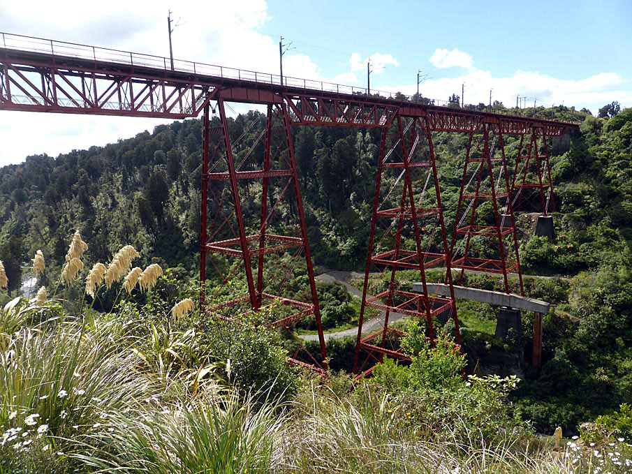
By 1887, despite hindrances caused by the difficult terrain and reduced government funding, the North Island Main Trunk Line had been opened to Te Kuiti, located 42 kilometres south of Te Awamutu. At the southern end, 30 kilometres of track had been laid. Attention turned to the Central Plateau, where the difficulties in finding a practical route between National Park and Raurimu were becoming increasingly clear. In 1887, the Engineer in Chief reported to the Minister of Works that 'two parties have recently been started to run trial gradients from the Waimarino Plateau to the Upper Whanganui Valley. The works on this section are not expected to be very heavy, but it will possibly be necessary to adopt a somewhat steeper gradient than on the portions of line now under construction'. Following exhaustive explorations of the area, these two parties proved that it was in fact impossible to achieve Rochfort's gradient of 1 in 70. Nine surveys were carried out to try and discover any practicable line through the Central Plateau. The only practicable option was a line surveyed by J. Barton Browne and C. B. Turner, which achieved a gradient of 1 in 50 down from National Park, past Raurimu and towards the Piopiotea Valley. The 20-kilometre line required the construction of an extra nine viaducts, three of which would be a minimum of 100 feet (31 metres) high. Although this made re-routing the line through the Taranaki region appear in a more attractive light, anticipated financial and other benefits of the central route created considerable pressure to continue with the existing route, and in 1892 a Committee of Inquiry into the matter simply stated that further exploration and survey was necessary before the final route would be determined.
It was clear that the pursuit of the central route would involve the Government in an expense of a magnitude not conceived of when Rochfort's route through the Central Plateau was adopted. In 1884, for instance, it was estimated that the cost of constructing the entire line between Marton and Te Awamutu would be approximately £1,293,134. The cost of the route through the Central Plateau was estimated at no more than £19,565. In 1894 the cost of the route through the Central Plateau alone was estimated at £174,250, with the cost of Browne and Turner's 20 kilometres of line and nine viaducts coming to £104,500.
Robert West Holmes' Solution (1856-1936)
Robert West Holmes, born in London, England, had arrived in New Zealand in 1871 at the age of 15 and joined the Public Works Department as a draughtsman the following year. He later served as a resident engineer in New Plymouth, where he investigated alternative routes for the proposed rail line through Taranaki, and was given charge of the North Island Main Trunk Railway Line in 1891. In 1893 the engineer began work re-surveying part of the line through the Central Plateau. By 1897 he had completed the work up to the point where the 20 kilometres of line proposed by Browne and Turner were required if the line was to reach the Piopiotea Valley. The following year, Holmes sent a report to the Engineer-in-Chief noting that 'A better line has been obtained down the Piopiotea River Valley than was expected to be got'. In 1899 it was reported that, due to this new line, 'All the viaducts between Waimarino and the Wanganui River have been avoided'. Holmes had found an ingenious means of traversing the drop toward the Piopiotea Valley that meant that Browne and Turner's solution, the only other practicable solution, was no longer required.
Traversing the Central Plateau
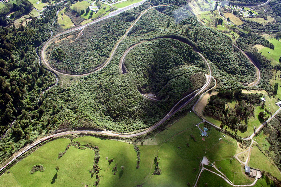
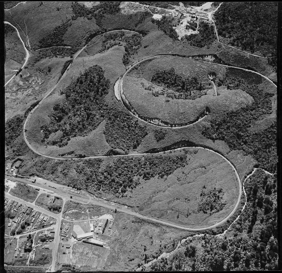
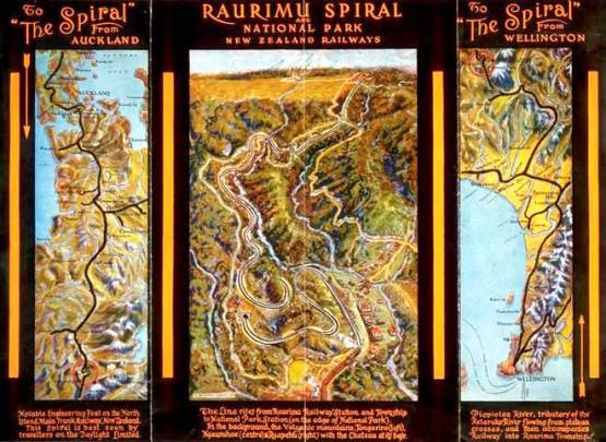
As was reported in the Herald on 12 September 1898, 'the supposed impossible engineering feat of dropping down from the tableland on the central route to the valley of the Wanganui on a good grade has been completely accomplished by Mr. Holmes making use of the ...device of a loop to gain distance and so reduce the grade'. Instead of creating a straight line down the 3 and a half miles to the valley as Browne and Turner had done, Holmes had designed a spiralling line seven miles (11 kilometres) long, which lost 715 feet (218 metres) of height without breaking the gradient of 1 in 50. The solution was far shorter and much cheaper than the tortuous line laid out in 1887 by Browne and Turner.
Construction
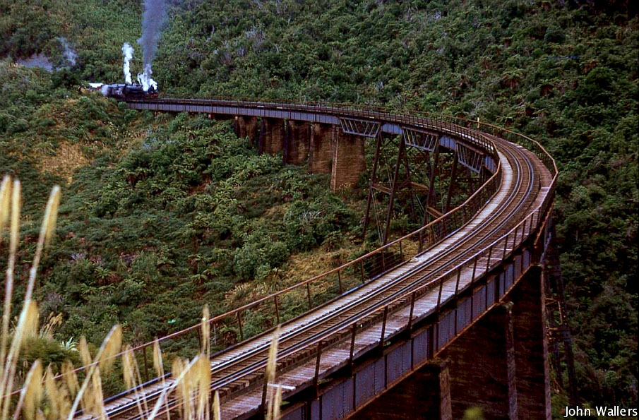
From the clearing of the bush to the final plate-laying at National Park, work on Holme's solution, the 'Raurimu Spiral', was completed in just two years and seven months and included three horseshoe bends, two tunnels and a circle. Transient railway workers employed on a day-to-day basis by the Public Works Department constructed it. These workers began moving to the area to work on the spiral in 1905. When engineering cadet Peter Keller arrived on the site of the future Raurimu township in March 1905, he reported that the area was 'all-pervading forest'. By 1906 Raurimu was a township of calico tents. It boasted a population of over 1000 and had a number of public buildings included 'a post office, town hall, school, railway station'. Yet the weather conditions meant that the work was sporadic. As men were paid only for days worked, the actual money earned tended to be low, while the isolated nature of the settlement meant that the cost for goods was very high. It was not uncommon for the workers to fall into debt and in 1906 the Auckland Weekly News noted that debt meant that '[m]any of the men...cannot get away'. The spiral was completed in 1908 and stands as a lasting testimonial to the transient population of rail workers that founded the Raurimu township.
Completion of the Line
On 6 November 1908, 38 years after it was first proposed by Vogel, the North Island Main Trunk Line was officially completed. During the celebratory ceremony, the then Prime Minister Joseph George Ward (1856-1930) drove a silver-plated spike, the 'last spike', symbolising the completion of the project and the connection of Wellington with Auckland by rail. Regular passenger services between Auckland and Wellington commenced later that same year.
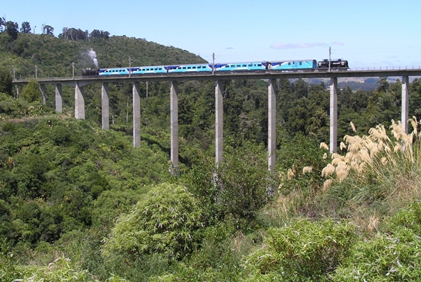
To transport passengers across the Central Plateau large, New Zealand built coal and, later, oil-fired steam locomotives of the 4-8-4 type, classes 'K' and Ka' were used on the North Island Main Trunk Line and travelled the 1 in 50 gradient of the Raurimu Spiral. From 1965, diesel-electric locomotives of the 80 tonne (1425 hp) 'Da' class, and their larger successors, were used on all types of trains over this section. These locomotives could haul 380 tonnes per engine up the spiral at the same speed as steam locomotives and at a much lower cost. From 1973, the 97-tonne 2040 kW (2750 hp) 'Dx-class diesel-electric locomotives were introduced. These could haul 700 tonnes up the Spiral.
In 1980, an area adjacent to the Spiral was made a recreation reserve and, six years later, the Minister of Railways, opened a lookout over the Spiral. An information board that outlined the history of the spiral was also erected. In 1997 a ceremony was held to acknowledge the importance of the engineering and construction skills of those involved in the project, and to acknowledge the importance, at that time and ever since, of the connection of the two major cities of New Zealand. The Institute of Professional Engineers New Zealand and the prestigious American Society of Civil Engineers jointly designated the site an 'International Historic Civil Engineering Landmark'. The Spiral continues to be used today.