

Location
List Entry Information
Overview
Detailed List Entry
Status
Listed
List Entry Status
Wahi Tapu Area
Access
Able to Visit
List Number
7653
Date Entered
3rd March 2006
Date of Effect
3rd March 2006
City/District Council
Ruapehu District
Region
Horizons (Manawatū-Whanganui) Region
Extent of List Entry
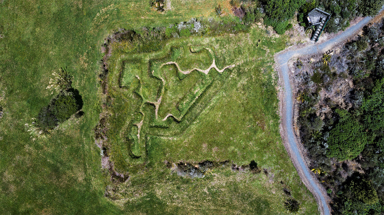
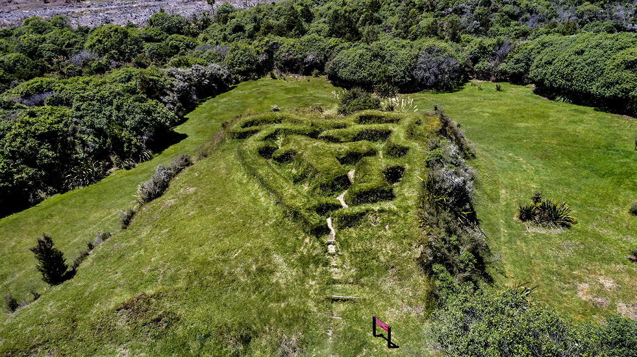
Te Porere Wahi Tapu Area is located in the Te Porere Pa Reserve. The reserve was the location of a battle ground and contains rua koiwi. Te Kooti and his followers built and occupied Te Porere Pa in 1869. The site also contains archaeological material including 2 redoubts.
Legal description
Pt Okahukura 6A2, Blk VIII Tongariro SD; Pt Okahukura 8M2C1, Blk VIII Tongariro SD; Pt Okahukura 6B, Blk VIII Tongariro SD, Sec 1 Blk VIII Tongariro SD; (NZ Gazette 23 April 1959, No.23 p.51; NZ Gazette 13 October 1966 Vol III p.1581; NZ Gazette October 1966 No 59, p.1578; NZ Gazette 1977 p.2700), Wellington Land District
Stay up to date with Heritage this month
