

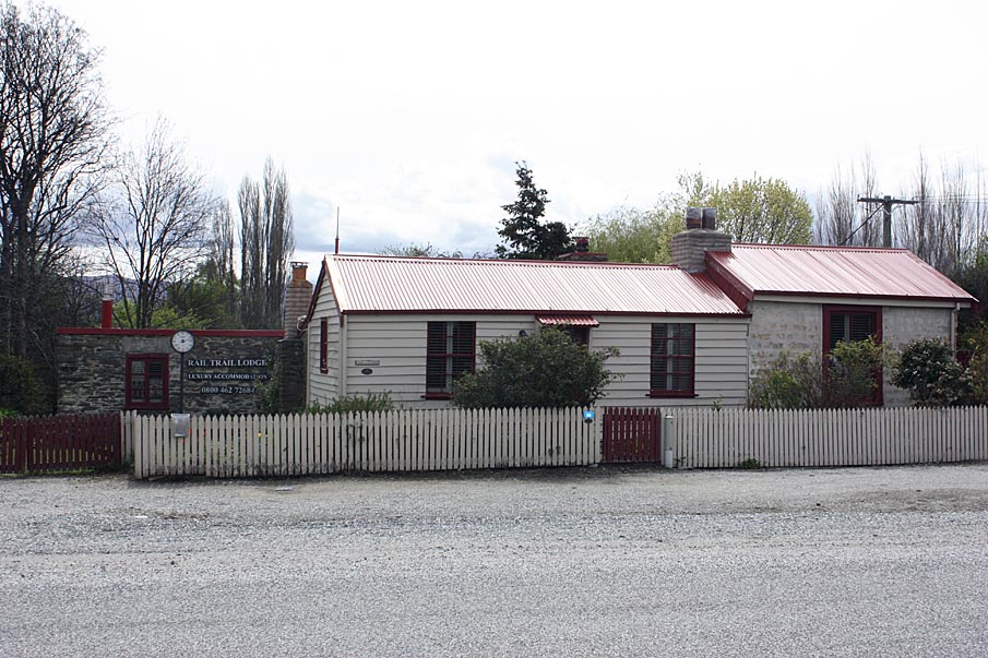
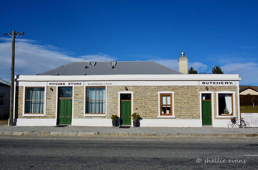
GENERAL DESCRIPTION:
Gold was discovered at Ophir in 1863, on land grazed by Charles F. Black - hence the town's early name, Black diggings, later shortened to Blacks. In 1875, the growing town was officially declared as such and given the name Ophir, said to be after the biblical Ophir where the Queen of Sheba obtained her gold for King Solomon.
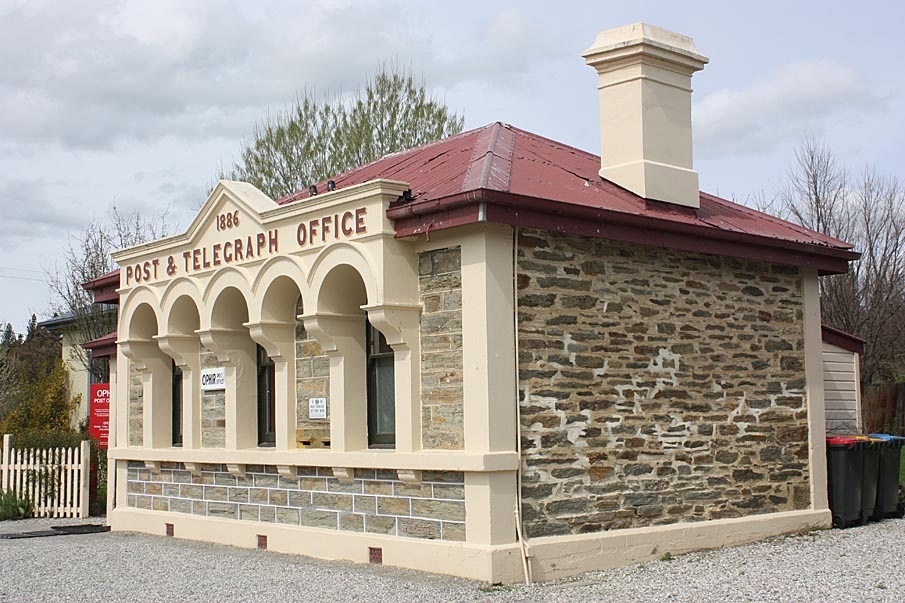
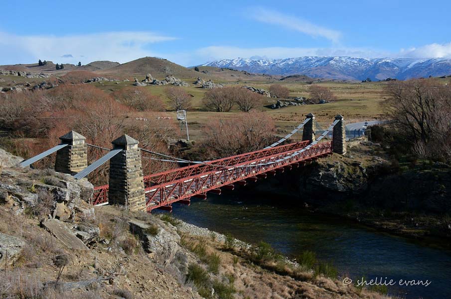
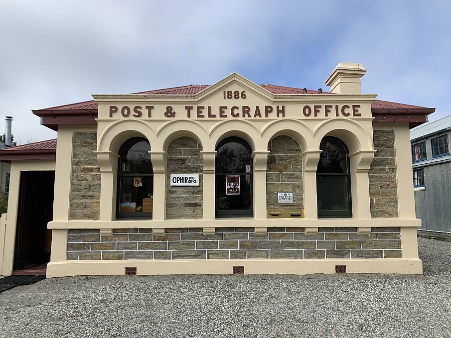
In the early years of the town when the population was around 1,000, Ophir is said to have competed with Clyde for the headquarters of the Vincent County Council, but lost out to the latter. Buildings such as the 1886 Post Office, the courthouse and former general store reflect the optimism that Ophir would continue to flourish long after the gold ran out, the small township did not experience this growth as a direct result of the Central Otago railway line by-passing Ophir on the other side of the Manuherikia River.
After the turn of the century, new development was concentrated closer to the railhead, 2krn away at Omakau. Ophir's remaining buildings, many of which have been more recently restored, provide a vital link between the early history of the town and the present day.

List Entry Information
Status
Listed
List Entry Status
Historic Area
Access
Private/No Public Access
List Number
7268
Date Entered
27th October 1995
Date of Effect
27th October 1995
City/District Council
Central Otago District
Region
Otago Region
Extent of List Entry
The area comprises the Town of Ophir and surrounding land, contained in secs 117, 118 & 119, Blk 2, Tiger Hill Survey District.
Legal description
Secs 117, 118 & 119, Blk 2, Tiger Hill Survey District
Why is this place significant?
Cultural Significance
This historic area was registered under the Historic Places Act 1993. The following text is from the original Recommendation for Classification report considered by the NZHPT Board at the time of registration. Cultural: Over the last one hundred years the small Central Otago town has not changed significantly and still demonstrates the traditional gold fields way of life. The size and scale of the remaining miners' huts and cottages, and their construction, tell of a much humbler, harsher existence experienced in the past. Social: This area demonstrates three distinct eras; the early gold mining period, when the town was given official status (post 1875) and the period of decline which began after the coming of the Central Otago Railway on the other side of the Manuherikia River.
Historic Significance
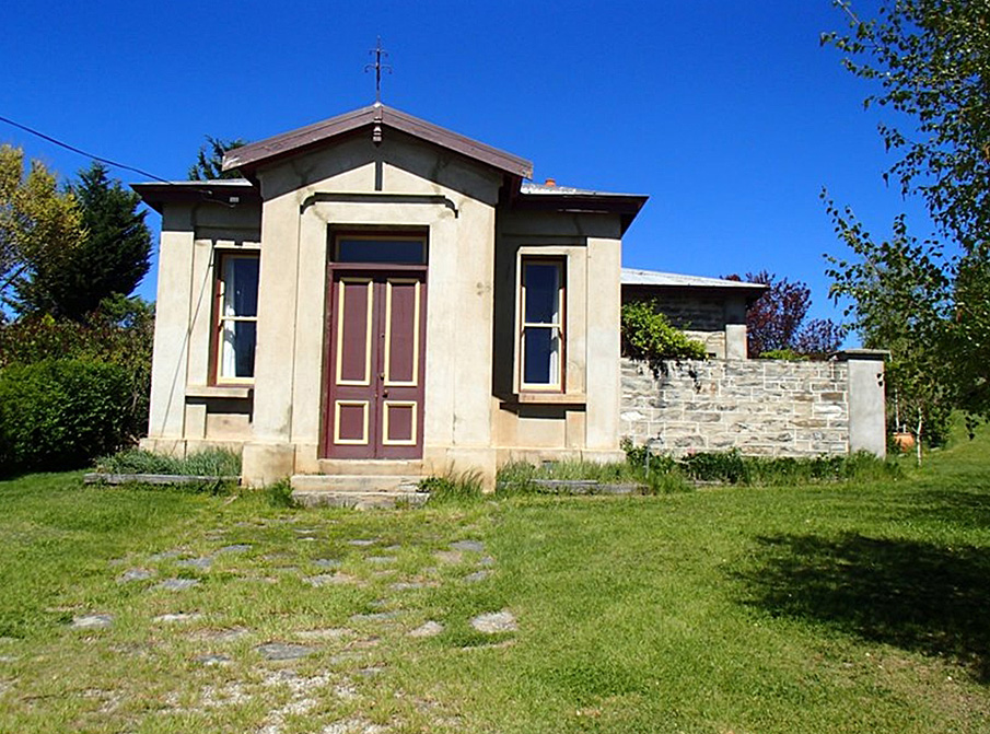
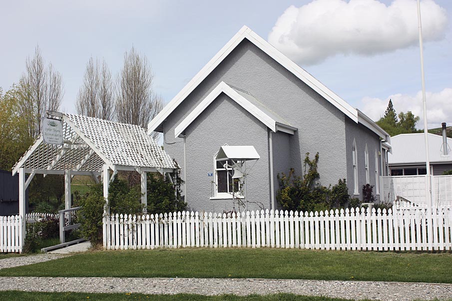
Historical Significance or Value This historic area was registered under the Historic Places Act 1993. The following text is from the original Recommendation for Classification report considered by the NZHPT Board at the time of registration. Historical: Ophir possesses considerable historical significance as a typical Central Otago gold mining township. Its stagnation, after being by-passed by the railway, has led to the preservation of several structures. The Ophir historic area with its variety of architectural styles and striking Central Otago scenery has great aesthetic appeal. It is historically significant depicting life in a Central Otago mining township and holds considerable archaeological remains that demonstrate past mining techniques.
Physical Significance
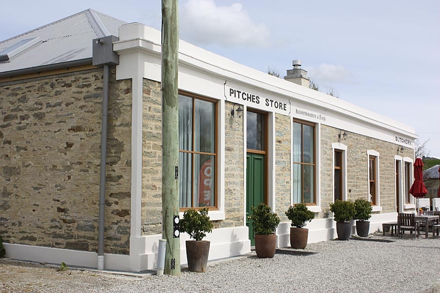
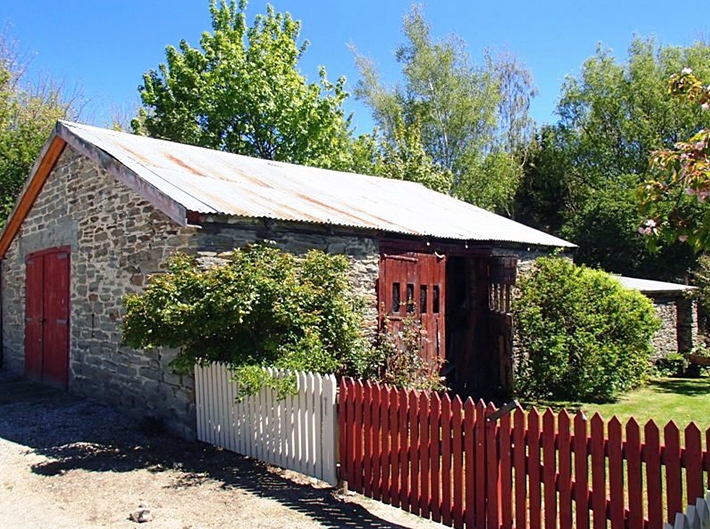
This historic area was registered under the Historic Places Act 1993. The following text is from the original Recommendation for Classification report considered by the NZHPT Board at the time of registration. Architectural: While the earliest buildings in the historic area could be classed as utilitarian, i.e. simple structures erected hastily to meet an immediate need, without much consideration for actual style, an interesting comparison can be made between these and the more permanent structures that followed the initial rush for gold and Ophir's official designation as a town. Building styles range from two-cell colonial cottages and one room mud or schist stone huts to high Victorian public buildings constructed of dressed and pointed stone. Technological: The area demonstrates the different mining methods used over a period of approximately seventy years. Aesthetic: The overall character of the Ophir historic area is still determined to a significant degree by its gold mining past (I863). This is essentially defined by the visually apparent archaeological remains of gold mining, e.g. shafts, adits, races and by the uniform single storey height and vernacular stone and mud brick construction of some of the historic buildings in the area Ophir is set between the stark Raggedy Range and the willow shaded Manuherikia River. Archaeological: The archaeological remains of nineteenth century gold mining at Ophir are extensive and consist of adits, shafts, stone races, darns and building remains. Several of the buildings in the area are over one hundred years old and may have archaeological significance.
Why is this place significant?
Cultural Significance
This historic area was registered under the Historic Places Act 1993. The following text is from the original Recommendation for Classification report considered by the NZHPT Board at the time of registration. Cultural: Over the last one hundred years the small Central Otago town has not changed significantly and still demonstrates the traditional gold fields way of life. The size and scale of the remaining miners' huts and cottages, and their construction, tell of a much humbler, harsher existence experienced in the past. Social: This area demonstrates three distinct eras; the early gold mining period, when the town was given official status (post 1875) and the period of decline which began after the coming of the Central Otago Railway on the other side of the Manuherikia River.
Historic Significance
Historical Significance or Value This historic area was registered under the Historic Places Act 1993. The following text is from the original Recommendation for Classification report considered by the NZHPT Board at the time of registration. Historical: Ophir possesses considerable historical significance as a typical Central Otago gold mining township. Its stagnation, after being by-passed by the railway, has led to the preservation of several structures. The Ophir historic area with its variety of architectural styles and striking Central Otago scenery has great aesthetic appeal. It is historically significant depicting life in a Central Otago mining township and holds considerable archaeological remains that demonstrate past mining techniques.
Physical Significance
This historic area was registered under the Historic Places Act 1993. The following text is from the original Recommendation for Classification report considered by the NZHPT Board at the time of registration. Architectural: While the earliest buildings in the historic area could be classed as utilitarian, i.e. simple structures erected hastily to meet an immediate need, without much consideration for actual style, an interesting comparison can be made between these and the more permanent structures that followed the initial rush for gold and Ophir's official designation as a town. Building styles range from two-cell colonial cottages and one room mud or schist stone huts to high Victorian public buildings constructed of dressed and pointed stone. Technological: The area demonstrates the different mining methods used over a period of approximately seventy years. Aesthetic: The overall character of the Ophir historic area is still determined to a significant degree by its gold mining past (I863). This is essentially defined by the visually apparent archaeological remains of gold mining, e.g. shafts, adits, races and by the uniform single storey height and vernacular stone and mud brick construction of some of the historic buildings in the area Ophir is set between the stark Raggedy Range and the willow shaded Manuherikia River. Archaeological: The archaeological remains of nineteenth century gold mining at Ophir are extensive and consist of adits, shafts, stone races, darns and building remains. Several of the buildings in the area are over one hundred years old and may have archaeological significance.
Historical and Associated Iwi / Hapū / Whānau
Information Sources
New Zealand Historic Places Trust (NZHPT)
New Zealand Historic Places Trust
Other Information
A copy of the original report is available from the NZHPT Southern region office Please note that entry on the New Zealand Heritage List/Rarangi Korero identifies only the heritage values of the property concerned, and should not be construed as advice on the state of the property, or as a comment of its soundness or safety, including in regard to earthquake risk, safety in the event of fire, or insanitary conditions.
Location
Related listings
Sign up to hear more
Get the latest heritage news, features and events delivered
straight to your inbox.
