EARLY HISTORY OF THE SITE:
Land in the vicinity of Symonds Street Cemetery was occupied by Maori prior to formal European colonisation in 1840. Early inhabitants of the Auckland area are said to have included Ngati Huarere who established a fortified village at Horotiu, in the region of today's Symonds Street ridge and Queen Street gully. A later group, Te Waiohua, are traditionally believed to have occupied Te Hororoa pa at the northern end of the Symonds Street ridge before invasion by Ngati Whatua in the 1740s. A track along the Karangahape Road ridge, which reaches the Symonds Street ridge at the current cemetery site, formed a thoroughfare for food-gathering parties and others. Te Iringaorauru, a short distance to the northwest of the site, is where the body of Rauru - a member of Ngati Whatua - was hung in a tree by Te Waiohua, an event said to have been a contributory cause of the Ngati Whatua conquest of the Auckland isthmus.
In the so-called Musket Wars of the early 1800s, Ngati Whatua retained cultivations at Horotiu on an occasional basis. The gardens were re-settled by Ngati Whatua in 1837, but again abandoned after Ngati Whatua's offer to sell 1214 hectares (3000 acres) to the British Crown for the creation of a colonial capital at Auckland was agreed in September 1840. Within two months, the layout for a new town was surveyed and drawn up by the acting Surveyor General, Felton Mathew, during which process the ridges were cleared of scrub. The northern end of the Symonds Street ridge was subsequently developed as a high-status area for official residences and related structures, while the Queen Street and Grafton gullies to either side of the ridge were earmarked for commercial and industrial activities respectively.
ESTABLISHMENT OF A GENERAL CEMETERY (1841-1842):
Although a designated graveyard was a basic requirement for the settlement, Mathew's plan did not include reference to a burial ground, nor did it specify the use of the land ultimately put to that purpose. Initial preoccupations were evidently with organising the lives of new colonists rather than making accommodation for their deaths. Mortality among incoming settlers, however, soon necessitated a place for burial. A cemetery consequently appears to have been established on the outskirts of the town during the course of 1841. Founded in the same year as a similar burial ground in the New Zealand Company settlement at Port Nicholson (Wellington), this was one of the very first urban cemeteries in New Zealand and possibly the earliest to be established under direct colonial government control.
Located on the eastern side of the Symonds Street ridge, the new cemetery was sited well away from contemporary habitations. It was positioned on the steep slopes of Grafton Gully, at the mouth of which industrial activity and Maori trade was carried out. Although beyond view of the main settlement, it was on the same ridge as major official structures such as the Britomart military barracks and St Paul's Anglican Church, both under construction in 1841. The burial ground also lay beside a major natural land route from Auckland leading in a southerly direction, being situated at the junction of the Symonds Street and Karangahape Road ridges.
The earliest date for the cemetery is currently unclear, but initial interments may be linked with nearby institutions. According to an eyewitness, Edward Costley (c.1796-1883), the first burial was that of a soldier, although other accounts state that a soldier's child was the earliest interment in Grafton Gully. Anglican records note that a person by the name of Emmerson was buried on 1 February 1841, although it is unclear if this was in the cemetery grounds. The earliest known grave marker, now lost, was that of nine-year old William Mason, who was buried on 13 September 1841 from the first St Paul's Church - a temporary raupo structure. Mason's father, also William Mason (1810-1897), designed the first permanent version of the church (built 1841-44) and was the colony's first architect and Superintendent of Works.
The land initially set aside for burials may have covered as much as 3.75 hectares (8¾ acres). It was later said to have been for the use of all the settlement's citizenry as a general cemetery, regardless of religious affiliation. Sited away from places of worship, it was unlike most previous burial grounds established by Pakeha in New Zealand prior to 1840, such as those at Kororareka (Russell) and Paihia, which were attached to churches following the traditional British model. Churchyard burial reinforced the role of religion in the disposal and commemoration of the dead and, particularly in an English context, the authority of the Anglican Church.
The creation of a general cemetery in Auckland away from its associated churches can be seen as a reflection of the greater separation between church and state in the new colony. This approach was based on a collective, egalitarian philosophy promoted by Enlightenment ideas, which was popular in progressive circles internationally in the late eighteenth and early nineteenth centuries, including among nonconformist Protestants. It may have been particularly attractive in a colonial context where there was perhaps a desire to forge a collective identity among settlers at an early stage. The separation of burial grounds from churches was also a reaction to prevailing public health concerns in Europe and elsewhere, where overcrowded cities and a growing awareness of the importance of hygiene led to attempts to close down inner-city churchyards and establish more carefully regulated cemeteries on the urban fringe.
Early international experiments in this approach included the foundation of the Père-Lachaise cemetery in Paris, in 1804. British prototypes for collective graveyards on the urban fringe encompassed several developed by private enterprise in the 1820s and 1830s, although they often incorporated churches or chapels. Churchyard burial remained the standard practice in English cities until legislation enforced the closure of urban churchyards in the 1850s and 1860s. Along with a similar general cemetery established in Bolton Street, Wellington, the Auckland burial ground reflects the adoption of a socially liberal, rationalist approach to the disposal and commemoration of the dead at an initial stage in New Zealand's urban history.
EXPANSION AND CONVERSION TO A DENOMINATIONAL CEMETERY (1842 - early 1850s):
By the middle of 1842, representations from the Anglican and Catholic authorities, in particular, resulted in steps being taken to create separate denominational graveyards on a greatly expanded site. Sections were eventually allocated as Anglican, Catholic and Jewish burial grounds, with a fourth area provided as a general graveyard for low-church Protestant faiths and others. The expanded cemetery occupied a total area of 7.5 hectares (18½ acres), straddling both sides of the track that was to become Symonds Street. The size of each burial ground appears to have been allocated according to the proportion of each religious group's adherents in the Auckland community, as ascertained by government census.
The first area to be allocated was the Anglican burial ground, which occupied a 3.75 hectare (8¾ acre) site previously used as the general cemetery. Granted by Governor William Hobson (1783-1842) on 12 July 1842, this land was formally consecrated as a Church of England cemetery by Bishop George Selwyn (1809-1878) less than a fortnight later. Resistance to common burial grounds by the Anglican authorities in Britain and elsewhere may have been partly linked to its clergy earning a stipend from burial fees and to newly emerging high-church philosophies such as those promoted by the Camden Society. Such beliefs reinforced the importance of a separate Anglican identity from other Protestant groups and, like Catholics, the need for burial in consecrated ground.
Perhaps in response to Catholic representations in May 1842, Hobson's initial intent had evidently been to divide cemeteries simply between the Catholic Church and all Protestants. His change of mind to allocate separate Protestant burial grounds sparked a fierce debate that resurfaced periodically over the next few years within the Protestant community. The new situation was seen by some colonists as politically divisive and a surrender to the intolerance of religious establishments that many had sought to escape or avoid. Whatever the accuracy of this opinion, it appears to have reflected the influence that established religions had begun to assert in the new colony as a counter-reaction to Enlightenment ideas in Britain and elsewhere set in. A further 0.375 hectares (nearly 1 acre) was added to the northern end of the Anglican holding in 1843, bringing its proportion to just over half of the total cemetery area. This corresponded with statistics that classified no less than 1,100 of the approximately 1,900 residents in Auckland as Anglican.
At the time of Hobson's 1842 Crown Grant to the Anglican Church, two similar plots were to be divided 'among the other denominations of Christians', although it was to be some time before these grants were formalised. Bishop Jean-Baptiste Pompallier (1801-1871) had applied in May 1842 for a burial ground for Auckland's Catholics and was advised that two acres would be granted adjoining the Protestant burial ground at the back of the town. The land, formally transferred in September 1852, comprised just over 2 hectares (5 acres) on the western side of Symonds Street and was bounded to the south by East Street, now known as Alex Evans Street. Its first interments may have occurred after June 1843, when Catholics and others were said to be excluded from burial in the Anglican graveyard unless they accepted certain ceremonies and fees.
An area of approximately 1.2 hectares (5 acres) immediately to the north was similarly allocated as a general burial ground, including for members of low-church Protestant faiths such as Wesleyans, Presbyterians and Baptists, and others. Being without a place of interment in June 1843, Auckland's Presbyterians had evidently sought a separate burial ground for their own use. Their application coincided with a religious schism that occurred in Britain between the Church of Scotland and the breakaway Free Church. Largely of Free Church disposition, Auckland's Presbyterians were evidently among those who perceived the Church of England's actions in taking over the pre-existing burial ground as an assumption of traditional authority by an established church. Whilst it is possible that from an early period Presbyterians were buried in a distinct space within the new general burial ground, later approaches to have the burial ground placed under their trustees were apparently not for the purpose of keeping it for their exclusive use, but to have it 'properly fenced, and laid out for the interment of all whose friends might wish to bury them there'. Wesleyans appear to have been particularly disposed to the idea of a general graveyard as part of their broader, egalitarian philosophy. They and other nonconformist faiths kept the original 1841 approach alive.
In November 1843 a relatively flat area of approximately 0.4 hectares (1 acre), also on the western side of Symonds Street, and bounded to the north by Karangahape Road, was granted for the burial of the dead of Auckland's Jewish community. A similar graveyard had been set aside in Wellington a few months earlier. Located closest to the main settlement of all the denominational burial grounds, the prominent location of Auckland's Jewish burial ground may reflect the relative importance of the Jewish community to the town's early commercial and social development. Its earliest interment was carried out in 1844.
While all of the denominational burial grounds lay just outside the formal town boundaries, colonial Auckland was primarily a 'walking city' with the graveyards forming the final destination for often large and elaborate funeral corteges - an important part of Victorian burial ritual. In September 1842, the track that later became Symonds Street was cut or improved to allow the passage of a funeral procession for Governor Hobson, New Zealand's first colonial governor, who was buried in the Anglican burial ground. The Anglican graveyard was evidently depicted shortly afterwards surrounded by a post and rail fence with graves set out haphazardly, some enclosed by timber palings. There are no plantings evident and most of the land appears to be scrub. A small dwelling for a ‘keeper of the ground' may have been erected slightly later.
In 1848, all of the burial grounds were described: the Anglican the largest graveyard, picturesquely situated on a ravine; ‘the cemeteries of the Scotch and the Wesleyans' on the opposite side of the road, unenclosed with about 20 wooden tombstones; the Jewish cemetery close by, carefully enclosed; and, a short distance apart from all, the resting place of the Catholics distinguished from the others by a large wooden cross. In 1850, significant improvements to the Jewish burial ground included the construction of a small timber chapel to accommodate specific mortuary rites. Tenders were also called for the erection of a drystone perimeter wall.
EXPANDED DENOMINATIONAL BURIAL GROUND (early 1850s - 1885):
Some reorganisation of the cemetery took place in the early 1850s due, in part, to expansion of the colonial town. By 1852, the cemetery was increased to encompass approximately 1.2 hectares (3 acres) to the north of the Anglican graveyard, for use as a Wesleyan and General burial ground. This brought the total cemetery area available for burial to its maximum size of just over 9 hectares (22½ acres). By implication, the previous general cemetery accommodating Wesleyans, Presbyterians and others appears likely to have been reserved for Presbyterians from this time, although some burials of individuals of other Protestant denominations who already had family members interred there appear to have continued. The first burial in the new extension was that of James Martin Buller, a son of the Wesleyan missionary, the Reverend James Buller (1812-1864), in September 1852. Crown grants formalising the separate landholdings as the Presbyterian, and Wesleyan and General cemeteries were not finalised until 1869 and 1872 respectively.
Expansion of the town closer to the cemetery created public health issues. Concerns that seepage from the Anglican burial ground might cause water in Mechanics Bay to become undrinkable led the Church of England to declare that it would introduce rules governing the size, depth and location of graves, and the space enclosed around them. The replacement of a keeper's house with a sexton's residence at the southern end of the burial ground may be linked with greater supervision. By this time interments in the Anglican graveyard numbered approximately 400, although no formal records were kept. Some regulation was already in place in the Catholic graveyard.
Significant changes in the 1860s and 1870s included the creation of more conscious layouts and beautification of the burial grounds. This development followed the emergence of Picturesque garden-cemeteries in Europe and elsewhere, and the subsequent influence of landscape designers such as John Loudon (1783-1843). Garden-cemeteries were promoted as places of quiet reflection and moral edification, and as conscious historical records. Perambulation, and contemplation of the gravestones, was encouraged often leading to a greater emphasis on the presentation of funerary monuments. In Auckland, this process coincided with the spread of residential settlement to the cemetery surrounds and beyond. It also occurred at a time of flux in Auckland's development, when the town sought to redefine its identity following transfer of its role as colonial capital to Wellington (1865). The increased emphasis on beautification effectively heralded the cemetery's heyday.
In 1864, the Catholic cemetery was cleared of scrub and lawn created. Consideration was given to the laying out of walks and the erection of a stone wall along Symonds Street to prevent damage from cattle. A timber mortuary chapel, the cruciform-shaped St Francis de Sales was opened in 1866, designed by the noted Auckland architect, Edward Mahoney (1824/25?-1895). Before the mid 1880s, a caretaker's house was also erected, looking out over a formal layout of linear paths flanked by orderly burials. Initially with few or no trees, perimeter plantings of conifers had by this time been augmented by Pinus radiata, which lined a central carriageway. Poplars and weeping willows were also established in a shallow gully largely unused for interment, which physically separated Catholic graves from Protestant burials to the north. The trees themselves had symbolic meaning. Traditionally, evergreens represented the eternal afterlife, and weeping willows symbolised mourning and loss.
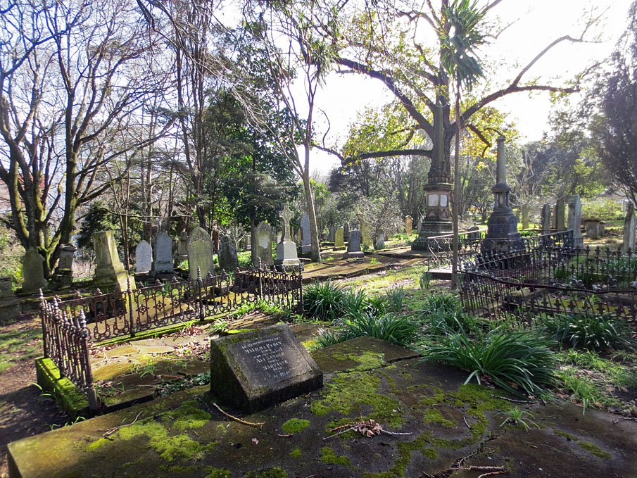
Changes were similarly made to other burial grounds in the cemetery. In 1866, the Anglican trustees invited public subscriptions to enable walls to be repaired and walks gravelled. Unspecified plants had been put in at regular intervals along some pathways, and steps cut by 1868. The first oaks, symbolic of Englishness and stoutness of resolve, are said to have been established in association with the grave of Governor Hobson (d.1842). Pinus radiata plantings were made in the 1870s. An 1887 plan indicates the extent to which a consciously irregular network of meandering paths was created, running along the length of the steep slopes of the Anglican graveyard as well as up and down its main gradient. Largely devoid of trees prior to 1868, the Anglican grounds were increasingly concealed by foliage by the 1880s. Both the layout and foliage contributed to the graveyard's Picturesque appearance, a style popular in many European gardens and cemeteries of a similar and earlier period.
In the Presbyterian graveyard, improvements by the 1880s included a modest gabled structure towards the western end. Its layout may have combined the formality of the Catholic burial ground with the more irregular nature of its Anglican counterpart. Both linear and meandering paths were evidently adopted. In the Wesleyan and General graveyard, subscriptions had been canvassed in 1866 for the completion of works in its neglected grounds. A decade later, inspired by improvements to the Presbyterian graveyard, footpaths and drains were formed and cut, rubbish cleared away and a contract let for the construction of boundary walls and fences. Money was also spent on plans, cemetery gates and plantings to counter unfavourable comment in the press. From 1876, the Wesleyan and General burial ground was known as the ‘Auckland Public Cemetery'.
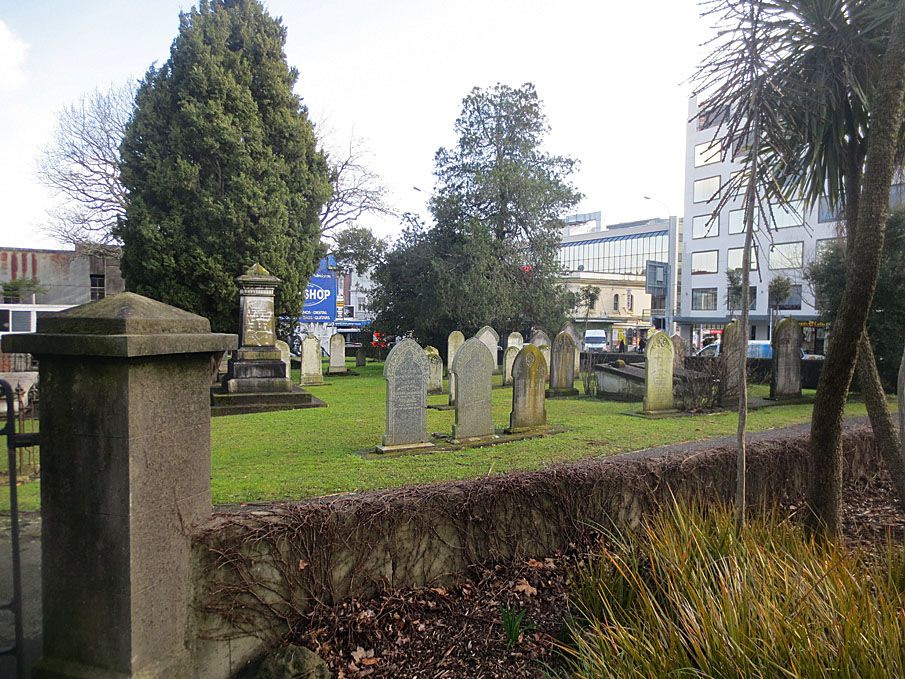
The Jewish graveyard may have been more orderly from an early stage. It encompassed a concentration of burials at its western end, which appear to have been arranged in rows. The earlier timber mortuary chapel continued in use, located close to an entrance in the Symonds Street frontage at the eastern end of the site. A central linear path led down from the chapel to the graves, which by the 1880s may have been interspersed with plantings. Trees in both the Jewish and adjoining Presbyterian graveyards included pines and cypress.
The varying layout and appearance of each graveyard can be seen to have reinforced separate religious and other aspects of cultural identity within the community. Messages differed according to the background and philosophy of each denomination. The Picturesque influences of the Anglican cemetery can be linked with conservative reactions to formal Enlightenment approaches within the Church of England, emphasising a shift away from symmetry and reliance on reason. The more rectilinear layout of the Catholic graveyard has been linked to the particular influence of French Marist missionaries in Auckland, who would have been acquainted with the reformation of French cemeteries in 1808 stimulated by the rationalist ideas of the French Revolution (1789). The Jewish cemetery reflected specific aspects of religious practice, including the particularly important link between mortuary preparation - through the Tahara or purification process - and burial.
Varying religious and other cultural identities were also promoted through the form and inscriptions of individual monuments. Many of the Jewish grave markers were inscribed in Hebrew. Numerous of those in the Presbyterian graveyard referred to Scottish origins. However, there were also similarities, both in monuments and in burial practice, which reflected common bonds. All funerary practice involved burial, and burials were carried out using a standard east-west orientation. Many of the monuments were also carved or supplied by the same masons.
As the cemetery grew in size and importance, its impact on the surrounding landscape correspondingly increased. In 1865, the Church of the Holy Sepulchre opened in a street overlooking the Anglican graveyard, and in the 1880s, St Benedict's Church and other Catholic buildings were similarly erected beside the Catholic burial ground. Commercial opportunities arose as the Victorian ‘celebration of death' developed into a major industry. By 1891, five undertaking premises were present in nearby Karangahape Road and Wellesley Street East alone. Several monumental masons also had businesses in the area, including Gillingham's on Karangahape Road.
DECLINE AND GENERAL CLOSURE (1886-1909):
Concerns about the effects of the cemetery on public health ultimately had an impact on its operations. Early worries about drinking water in Mechanics Bay were followed by apprehensions about noxious gases in the early 1860s, when fumes were said to be noticeable as far afield as Khyber Pass Road. An 1862 Select Committee on Burial Grounds saw no immediate need to close the cemetery, but advocated the opening of new facilities away from urban settlement. In 1871, an Act to Regulate Burials near the City of Auckland allowed trustees to enforce ‘exclusive interment' or ban burials entirely, although a further 1874 Act allowed the interment of blood relatives and a marriage partner of those already buried. From 1878, the Anglican trustees accepted for burial only those who had already purchased a plot, overcrowding having become a major issue.
FOR THE REMAINDER OF THIS HISTORICAL DESCRIPTION PLEASE REFER TO THE REGISTRATION REPORT HELD AT THE AUCKLAND OFFICE OF NZHPT.