The Otago Pioneer Quartz (OPQ) Complex depicts the first quartz mine established in Otago and one of the longest continually running quartz mining endeavours in the region. The complex is associated with various quartz mining operations from 1862 until the early twentieth century. The OPQ Complex provides special insight into the earliest example of this significant New Zealand industry. The OPQ Complex has special archaeological, historical and technological significance.
In the early 1860s, in the wake of the gold rush to Gabriel’s Gully near Lawrence, miners made their way over the high and isolated country near what is now Waipori. Some prospected in the gullies and streams and found gold in December 1861 and miners rushed the area hoping to make their fortunes. A party of Shetland Islanders found a gold-bearing quartz reef as early as March 1862. The reef became known as the Shetland Quartz Reef and was the site of the first quartz mine in Otago. Initially the miners worked by hand, crushing the stone, but when the stone became too hard the first miners abandoned the claim, not having the funds to develop the mine - quartz mining required backing and capital. The Otago Pioneer Quartz Mining and Crushing Company took over the reef and they imported a stamper mill and water wheel from Melbourne to work the reef.
As was common with quartz mines, companies came and went and restructured. Other companies operated batteries on different parts of the reef, including the Canton (started by Chinese miners) and the Victory Company. Ultimately, some 70 companies mined for quartz, in this, the earliest of Otago’s quartz mines. Quartz mining at Waipori lasted until around 1912.
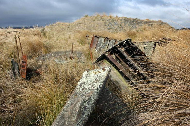
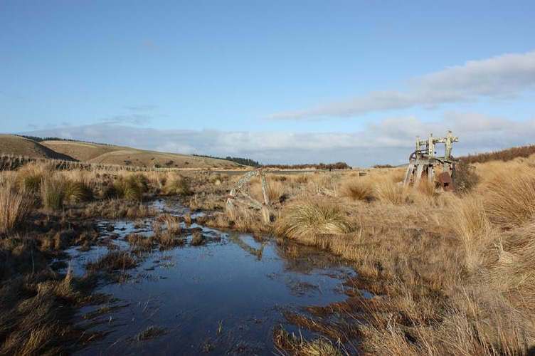
The archaeological features within the Otago Pioneer Quartz area represent the range of sites characteristic of quartz mining – battery sites, shafts, water races, mullock heaps, water wheels and the like. Together they provide evidence of quartz mining as a working system where each part forms a function. Quartz crushing plants included battery houses, the batteries themselves, specialised machinery and other associated structures such as dwellings and office buildings. Water wheels, fed from water races, drove quartz crushing machinery, water pumps, lifting gear and electric generators. The recorded sites provide evidence of these systems on the ground, reflecting the changes over time – the closure and re-opening of plants, and the development of new plants. Old road or tramway alignments provide evidence of the communication and transport links that were vital to the working of these mines.
Once the goldfield was worked out, land reverted to farming, with mining sites marked by their races and machinery remnants across the landscape. In 1987, the land associated with the OPQ Complex became stewardship land under the Conservation Act, recognising its natural and historic values.
In the early 1860s, in the wake of the gold rush to Gabriel’s Gully near Lawrence, miners made their way over the high and isolated country near what is now Waipori. Some prospected in the gullies and streams and found gold in December 1861 and miners rushed the area hoping to make their fortunes. A party of Shetland Islanders found a gold-bearing quartz reef as early as March 1862. The reef became known as the Shetland Quartz Reef and was the site of the first quartz mine in Otago. Initially the miners worked by hand, crushing the stone, but when the stone became too hard the first miners abandoned the claim, not having the funds to develop the mine - quartz mining required backing and capital. The Otago Pioneer Quartz Mining and Crushing Company took over the reef and they imported a stamper mill and water wheel from Melbourne to work the reef.
As was common with quartz mines, companies came and went and restructured. Other companies operated batteries on different parts of the reef, including the Canton (started by Chinese miners) and the Victory Company. Ultimately, some 70 companies mined for quartz, in this, the earliest of Otago’s quartz mines. Quartz mining at Waipori lasted until around 1912.
The archaeological features within the Otago Pioneer Quartz area represent the range of sites characteristic of quartz mining – battery sites, shafts, water races, mullock heaps, water wheels and the like. Together they provide evidence of quartz mining as a working system where each part forms a function. Quartz crushing plants included battery houses, the batteries themselves, specialised machinery and other associated structures such as dwellings and office buildings. Water wheels, fed from water races, drove quartz crushing machinery, water pumps, lifting gear and electric generators. The recorded sites provide evidence of these systems on the ground, reflecting the changes over time – the closure and re-opening of plants, and the development of new plants. Old road or tramway alignments provide evidence of the communication and transport links that were vital to the working of these mines.
Once the goldfield was worked out, land reverted to farming, with mining sites marked by their races and machinery remnants across the landscape. In 1987, the land associated with the OPQ Complex became stewardship land under the Conservation Act, recognising its natural and historic values.