Early Napier
The Ahuriri area’s rivers, wetlands, lagoons and fertile land produced important resources, making the area an attractive place to live. Settlement is thought to have begun in the twelfth or thirteenth century and Ngāti Kahungunu became the dominant iwi from the sixteenth century. There were several pā at what became Port Ahuriri and Napier, including an island pā, Te Pakake, just west of Mataruahou island (Scinde Island, later Napier/Hospital/Bluff Hill), Pukemokimoki to the south and Hukarere on top of Mataruahou. As a result of inter-tribal warfare, around the 1830s many local Ngāti Kahungunu sought refuge in Māhia. When missionaries and other Europeans began arriving in earnest after the signing of the Treaty of Waitangi, the exiles had returned and Te Koau, near Te Pakake, became the principal local pā.
With the Ahuriri Purchase of 1851, the Crown acquired the lands between the Tutaekuri River and north to the Mōhaka area, inclusive of Mataruahou and most of its surrounds. A few years later, in 1855, Napier was established by the government, with the town primarily located on the hill and around its base, as well as the narrow spits extending south and west. The site was not promising because road access was difficult and future expansion would be challenging. However, Napier had a port. This was an important factor in Napier becoming Hawke’s Bay’s early administrative, commercial, and social centre.
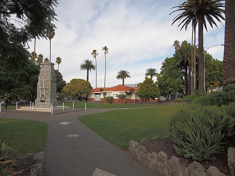
In 1855 a town plan for Napier was produced by Alfred Domett (1811-1887), Commissioner of Crown Lands in Hawke’s Bay. The plan was ‘for a complete town, and laid down a pattern of roads and sections, with sites being reserved for public facilities.’ One of these public facilities was an area of land named Clive Square, envisaged as a recreation space or ‘village green’. Recent archaeological work has found evidence of pre-European Māori occupation of Clive Square. Clive Square was initially favoured as the town’s centre, but the rapid growth of businesses elsewhere in the town meant this never eventuated. When the Hawke’s Bay Provincial Council was abolished and replaced by the Napier Borough Council, the ‘Reserve known as Clive Square’ was included in the Napier Borough Endowments Act 1876 for the ‘use benefit and improvement of the Borough of Napier.’
From early on in Napier’s colonial history, the residents of Napier made good use of Clive Square for sporting and cultural activities and entertainment. In the 1860s an area of the Square was filled in and levelled for cricket and football matches. The Napier City Band (formed in 1868) gave recitals in the Square and it was the site of regular military inspection parades and of visiting entertainment such as circuses.
In 1884, the Napier Recreation Ground took over as the town’s main sportsground and a group of private funders supported the Council to undertake beautification of the southern end of the Square. Improvements included the installation of gas lamps and fencing, ‘…trees were planted, boggy patches drained and levelled, and gardens laid out. A band rotunda, with a light for concerts at night, and ironwork painted blush pink...added to the appeal of the square.’ The opening of the newly appointed Square on 29 November 1886 was a festive occasion, featuring a torchlight procession, music and fireworks. The northern end of the Square was left undeveloped to serve as the playground for students of Napier Main School just across the road.
Further improvements were made to the Square in 1920, in advance of the Prince of Wales’ visit. Despite being used for many years as a road, it wasn’t until 1962 that a strip of land dividing what is now known as Clive Square and Memorial Square gained the status of a legal road (Emerson Street).
Memorialising the First World War
Troops had assembled at Clive Square before departing for the First World War and on 25 April 1916 a large crowd gathered on the site for the beginning of a procession that marked Napier’s first Anzac Day commemorations. As such, it was fitting that after the war Clive Square became a centre for Napier’s remembrance of its fallen soldiers.
Following the end of the First World War there was widespread debate in New Zealand about what form ‘fallen soldiers memorials’ should take. Over 18,000 New Zealand service personnel were killed during the First World War, a significant loss felt by families and communities throughout the country. Almost 17,000 of these personnel were buried overseas, many with unmarked graves. Initially, communities showed enthusiasm for useful memorials such as halls, hospital facilities, bridges and swimming baths. However, advocates of more traditional European-style monuments argued that utilitarian memorials ‘inevitably obscured the heroic ideals they were supposed to recall.’ In the words of William Hugh Montgomery (former Member of Parliament and the army’s director of vocational training during the war), ‘The result is always that the local want is satisfied - the library is built - and its memorial purpose is forgotten.’ Montgomery, his father-in-law Acting Prime Minister Sir James Allen and their supporters favoured traditional monuments because they saw them as artistic expressions of the principles service personnel had fought and died for, while for the thousands of families whose sons lay buried overseas, such monuments acted as a ‘surrogate tomb’ that they could visit. Ultimately the anti-utilitarian argument gained high-profile support. Traditional monuments proved much more achievable given the cost of memorials were mostly met by public subscription.
By 1920, around £100,000 had already been raised in a province-wide Hawke's Bay Memorial Fund. This funded the Hastings Cenotaph (List No. 1083), unveiled in 1923, and the Hawke’s Bay Fallen Soldiers Memorial Hospital in Hastings, first proposed in 1918 and finally opened in 1928, both of which were described as being memorials to soldiers from throughout the province. In Napier, the Plunket Society made an early suggestion of a ‘baby hospital’ as a suitable war memorial, and a large public appeal was made in 1919 to raise money towards a new boys’ high school and war memorial college. The appeal asked, ‘In the training of boys’ minds and bodies, will not the souls of the dead rejoice for evermore?’ This idea appears to have been dropped, however, the following year. By late 1921 the Napier War Memorial Committee had received ‘no less than 20 suggestions…as to what design the Napier memorial should be.’ By February the following year it was reported that the Committee had approved a 15-metre high lighthouse monument as Napier’s war memorial, but the following month Mayor J. B. Andrew called a public meeting after the resignation of all the Committee’s members.
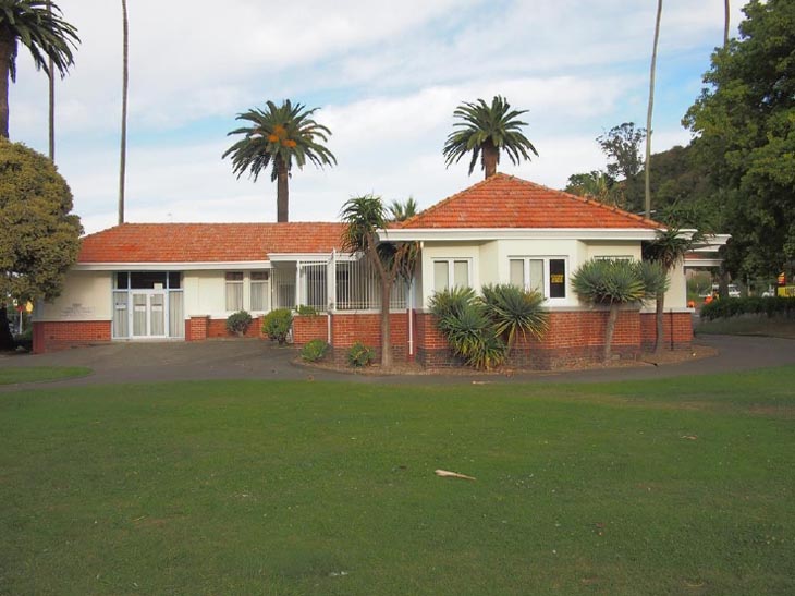
On 1 February 1924, more than five years after the end of the war, the Poverty Bay Herald noted that ‘considerable controversy has taken place at Napier, extending over a lengthy period, respecting the erection of a suitable war memorial. It has now been decided that the memorial should take the form of a mothers’ rest and cenotaph in the northern portion of Clive Square.’ The decision to erect both a cenotaph and a mothers’/women’s rest (a public facility for women including a large ‘rest room’, kitchen, toilets and Plunket Rooms) as a war memorial in Napier appears to have been a compromise between the ‘useful’ memorial and traditional monument schools of thought. No other mothers’/women’s rest buildings are known to have been built as war memorials, making the Napier Women’s Rest (List No. 1180) highly unusual amongst utilitarian First World War memorials in New Zealand. Even more unusual is a war memorial structure specifically providing for the needs of women.
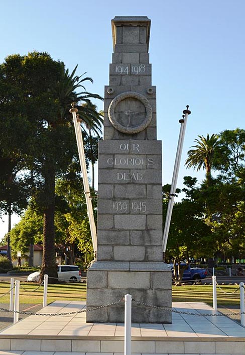
A cenotaph (meaning ‘empty tomb’) was the ‘most obviously funereal type’ of war memorial. The Napier cenotaph, and many others throughout the British Empire, including in Auckland (List No. 122), are based on the design for the cenotaph in Whitehall, London, conceived by British architect Sir Edward Lutyens (1869-1944) in 1919 ‘in reaction to triumphant and over-ostentatious monuments.’ A cenotaph is essentially a ‘massive elevated coffin, a powerful reminder of the cost of war’ and this was considered ‘too gloomy’ by some. As such, it was not a particularly common choice in New Zealand, with only 33, out of 505 known First World War memorials, taking the form of a cenotaph. Communities often added heroic details to their cenotaph designs, such as laurel wreaths ‘to satisfy the sentiments of pride.’ While the design for the Napier Cenotaph included wreaths, unlike the Hastings Cenotaph, it did not list the names of service personnel from the area who died.
Architect David Bruce Frame designed the Napier Cenotaph on behalf of the associated Hawke’s Bay architects and he publicly called for tenders from stonemasons at the end of May 1924. By the end of June the construction of the Cenotaph was reportedly ‘progressing satisfactorily’ and it was formally unveiled on the afternoon of Sunday 9 November 1924, two days prior to the sixth anniversary of the 1918 Armistice. Another Napier war memorial, a large stone cross in memory of ‘all those from Hawke’s Bay who served in the Great War’ had already been unveiled in 1924, on Sunday 15 June, in front of the Napier Cathedral.
A newspaper report of the Cenotaph’s unveiling described the monument as ‘tall, impressive, beautifully proportioned, standing four square in its garden setting.’ A huge crowd gathered in ‘clear, windless weather’ for the ‘simple yet touching ceremony’ led by Mayor Andrew, whose speech emphasised the words ‘Our Glorious Dead’ inscribed on the monument. He acknowledged that very few members of the community had not ‘felt personally, and perhaps painfully, the rigours of war’ and noted that ‘all the good people of Napier had shown practical interest in the progress of the work, and had materially assisted its successful consummation.’
After the canvas covering the Cenotaph was dropped, the Napier Citizens Band played ‘Recessional’ as wreaths were placed the base of the monument. ‘The Last Post’ and ‘Reveille’ were sounded, the hymn ‘All People That On Earth Do Dwell’ was led by Commandant H. Wyatt and a prayer and the Benediction recited by the Very Rev. Dean F. Mayne. The ceremony finished with the national anthem and further wreaths were laid.
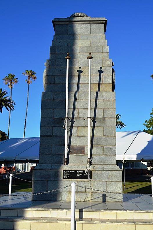
The Daily Telegraph report praised the ‘dignified, impressive’ appearance of the Cenotaph and the appropriate symbolism of the interlaced laurel and fern leaf carved stone wreaths, one atop the monument and one on either side. It noted that ‘a martial touch’ was added to the ceremony by military and naval standards ‘mounted at the foot of the Cenotaph.’
The Napier Women’s Rest was officially opened on Anzac Day 1926 and at that time the site of both the Rest and Cenotaph was renamed Memorial Square. A photograph of the opening of the Women’s Rest published in the Auckland Weekly News shows neat paths and lawn around the Cenotaph and in the following years the immaculately manicured Memorial Square was the subject of tourist postcards.
1931 Hawke’s Bay Earthquake
On the morning of 3 February 1931, a magnitude 7.8 earthquake killed at least 256 and injured thousands more in Hawke’s Bay. Buildings in Napier and Hastings crumbled and fire quickly tore through Napier’s central business district. The damage was catastrophic. The Cenotaph has a strong connection to post-earthquake life from 1931 until 1933 in Napier. In the weeks following the earthquake, the rebuilding of central city business premises was forbidden, to allow thoughtful planning of the town centre’s reconstruction. This also ensured that debris could be cleared without impediment and prevented hastily erected structures. Instead, government funding was provided for the construction of temporary shops and offices in Clive and Memorial Squares. In Memorial Square, the roofs of the corrugated iron structures (hence ‘Tin Town’) were directly connected to the roof of the Women’s Rest, effectively ‘wrapping’ two side of the Rest building. The Cenotaph was undamaged by the earthquake and in photographs of Tin Town, its upper half can be seen above the roofs of the temporary shops and offices in an alleyway created by the structures.
An Anzac Day service was held at the Cenotaph just over two months after the earthquake, in April 1931. A photograph of the service shows a crowd gathered on the street in front of a makeshift platform erected at the entry to the Tin Town alleyway leading to the Cenotaph. By May 1933, Tin Town had been completely dismantled and in 1934 the Women’s Rest, which had suffered damage from the earthquake, was fully repaired, returning Memorial Square to its pre-earthquake state.
Post-Second World War
The Cenotaph was originally built as a memorial to those who had died during the First World War, with the years 1914-1918 inscribed in the stone above the carved wreaths on the northern and southern sides of the monument. Following the Second World War, the years 1939-1945 were carved below the wreaths and subsequent plaques were added to the eastern side acknowledging the forces who served during the First and Second World Wars and listing other international conflicts in which New Zealand participated.
In July 1957 the Napier War Memorial Hall (now Napier War Memorial Conference Centre) on Marine Parade opened, financed by public donations, a government subsidy and a monetary gift from Napier City Council. It was ‘dedicated to the memory of more than 300 members of the Napier community who gave their lives in World War 2’ and satisfied a practical need in the community. Incorporated into the design was a roll of honour listing residents of the Napier Borough who had died in the Second World War and an eternal flame.
Public resistance to the Council’s proposed changes related to the Cenotaph and other war memorial elements in other parts of the city occurred in 2016-17. These proposals included relocating the Cenotaph to Marine Parade, or bringing the eternal flame and roll of honour from the War Memorial Conference Centre to Memorial Square. This opposition shows the ongoing relevance and value placed on these sites by the community and a respect for the original intent and purpose of these memorials.
The Cenotaph has continued to play a central role in Napier’s annual Anzac Day services. On 25 April 2019, a large crowd gathered in Memorial Square for the Civic Service attended by representatives of local and central government, veteran service personnel and members of the public of all ages.