

Waima is a small bay situated in the north-eastern curve of Tokomaru Bay. The district was once called Toka-a-Namu, (abundance of sandflies - namu). The principal hapu is Ngati Porou and the first people who settled in the district were tribal groups thought to be descended from ancestor Toi te Huatahi. Henare Potae (?-1895) was a prominent leader in the area. He encouraged settlement at Tokomaru Bay by granting long-term leases to graze blocks of land as sheep runs. Farming was to become the primary enterprise within the Tairawhiti region, which generated a need for local freezing works. The reliance was on shipping for transport due to poor road networks.
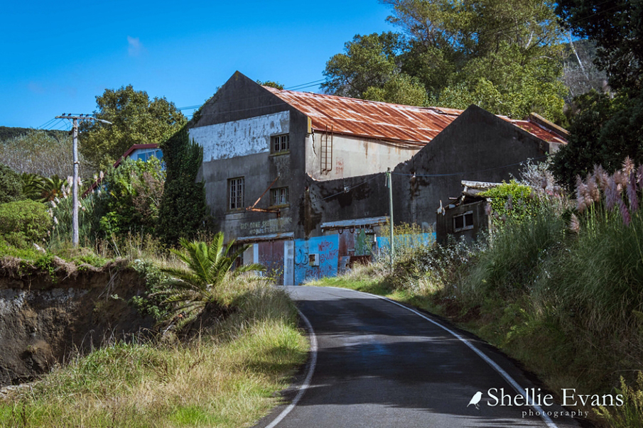
At Waima, on the north side of the bay, the Tokomaru Bay Freezing Works were erected in 1911 through the efforts and fundraising of a group of local farmers. There was already a wharf at Waima before the establishment of the freezing works, however that same year the wharf was extended and improved to allow larger vessels to dock. The enlarged wharf is described as 1200 (365.7 metres) feet in length. The Tokomaru Harbour Board was also established in 1911, taking over the existing wharf and sheds.
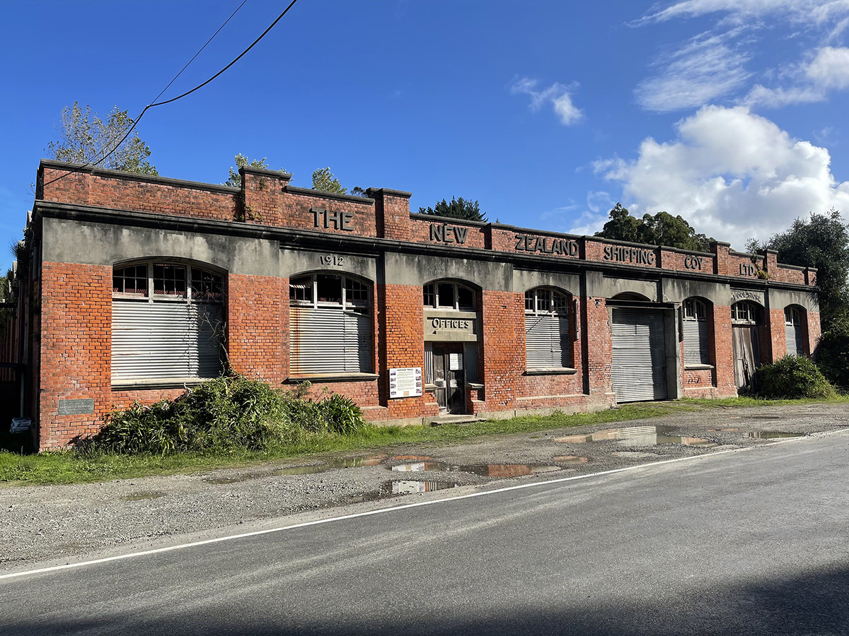
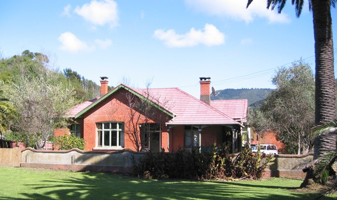
In 1912 a 3 foot (0.91 metre) railway was constructed to carry cargo to and from the lighters at the end of Tokomaru Bay Wharf. The cargo was transported by a small steam locomotive. The New Zealand Shipping Company Offices and Wool Store (Register No. 3480), Manager’s House (Register No. 3479) and Stables (Register No. 3478) were also constructed in 1912. By 1914 the wharf was extremely busy with passengers and livestock; further extension of the wharf occurred at the instigation of the Tokomaru Bay Harbour Board. Between 1913 and 1916 approximately 400 vessels were handled annually.
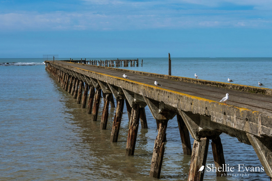
During the 1930s plans were drawn up by the Tokomaru Bay Harbour Board to replace the wharf with a new timber and concrete structure. In 1937 the successful tenderer to reconstruct the wharf was Mr R.A. Cornish of Auckland. Mr Cornish was to be allowed 15 months for the completion of the work. Approximately 100,000 tons of cargo was handled in 1939.
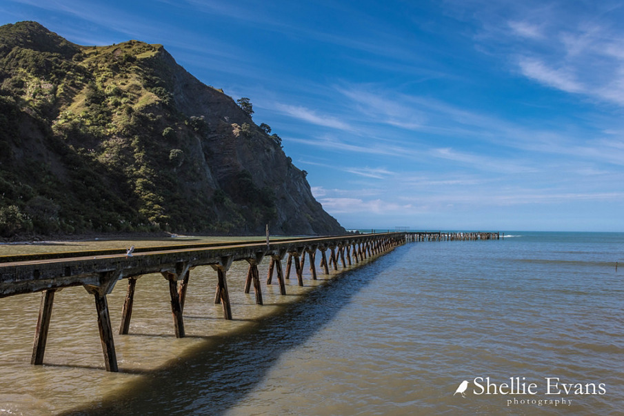
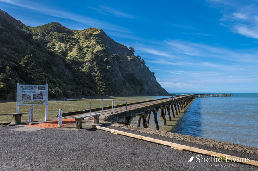
Tokomaru Bay Wharf was completed by 1940. However, the improvement of overland transport routes and decline in overseas shipping caused the closure of the freezing works in 1952. In 1963 the Harbour Board was dissolved, and its powers were transferred to the Waiapu County Council (amalgamated into the Gisborne District Council in 1989). Today the much photographed Tokomaru Bay Wharf is used by visitors and residents as a place for fishing, walking and recreational boats to dock.
List Entry Information
Status
Listed
List Entry Status
Historic Place Category 2
Access
Able to Visit
List Number
3565
Date Entered
5th April 1984
Date of Effect
5th April 1984
City/District Council
Gisborne District
Region
Gisborne Region
Extent of List Entry
Extent includes the whole of the structure known as Tokomaru Bay Wharf, which extends south-east from the land parcel described as Sec 1 Blk IVA Tokomaru SD (RT GS3A/716), Gisborne Land District and across the beach front and into Tokomaru Bay (refer to map tabled at the Board meeting on 27 June 2013).
Legal description
Sec 1 Blk IVA Tokomaru SD (RT GS3A/716), Gisborne Land District
Construction Professional
Name
Cornish, R.A.
Type
Builder
Biography
No biography is currently available for this construction professional
Construction Details
Start Year
1911
Type
Reconstruction
Description
Tokomaru Bay Wharf rebuilt and enlarged
Start Year
1912
Type
Addition
Description
Tramway added
Start Year
1940
Type
Reconstruction
Description
Tokomaru Bay Wharf constructed in current configuration
Construction Materials
Timber, concrete
Historical and Associated Iwi / Hapū / Whānau
Completion Date
13th June 2013
Report Written By
Linda Pattison
Information Sources
Mason, 1984
Mason, Helen, Waima of Tokomaru Bay, Tauira Crafts 1984
O'Connell, 1977
O’Connell, John, Pride in their Ports, Dunmore 1977
Other Information
This place was identified as significant under previous legislation with different information requirements. It remains significant under the current legislation. There is opportunity under our legislation and policies to add to this information. Further information about this place may be available from the Lower Northern Office of Heritage New Zealand Pouhere Taonga. A fully referenced Upgrade Report is available from the Lower Northern Area office of NZHPT. Please note that entry on the New Zealand Heritage List/Rarangi Korero identifies only the heritage values of the property concerned, and should not be construed as advice on the state of the property, or as a comment of its soundness or safety, including in regard to earthquake risk, safety in the event of fire, or insanitary conditions.
Current Usages
Uses: Civic Facilities
Specific Usage: Civic facilities - other
Uses: Cultural Landscape
Specific Usage: Industrial/mining landscape
Uses: Transport
Specific Usage: Wharf/Dock/ Pier/ Jetty
Former Usages
General Usage: Transport
Specific Usage: Wharf/Dock/ Pier/ Jetty
Current Usages
Uses: Civic Facilities
Specific Usage: Civic facilities - other
Uses: Cultural Landscape
Specific Usage: Industrial/mining landscape
Uses: Transport
Specific Usage: Wharf/Dock/ Pier/ Jetty
Former Usages
General Usage: Transport
Specific Usage: Wharf/Dock/ Pier/ Jetty
Location
Related listings
Sign up to hear more
Get the latest heritage news, features and events delivered
straight to your inbox.
