

Planning for the NIMT began in the 1870s, but it took nearly 40 years for the railway to be completed. By 1900 the public had become dissatisfied with the protracted construction period, which spurred the government to pump more resources into a 'final push.' In accordance with Julius Vogel's plan, the construction of this engineering feat attracted immigrants to New Zealand, many of whom stayed in the area after the project was completed, forming the foundation of the settlements along the railway and contributing to the growth of towns, such as Taumarunui and Manunui. On a national level, the NIMT was a vital means of passenger and freight transport until it was surpassed by road transport in the late 20th century.
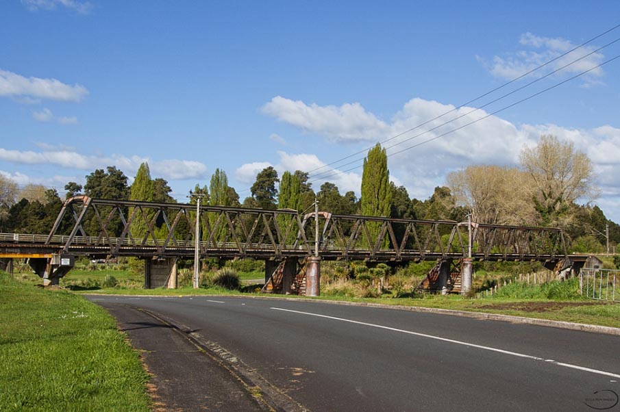
After the Matapuna Bridge was constructed local people campaigned for the structure to be opened for road traffic. The bridge then became both a salvation and an annoyance until it reverted to a rail-only bridge in the 1960s. The bridge was a life-line because it was the only, and later the main, transportation portal over the river which divided Taumarunui from Manunui and other southern NIMT and timber industry settlements. However, it was also a landmark because the density of traffic on this one-way and rail priority structure created notorious traffic jams for almost 50 years.
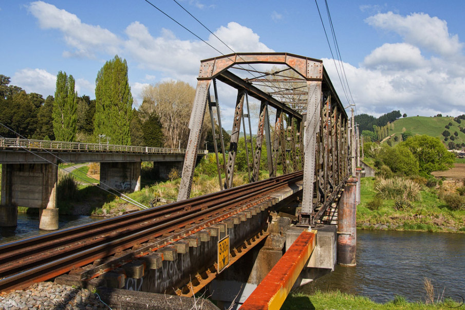
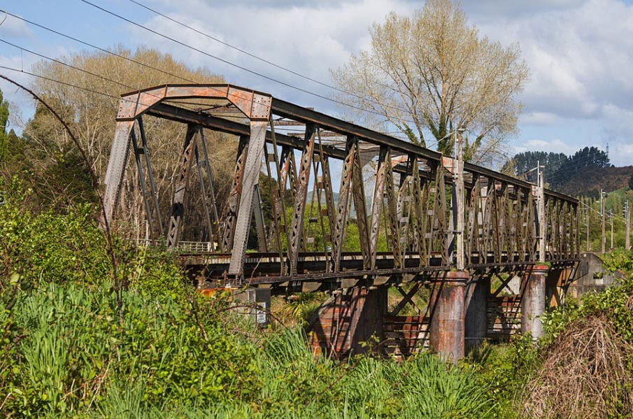
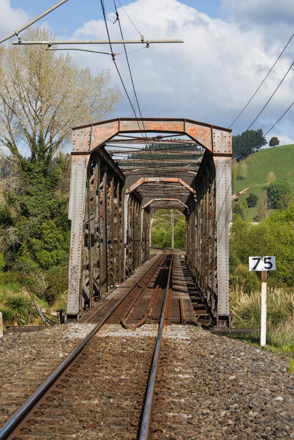
The Matapuna Bridge was completed in 1904 and is a steel through truss bridge which was initially designed as a combined structure and later converted to a rail-only bridge. The design was a standard Public Works Department (PWD) form, although this example is notable because of its length. Originally the bridge featured predominantly timber piers, which eventually degenerated and were subsequently replaced with concrete equivalents. Despite these modifications components such as the central iron cylinder piers date from the bridge's construction-era, as do the cutwaters and the trusses.
The Matapuna Bridge is a structure of regional and national historic significance primarily because it was a key component in the 'final push,' and also the pre-eminent land-based transport asset along the national road and rail routes through the central North Island until the 1960s. It also has historic value as the first upper river bridge over an important North Island waterway; the Whanganui River. Another contributor to its significance is that the Matapuna Bridge is one of the oldest remaining railway structures in this area whose growth and early prosperity depended on the NIMT.
List Entry Information
Status
Listed
List Entry Status
Historic Place Category 1
Access
Private/No Public Access
List Number
9277
Date Entered
27th March 2009
Date of Effect
27th March 2009
City/District Council
Ruapehu District
Region
Horizons (Manawatū-Whanganui) Region
Extent of List Entry
Extent includes part of the land described as the NIMT rail corridor and the structure known as the Matapuna Bridge thereon, including its abutments (Refer to map in Appendix 1 of the registration report for further information).
Legal description
The Matapuna Bridge has no legal description. The structure and abutments are part of the NIMT rail corridor: NZ Gazette 1902, p.2420 & NZ Gazette 1905, p.1240
Location Description
Turn into the road immediately north of the State Highway 4 (SH4) road bridge over the Whanganui River, which loops to the east and underneath both the highway and Matapuna bridges. Parking is available on Taupo Road, and the bridge can be viewed from underneath, and also the track level by walking up a small embankment. Access from the south is also available from the Taumarunui Holiday Park, entrance SH4 opposite Racecourse Road. There is parking by the river and then it is only a short walking distance to the bridge.
Why is this place significant?
Cultural Significance
Social Significance or Value: The Matapuna Bridge has outstanding local social significance because it was the only, and later the main, upper river crossing of the Whanganui River and enabled the establishment of the NIMT and timber industry settlements in the region. Because it was the main portal and a combined bridge on which rail traffic was given precedence, the bridge was notorious for the traffic delays during the early to mid 20th century and has become part of local legend. This has contributed to its landmark status and because it is situated at a main river access point and near a recreational reserve it is also closely linked to the community's leisure activities.
Historic Significance
Historical Significance or Value The Matapuna Bridge has considerable historic importance both nationally and regionally as an important structure in the 'final push' to complete the NIMT. The construction of the NIMT took 23 years and was only made possible because of the agreement of some Maori to allow surveying in, and eventually the establishment of the railway reserve through, the restricted area of the Rohe Potae. This access initiated one of the most expensive state projects undertaken in New Zealand; expenditure which was justified by the governments of the time as a means of gaining a foothold in the King Country, of encouraging immigration to New Zealand, and stimulating settlement in the central North Island. The NIMT also promised to create huge economic benefit when finished. From 1904 to 1908, the successful completion of the northern section of the 'final push' relied heavily on the transportation of ballast from the Ballast Reserve immediately north of the Matapuna Bridge and the transport of this resource across the structure. Therefore, the Matapuna Bridge was a requisite part in the completion of the NIMT. Taumarunui was a launching pad for, and key centre during, the 'final push.' The railway presence in the heart of the once impenetrable King Country was a major success for the government, and the subsequent settlement cemented European influence in the area from 1903. Because the Matapuna Bridge was begun that year and completed in 1904, it is one of the oldest surviving structures in the Taumarunui area, as well as a symbol of the success of Vogel's plan. The NIMT which contributed to the areas growth and prosperity in the early 20th century, and the bridge's inclusion in the rail network imbues the structure with further local significance because it is a prominent remnant of this boom period. As the first permanent upper Whanganui River bridge, and the second oldest remaining bridge over the river, the Matapuna Bridge was a seminal structure that directly facilitated settlement in the region. Because the Matapuna Bridge was a combined road and rail bridge until the 1960s, it was an important national transport and economic asset as a main portal for all forms of land-based transport through the central North Island. Rail traffic had priority use of the Matapuna Bridge and it is indicative of the surpassing of rail transports pre-eminence by road in the mid to late 20th century that the bridge was converted back to rail only traffic when a separate highway bridge was built in order to satisfy changing transport infrastructure demands. The subsequent structural alterations to the bridge were indicative of the importance placed on maintaining the structure to ensure it continued to be a viable part of the NIMT.
Physical Significance
Technological Significance or Value: Combined bridges were a result of the railway boom of the mid 19th century and the Matapuna Bridge is a representative example of an early 20th century PWD standard design combined bridge, but one which is unusual because of its length. The structure was the longest bridge, and the fifth longest bridge or viaduct in the NIMT when the railway was completed in 1908. Despite the necessity of replacing the degraded construction-era timber in the superstructure, the fact that the central piers have not needed underpinning or alteration is indicative of the sound analysis undertaken in the planning stages, which is given value when considered in the context of the 'final push' which dictated design and construction within a short time-span. Aesthetic Significance or Value: Although designed primarily as a utilitarian structure, the Matapuna Bridge has aesthetic value because it is an impressive structure whose extended linearity compliments the form of the landscape in the immediate surrounding of the Whanganui River basin, but also stands out from it because of the height created by its trusses. These factors make the structure a prominent local feature in the landscape.
Why is this place Category 1 / Category 2?
Detail Of Assessed Criteria
(a) The extent to which the place reflects important or representative aspects of New Zealand history: The Matapuna Bridge is a physical remnant of the enormous engineering feat which was the construction of the NIMT. The NIMT was politically and socially important, particularly in the realm of race relations, and also revolutionised transport and the economy. As an integral functioning part of the NIMT, the Matapuna Bridge was, and still is, a significant part of these aspects of New Zealand's history. (b) The association of the place with events, persons, or ideas of importance in New Zealand history: It is almost certain that Peter Seton Hay, the Engineer-in-Chief of the Public Works Department, designed the Matapuna Bridge and therefore it has an association with this important engineer and the other structures he designed during his career. The construction company, Scott Bros. Ltd, also features significantly in New Zealand engineering history because it was one of the earliest firms established, and undertook numerous important civil engineering projects, although it was best known as the manufacturer of Atlas ranges in New Zealand. This firm also had a large physical presence in Christchurch with their expansive inner city workshop and foundry, and both of the partners were prominent local citizens. The Matapuna Bridge was one of the first structures finished at the northern end of the 'final push' and because it was an important portal for the transportation of construction materials it is an essential component in the history of the railway and the drive to complete it. This structure was also a feature in another New Zealand transport milestone; the first motorcar journey through the central North Island from Wellington to Auckland. (e) The community association with, or public esteem for the place: There is a significant community association with the Matapuna Bridge amongst those who knew it as the main route across the Whanganui River and its ambiguous status as both a vital link and a cause of frustration. Despite the building of the separate highway bridge, the Matapuna Bridge has maintained a level of local standing because it is a prominent landmark on Whanganui River and is highly visible from the highway. (f) The potential of the place for public education: There is great potential for interpretation about the history of the bridge's seminal importance to the completion of the NIMT, and its place within the broader context of the settlement in, and the economy of, the King Country. Appropriate sites for possible interpretation could be at the river access site abutting the Manunui Reserve, which could also discuss the NIMT pre-construction history of Maori settlement in the immediate area. Because the Matapuna Bridge can also be linked to recognised NIMT 'final push' heritage structures in the region, such as the Raurimu Spiral, Ohakune to Horopito Old Coach Road, and the Old Hapuawhenua Viaduct. This grouping of a series of recognised and related heritage structures in close proximity has the potential to form the basis of a local historic rail route which would highlight the engineering feat that was the completion of the NIMT and its effect on New Zealand's history. (k) The extent to which the place forms part of a wider historical and cultural complex or historical and cultural landscape: The Matapuna Bridge is one element in the nationally significant network of structures, track, and other associated sites, that form the NIMT between Wellington and Auckland and was of key importance in the railways completion. Because the bridge crosses the Whanganui River it is also a noteworthy component in the history of transport and settlement along and around that important waterway. As such, the Matapuna Bridge is an integral part of several wider historical and cultural landscapes which are predominantly important at a local and regional level, but which also span a large section of the North Island. Summary of Significance or Values: This place was assessed against, and found to qualify under the following criteria: a, b, e, f, and k. Conclusion: It is considered that this place qualifies as a Category I historic place. The Matapuna Bridge was the first significant structure from the northern end of the final drive to complete the NIMT; the single largest construction project in New Zealand's history. This railway directly affected the physical and social landscape of the central North Island and was integral in the development of New Zealand's economy. The bridge was important because it enabled the chronology of NIMT construction to continue, but also because the Matapuna Bridge was the gateway for the transportation of vital construction materials. As such, the Matapuna Bridge was a pivotal structure within this considerable engineering feat. Another outstanding feature of the Matapuna Bridge is its fundamental importance as the main land-based transport structure on the arterial road and rail routes through the central North Island until the 1960s. These aspects of the historic heritage of the Matapuna Bridge, combined with the fact that it is one of the earliest surviving structures in the Taumarunui area and over the Whanganui River, imbue the structure with exceptional local and national significance.
Construction Professional
Name
Hay, Peter Seton
Type
Designer
Biography
Peter Seton Hay (1852/1853? - 1907) was born in Glasgow, Scotland, probably in 1852 or 1853, the son of Janet (Jessie) Dalziel and her husband, James Johnston Hay, a journeyman engineer. When Peter was a child the family emigrated to New Zealand, arriving at Port Chalmers on the Storm Cloud in April 1860. Educated in Dunedin, he was the first graduate of the newly established University of Otago, obtaining a BA in 1877 and an MA with first-class honours in mathematics in 1878. In June 1875 on the advice of a university teacher he had joined the Public Works Department as an engineering cadet. After completing his studies he was engaged in railway surveys and construction for the lines from Dunedin to Moeraki and Clinton. In the early 1880s he was employed on Central Otago railway surveys from Rough Ridge to Hawea, in the Cromwell district, and from Balclutha to the Catlins River. Hay's reputation as a brilliant young engineer was established in these Otago days. Stories were told of his prodigious mental calculations when he was working in the field without the usual aids such as logarithm tables. In 1884 Hay was transferred to the head office of the Public Works Department in Wellington. He began his steady progress through the ranks of the department, and two years later was promoted to resident engineer. In 1896 he was promoted to superintending engineer, equivalent to assistant engineer-in-chief. By then the construction of the North Island main trunk rail link was the foremost Public Works Department project. Hay helped plan most of the important railway works of the central North Island section and was responsible for the primary design of the Makohine, Mangaweka, Hapuawhenua, Taonui, Manganui-a-te-ao and Makatote viaducts. By any standards the viaducts were great works of engineering. Much of the credit for their construction must be attributed to Peter Hay. Hay succeeded W. H. Hales as engineer-in-chief of the Public Works Department in 1906, only to die in office on 19 March 1907. He suffered the effects of exposure while inspecting the main trunk railway works near Waiouru, and subsequently died from pleurisy at his home in Wadestown, Wellington. He was aged 54. One of Hay's major achievements was his investigation and report on the proposed Southern Alps rail crossing by the Midland railway in 1903. The scheme recommended by the government's American advisory engineer, Virgil Gay Bogue, required a 3½-mile tunnel and a steep gradient incline track. Hay's scheme, which was ultimately adopted, avoided expensive grading and track work but required a tunnel over five miles long. This tunnel, at Otira, was completed in 1923, long after Hay's death. Equally important was Hay's contribution to the development of hydroelectric power generation in New Zealand. Peter Seton Hay married Mary Clarke at Wairuna, Otago, on 22 April 1879 and they had four sons and one daughter. His wife and children survived him. Hay was the first New Zealand-trained engineer to rise to the rank of engineer-in-chief. He died at the height of his powers and before many of his projects had been completed. Although his life was relatively brief, his works endured. Lowe, Peter. 'Hay, Peter Seton 1852/1853? - 1907'. Dictionary of New Zealand Biography, updated 16 December 2003 URL: http://www.dnzb.govt.nz/
Name
Scott Bros.
Type
Engineer
Biography
Scott Bros. Ltd, Christchurch This firm was owned by brothers John Lee (1844-1913) and George (1851-1930) Scott who both immigrated to New Zealand in 1870 from Derby, England, their hometown where they underwent their engineering training. They set up a large foundry and workshop in Christchurch in 1876 and the business manufactured farming machinery, locomotives, and other items such as the street lamps in central Christchurch. Aside from their work manufacturing steelwork for, or constructing, several prominent railway and combined bridges, the company's staple business was manufacturing Atlas ranges. Both brothers were prominent Christchurch citizens with John Lee sitting on the board of, and occasionally lecturing at, Canterbury College, and George being a member of the Christchurch City Council.
Construction Details
Start Year
1901
Type
Other
Description
Contract let to Scott Bros., Christchurch
Start Year
1902
Type
Other
Description
Steelwork for bridge is manufactured
Start Year
1903
Type
Original Construction
Description
Construction begins
Start Year
1903
Type
Other
Description
The central cast iron piers are constructed
Start Year
1904
Type
Other
Description
Bridge completed
Start Year
1904
Type
Other
Description
Decking built and rail laid
Start Year
1905
Type
Modification
Description
Decking to allow vehicle traffic is laid on bridge
Start Year
1916
Type
Modification
Description
Bridge re-decked
Start Year
1937
Type
Modification
Description
Longitudinal rimu decking constructed on top of existing deck
Start Year
1938
Type
Modification
Description
Bridge strengthened
Start Year
1944
Type
Modification
Description
By 1944. Lighting installed at either end of bridge
Start Year
1956
Finish Year
1958
Type
Modification
Description
Bridge repairs including renewal of piles, caps, and beams, as well as replacement of decking and handrails
Start Year
1965
Finish Year
1968
Type
Modification
Description
Strengthening elements of the bridge and replacement of flanking spans, abutments and some pier fabric
Start Year
1986
startYearCirca
Type
Addition
Description
Electrification masts added
Start Year
2005
Finish Year
2006
Type
Modification
Description
Replacement of timber rail beams and decking
Construction Materials
Steel, cast iron, concrete, timber
The Matapuna Bridge spans the Whanganui River just east of Taumarunui in the Central North Island. It was constructed as part of the NIMT between 1903 and 1904 and is still a functioning part of that railway. As such, it is part of a wider set of important railway structures, as well as being one of the earliest surviving bridges over the Whanganui River. The NIMT - a catalyst for change: The Whanganui River is an important geographical and cultural feature in the North Island and is said to have had its genesis as one of the tear drops that Ranginui laid at the feet of Matua Te Mana - Ruapehu. From its watershed close to the mountains of the Central Plateau, the river courses west before cutting a long path south towards the sea at Wanganui. It was at the western point of the river that Taranaki struck out to the coast to begin his exile away from the rest of the mountain enclave created as company for Ruapehu by Ranginui. As is suggested in its creation story, there is much more to the Whanganui River than its name, 'big harbour,' suggests. The river was an important site of Maori settlement because it was a ready food source, and was also the main transport route in the central North Island, prior to the construction of the NIMT, alongside its two major tributaries, the Manganui-o-te-ao and Ongarue Rivers. From the mid 19th century, Europeans began to use the river and it provided access for missionaries as well as those planning the NIMT. This railway not only revolutionised travel in the North Island, but directly affected the demography of the area, as well as the local and national economies. The concept of the NIMT was promoted by Julius Vogel (1835-1899), then the Colonial Treasurer in William Fox's government, as part of his bold expansionist policy which was adopted by the House in 1870. From a purely practical stand-point, the NIMT was necessary because it established a direct transport route between New Zealand's two major cities, Auckland and Wellington. For 20 years prior to the NIMT's completion goods and passenger traffic between these cities was typically directed from Auckland to New Plymouth via coastal shipping and then continued by ship or train onto Wellington, and vice versa. This was by no means an ideal, or efficient, means of freight or passenger transport, but a route through the King Country was. From the mid-1860s Maori in the central North Island had repelled European encroachment by establishing, and staunchly upholding, the restricted area known as the Rohe Potae, and the governments of the late 19th century saw the construction of the NIMT as a tool for gaining access to the King Country. In 1883, after a decade of persistent approaches from the government regarding the area, talks between officials and some King Country chiefs regarding the establishment of the railway through their land began in earnest. A series of rigorous negotiations was then initiated with two Ngati Maniapoto leaders, Wahanui Hautare and Rewi Maniapoto. There seems to have been a feeling that the railway and European incursion into the King Country was inevitable, but these chiefs wanted to make sure that it was on their terms. In late 1884 Wahanui announced his intention to cooperate with the government over the railway, and he laid out a set of conditions before the House of Representative on 1 November 1884. The conditions included the right of the King movement to manage their own affairs, the banning of liquor from Waikato-Ngati Maniapoto territory, the right of his people to have sole responsibility for administering their ancestral lands, and that they were compensated for the land which was used. Following this, in early 1885 surveyors were allowed into the Rohe Potae to locate possible railway routes. Because of the tenuous relationship between the Crown and King Country iwi it was felt that the negotiation process was essential. However, by only consulting with Wahanui and Maniapoto the government purposely side-stepped King Tawhiao and other leaders who opposed the railway. Therefore, this initial agreement was not universal and accordingly there were instances of resistance, such as the destruction of surveying marks. Despite some opposition, surveying and construction plans continued and on 15 April 1885 it was Wahanui who wielded the shovel that turned the NIMT's first sod, which was then ceremonially wheeled away by Premier Robert Stout. Prior to the chiefs allowing surveyors into the Rohe Potae, possible railway corridors through the King Country were only speculative because there had not been any previous opportunity to map it in detail. There were several proposed routes for the NIMT and John Rochfort (1832-1893) surveyed for a possible corridor through the Central Plateau between 1883 and 1887. This was said to be his tour de force because he had to start from scratch and cover a large, and topographically complex, area. After much debate and delay it was Rochfort's route that NIMT eventually followed. The Maori land that this route required progressively passed into Crown ownership under the Public Works Acts of 1882 and 1894. This legislation stipulated that construction could not begin until the governor issued a proclamation detailing the middle-line that each successive section would take. Another key part of Vogel's scheme was to use the construction project as the basis for bringing thousands of assisted immigrants to New Zealand. His policy drew heavily on the model formulated in the United States of America, which used railways to gain access to previously remote areas, then to create settlements in these areas using the construction workers as the foundation of the local populous. The NIMT can be viewed as successful realisation of this model and it was also the catalyst for demographic change for the existing Maori population. In the Central Plateau and King Country Maori settlement was mostly concentrated around the Whanganui River and its tributaries, the Manganui-o-te-ao and Ongarue Rivers. However, the NIMT caused a population shift, for example it is said that by 1900 the various settlements around the Manganui-o-te-ao River were largely depopulated because many inhabitants gained employment as labourers on the railway. Once construction was complete it appears that local Maori gravitated toward railway towns. Therefore, the NIMT is responsible for radically changing the social landscape of the central North Island. The initial stages of the NIMT were protracted, and once the route was resolved and the required land obtained, the construction progress followed this early pattern and laboured along. The NIMT was eventually completed in 1908 having taken 23 years to finish due to various political and financial impediments, including the economic depression of the 1890s. The slow progress bred public dissatisfaction and this had reached such a pitch by 1900 that it motivated parliament to inject significantly more money and manpower to the project to facilitate a quick resolution. A few years later Taumarunui became the northern railhead, and was a significant launching pad for the drive to complete the railway. Taumarunui was important because of the railway construction resources which were readily available in the area, such as timber for the sleepers and buildings. The Whanganui River also provided a substantial and essential source of ballast, and most of the original ballast for the central portion of the NIMT was extracted from the river. In particular, the area around the Matapuna Bridge was significant and a Ballast Reserve was established immediately north of the bridge site by 1903. Therefore, the NIMT not only followed the route of the river eastward from Taumarunui, but part of the river became physically intertwined with the railway. The central importance of this resource to the work from the northern end and in the 'final push' between Raurimu and Ohakune meant that, despite track being laid south of Taumarunui, the section was kept under PWD control and not handed over to the Railways Department until 1908. It was the milling and farming potential of the area, as well as the railway, that drew people to the Taumarunui area and contributed to the exponential increase in the population after the railhead reached the town in 1903. At this time Taumarunui was not an official town and only became one in 1906, although the first leases for sections in 'the native township' were let two years earlier. This means that the Matapuna Bridge is one of the oldest surviving structures in the district. However, Taumarunui was a well-known place prior to the construction of the NIMT. Initially it was settled by Maori because it was situated at the junction of the important Whanganui and Ongarue Rivers. It then became noted as a meeting and council place for the various iwi in the region, and in the late 19th century the area was renowned as a stronghold of the King Movement. It was just upriver from the eventual site of the Matapuna Bridge, at Matahanea, that William Moffat, a European suspected of being a land-buying agent and gold prospector, was killed for trespassing in the Rohe Potae in 1880 after he was warned several times not to return to Taumarunui. There were also kainga in the immediate vicinity of where the bridge was later built. For example, there were Ngati Haua affiliated kainga on the southern side of the bridge site, and at least two other locations nearby. With the approach of the railway more people were drawn to the area, and the establishment of settlements on the south side of the Whanganui River, such as Manunui, meant there was an urgency to build a bridge across the river which could accommodate road traffic. There was a ford at the Matapuna Bridge site prior to its construction and it had been noted by the House of Representatives that the river was dangerous to cross especially when in flood. Because of this hazard and the lack of bridges upriver, government officials approached the PWD about possibly designing their proposed rail bridge as a combined bridge for road and rail traffic. At this time the only other permanent bridges across the Whanganui River were in Wanganui itself. All of these bridges, except the Aramoho Rail Bridge (1876), have now been replaced, which makes the Matapuna Bridge the oldest surviving upper river bridge and the second oldest remaining bridge over the river. The Matapuna Bridge - a mixed blessing: Bridges had been built to accommodate both rail and general traffic from early in railway construction and internationally these often took the form of double-decker bridges. There were only three such bridges built in New Zealand, and the majority of this country's combined bridges are single deck, like the Matapuna Bridge. In the case of the Matapuna Bridge, when it was decided to build it as a combined bridge there was an extra cost of approximately £1000 which the Minister of Lands agreed would be paid. It is unclear exactly how much the bridge cost in total, but the decision to make it a combined bridge would have been dictated by the fact that this was a cheap alternative to building individual traffic structures. The contract for the bridge was let to Scott Bros. Ltd. in May 1901 and coincided with the bush clearing and building of a service road in the Taumarunui section of the NIMT. Scott Bros. was a prominent Christchurch engineering firm who had a one acre foundry and workshop on Manchester Street from 1876. The firm is perhaps best known as the manufacturers of Atlas ranges, but they also had considerable railway and bridge construction experience before they won the contract to build the Matapuna Bridge. Some of their notable bridge work includes the construction of the Taramakau River Bridge (1890) which was a combined bridge, as was their double-decker bridge over the Awatere River near Seddon (1902). The firm also built the Patterson's Creek Viaduct (1902), manufactured the fabric for the Toi Toi Viaduct (1903), and later constructed the Hurunui River Railway Bridge (1904). All of these projects were PWD contracts and most were designed by Peter Seton Hay (185/53-1907). Because of the consistent partnership between Peter Seton Hay as the designer of PWD bridges which Scott Bros. were contracted to construct or manufacturer the steelwork for during this time period, it is highly probable that Hay was responsible for the Matapuna Bridge design. Hay is noteworthy because he was the first person to graduate from the University of Otago with a Bachelor of Arts in 1877. He then joined the PWD and gradually progressed through its ranks to become the engineer-in-chief by the time he died prematurely in 1907. Hay's designs for other NIMT structures such as the Makohine, Mangaweka, Hapuawhenua, Taonui, Mangaturuturu, Manganui-o-te-ao, and Makatote Viaducts are recognised alongside his pioneering research into New Zealand's hydroelectric capabilities as his most important legacies. This concentration of known Hay designs within the central section of the NIMT also suggests that he designed the Matapuna Bridge. If this is correct, then Hay's design became a standard PWD design for this style of bridge, and at Matapuna it consisted of three through steel trusses each 122ft (37m) long. This made the structure the longest bridge, and the fifth longest bridge or viaduct, in the NIMT upon that railways completion in 1908. This length was supported by timber and cast iron cylinder piers, as well as featuring a large proportion of other timber components. Despite the steelwork being manufactured well in advance, Scott Bros., who were due to have completed the bridge by February 1903, only began construction in March 1903. It is unknown why construction was held-up, but it would appear that Scott Bros. were particularly busy at this time which may have been a factor. As a consequence the construction of the northern end of the ‘final push' was delayed until the bridge was finally completed in January 1904. The combination of this setback and frequent slips, which were particularly serious in early 1905, meant that the section was well behind schedule. Despite being designed as a combined bridge, the decking for road traffic was only installed on the bridge in 1905. Even then the PWD was reluctant to grant public access to the bridge because they asserted that it would delay construction further by interrupting the tide of ballast trains from Taumarunui, and also because they would need to employ a bridge-keeper. The department maintained this stance despite considerable pressure from Ministers and government officials who had been petitioned by local iwi. However, by late 1905 the PWD acceded to these requests and there was talk of building a cottage near the bridge for A. Watson, a disabled railway worker, to use in his role as bridge-keeper. Watson's job was to be the signalman and caretaker at the bridge, and by 1908 this job description also included monitoring the traffic across the bridge. Later, the bridge-keeper also had to accompany the vehicles who needed a permit under the conditions of the bylaw governing use of the bridge. This bylaw was gazetted in 1909 and posted at either end of the bridge. This notice and the available photographs of the bridge demonstrate the quantity and variety of traffic that used the structure, which ranged from trains and carts, to combine harvesters and bicycles, as well as pedestrians, cattle, sheep, pigs, and donkeys. The volume of traffic is not surprising because farming and the timber industry, and correspondingly, the population increased substantially throughout the district after Taumarunui became the railhead. For the first three decades of the 20th century Taumarunui was considered the hub of the North Island because of its important place within the NIMT, and eventually the road network, as well as being the departure point for the famous Whanganui River steamboat trips. The significance of the Matapuna Bridge to the community and these travellers is confirmed by a PWD survey of the use of the bridge in May 1917. This found that during the month, 1762 pedestrians, 1099 cycles, 688 cars, 663 vehicles, 1422 equestrians, and 6336 livestock of various forms crossed the structure, not including rail traffic. Most of the traffic was from Taumarunui and the nearby mill town of Manunui. The density of the traffic meant that by 1921 there were two bridge-keepers employed at Matapuna who worked day and night shifts. However, while the bridge was in constant use, getting to it could be problematic because of the appalling state of the roads. This was particularly the case between Manunui and the bridge, and it is reported that in the early period it could take as long as three hours to navigate this 15km stretch of road because of the mud. The first car in Taumarunui was registered in 1912 and it was used as a taxi by Bert Meyenberg. As part of his business Meyenberg frequently used the Matapuna Bridge on his runs from Taumarunui to Manunui and often got stuck in the aforementioned mud on the Manunui side. The bridge was also a key part of a national motoring milestone; the first car trip from Wellington to Auckland via the central North Island. This expedition took eight days and nearly came to a halt in Taumarunui because Meyenberg was out of town and there was no other supply of petrol to be found. This journey was a true pioneering effort when you consider that the return trip along the established roads through Taupo and Napier only took three days. The Matapuna Bridge was also the site of several instances of drama in the form of crashes and near misses. In 1918 a taxi driver had a lucky escape when he found himself confronted with a train as he was nearing the end of the bridge. While the driver leapt to safety, and it appears the bridge was not damaged, the car was ‘smashed to atoms.' A few years later, in 1925 a female motorist failed to give way to an equestrian and, since the bridge was really only wide enough for the vehicle, the episode ended with the horse being injured to the point where it had to be shot. This latter crash was a catalyst for local people to vent their frustration concerning the bridge in the press. The main problems which were identified included the bridge being too narrow at only 11ft (3.4m) wide, and also the delays caused by rail traffic having preferential use of the structure. By 1925 gates had been installed across the road at either end of the bridge as a traffic control and safety measure. Rail traffic had priority use of the Matapuna Bridge and it was the bridge-keepers job to close the gates 15 minutes prior to a train being due to cross it. Combined with the fact that 25 to 30 trains crossed the bridge per day and that the bridge-keepers had been working off the schedule and not compensating for the fact that these trains could, and invariably were, late, vehicles were frequently queued for long periods at either end. As well as the irritation this caused, there were also amusing anecdotes about the wait at the bridge, such as the time when a taxi was taking a pregnant woman to the hospital in Taumarunui and got to the bridge just as the gates were shut. This sent the driver into a panic because he was terrified that the wait would be customarily long and that she would have her baby in his taxi. By 1934 the bridge-keepers were being notified, presumably by a telephone in their work hut at the north end of the bridge, when the trains were leaving the last stations before the bridge, but the queues were still notorious. The height of the rails also made it difficult for motor vehicles to navigate the bridge without damaging the vehicle, or the handrail of the bridge, and it was decided to build the deck up to make this easier. However, even with these changes the Matapuna Bridge was labelled a ‘public nuisance.' It would seem that there were varied feelings towards this vital local link and national transport asset. As well as being a transport focal point, the Matapuna Bridge was also a significant local landmark because of its position on the Whanganui River. Early in the structure's history, the land on the south-east bank of the river was designated as a reserve, which made it a popular river access point and picnic area. For example, the Manunui Club held an annual summer picnic close to the bridge which most of the community would attend. It was also a popular swimming point, and children used to jump off the bridge into the river. Therefore, for many local people, as well as visitors at the current holiday park and to the Manunui Reserve, the bridge is linked to their leisure activities. Changing with the times: The infamy of the Matapuna Bridge meant that local people celebrated in the mid-1950s when they were promised a separate highway bridge. However, they had to show further forbearance as the concrete road bridge, immediately east of the Matapuna Bridge, was only completed in May 1962 and not before there was a serious incident on its predecessor. Just prior to the opening of the highway bridge, the Matapuna Bridge reverted to a rail-only structure and motorists used a bailey bridge nearby. This meant that the gates at the Matapuna Bridge were no longer used and there was no bridge-keeper. The change in circumstances must have caused confusion for a couple of children who obviously thought that the Matapuna Bridge was no longer in use for any traffic and they were subsequently caught unaware while playing on it and were struck and killed by a train. As a combined bridge the Matapuna Bridge was a mixed blessing because the bridge had caused years of frustration, but it was also an essential link for the community and motoring travellers. Therefore, it is unfortunate that this history as a combined bridge ended on a sad note in the early 1960s. Despite the decline in rail traffic in the later 20th century, the strategic importance of the Matapuna Bridge within the NIMT has continued and resulted in the bridge undergoing many repairs and alterations. Railway structures, like the Matapuna Bridge, were built and operated based around the principle of continuous improvement and repair when needed and these alterations often reflect larger historical changes in railway operations and engineering practices. However, up until the bridge reverted to a rail-only bridge in the early 1960s, there had been very little structural change to it aside from strengthening in the 1930s as part of a NIMT-wide programme. Because of this the structure still featured a significant amount of 1903 and early 20th century timber which was used in some of its spans and piers. Because of their age, these parts of the bridge had degraded to a worrying point by 1965 and needed replacing, as did the trusses lateral bracing systems. In engineering terms, it was not appropriate to replace the timber with like material, and concrete and steel were used instead because of their durability and strength. Two years later it was necessary for further work to be done in order to ensure the integrity of the structure, which resulted in most of the spans being replaced, as well as the abutments, and general strengthening in other parts. The flurry of activity during this period seems to have been a matter of catching-up on work generated by the fact that the Railways Department now had sole use of the bridge. It was at this time that the width of the entire bridge, or at least the deck, seems to have been reduced.
The Matapuna Bridge spans the Whanganui River just east of Taumarunui in the Central North Island. It was constructed as part of the NIMT between 1903 and 1904 and is still a functioning part of that railway. As such, it is part of a wider set of important railway structures, as well as being one of the earliest surviving bridges over the Whanganui River. The NIMT - a catalyst for change: The Whanganui River is an important geographical and cultural feature in the North Island and is said to have had its genesis as one of the tear drops that Ranginui laid at the feet of Matua Te Mana - Ruapehu. From its watershed close to the mountains of the Central Plateau, the river courses west before cutting a long path south towards the sea at Wanganui. It was at the western point of the river that Taranaki struck out to the coast to begin his exile away from the rest of the mountain enclave created as company for Ruapehu by Ranginui. As is suggested in its creation story, there is much more to the Whanganui River than its name, 'big harbour,' suggests. The river was an important site of Maori settlement because it was a ready food source, and was also the main transport route in the central North Island, prior to the construction of the NIMT, alongside its two major tributaries, the Manganui-o-te-ao and Ongarue Rivers. From the mid 19th century, Europeans began to use the river and it provided access for missionaries as well as those planning the NIMT. This railway not only revolutionised travel in the North Island, but directly affected the demography of the area, as well as the local and national economies. The concept of the NIMT was promoted by Julius Vogel (1835-1899), then the Colonial Treasurer in William Fox's government, as part of his bold expansionist policy which was adopted by the House in 1870. From a purely practical stand-point, the NIMT was necessary because it established a direct transport route between New Zealand's two major cities, Auckland and Wellington. For 20 years prior to the NIMT's completion goods and passenger traffic between these cities was typically directed from Auckland to New Plymouth via coastal shipping and then continued by ship or train onto Wellington, and vice versa. This was by no means an ideal, or efficient, means of freight or passenger transport, but a route through the King Country was. From the mid-1860s Maori in the central North Island had repelled European encroachment by establishing, and staunchly upholding, the restricted area known as the Rohe Potae, and the governments of the late 19th century saw the construction of the NIMT as a tool for gaining access to the King Country. In 1883, after a decade of persistent approaches from the government regarding the area, talks between officials and some King Country chiefs regarding the establishment of the railway through their land began in earnest. A series of rigorous negotiations was then initiated with two Ngati Maniapoto leaders, Wahanui Hautare and Rewi Maniapoto. There seems to have been a feeling that the railway and European incursion into the King Country was inevitable, but these chiefs wanted to make sure that it was on their terms. In late 1884 Wahanui announced his intention to cooperate with the government over the railway, and he laid out a set of conditions before the House of Representative on 1 November 1884. The conditions included the right of the King movement to manage their own affairs, the banning of liquor from Waikato-Ngati Maniapoto territory, the right of his people to have sole responsibility for administering their ancestral lands, and that they were compensated for the land which was used. Following this, in early 1885 surveyors were allowed into the Rohe Potae to locate possible railway routes. Because of the tenuous relationship between the Crown and King Country iwi it was felt that the negotiation process was essential. However, by only consulting with Wahanui and Maniapoto the government purposely side-stepped King Tawhiao and other leaders who opposed the railway. Therefore, this initial agreement was not universal and accordingly there were instances of resistance, such as the destruction of surveying marks. Despite some opposition, surveying and construction plans continued and on 15 April 1885 it was Wahanui who wielded the shovel that turned the NIMT's first sod, which was then ceremonially wheeled away by Premier Robert Stout. Prior to the chiefs allowing surveyors into the Rohe Potae, possible railway corridors through the King Country were only speculative because there had not been any previous opportunity to map it in detail. There were several proposed routes for the NIMT and John Rochfort (1832-1893) surveyed for a possible corridor through the Central Plateau between 1883 and 1887. This was said to be his tour de force because he had to start from scratch and cover a large, and topographically complex, area. After much debate and delay it was Rochfort's route that NIMT eventually followed. The Maori land that this route required progressively passed into Crown ownership under the Public Works Acts of 1882 and 1894. This legislation stipulated that construction could not begin until the governor issued a proclamation detailing the middle-line that each successive section would take. Another key part of Vogel's scheme was to use the construction project as the basis for bringing thousands of assisted immigrants to New Zealand. His policy drew heavily on the model formulated in the United States of America, which used railways to gain access to previously remote areas, then to create settlements in these areas using the construction workers as the foundation of the local populous. The NIMT can be viewed as successful realisation of this model and it was also the catalyst for demographic change for the existing Maori population. In the Central Plateau and King Country Maori settlement was mostly concentrated around the Whanganui River and its tributaries, the Manganui-o-te-ao and Ongarue Rivers. However, the NIMT caused a population shift, for example it is said that by 1900 the various settlements around the Manganui-o-te-ao River were largely depopulated because many inhabitants gained employment as labourers on the railway. Once construction was complete it appears that local Maori gravitated toward railway towns. Therefore, the NIMT is responsible for radically changing the social landscape of the central North Island. The initial stages of the NIMT were protracted, and once the route was resolved and the required land obtained, the construction progress followed this early pattern and laboured along. The NIMT was eventually completed in 1908 having taken 23 years to finish due to various political and financial impediments, including the economic depression of the 1890s. The slow progress bred public dissatisfaction and this had reached such a pitch by 1900 that it motivated parliament to inject significantly more money and manpower to the project to facilitate a quick resolution. A few years later Taumarunui became the northern railhead, and was a significant launching pad for the drive to complete the railway. Taumarunui was important because of the railway construction resources which were readily available in the area, such as timber for the sleepers and buildings. The Whanganui River also provided a substantial and essential source of ballast, and most of the original ballast for the central portion of the NIMT was extracted from the river. In particular, the area around the Matapuna Bridge was significant and a Ballast Reserve was established immediately north of the bridge site by 1903. Therefore, the NIMT not only followed the route of the river eastward from Taumarunui, but part of the river became physically intertwined with the railway. The central importance of this resource to the work from the northern end and in the 'final push' between Raurimu and Ohakune meant that, despite track being laid south of Taumarunui, the section was kept under PWD control and not handed over to the Railways Department until 1908. It was the milling and farming potential of the area, as well as the railway, that drew people to the Taumarunui area and contributed to the exponential increase in the population after the railhead reached the town in 1903. At this time Taumarunui was not an official town and only became one in 1906, although the first leases for sections in 'the native township' were let two years earlier. This means that the Matapuna Bridge is one of the oldest surviving structures in the district. However, Taumarunui was a well-known place prior to the construction of the NIMT. Initially it was settled by Maori because it was situated at the junction of the important Whanganui and Ongarue Rivers. It then became noted as a meeting and council place for the various iwi in the region, and in the late 19th century the area was renowned as a stronghold of the King Movement. It was just upriver from the eventual site of the Matapuna Bridge, at Matahanea, that William Moffat, a European suspected of being a land-buying agent and gold prospector, was killed for trespassing in the Rohe Potae in 1880 after he was warned several times not to return to Taumarunui. There were also kainga in the immediate vicinity of where the bridge was later built. For example, there were Ngati Haua affiliated kainga on the southern side of the bridge site, and at least two other locations nearby. With the approach of the railway more people were drawn to the area, and the establishment of settlements on the south side of the Whanganui River, such as Manunui, meant there was an urgency to build a bridge across the river which could accommodate road traffic. There was a ford at the Matapuna Bridge site prior to its construction and it had been noted by the House of Representatives that the river was dangerous to cross especially when in flood. Because of this hazard and the lack of bridges upriver, government officials approached the PWD about possibly designing their proposed rail bridge as a combined bridge for road and rail traffic. At this time the only other permanent bridges across the Whanganui River were in Wanganui itself. All of these bridges, except the Aramoho Rail Bridge (1876), have now been replaced, which makes the Matapuna Bridge the oldest surviving upper river bridge and the second oldest remaining bridge over the river. The Matapuna Bridge - a mixed blessing: Bridges had been built to accommodate both rail and general traffic from early in railway construction and internationally these often took the form of double-decker bridges. There were only three such bridges built in New Zealand, and the majority of this country's combined bridges are single deck, like the Matapuna Bridge. In the case of the Matapuna Bridge, when it was decided to build it as a combined bridge there was an extra cost of approximately £1000 which the Minister of Lands agreed would be paid. It is unclear exactly how much the bridge cost in total, but the decision to make it a combined bridge would have been dictated by the fact that this was a cheap alternative to building individual traffic structures. The contract for the bridge was let to Scott Bros. Ltd. in May 1901 and coincided with the bush clearing and building of a service road in the Taumarunui section of the NIMT. Scott Bros. was a prominent Christchurch engineering firm who had a one acre foundry and workshop on Manchester Street from 1876. The firm is perhaps best known as the manufacturers of Atlas ranges, but they also had considerable railway and bridge construction experience before they won the contract to build the Matapuna Bridge. Some of their notable bridge work includes the construction of the Taramakau River Bridge (1890) which was a combined bridge, as was their double-decker bridge over the Awatere River near Seddon (1902). The firm also built the Patterson's Creek Viaduct (1902), manufactured the fabric for the Toi Toi Viaduct (1903), and later constructed the Hurunui River Railway Bridge (1904). All of these projects were PWD contracts and most were designed by Peter Seton Hay (185/53-1907). Because of the consistent partnership between Peter Seton Hay as the designer of PWD bridges which Scott Bros. were contracted to construct or manufacturer the steelwork for during this time period, it is highly probable that Hay was responsible for the Matapuna Bridge design. Hay is noteworthy because he was the first person to graduate from the University of Otago with a Bachelor of Arts in 1877. He then joined the PWD and gradually progressed through its ranks to become the engineer-in-chief by the time he died prematurely in 1907. Hay's designs for other NIMT structures such as the Makohine, Mangaweka, Hapuawhenua, Taonui, Mangaturuturu, Manganui-o-te-ao, and Makatote Viaducts are recognised alongside his pioneering research into New Zealand's hydroelectric capabilities as his most important legacies. This concentration of known Hay designs within the central section of the NIMT also suggests that he designed the Matapuna Bridge. If this is correct, then Hay's design became a standard PWD design for this style of bridge, and at Matapuna it consisted of three through steel trusses each 122ft (37m) long. This made the structure the longest bridge, and the fifth longest bridge or viaduct, in the NIMT upon that railways completion in 1908. This length was supported by timber and cast iron cylinder piers, as well as featuring a large proportion of other timber components. Despite the steelwork being manufactured well in advance, Scott Bros., who were due to have completed the bridge by February 1903, only began construction in March 1903. It is unknown why construction was held-up, but it would appear that Scott Bros. were particularly busy at this time which may have been a factor. As a consequence the construction of the northern end of the ‘final push' was delayed until the bridge was finally completed in January 1904. The combination of this setback and frequent slips, which were particularly serious in early 1905, meant that the section was well behind schedule. Despite being designed as a combined bridge, the decking for road traffic was only installed on the bridge in 1905. Even then the PWD was reluctant to grant public access to the bridge because they asserted that it would delay construction further by interrupting the tide of ballast trains from Taumarunui, and also because they would need to employ a bridge-keeper. The department maintained this stance despite considerable pressure from Ministers and government officials who had been petitioned by local iwi. However, by late 1905 the PWD acceded to these requests and there was talk of building a cottage near the bridge for A. Watson, a disabled railway worker, to use in his role as bridge-keeper. Watson's job was to be the signalman and caretaker at the bridge, and by 1908 this job description also included monitoring the traffic across the bridge. Later, the bridge-keeper also had to accompany the vehicles who needed a permit under the conditions of the bylaw governing use of the bridge. This bylaw was gazetted in 1909 and posted at either end of the bridge. This notice and the available photographs of the bridge demonstrate the quantity and variety of traffic that used the structure, which ranged from trains and carts, to combine harvesters and bicycles, as well as pedestrians, cattle, sheep, pigs, and donkeys. The volume of traffic is not surprising because farming and the timber industry, and correspondingly, the population increased substantially throughout the district after Taumarunui became the railhead. For the first three decades of the 20th century Taumarunui was considered the hub of the North Island because of its important place within the NIMT, and eventually the road network, as well as being the departure point for the famous Whanganui River steamboat trips. The significance of the Matapuna Bridge to the community and these travellers is confirmed by a PWD survey of the use of the bridge in May 1917. This found that during the month, 1762 pedestrians, 1099 cycles, 688 cars, 663 vehicles, 1422 equestrians, and 6336 livestock of various forms crossed the structure, not including rail traffic. Most of the traffic was from Taumarunui and the nearby mill town of Manunui. The density of the traffic meant that by 1921 there were two bridge-keepers employed at Matapuna who worked day and night shifts. However, while the bridge was in constant use, getting to it could be problematic because of the appalling state of the roads. This was particularly the case between Manunui and the bridge, and it is reported that in the early period it could take as long as three hours to navigate this 15km stretch of road because of the mud. The first car in Taumarunui was registered in 1912 and it was used as a taxi by Bert Meyenberg. As part of his business Meyenberg frequently used the Matapuna Bridge on his runs from Taumarunui to Manunui and often got stuck in the aforementioned mud on the Manunui side. The bridge was also a key part of a national motoring milestone; the first car trip from Wellington to Auckland via the central North Island. This expedition took eight days and nearly came to a halt in Taumarunui because Meyenberg was out of town and there was no other supply of petrol to be found. This journey was a true pioneering effort when you consider that the return trip along the established roads through Taupo and Napier only took three days. The Matapuna Bridge was also the site of several instances of drama in the form of crashes and near misses. In 1918 a taxi driver had a lucky escape when he found himself confronted with a train as he was nearing the end of the bridge. While the driver leapt to safety, and it appears the bridge was not damaged, the car was ‘smashed to atoms.' A few years later, in 1925 a female motorist failed to give way to an equestrian and, since the bridge was really only wide enough for the vehicle, the episode ended with the horse being injured to the point where it had to be shot. This latter crash was a catalyst for local people to vent their frustration concerning the bridge in the press. The main problems which were identified included the bridge being too narrow at only 11ft (3.4m) wide, and also the delays caused by rail traffic having preferential use of the structure. By 1925 gates had been installed across the road at either end of the bridge as a traffic control and safety measure. Rail traffic had priority use of the Matapuna Bridge and it was the bridge-keepers job to close the gates 15 minutes prior to a train being due to cross it. Combined with the fact that 25 to 30 trains crossed the bridge per day and that the bridge-keepers had been working off the schedule and not compensating for the fact that these trains could, and invariably were, late, vehicles were frequently queued for long periods at either end. As well as the irritation this caused, there were also amusing anecdotes about the wait at the bridge, such as the time when a taxi was taking a pregnant woman to the hospital in Taumarunui and got to the bridge just as the gates were shut. This sent the driver into a panic because he was terrified that the wait would be customarily long and that she would have her baby in his taxi. By 1934 the bridge-keepers were being notified, presumably by a telephone in their work hut at the north end of the bridge, when the trains were leaving the last stations before the bridge, but the queues were still notorious. The height of the rails also made it difficult for motor vehicles to navigate the bridge without damaging the vehicle, or the handrail of the bridge, and it was decided to build the deck up to make this easier. However, even with these changes the Matapuna Bridge was labelled a ‘public nuisance.' It would seem that there were varied feelings towards this vital local link and national transport asset. As well as being a transport focal point, the Matapuna Bridge was also a significant local landmark because of its position on the Whanganui River. Early in the structure's history, the land on the south-east bank of the river was designated as a reserve, which made it a popular river access point and picnic area. For example, the Manunui Club held an annual summer picnic close to the bridge which most of the community would attend. It was also a popular swimming point, and children used to jump off the bridge into the river. Therefore, for many local people, as well as visitors at the current holiday park and to the Manunui Reserve, the bridge is linked to their leisure activities. Changing with the times: The infamy of the Matapuna Bridge meant that local people celebrated in the mid-1950s when they were promised a separate highway bridge. However, they had to show further forbearance as the concrete road bridge, immediately east of the Matapuna Bridge, was only completed in May 1962 and not before there was a serious incident on its predecessor. Just prior to the opening of the highway bridge, the Matapuna Bridge reverted to a rail-only structure and motorists used a bailey bridge nearby. This meant that the gates at the Matapuna Bridge were no longer used and there was no bridge-keeper. The change in circumstances must have caused confusion for a couple of children who obviously thought that the Matapuna Bridge was no longer in use for any traffic and they were subsequently caught unaware while playing on it and were struck and killed by a train. As a combined bridge the Matapuna Bridge was a mixed blessing because the bridge had caused years of frustration, but it was also an essential link for the community and motoring travellers. Therefore, it is unfortunate that this history as a combined bridge ended on a sad note in the early 1960s. Despite the decline in rail traffic in the later 20th century, the strategic importance of the Matapuna Bridge within the NIMT has continued and resulted in the bridge undergoing many repairs and alterations. Railway structures, like the Matapuna Bridge, were built and operated based around the principle of continuous improvement and repair when needed and these alterations often reflect larger historical changes in railway operations and engineering practices. However, up until the bridge reverted to a rail-only bridge in the early 1960s, there had been very little structural change to it aside from strengthening in the 1930s as part of a NIMT-wide programme. Because of this the structure still featured a significant amount of 1903 and early 20th century timber which was used in some of its spans and piers. Because of their age, these parts of the bridge had degraded to a worrying point by 1965 and needed replacing, as did the trusses lateral bracing systems. In engineering terms, it was not appropriate to replace the timber with like material, and concrete and steel were used instead because of their durability and strength. Two years later it was necessary for further work to be done in order to ensure the integrity of the structure, which resulted in most of the spans being replaced, as well as the abutments, and general strengthening in other parts. The flurry of activity during this period seems to have been a matter of catching-up on work generated by the fact that the Railways Department now had sole use of the bridge. It was at this time that the width of the entire bridge, or at least the deck, seems to have been reduced.
The Matapuna Bridge spans the Whanganui River between Taumarunui and Manunui and is a functioning part of the NIMT. It was constructed between 1903 and 1904 as a combined road and rail bridge comprising of three steel Warren-type through trusses. Each of these truss spans is 122ft (37m) long and there are two 40ft (12m) steel girders spans on either end of this grouping. The bridge is 470ft (143m) long. If the width of the bridge was reduced when it became a rail-only bridge then the trusses were altered c.1965. At this time the construction-era lateral bracing and struts of the top chord would also have been shortened or replaced. New horizontal girders were added to each truss portal on the structure during this period and the c.1956 parapet/handrail was also removed. However, the vertical truss sides appear to be construction-era fabric. The electrification masts and wires would have been added c.1986 as part of the NIMT electrification programme. The decking has been altered and replaced several times which is reflective of the heavy wear to which this component is subjected. The first change to the construction-era deck was in 1905 when it was changed to accommodate road and rail traffic. The decking was then replaced or altered on at least three other occasions between 1905 and the most recent major work on the bridge in 2005-2006. At this time the c.1956 timber rail beams were also replaced with steel equivalents. All of the original timber fabric from the superstructure has been replaced. The concentration of structural repairs and component replacement in the mid 20th century is reflective of the degradation of the fabric by this time. This included the replacement of the timber flanking spans between piers 1-2 and 5-6 with steel equivalents in 1965 at which time the abutments were also replaced, and the timber piers (1, 2, 5 and 6) were substituted with concrete versions. When this work was completed the central truss spans were strengthened in 1968. These had only been strengthened once previously in 1938. There is no evidence to suggest that the central cast iron cylinder piers have been altered or underpinned. Therefore, piers 3 & 4 appear to consist entirely of construction-era fabric, as do the cutwaters and the timber cross-bracings and boxing. If this inference is correct, because of the prevalence of timber in the 1903-1904 form of the bridge and because much of this was subsequently removed, then the remaining original timber fabric is a high category heritage fabric, as are the piers. A certain amount of construction-era fabric has been removed from the Matapuna Bridge mainly due to the relative vulnerability of timber, the main construction material, and the need to replace these degenerated elements to ensure the integrity of the structure. Their replacement with steel and concrete components, mostly in the mid-20th century, was logical as a long term solution, particularly when we consider that the construction-era steel truss sides have not needed to be replaced. The appearance of the bridge is still similar to when it was constructed despite the modifications, mostly because of the retention of the through trusses and the central piers with their cutwaters.
The Matapuna Bridge spans the Whanganui River between Taumarunui and Manunui and is a functioning part of the NIMT. It was constructed between 1903 and 1904 as a combined road and rail bridge comprising of three steel Warren-type through trusses. Each of these truss spans is 122ft (37m) long and there are two 40ft (12m) steel girders spans on either end of this grouping. The bridge is 470ft (143m) long. If the width of the bridge was reduced when it became a rail-only bridge then the trusses were altered c.1965. At this time the construction-era lateral bracing and struts of the top chord would also have been shortened or replaced. New horizontal girders were added to each truss portal on the structure during this period and the c.1956 parapet/handrail was also removed. However, the vertical truss sides appear to be construction-era fabric. The electrification masts and wires would have been added c.1986 as part of the NIMT electrification programme. The decking has been altered and replaced several times which is reflective of the heavy wear to which this component is subjected. The first change to the construction-era deck was in 1905 when it was changed to accommodate road and rail traffic. The decking was then replaced or altered on at least three other occasions between 1905 and the most recent major work on the bridge in 2005-2006. At this time the c.1956 timber rail beams were also replaced with steel equivalents. All of the original timber fabric from the superstructure has been replaced. The concentration of structural repairs and component replacement in the mid 20th century is reflective of the degradation of the fabric by this time. This included the replacement of the timber flanking spans between piers 1-2 and 5-6 with steel equivalents in 1965 at which time the abutments were also replaced, and the timber piers (1, 2, 5 and 6) were substituted with concrete versions. When this work was completed the central truss spans were strengthened in 1968. These had only been strengthened once previously in 1938. There is no evidence to suggest that the central cast iron cylinder piers have been altered or underpinned. Therefore, piers 3 & 4 appear to consist entirely of construction-era fabric, as do the cutwaters and the timber cross-bracings and boxing. If this inference is correct, because of the prevalence of timber in the 1903-1904 form of the bridge and because much of this was subsequently removed, then the remaining original timber fabric is a high category heritage fabric, as are the piers. A certain amount of construction-era fabric has been removed from the Matapuna Bridge mainly due to the relative vulnerability of timber, the main construction material, and the need to replace these degenerated elements to ensure the integrity of the structure. Their replacement with steel and concrete components, mostly in the mid-20th century, was logical as a long term solution, particularly when we consider that the construction-era steel truss sides have not needed to be replaced. The appearance of the bridge is still similar to when it was constructed despite the modifications, mostly because of the retention of the through trusses and the central piers with their cutwaters.
Historical and Associated Iwi / Hapū / Whānau
Completion Date
10th February 2009
Report Written By
Karen Astwood
Information Sources
Appendices to the Journals of the House of Representatives (AJHR)
Appendices to the Journals of the House of Representatives
Alexander Turnbull Library
Alexander Turnbull Library, Wellington
Archives New Zealand (Wgtn)
Archives New Zealand (Wellington)
Dictionary of New Zealand Biography
Dictionary of New Zealand Biography
Evening Post
Evening Post, 27 Jun 1919, p.7.
Grey River Argus
Grey River Argus
New Zealand Historic Places Trust (NZHPT)
New Zealand Historic Places Trust
Progress
Progress
New Zealand Railway Magazine
The New Zealand Railway Magazine
Waitangi Tribunal
Waitangi Tribunal Report, www.waitangi-tribunal.govt.nz
Wanganui Herald
Wanganui Herald
ONTRACK
ONTRACK Wellington
Other Information
A fully referenced registration report is available from the NZHPT Central Region office. Please note that entry on the New Zealand Heritage List/Rarangi Korero identifies only the heritage values of the property concerned, and should not be construed as advice on the state of the property, or as a comment of its soundness or safety, including in regard to earthquake risk, safety in the event of fire, or insanitary conditions.
Current Usages
Uses: Transport
Specific Usage: Bridge/ Viaduct
Former Usages
General Usage: Transport
Specific Usage: Bridge/ Viaduct
Themes
North Island Main Trunk Line
Current Usages
Uses: Transport
Specific Usage: Bridge/ Viaduct
Former Usages
General Usage: Transport
Specific Usage: Bridge/ Viaduct
Themes
North Island Main Trunk Line
Location
Related listings
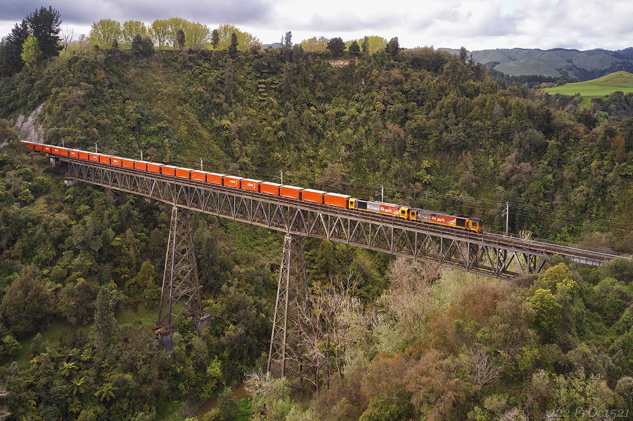
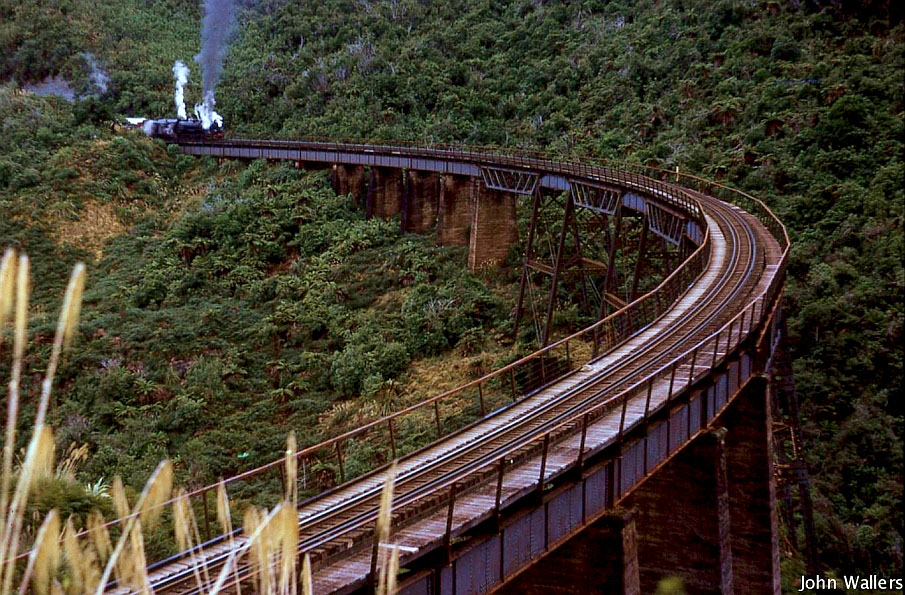
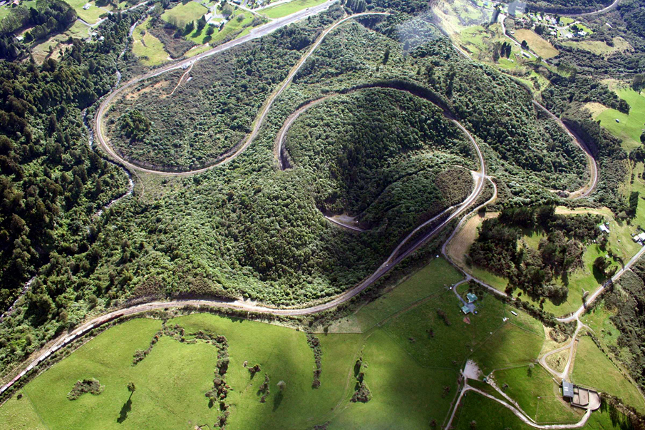
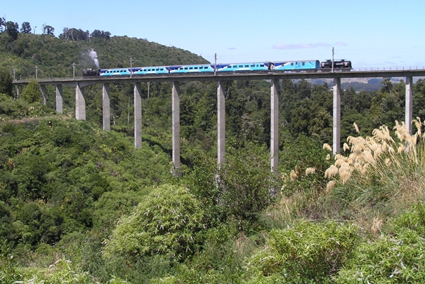
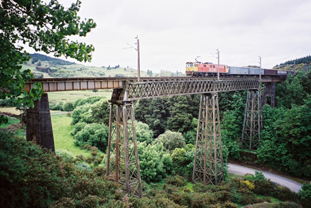
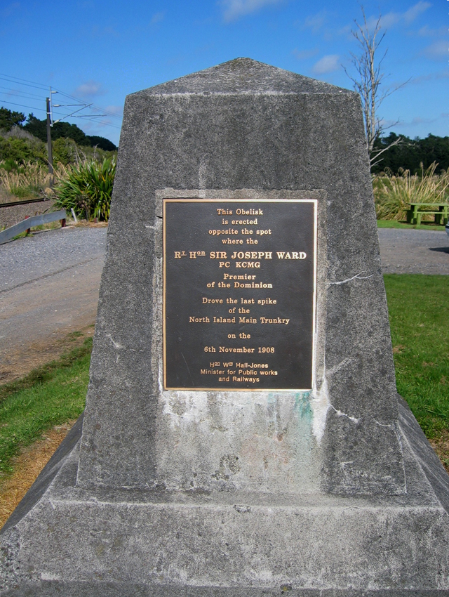
Sign up to hear more
Get the latest heritage news, features and events delivered
straight to your inbox.
