

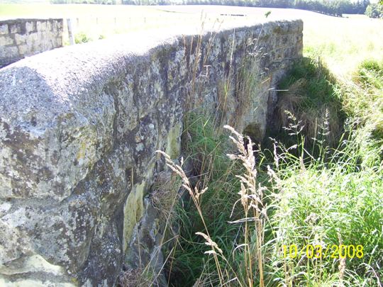
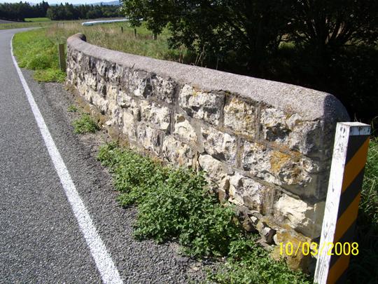
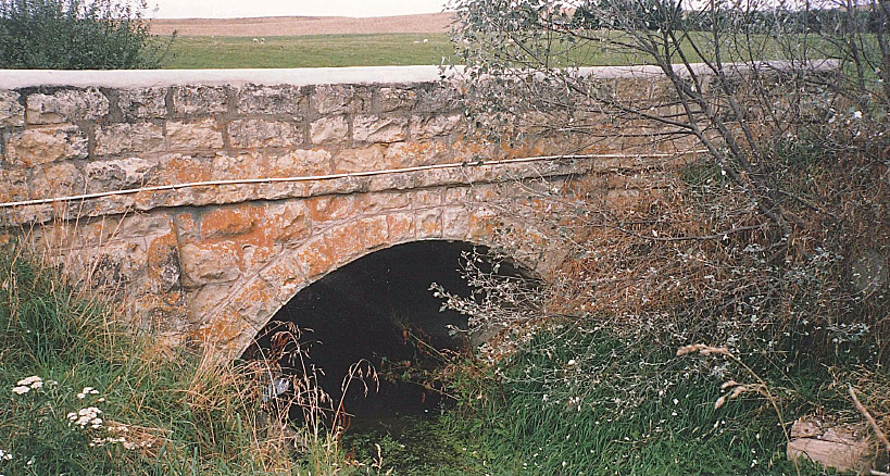
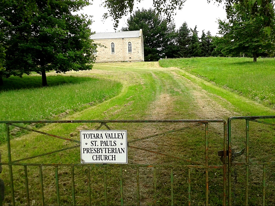
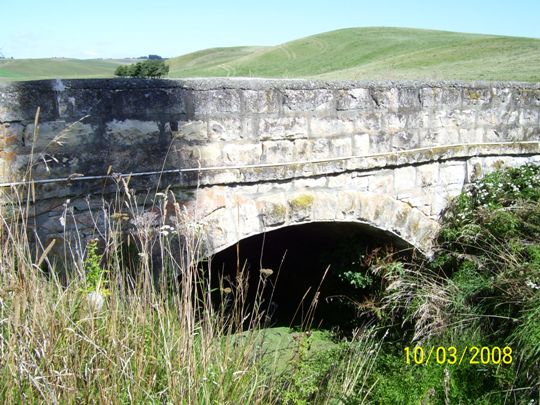
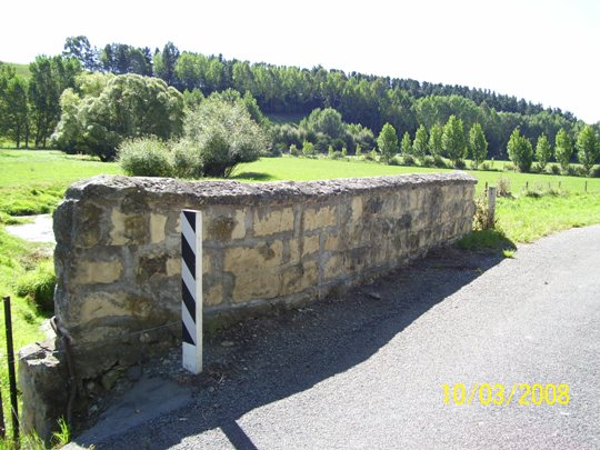
Built in circa 1870, the Limestone Bridge on Cleland Road, Totara Valley, is one of a number of stone arch bridges built in the nineteenth century in South Canterbury that are an enduring reminder of early engineering design and which have high level of craftsmanship. Constructed by the Levels Road Board and still in use today, the Limestone Bridge is one of the few intact limestone arch bridges in the district and has historical, archaeological, aesthetic and architectural value. Between the 1865 and 1880s, a number of stone bridges and culverts were constructed in South Canterbury. Most were small single span structures built of local limestone or bluestone (basalt). Early newspaper reports of the Levels Road Board meetings contained references to a ‘manuka bridge’ at Totara Flat. In 1874, Mr W Williamson, Engineer to the Board, suggested that it might be better to discontinue having anything further to do with bush bridges and recommended the use of stone as a material for bridge works where it could be easily procured. One of these stone bridges built was on Cleland Road, probably around 1870. Cleland Road is named after Scottish-born Andrew Cleland, who took up 2060 acres which he named ‘Loudon’, in the Totara Valley. He was a member of the Levels Road Board from 1875 to 1880. The Limestone Bridge is on a mostly straight stretch of Cleland Road, around 200 metres to the north of the T-junction where Hays Road joins Cleland Road which is also the entrance to the St Paul’s Presbyterian Church (Former) (List No. 1995). The Limestone Bridge has a span of approximately 3.8 metres. The road width is 5.5 metres and the depth of the crown of the arch to water level is approximately 2 metres. The materials are local limestone. In his 1958 publication, South Canterbury – A Record of Settlement, Oliver A Gillespie records the construction of these early bridges as follows: ‘Before building a stone bridge, a wooden framework was erected to support the weight as the prepared stones were placed in position. Cement was used only for foundations and to smooth over interstices between the stones after these had been filled with chips. Stones, shaped at an angle to give an arch, were packed as tightly as possible. Those last to be placed in position were the wedge-shaped keystones which locked the whole structure and gave it strength. Once they were placed, the framework was removed and the bridge was ready to take the weight of traffic.’ In the early 1990s the side walls of the bridge were repaired and repointed.
Location
List Entry Information
Overview
Detailed List Entry
Status
Listed
List Entry Status
Historic Place Category 2
Access
Able to Visit
List Number
1986
Date Entered
6th June 1983
Date of Effect
6th June 1983
City/District Council
Timaru District
Region
Canterbury Region
Extent of List Entry
Extent includes part of the land described as Legal Road, Canterbury Land District and the structure known as Limestone Bridge thereon. Refer to extent map tabled at Heritage New Zealand Board meeting on 26 June 2014.
Legal description
Legal Road, Canterbury Land District
Location Description
There is no street number. The GPS coordinates are 1440299.0438, 5100182.8528.
Related listings
Stay up to date with Heritage this month
