

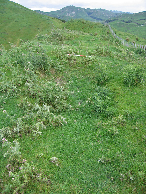
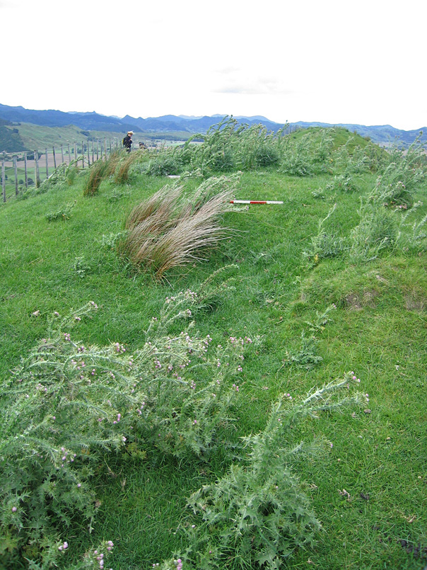
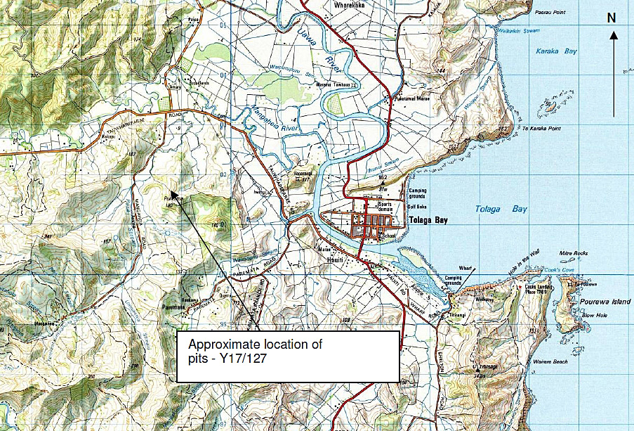
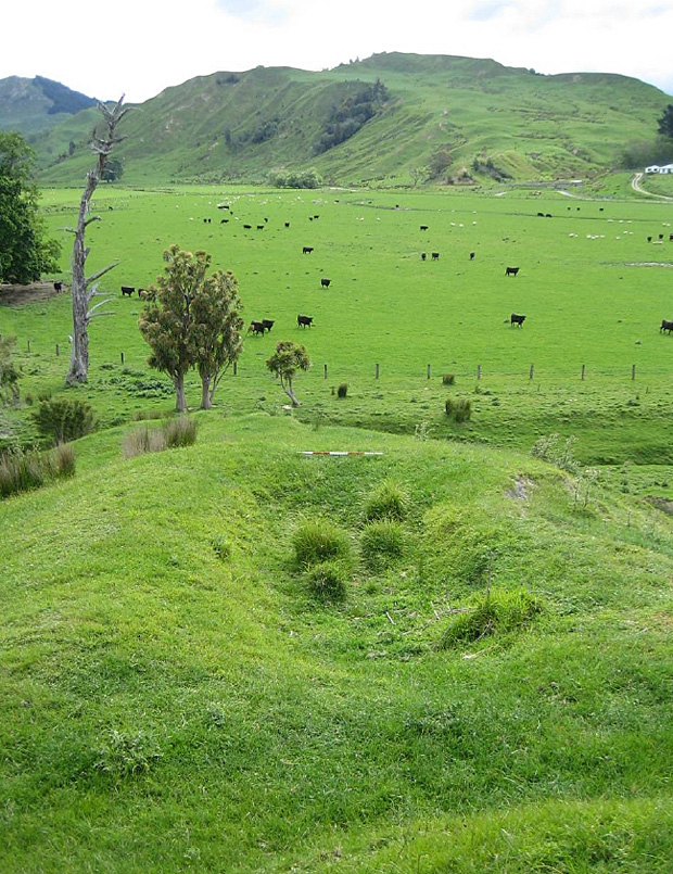
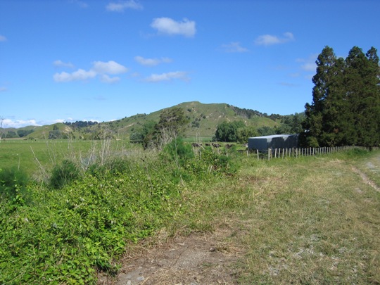
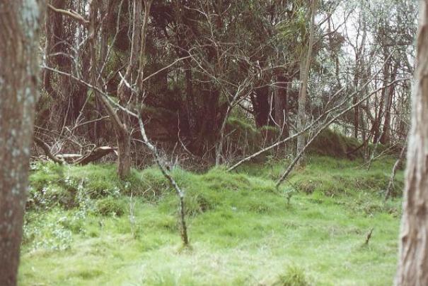
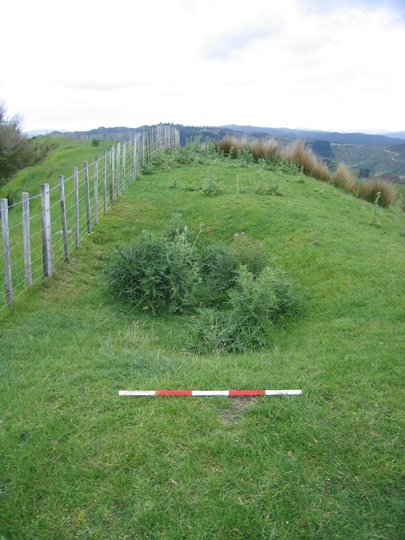
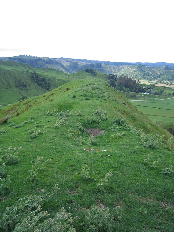
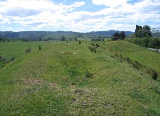
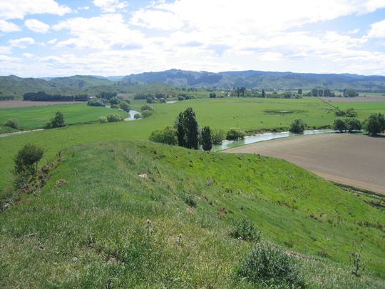
New Zealand Archaeological Association Site Record Number Y17/127 is a pit site that forms part of the dense archaeological landscape of the Tolaga Bay (Uawa) area. It is located on Iwinui Station, to the west of the Tolaga Bay township. Pit sites and the many other recorded archaeological sites including pa, midden, gardens and urupa reflect the intensive Maori occupation of the Tolaga Bay from the time of initial Polynesian settlement approximately 700 years ago. Access to abundant food resources from the sea, rivers, inland forests and horticultural production (kumara) meant that a large population could be sustained. It has been estimated that the early Maori population of Tolaga Bay totalled approximately 1200; and the main iwi was Te Aitanga a Hauiti. Pit and pit/ terrace sites are very common in Tolaga Bay, and demonstrate the importance of horticulture to Tolaga Bay's earliest inhabitants. The Bay's fertile soils and temperate climate were well suited to kumara gardening, and the pits were used for storing harvested kumara over the winter months. Rectangular storage pits (which were once roofed with a layer of earth), are more prevalent than the underground storage pits found elsewhere in New Zealand, a pattern attributed to the harder substrate of the soil in this area. They are in fact the most common archaeological site type in Tolaga Bay, and are found along the river banks and on the rolling hills to the south of the Bay. They are generally located in clusters on knolls or terraces, or on ridge crests, in lines from end to end, as found with this site -Y17/127. Pit site Y17/127 is located in a saddle on the highest part of the ridgeline leading north from Pukeatua trig. It is approximately 700 metres east of Mangaheia Road. There are a number of other recorded archaeological sites in the vicinity, such as pit site Y17/5 to the south along the ridgeline at the Pukeatua trig site, and pit site Y17/128 to the north. This site was first recorded by archaeologist Kevin Jones during his archaeological survey work in the Whangara, Tolaga Bay and Uawa Catchment areas in 1982-1983. This survey work was undertaken to gain information about the nature of prehistoric settlement in this locality, and also to evaluate specific sites for registration under the Historic Places Act 1980. Jones described the site as a 'battery of pits, some with raised rims along ridge'. A sketch plan completed of the site illustrates a total of eight pits on the eastern side of the ridge (bisected by a fence line), measuring approximately 3 metres x 2 metres. The site occupied approximately 100 metres of the ridgeline in total. Archaeologist Vanessa Tanner revisited the recorded archaeological sites on Iwinui Station in 2000 as part of the New Zealand Archaeological Association Site Recording Scheme Upgrade Project. The completed Site Record Form for Y17/127 actually seems to illustrate the northern part of pit site Y17/5 however, which was excluded from the Upgrade Project. This conclusion is based on the close similarities between the GPS coordinates and photograph taken for site Y17/127 during the Upgrade Project, and the photos and GPS coordinates obtained for site Y17/5 during a site visit by the New Zealand Historic Places Trust in November 2007. Y17/127 was also revisited by the New Zealand Historic Places Trust in November 2007, and no major changes to the site were noted apart from the moving of the fence line. The pits had suffered from stock damage and were partially covered in thistles at the time of the site visit, but were still distinct and in average condition overall. It was also noted that the fence line at the northern end of the site now continued off in a north-westerly direction towards pit site Y17/128, and did not continue directly north as originally recorded. The northernmost pit is now therefore located to the east of the fence line. Y17/127 is one of numerous pit and pit/terrace sites recorded in the Tolaga Bay area. It is part of a dense archaeological and cultural landscape that is of considerable significance to Te Aitanga a Hauiti, reflecting the intensive Maori occupation and settlement of the Tolaga Bay area since the 14th - 15th centuries AD, and the important role that horticulture played in this.
Location
List Entry Information
Overview
Detailed List Entry
Status
Listed
List Entry Status
Historic Place Category 2
Access
Private/No Public Access
List Number
6541
Date Entered
3rd March 1986
Date of Effect
3rd March 1986
City/District Council
Gisborne District
Region
Gisborne Region
Extent of List Entry
Registration includes part of the land described as Pt Paremata 3A Block, Gisborne Land District and the archaeological site Y17/127 (New Zealand Archaeological Association Site Record Number).
Legal description
Pt Paremata 3A Block (RT GS1C/1268), Gisborne Land District
Related listings
Stay up to date with Heritage this month
