

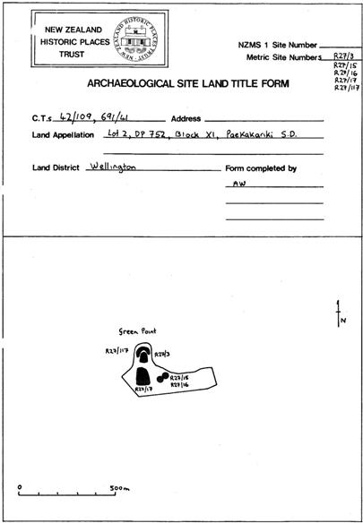
Setting: Situated on coast, circa four kilometres south of Titahi Bay, on Green Point, (opposite Mana Island). Archaeological Features: Headland pā; protected by cliffs on three sides, and by a narrow connecting ridge on the inland side. Terraces present on outer margin, as well as pits. Supporting Evidence: Site with a traditional name (Best 1914; Best et al 1916). A description of this site was undertaken by Miss Deborah Howitt (n.d.) for Wellington Teachers College Anthropology Studies project. Condition of Site : In grass, grazed by stock. Condition of features, reasonably good, although not particularly distinctive. Assessment: A coastal headland pā site in a good state of preservation. Traditional name known. Site in farmed area and thus likely to remain fairly safe from damage, unless Porirua District Sewerage schemes require land at base of site for pipeline excavation. Surface features of site not currently well-documented, but site may yield more with detailed mapping.
Location
List Entry Information
Overview
Detailed List Entry
Status
Listed
List Entry Status
Historic Place Category 2
Access
Private/No Public Access
List Number
6144
Date Entered
10th October 1984
Date of Effect
10th October 1984
City/District Council
Porirua City
Region
Wellington Region
Legal description
Lot 2 DP 752 (RT WN691/41), Wellington Land District
Stay up to date with Heritage this month
