

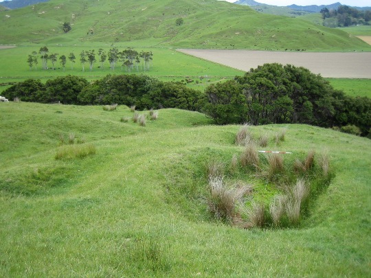
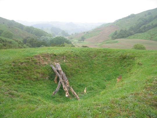
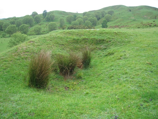
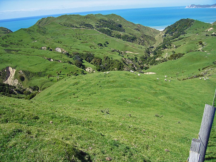
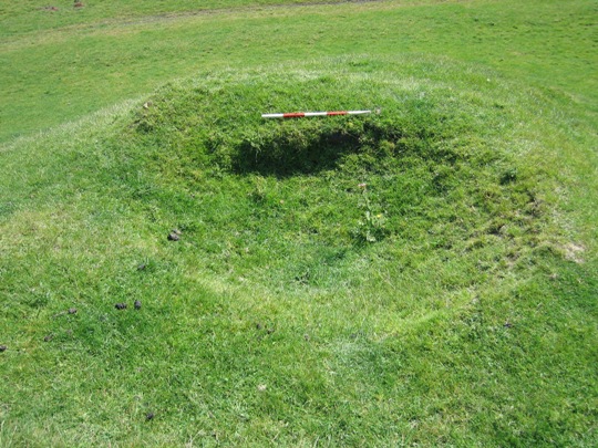
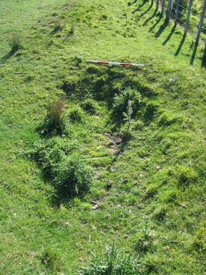
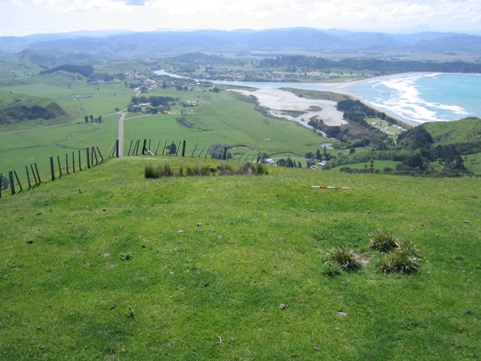
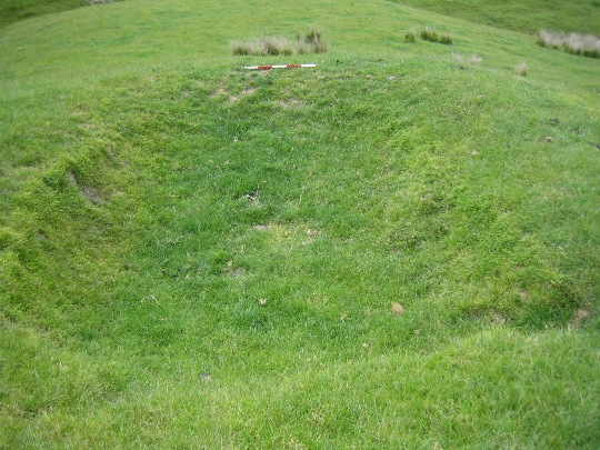
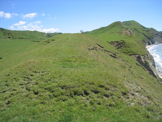
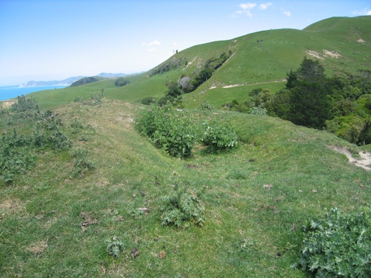
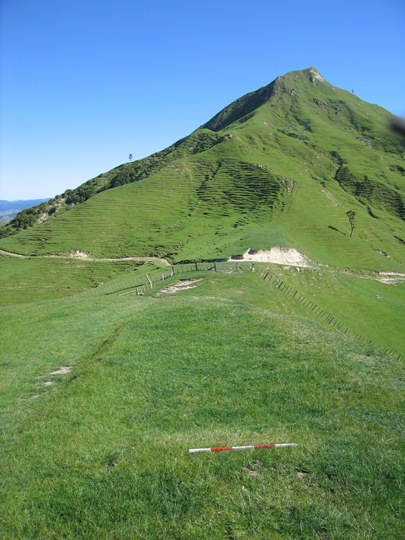
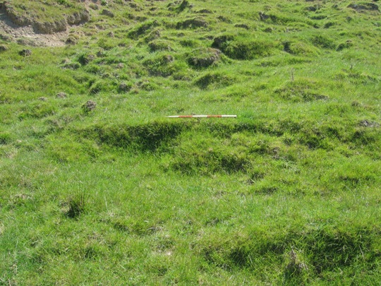
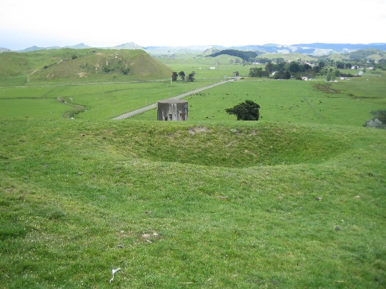
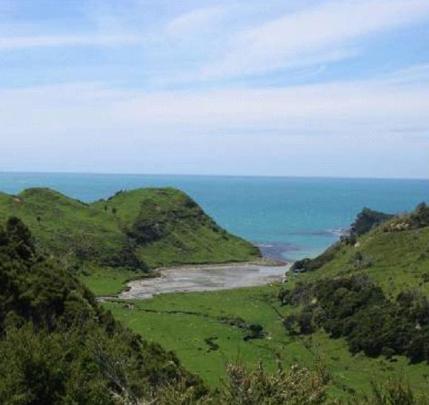
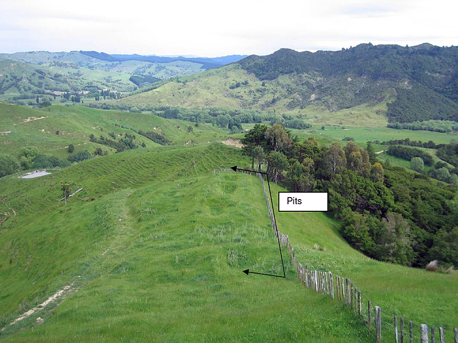
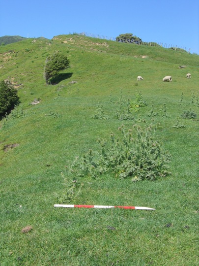
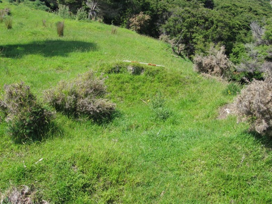
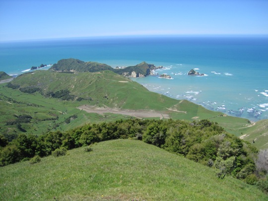
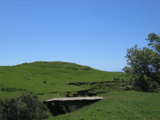
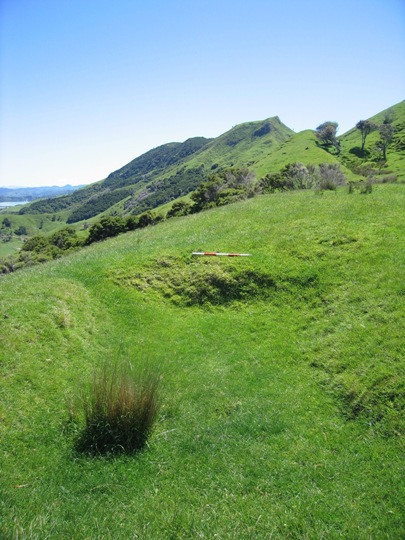
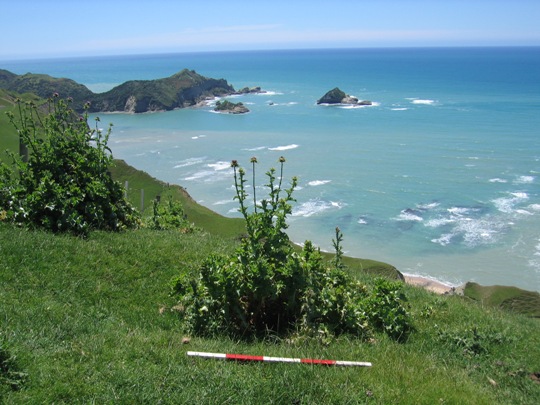
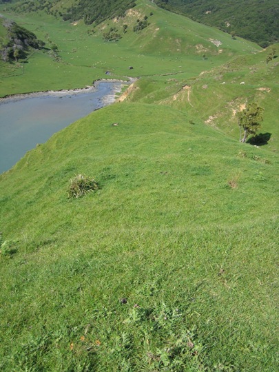
New Zealand Archaeological Association Site Record Number Z17/272 is a pit complex that forms part of the dense archaeological landscape of the Tolaga Bay (Uawa) area. It is located on Titirangi Station, to the southeast of the Tolaga Bay township. Pit sites and the many other recorded archaeological sites including pa, midden, gardens and urupa reflect the intensive Maori occupation of the Tolaga Bay from the time of initial Polynesian settlement approximately 700 years ago. Access to abundant food resources from the sea, rivers, inland forests and horticultural production (kumara) meant that a large population could be sustained. It has been estimated that the early Maori population of Tolaga Bay totalled approximately 1200; and the main iwi was Te Aitanga a Hauiti. Pit and pit/ terrace sites are very common in Tolaga Bay, and demonstrate the importance of horticulture to Tolaga Bay's earliest inhabitants. The Bay's fertile soils and temperate climate were well suited to kumara gardening, and the pits were used for storing harvested kumara over the winter months. Rectangular storage pits (which were once roofed with a layer of earth), are more prevalent than the underground storage pits found elsewhere in New Zealand, a pattern attributed to the harder substrate of the soil in this area. They are in fact the most common archaeological site type in Tolaga Bay, and are found along the river banks and on the rolling hills to the south of the Bay. They are generally located or ridge crests, in lines from end to end, or in clusters on knolls or terraces, as with site Z17/272. Pit complex Z17/272 is located in pasture (with some tussocks) on a knoll approximately 100 metres east of Shelton Road. It is located south of the intersection with Wharf Road, at the point of two double farm gates, and a track leads from the left gate to the site. Stands of manuka are located to the south and north of the pits, and a shallow gully separates the larger southern pit complex from the three pits to the north. A large stock pond is located towards the western end of the shallow gully. A number of other archaeological sites are located in the vicinity, such as the pit complex (Z17/194) approximately 200 metres to the north. This site was first recorded by A. Nowakowski in 1983, who noted ten pits of varying sizes on the knoll. A sketch plan completed of the site shows nine large pits (some with raised rims) grouped together on the knoll; with a tenth smaller pit (1.5 metre x 1.5 metre) approximately 30 metres to the west. The pits on the knoll ranged from 2 metres x 1.5 metres to 6 metres x 4 metres. Z17/272 was revisited by archaeologist Vanessa Tanner in 2000 as part of the New Zealand Archaeological Association Site Recording Scheme Upgrade Project. The site was still in good condition, and three additional pits were recorded, on the northern side of the shallow gully. These pits are shown on an amended version of A. Nowakowski's 1983 sketch plan, ranging from 3 metres x 1 metre to 4 metres x 1 metres (with a depth of 1 metre). The site was revisited by the New Zealand Historic Places Trust in November 2007, and no major changes were observed. The pits are still well-defined, particularly the three to the north of the shallow gully. Z17/272 is one of the numerous pit and pit/terrace sites recorded in the Tolaga Bay area and it forms part of a dense archaeological and cultural landscape that is of considerable significance to Te Aitanga a Hauiti. This landscape reflects the intensive Maori occupation and settlement of the Tolaga Bay area since the 14th - 15th centuries AD, and the important role that horticulture played in this.
Location
List Entry Information
Overview
Detailed List Entry
Status
Listed
List Entry Status
Historic Place Category 2
Access
Private/No Public Access
List Number
6650
Date Entered
3rd March 1986
Date of Effect
3rd March 1986
City/District Council
Gisborne District
Region
Gisborne Region
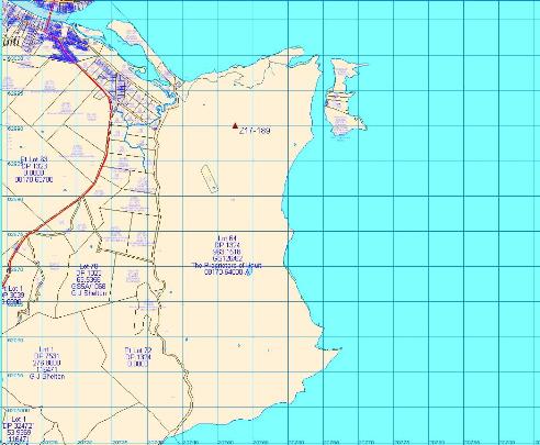
Extent of List Entry
The registration includes part of the land described as Lot 64 DP 1324, Gisborne Land District and the archaeological site Z17/272 (New Zealand Archaeological Association Site Record Number).
Legal description
Lot 64 DP 1324 (RT GS126/62), Gisborne Land District
Related listings
Stay up to date with Heritage this month
