

The archaeological remains of the Pipiriki Flour Mill, constructed between 1854 and 1857 on the Whanganui River, represent the fluorescence of agricultural activity carried out by Maori following contact with Europeans in the 1840s. Maori had adopted European crops such as wheat, maize and potatoes for use in the 1820s, and, by the late 1840s, were the primary suppliers of agricultural produce for trade in the growing settlements of Auckland and Wellington. Growing demand prompted Maori to replace labour-intensive, hand-operated steel mills with water-powered mills first introduced to New Zealand in 1835. The construction of the mills was encouraged by government officials and missionaries; agriculture was seen as a means of dissuading Maori from armed conflict by providing them with material wealth. In 1843, Anglican missionary Richard Taylor (1805-1873) was sent to the Whanganui River region. Taylor's construction of the first mill in the area in 1845 served as a catalyst for agricultural development along the river, while the growing number of acres cultivated during this period fueled the demand for water-powered flourmills. In 1852, to forestall the influence over Maori of a newly arrived Catholic priest, Taylor facilitated the construction of a mill at Pipiriki. The Mill, which was partially paid for with government funding, was constructed between 1854 and 1857 by millwright Mr. Soulby. The Mill was a three-storey, wooden structure with a cast iron water wheel and millpond that was used to grind the wheat grown across the river. Production was halted during the New Zealand Wars but, in the 1870s, the mill became a focal point in the drive to revive the Pipiriki settlement. The Mill remained functional until 1892, after which it was converted to function as a generator for Pipiriki House. It sustained damage during the construction of the Whanganui River Road in 1928, and by 1949 had been abandoned for a number of years. In the 1980s, the Department of Conservation began actively managing the remains of the Mill, which consist of parts of the timber structure and the cast iron water wheel, as an historic site. The remnants of the Mill are historically significant as the most intact archaeological site remaining that was associated with the construction and ownership of flourmills by Maori on the Whanganui River. Its history provides insight into relations between both Maori and Pakeha, and early Pakeha missionaries, during the early contact period on the Whanganui River. The Pipiriki Flourmill is culturally important as a symbol of social change and interaction. Flourmills such as this represent a significant economic shift for Maori communities from traditional horticultural practices to the adoption of European food crops and processing techniques. As one of five mills constructed with the assistance of the government, the Pipiriki Flourmill is also associated with the mid-nineteenth century drive to 'Europeanise' Maori through means such as the provision of access to technological developments that would allow engagement in Pakeha-style economic activities.
Location
List Entry Information
Overview
Detailed List Entry
Status
Listed
List Entry Status
Historic Place Category 2
Access
Private/No Public Access
List Number
7589
Date Entered
4th April 2005
Date of Effect
4th April 2005
City/District Council
Ruapehu District
Region
Horizons (Manawatū-Whanganui) Region
Extent of List Entry
The registration includes all of the land in RT WN14B/1006, and the remains of the Pipiriki Flourmill thereon, including the water wheel, the dam, and the water-race, and the levelled area on which the mill house was originally located.
Legal description
Pt Lot 1 Blk X Rarete SD, DP 29339 (RT WN 14B/1006), Wellington Land District
Location Description
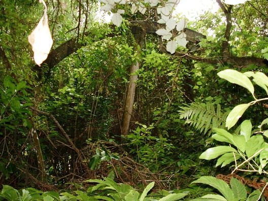
The remains of the Pipiriki Flourmill are in dense bush on the true left bank of the Kaukore Stream below the level of the road just below the present road bridge.
Status
Listed
List Entry Status
Historic Place Category 2
Access
Private/No Public Access
List Number
7589
Date Entered
4th April 2005
Date of Effect
4th April 2005
City/District Council
Ruapehu District
Region
Horizons (Manawatū-Whanganui) Region
Extent of List Entry
The registration includes all of the land in RT WN14B/1006, and the remains of the Pipiriki Flourmill thereon, including the water wheel, the dam, and the water-race, and the levelled area on which the mill house was originally located.
Legal description
Pt Lot 1 Blk X Rarete SD, DP 29339 (RT WN 14B/1006), Wellington Land District
Location Description
The remains of the Pipiriki Flourmill are in dense bush on the true left bank of the Kaukore Stream below the level of the road just below the present road bridge.
Cultural Significance
Social The history of the Pipiriki Flourmill provides insight into relations between both Maori and Pakeha, and early Pakeha missionaries, during the early contact period on the Whanganui River. Pipiriki Maori first approached Anglican missionary Richard Taylor for assistance to construct a water-powered flourmill in 1848. Nothing was achieved until 1852, when Father Jean Lampila, a Catholic priest, arrived in the area. Lampila was instrumental in constructing a number of mills on the Whanganui River, and won him converts to the Catholic faith. Rivalry between Lampila and Taylor escalated and Pipiriki Maori used the situation to their advantage by threatening to withdraw their support of Taylor unless he helped facilitate the construction of a mill. Taylor deplored the connection between religion and material goods but agreed to find a suitable millwright for them. Taylor obtained the services of Mr. Soulby the following year, and the Mill was finally completed under his supervision in 1857.
Historic Significance
Historical Significance or Value Historical The Pipiriki Flourmill is part of a 'golden age' of Maori agricultural activity that developed between 1840 and 1870 and, as such, has historical significance. Maori had adopted European crops such as wheat, maize and potatoes for use as early as the 1820s and, by the late 1840s, were the primary suppliers of agricultural produce for trade in the growing settlements of Auckland and Wellington. Growing demand for their produce prompted Maori to replace labour-intensive, hand-operated steel mills with water-powered mills. With the aid of missionaries and, from 1849, the Government, approximately 79 Maori-owned flourmills were constructed. The Pipiriki Flourmill was one of between 15 and 20 mills erected on the Whanganui River, and one of the five constructed with financial assistance from the New Zealand Government, in accordance with Governor Grey's policy to assist Maori towards economic independence. In the 1870s the mill became a means of resuscitating the Pipiriki settlement after the New Zealand Wars.
Physical Significance
Archaeological The archaeological remains of the Pipiriki Flourmill (R21/29) represent one of only three recorded flourmill sites in the New Zealand Archaeological Association Site Recording Scheme on the Wanganui River. The sole remains of the Maraekowhai Flourmill (R19/23) are a depression with the remnants of three posts, whilst the possible site of the Kauaeroa Flourmill is recorded simply on the basis of the discovery of a millstone just south of Jerusalem (R21/91). The most well-known flourmill site on the river, that at Kawana, has been completely reconstructed and it is likely that its archaeological value is now extremely low. The Pipiriki site, therefore, is the most intact known site associated with the construction and ownership of flourmills by Maori on the Wanganui River during the middle of the 19th century. These flourmills form an important class of archaeological sites representing a significant economic shift for Maori communities from traditional horticultural practices to the adoption of European food crops and processing techniques. They also represent the incorporation of building techniques within traditional settlements. The historical record suggests that this mill has undergone phases of destruction and renewal. It may be possible, through archaeological investigation, to obtain further information about changes to the structure. It may also be possible to document different construction techniques over time. From an archaeological perspective, it is important that the remains of the flourmill are not viewed in isolation. This mill was one component of the settlement and economic activity by Maori at Pipiriki. It is possible that further archaeological remains have survived that may place it within in its context.
Detail Of Assessed Criteria
(a)The extent to which the place reflects important or representative aspects of New Zealand history The sudden increase in construction of water-powered flourmills between 1846 and the late 1860s in Maori communities reflects the fluorescence of agricultural activity by Maori in the first half of the nineteenth-century. Approximately 79 Maori-owned mills were constructed during this period, including the Pipiriki Flourmill, which was constructed between 1854 and 1857. In the 1820s, Maori had adopted European crops such as wheat, maize and potatoes for their own use, and by the late 1840s, were the primary suppliers of agricultural produce for trade in the growing settlements of Auckland and Wellington. Growing demand prompted Maori to replace labour-intensive, hand-operated steel mills with the water-powered mills first introduced to New Zealand in 1835. By the 1870s, the majority had fallen into disuse, and few now remain extant. The Pipiriki Flourmill remained in use until 1894 and was subsequently used to generate electricity for Pipiriki House. Re-use ensured that the site remained relatively intact, and is now a significant reminder of what has been described as a 'golden age' in Maori agricultural development. As the construction of Maori-owned mills was encouraged by government officials and missionaries, extant sites such as the Pipiriki Flourmill also provide insight into the early relations between Maori and Pakeha. Pakeha perceived the mills as a means of promoting Maori economic independence and of dissuading Maori from armed conflict by providing them with material wealth. (b)The association of the place with events, persons, or ideas of importance in New Zealand history People: The construction of the Pipiriki Flourmill was facilitated by Anglican missionary Richard Taylor (1805-1873), and partially funded through the policies of Sir George Grey (1812-1898), the then Governor of New Zealand. Taylor instigated the construction of the first mill in the Whanganui River region, which served as a catalyst for agricultural development along the river. In 1852, he located the millwright who would help construct the flourmill at Pipiriki and helped to organise the administrative side of the Mill's construction. Ideas: The promotion of Maori-owned flourmills like the mill at Pipiriki by government officials and missionaries is associated with the mid-nineteenth century drive to 'Europeanise' Maori. The provision of access to technological developments such as flourmills was seen as a means of assisting Maori to engage in Pakeha-style economic activities and making them less disposed towards warfare, which would put their property at risk. It reflects a formal level of interaction between Maori and Pakeha which contrasts with more spontaneous, unregulated interaction, for example between whalers and Maori, and represents a concerted effort to integrate Maori into a European way of life. (c)The potential to provide knowledge of New Zealand history The site of the mill has the potential to provide information about the construction of these mills within Maori communities, including the way in which they developed and the relationship of these buildings with others within the settlement. Subsurface excavation may also provide information about other activities that may have occurred around the mill site for which there is no documentary evidence. It is possible that the periods of reconstruction are archaeologically visible; therefore, changes in construction technique may be documented. On the basis of material potentially recovered, it may be possible to more definitively date any changes made to the structure. (e)The community association with, or public esteem for, the place When first constructed, the Pipiriki Flourmill was of importance to both Maori at Pipiriki and to the Anglican Mission. For Maori, the Mill represented economic advancement, and ready access to flour. They first began advocating for the construction of a mill in 1848 and Maori from Pipiriki assisted in both the provision of materials for, and the construction of, the Pipiriki Flourmill. For Anglican missionary Richard Taylor, the erection of the Mill represented the victory of Anglicanism over Catholicism, and the continued support of the Pipiriki Maori. Taylor, while noting his sorrow at the connecting of mill building with religion, was prompted to facilitate the construction of the mill in 1852 by the deliberately expressed desire of Pehi Turoa to convert to Catholicism to obtain a mill. In the 1870s the mill served as a means of resuscitating the Pipiriki settlement after the New Zealand Wars. (i)The importance of identifying historic places known to date from early periods of New Zealand settlement The Pipiriki Flourmill was constructed between 1854 and 1857, shortly after imported crops, such as potatoes, wheat and maize, were first planted in the Whanganui River region, and during the initial phase of Pakeha settlement, which had commenced in the area 1840, after the signing of the Treaty of Waitangi. (j)The importance of identifying rare types of historic places The impact of the New Zealand Wars, combined with decreasing flour prices and a declining Maori population meant that, by the 1870s, the majority of Maori-owned, water-powered flourmills fell into disuse. The Pipiriki Flourmill operated until 1894 and was later used to generate electricity for Pipiriki House, ensuring that the Mill site remained relatively intact. By 1949, the Pipiriki Flourmill and the Kawana Mill, which operated on the Whanganui River until 1913, were among last remaining examples on the river. Just two other archaeological mill sites on the river have been identified by the NZAA. In the late 1970s, the Kawana Mill was completely reconstructed, and its value as an archaeological site was substantially reduced. The Pipiriki Flourmill site remains the most intact of the flourmills that once operated on the Whanganui River. Research on other Maori-owned mill sites indicates that the Pipiriki Flourmill is a representative, if not rare, example of remaining Maori owned flourmill sites in the North Island. While no comprehensive study of these sites has been undertaken, it appears that only a small number have survived, although a number of millstones remain extant. The best-known flourmill site includes the reconstructed Kawana Flourmill (Reg # 158). (k)The extent to which the place forms part of a wider historical and cultural complex or historical and cultural landscape The Pipiriki Flourmill is part of a wider historical landscape that reflects the 'golden age' of Maori agricultural development between 1840 and 1870. One of the most visible signs of this development was the construction of water-powered flourmills, which provided rapid processing of wheat into flour. During this period, it has been estimated that approximately 79 Maori-owned flourmills were constructed, and that between 15 and 20 of these were in operation on the Whanganui River. The Pipiriki Flourmill is also part of subset of mills that were constructed with financial assistance from the New Zealand Government, in accordance with Governor Grey's policy to assist Maori towards economic independence.
Construction Professional
Biography
Millwright, Wanganui
Name
Soulby
Type
Designer
Construction Details
Start Year
1853
Type
Designed
Start Year
1857
Type
Original Construction
Description
Flood damages dam.
Start Year
1857
Type
Other
Description
Reconstruction after New Zealand Wars.
Finish Year
1874
Start Year
1873
Type
Reconstruction
Description
Use as a flourmill ceases.
Start Year
1892
Type
Original Construction
Description
Converted for use as a generator for Pipiriki House
Finish Year
1909
Start Year
1892
Type
Other
Description
Damaged by construction works.
Start Year
1928
Type
Other
Construction Materials
Originally a timber frame mill with a iron waterwheel.
Notable Features
The registration includes all of the land in CT WN14B/1006, and the remains of the Pipiriki Flourmill thereon, including the water wheel, the dam, and the water-race, and the levelled area on which the mill house was originally located.
The archaeological remains of the Pipiriki Flourmill, constructed between 1854 and 1857 on the Whanganui River, represent the fluorescence of agricultural activity carried out by Maori following contact with Europeans in the 1840s. Agricultural Developments By the 1820s, European crops such as wheat, maize and potatoes were well established in New Zealand. Missionaries, required to be self-supporting, planted the crops to feed the communities that developed around mission stations. Maori rapidly adopted the practice for use in their own communities. By the 1850s, Maori had planted almost 90,000 acres of wheat in the Auckland province alone, and were the primary suppliers of agricultural produce for trade in the growing settlements of Auckland and Wellington. Initially, hand-operated steel mills, introduced in New Zealand in 1814, were used to grind the wheat produced into flour. However, such mills were labour intensive; an hour's grinding produced just half a kilo of flour. In 1835, Anglican missionaries of the Church Missionary Society (CMS) constructed New Zealand's first water-powered flourmill at their Maori mission station in Waimate. The mill's success led the CMS to construct others at Hokianga (1838), Wellington (1841), and Auckland (1844). During this period, an increasing rate of agricultural industry by Maori created a new demand for the more efficient water-powered mills. The first Maori-owned mill was constructed at Aotea, near Raglan harbour, in 1846, and in 1856, it was reported by Mr. Boyton, Inspector of Mills, that at least 29 Maori-owned mills in the North Island had been constructed, or were in the process of construction. Response Government officials and missionaries alike initially encouraged the development. The growth of agricultural independence among Maori was seen as an essential. One means of doing so was to encourage the ability of Maori to engage in Pakeha-style economic activities by providing access to technological developments such as flourmills. In 1840, for instance, CMS missionary Reverend John Morgan noted that 'I know of no plan that would so tend to check the progress of disease and rescue from destruction the native population as the erection of wind or water mills...'. CMS authorities concurred, and it became part of CMS practice to promote the construction of mills in areas where their missionaries were active. Between 1845 and 1847, the mills took on further significance for the Government, and prompted a scheme to help fund their construction in Maori communities. In several districts of the North Island there had been violent disputes between settlers and Maori over land claims. In Wellington, Nelson, and Taranaki, there had been conflict over disputed New Zealand Company land purchases. The then Governor of New Zealand, Sir George Grey (1812-1898) believed that the possession of valuable property by Maori would make them less disposed to 'indulge' in war. He attempted to persuade Maori to 'concentrate on producing a surplus of pigs and potatoes, corn, flax and timber for the Europeans, and thus improve their own standard of living'. To this end, the government provided funding for six mills worth £1400 at Raniaowia, Otawhao and Maungatauri in 1849. Further funding was provided in later years and, on the Whanganui River, Sir George Grey's policy assisted the construction of water wheels at Jerusalem, Kawana, Koroniti, Kaiwhaike, and Pipiriki. The Whanganui River In 1851, the results of an official census of the Whanganui River Basin undertaken between 1849 and 1851 indicated that there were at least 3374 Maori living in the area. The area was settled by the descendants of Tamekehu and his three children Hinengakau, Tupoho, and Tama-Upoko, whose descendants settled around the river's upper reaches. Distributed among 34 kainga along 140 miles (225.3 kilometres) of riverbank, the Whanganui iwi were closely linked by marriage and the common use of river resources, which did not restrict hapu to a particular rohe. In 1839, when the first European missionary, Henry Williams (1792-1867), arrived in the area, the Whanganui iwi had a sound understanding of Christianity, indicating an awareness of European developments elsewhere in the country. Shortly after Williams' visit, the CMS posted missionaries John Mason and Richard Matthews to the Whanganui Region. Mason established himself at Putiki Waranui, a settlement attacked by Te Rauparaha (? - 1849) in 1829 and, with the support of key Maori leaders, he established a thriving mission in the region prior to his death in 1843. Later that year Mason was replaced by Richard Taylor (1805-1873). Taylor, an English born missionary, baptised 'perhaps two-thirds of the population in Wanganui', and acted as a keeper of the peace both among Maori tribes and between settler and Maori. However, Taylor also encouraged Maori towards European policies and practices. As Owens has noted, religious belief served as a form of social control and, as well as a spiritual role, missionaries like Taylor took responsibility for 'civilising' Maori. It was in this capacity, and with the aid of government funding prompted by Grey's policy, that Taylor helped to facilitate the construction of the first flourmills along the Whanganui River. Agricultural Development on the Whanganui River It is not known when imported crops, such as potatoes, wheat and maize, were first planted in the Whanganui River region. In 1845, Taylor instigated the construction of the first mill in the area at Putiki Wharanui, indicating that at least some cultivation of crops had occurred by this period. The construction of Taylor's mill may have then served as a catalyst for agricultural development along the river. The following year Taylor reported that 'I was much pleased to notice how generally the natives are cultivating wheat up the river, I should think there are several hundred acres of it'. The growing number of acres cultivated during this period created a demand for water-powered flourmills, and Taylor further noted that 'The general anxiety in all parts to procure mills argues well for the future improvement of the native population in this district if it please the Lord to give us peace'. In the years following the construction of the mill at Putiki until 1852, Maori were the primary instigators of mill construction along the river. Taylor records their activities to this end without involving himself greatly in the process of their erection or operation. For instance, in 1851 he wrote 'The Ketemarae natives built a mill, the second within 16 miles, for which they paid 200 pigs'. This lack of involvement was to end in 1852, with the arrival of the Catholic missionary Father Jean Lampila, in the Whanganui region. Missionary Involvement in Mill Construction on the Whanganui River In 1852, Taylor recorded that a lay assistant to the Roman Catholic priest was assisting Maori to build a mill at Towhera. It was to be the first of many similar observations. Tensions mounted between Taylor and Lampila, and Maori played on both missionaries to obtain the flourmills they required. The following year, Taylor became involved in a plan by Maori at Pipiriki to obtain a flourmill. His journal entries regarding this plan demonstrate the use made by Maori of the battle between the rival churches: I held service this morning by six and afterwards attended a large meeting of all the principal chiefs relative to the erection of the mill at Pipiriki. Pehi spoke first and spoke in favour of the priests and said that they were the first to erect a mill at Otaki and this gave proof that they were the true friends of the natives, that for his part he had first leaned to the church but when Mr Kirk came he turned Wesleyan and now he felt disposed to turn over to the church of Rome and let the priest make his mills. Taylor responded by pointing out Anglican missionaries had been responsible for New Zealand's first mill (at Waimate), and reflected on the superior nature of Anglican mills over 'trumpery' Catholic mills and berated those present for connecting mill building with religion. The outcome of the meeting was that Taylor would find a millwright for the Maori of Pipiriki. The Pipiriki Flourmill Following the meeting, Taylor contacted the then chief land purchase commissioner Donald McLean (1820-1877) to ask if he knew of a suitable millwright, writing 'I am very anxious to get these mills erected without delay'. On 1 December 1853 Taylor contacted a millwright named Mr. Soulby, and took him to Pipiriki to arrange for the construction of the Pipiriki Flourmill. On 3 December, Soulby's offer to construct the Mill for £320 was accepted and he was taken to examine a suitable site on the river. The site was the same site that had been viewed by Taylor in the company of Hori Patene and Haumera in 1848. Taylor had then noted of his companion that 'they are most anxious to have a water mill finding already how tedious the steel mills are'. On 5 December Soulby was given a first instalment of £100, baskets of coal for the ironwork, and an assistant from Pipiriki. When Taylor visited the site in March the following year, he found Soulby constructing the Mill and approximately 50 Maori at work on the dam. He was greeted with loud cheers. Pipiriki Flourmill in Operation The Pipiriki Flourmill was completed in 1857 and began processing wheat grown on the flat terraces near the Pipiriki settlement. The stream from which the Mill drew water was re-named 'Kaukore', meaning 'no swimming' as a warning that the waters were tapu because of their connection with the grinding of flour. The Mill itself was originally housed in a three-storied, pit-sawn timber structure. To the side of the Mill was the waterwheel, which was propelled by water flooding through the flume gate from the millpond. A tailrace allowed the water to flow away into the river. The turning of the wheel operated the millstones, which were located at ground level, which ground the wheat into flour. However, just a few months after its completion, the dam gave way following severe flooding in the Whanganui River, and wheat had to be processed by the newly constructed Kawana Kerei mill (Category I Historic Place, Reg # 158) until it was repaired. Maori-owned Mills It has been estimated that approximately 79 Maori owned flourmills were constructed during the latter half of the nineteenth-century. By the early 1860s, between 15 and 20 of these flourmills were in operation on the Whanganui River. Over the next decade, the number of Maori-owned mills in the North Island dropped dramatically. During the New Zealand Wars, mills, which had been promoted as a means of encouraging Maori economic independence, were targeted for destruction, and land formerly used to grow crops was lost after the wars through confiscation. This was exacerbated by a declining Maori population, and a drop in flour prices, which made it uneconomical to repair the ageing mills. By the late 1870s, only a handful of Maori-owned mills were still in operation. At least two of these, the Pipiriki Flourmill and the Kawana Mill, were located on the Whanganui River. Impact of War on Pipirikir Issues of power and government were central to the wars of the 1860s, which Pipiriki Maori were drawn into with significant consequences. In 1860, the first fighting between Maori and British forces began in Taranaki, where Whanganui Maori had strong kin links. Along with many other upper river Maori, the inhabitants of Pipiriki became involved in the King Movement - the Waikato based pan-tribal organisation that emerged in the late 1850s with the principal objective of opposing further land sales to the government. By 1860, a boundary - the 'rohe potae' - was being defined around a large territory within which followers of the King Movement claimed a right of autonomy. Though Pipiriki lay just outside this territory, James Booth, Taylor's assistant, reported in March 1863 that all Maori from Pipiriki to the head of the river had joined the King Movement. Showing a divide between upper and lower river Maori, Booth stated that: 'they are very jealous of Mr Taylor, & do not welcome him as formerly his station being in town'. In June 1863, a number of Pipiriki Maori were among a party of 50 Whanganui who supported their Taranaki relatives in fighting on the Tataraimaka block. Twenty-four Whanganui died in this conflict, including Hori Patene, the leading chief at Pipiriki. Following from the losses at Taranaki, many Pipiriki Maori embraced the Pai Marire or Hauhau faith, which was influential within the King Movement. With a mixture of traditional and new influences, Pai Marire was founded by the south Taranaki prophet Te Ua, who had a vision in September 1862. Though Te Ua's message was of largely one of peace, this was subverted by the motivations of his converts, and in the minds of Europeans at the time the word 'Hauhau' became synonymous with fanaticism and atrocities. Te Ua's message was taken to Pipiriki early in 1864 by Pai Marire convert Matene Rangitauira, who carried the preserved head of Captain Lloyd of the 57th Regiment, who had been killed in fighting at Taranaki. The Pai Marire faith established a strong footing among upper river Maori, who sought to reclaim control over their lives and land. Ceremonial niu poles were erected in a number of settlements along the river, including Pipiriki. On 14 May 1864, a battle was fought at Moutoa Island between a Hauhau taua that threatened to attack Wanganui township and a force of lower river Maori. The attacking party was forced to retreat, with about 50 of their number having been killed. Further clashes on the river led the government to post troops at Pipiriki. A member of this force described the location of the Pipiriki kainga, noting that the troops entered the settlement unopposed on 3 April 1865: On the right bank of the river there lies right on the bank about 20 feet high or so on a narrow but fairly long plateau, the village of the natives which fell into our hands . . . without firing a shot. After entering Pipiriki, the government troops occupied three positions on the right bank. About a quarter of a mile further up the river, on the left bank, forces of opposing Maori occupied a hill named Pukihinau. Desultory fighting lasted for several weeks, with the government troops becoming besieged by a large number of upriver Maori, who eventually withdrew when reinforcements and supplies were brought forward from Wanganui. The prospect of further fighting along the river was removed when a peace meeting was held at Pipiriki in October 1866. This meeting was attended by Governor Grey and lower and upper river chiefs. It had been called by Te Pehi Pakaro, an upper river chief who, with many others, had been to the Waikato to declare their allegiance to the Crown rather than the Maori King. The meeting agreed that peace should always be maintained along the river. In response to this, the government garrison at Pipiriki was withdrawn, leaving the settlement almost completely deserted. When Taylor visited Pipiriki in November 1866, he came into contact with only three people. Recovery and the Pipiriki Flourmill It appears that many Pipiriki Maori did not immediately return to the settlement after peace had been established on the river. In his annual report for 1873, Resident Magistrate Woon noted that efforts were being made to re-build the flourmill at Pipiriki, 'with the view of resuscitating the Pipiriki settlement, and encouraging its scattered inhabitants to return to that locality and settle down again there in peace and prosperity.' Woon explained that, as a result of the conflict of the 1860s, many Pipiriki Maori were residing 'at Taranaki and elsewhere . . . in a state of sullenness and despair.' In his report for 1874, Woon again expressed hope that the mill would attract Pipiriki Maori to return to the settlement: Some of the absent Natives are about returning to Pipiriki to assist in putting up this mill, and I believe it will be a means of attracting thither again the scattered remnant of a once powerful tribe on the Whanganui River. Pipiriki, a place already noted in the past, will, I trust, ere long again assume its importance as the most flourishing and advantageously situated settlement on the river. Censuses carried out by officers of the Native Department in 1874, 1878, and 1881 indicate that the Pipiriki population - along with other Whanganui settlements - had declined markedly since the earlier counts of the 1840s and 1850s. The 1874 census recorded 118 inhabitants at Pipiriki, while the counts taken in 1878 and 1881 respectively returned population figures of 77 and 73. These censuses are thought to provide only a rough approximation of the Whanganui Maori population owing to people being absent from the district, mostly at Parihaka and Murimotu. The decline in the Whanganui Maori population between the 1840s and 1870s is attributed principally to the impact of disease, but at Pipiriki the wars of the 1860s were clearly also significant. In 1887, land purchase officer W J Butler reported that a number of Whanganui Maori had returned from Parihaka. It is likely that some of these individuals were from Pipiriki and that they resettled at their old home. Decline of the Pipiriki Flourmill The Pipiriki Flourmill continued to operate until 1892, when Alexander Hatrick (1857-1918), ship-owner and entrepreneur, began promoting the Whanganui River as a tourist destination. Hatrick advertised his steamboat service both in New Zealand and overseas, and extolled the scenic attractions of the 'Rhine of Maoriland'. In 1901 Hatrick purchased 'Huddle's Temperance Hotel', and developed the complex into a luxurious resort known as Pipiriki House for those using his steamer boat service. As part of this development, Hatrick converted the water wheel of the Mill into an electricity generator to power the electric lights in the hotel. The hotel was extremely successful, with over 12,000 visitors staying at the resort in 1905. The water wheel is presumed to have functioned in this capacity until Pipiriki was connected to the national grid. In 1928 the creation of the Kaukore road bridge, which was part of the Whanganui River Road upgrade, bisected the Mill and the water race leaving the building, the waterwheel, and a short length of the water race, below the road level. In 1949, 21 years later, the Pipiriki and Kawana Mill sites were inspected by the Department of Internal Affairs. The two sites were the last remaining examples on the Whanganui River and were considered by the Department for restoration, to recognise the historical importance of the milling industry. The Kawana Mill was selected as the best-preserved example and its restoration was completed in 1980. The Pipiriki Flourmill was abandoned until the 1980s, when the Department of Conservation created a walking track to the site. This track was obliterated by a major landslide in 1992 and for safety reasons access by members of the public is now strongly discouraged. The remains of the Pipiriki Flourmill now lie hidden amongst the regenerating native bush.
The site comprises the remains of the water wheel, the mill house and the dam. These are connected by a water race cut into the papa rock. The race runs from the mill site to the west of the Pipiriki Bridge up the true left bank of the Kaukore Stream into the dam. When the site was recorded in 1984 the banks of the race varied between 0.1m to 1m in height and between 1m to 0.3m in width. Vegetation has subsequently infilled the race in places. The race runs between approximately 3 and 5 metres above the stream and, in parts, has collapsed into the stream. The construction of the bridge has resulted in the destruction of the banks along the bridge section of the race. The dam is less well preserved. It is located just before a bend in the stream where the banks have been widened slightly. There is a small hole in the papa on the left bank, which may have been for a support. There are also a couple of cuttings into the papa banks. At the mill site, located on a flood terrace above the Whanganui River, the most visible remaining feature is the water wheel. This appears to be in situ and is in an upright position with about a quarter of it buried. It is 18 foot (5.49 metres) in diameter and 4 foot (1.22 metres) wide. It is 'Overshot' type, built entirely from steel and the inside of the wheel is serrated. Also remaining are at least 2 of the wooden supports and the wheel spokes and hub. All are suffering from rot and corrosion. The only visible remains of the mill itself are a levelled area adjacent to the wheel. Other in situ features and artefacts include water pipes, and a shallow drain that may have been used to remove excess water from the site.
Completion Date
9th September 2004
Report Written By
Rebecca O'Brien
Information Sources
Alexander Turnbull Library
Alexander Turnbull Library, Wellington
Cleaver, 2004
Phillip Cleaver, 'Te Poti', 18 November 2004 (unpublished research report commissioned by NZHPT)
New Zealand Architectural and Building Review
New Zealand Architectural and Building Review
Report Written By
A fully referenced registration report is available from the NZHPT Central Region Office Please note that entry on the New Zealand Heritage List/Rarangi Korero identifies only the heritage values of the property concerned, and should not be construed as advice on the state of the property, or as a comment of its soundness or safety, including in regard to earthquake risk, safety in the event of fire, or insanitary conditions.
Former Usages
General Usage:: Manufacturing
Specific Usage: Flour/grain mill
Stay up to date with Heritage this month
