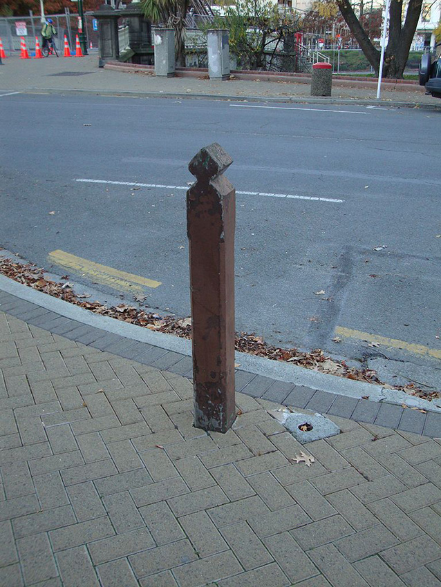
This modest timber hitching post, fitted with a metal ring and bolt attachment, stands near the kerb on Church Street at the edge of The Square in Palmerston North. It is a rare and tangible remnant of the town’s early infrastructure. The post once formed part of a network of hitching posts that lined The Square, providing a practical amenity where horses could be tethered while their owners shopped, traded goods, or socialised in the township. It has historical significance as a reminder a period when horsedrawn transportation was the principal means of travel and goods movement in the nineteenth and early twentieth centuries.
Rangitāne o Manawatū are mana whenua in the Manawatū rohe, which extends from the Tararua range to the mouth of the Manawatū river, to the south bank of the Rangitīkei river and across to the summit of the Ruahine range in the east. Māori settlers in the region were descended from Rangitāne, the grandson of the renowned Polynesian explorer Whātonga, whose descent is traced from the Aotea and Kurahaupō waka. The alluvial plains of the Manawatū river supported dense forest and swampy watercourses punctuated by open spaces. Kainga and pā were established in these open places, among them Papaioea (“beauties indeed!”), the historic Rangitāne pā. Along the river and its tributaries was a plentiful supply of eels, which provided an important part of the diet. The river also supplied ample fish, and, as it flowed west into the estuary, shellfish. Flax was plentiful in the wetland areas and the deep forests provided abundant birdlife and berries.
In the 1820s, migration and raiding parties from Waikato resulted in a changed tribal dynamic during the turbulent period associated with the advent of European muskets. Further changes followed after 1840 with the arrival of European settlers, led by the New Zealand Company, which sought land for organised settlement. Land for a township was acquired by the Crown in 1864, and a town plan was laid out in 1866 by pioneering government surveyor John Tiffin Stewart. The plan centred around a large town square to take in the Papaioea clearing. The proposed town was named Palmerston, and later rechristened Palmerston North to avoid postal confusion with the Otago town of the same name.
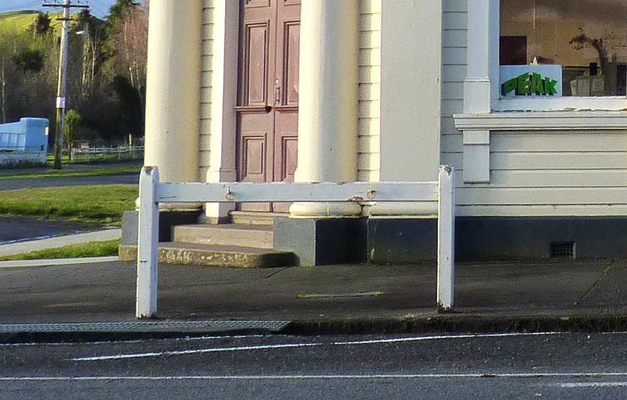
The hitching posts around The Square were installed in about 1900 at the height of horse-drawn vehicle transportation. The post that remains today was originally the end of a three-post structure joined by a horizontal rail inserted into the vertical posts by means of a mortice joint. The top of the post has a reversed scalloped decoration. In 1901, the volume of horse traffic had increased to the point that the existing hitching posts were deemed inconvenient: “the present posts, while providing ample accommodation in their own vicinity, are too widely separated”. Further posts were installed in between the existing ones to provide better convenience.
By the early part of the twentieth century the post and rail hitching structures were placed at regular intervals along the roads surrounding The Square, “notably on the opposite side of the road to the shops”. Presumably this was to remove the nuisance of horse droppings in pedestrian footways. Horse teams, such as those pulling a wagon or buggy could be tethered by looping the reins over the horizontal bar. Metal ring bolts were added to the vertical posts so that riding horses could be tethered by a leading rope.
With the advent of motor vehicles, the need for hitching posts rapidly declined, and over the decades up to the Second World War, those in The Square were gradually removed. This one remaining post stands as a lone representative of the historical ubiquity of horse transport for those that recognise it for what it once was.