

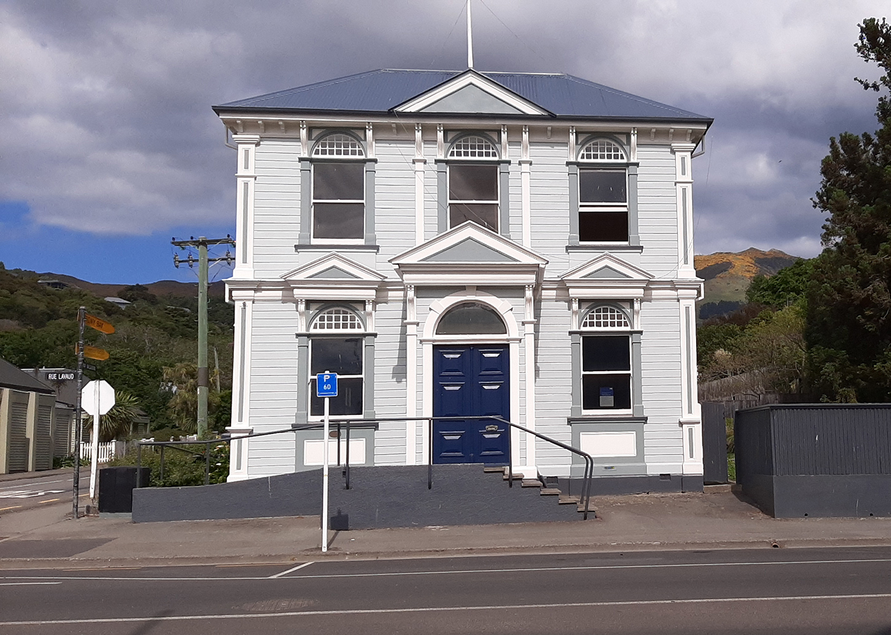
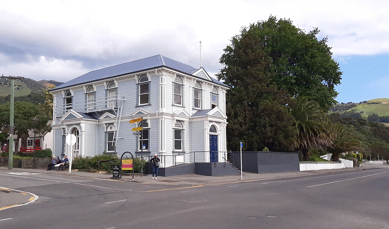
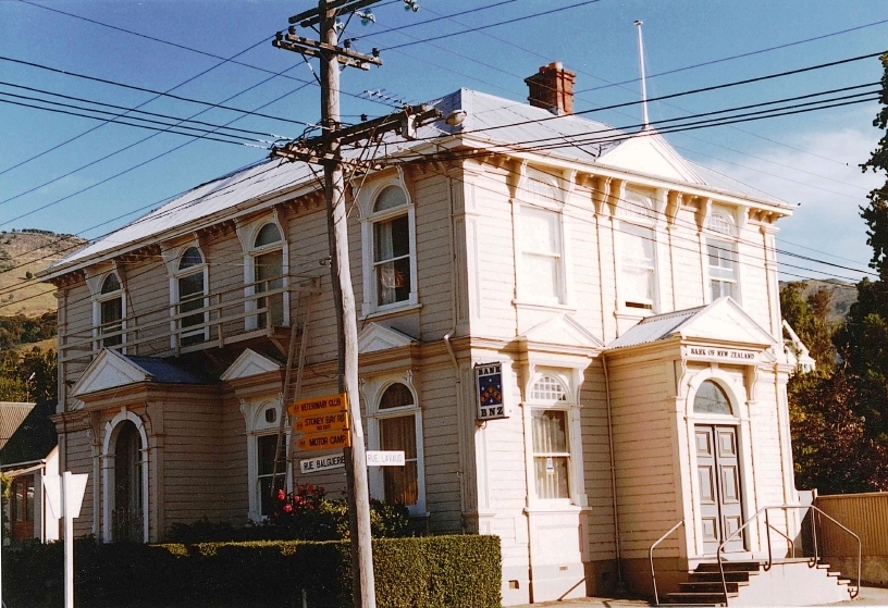
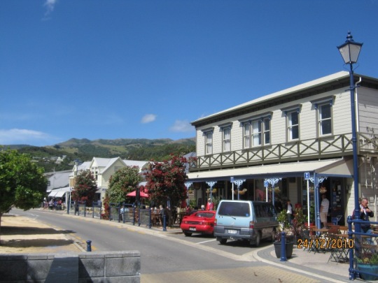
The two-storeyed Italianate style Bank of New Zealand Building, located in the heart of Akaroa’s commercial area at 73 Rue Lavaud, on the corner with Rue Balguerie, was built in 1904 as a replacement of an earlier single storeyed Italianate style Bank of New Zealand building that had been constructed in 1875. It has aesthetic, archaeological, architectural, historical, cultural and social significance. Akaroa Harbour is a large, long harbour on the southern coast of Horomaka/Te Pātaka-a-Rākaihautū (Banks Peninsula). Tuhiraki (Mount Bossu) is the kō (digging stick) of the famous Waitaha explorer Rākaihautū. Akaroa was occupied by iwi such as Hāwea, Waitaha, Rapuwai, and Kāti Māmoe prior to the southern Kāi Tūhaitara migration to Canterbury. Te Ake was one of several Ngāi Tahu tūpuna (ancestors) who claimed land during this migration, placing his tokotoko at the head of the harbour. Akaroa continues to be a renowned mahinga kai (food-gathering area) for the local Kāi Tahu hapū based at the small kāika of Ōnuku which is located just to the south of Paka Ariki, Akaroa township. By the early nineteenth century, Akaroa Harbour had become a favourite port of call for whaling ships. French whaler, Jean François Langlois became involved in land transactions in the area in the late 1830s, which eventually lead to the founding of the Nanto-Bordelaise Company and ultimately In August 1840, French (and some German) settlers from the Comte de Paris landing at Paka Ariki/Akaroa. With the arrival of more and more British settlers, by the 1860s Akaroa was beginning to look more like a typical colonial settlement in New Zealand. The Bank of New Zealand had a presence in Akaroa from 1863. From 1863-1865, the Bank of New Zealand had operated an agency at the corner of Rue Lavaud and Rue Benoit. In 1864 the Bank of New Zealand purchased the corner site at 73 Rue Lavaud but did not build on it for 10 years. Instead, after an eight-year absence from the town, they returned in 1873, operating from de Malmanche’s private residence on Rue Lavaud opposite what is now the War Memorial. In 1874-75 a single storeyed Italianate styled timber bank building was constructed on the corner land parcel earlier purchased at 73 Rue Lavaud. However, that building tended to leak badly and by 1904 a plan was made to demolish it and replace it with the current Bank of New Zealand Building, which formally opened in 1905. Designed by the well-known Christchurch architectural firm of England Brothers, the Bank of New Zealand Building provided banking facilities on the ground floor and bank manager accommodation on the first floor. The Italianate style of the building reflects the typical corporate imagery of the Bank of New Zealand in the nineteenth and early twentieth centuries – indeed, its design is very similar to the original single storeyed bank building on this site. The building is constructed of timber and has a rectangular footprint. Its hipped roof is clad in corrugated steel. Its corner location means it has two façades overlooking the street, both of which have elaborate detailing, including pedimented entrance porches with arched openings, arched sash windows with imitation keystones, pilasters at the edges of the window frames that extend upwards to ornamental scrolls below the eaves. The ground floor windows sit under small projecting pediments. The building is held in high esteem by the community and it continues its long-held association with the Bank of New Zealand. The porch on the Rue Balguerie (north-facing) façade has an automatic money dispensing machine (ATM) installed in place of an entry to the building. The building’s chimneys came down in the Canterbury Earthquakes of 2010 and 2011. It was subsequently repaired and repainted.
Location
List Entry Information
Overview
Detailed List Entry
Status
Listed
List Entry Status
Historic Place Category 2
Access
Private/No Public Access
List Number
1710
Date Entered
6th June 1983
Date of Effect
6th June 1983
City/District Council
Christchurch City
Region
Canterbury Region
Extent of List Entry
Extent includes the land described as Lot 1 DP 82185 (RT CB47B/1231), Canterbury Land District.
Legal description
Lot 1 DP 82185 (RT CB47B/1231), Canterbury Land District.
Stay up to date with Heritage this month
