The Ross Historic Area is the centre of the mining town of Ross on the West Coast (32 kilometres south of Hokitika). The town was established in 1865 with the discovery of payable quantities of gold at Jones's Creek and the Mikonui and Totara Rivers. The quantity of alluvial gold sustained large numbers of miners for several decades, so that the town did not continue as a temporary settlement like many of the West Coast places of gold discovery. [Nearby to Ross, Maori knew the Totara Lagoon as Paiari, a place abundant with bird and fish]. The town of Ross was promptly surveyed as the 1865 rush began and named after Canterbury Provincial Council's Treasurer, Donald Ross. Between 1865 and 1875 the mining population rapidly grew to at least 3,500. Jones's Flat was the richest piece of gold bearing ground in New Zealand, with work concentrated on a compact block of land only approximately five kilometres square. Ross township, in its earliest years, was typical of other gold field towns with structures rapidly built of saplings and canvas. It grew on a terrace overlooking Jones's Flat, the centre of mining activity, resulting in chimneys and poppet heads of the mines towering over the buildings of the town. The majority of the gold bearing layers in this field were deep underground, so companies were formed to finance the sinking of shafts. These shafts were operated by horsepower and later (1867) by the steam engine which opened up a new era in mining. With the prospect of several steady years of work ahead, more permanent timber buildings were erected in the township. By the turn of the century, the population had considerably diminished to approximately 600. Today the township's population is even smaller and the few surviving historic buildings are the principal indication of its mining past and once thriving community. The heritage structures, remnants of mining machinery and detailed interpretation panels in the Historic Area are sited in what was the town's centre during the goldfield's early, most productive decades. They provide an important understanding of the place's unique past. The site alone has important heritage and archaeological values. These values are enhanced by the six structures - St Patrick's Church, 1866; Catholic Presbytery, 1870s (now in private ownership); de Bakker Cottage, 1885; Former Jail, 1890s; Fire Brigade Tower, c.1874 (reconstructed 1977); and Grimmond House, 1870,(reconstructed 1990). The Ross Goldfield Historic Reserve, managed by the Department of Conservation, covers a large portion of the Historic Area and the Information Centre, with walkway leaflets available, is located here.
Location
List Entry Information
Overview
Detailed List Entry
Status
Listed
List Entry Status
Historic Area
Access
Private/No Public Access
List Number
7055
Date Entered
3rd March 1995
Date of Effect
3rd March 1995
City/District Council
Westland District
Region
West Coast Region
Extent of List Entry
Extent includes the part of the land described as Lot 1 DP2387 (RT WS5B/1029), Lot 2 DP2387 (RT WS5B/1030), and Sec 1 SO11511, Secs 34-40 Town of Ross and Res 96A (NZ Gazette 1990, p. 964, RT WS2D/180, WS2B/232) and Legal Road, Westland Land District and the buildings and structures along Aylmer Street and Bond Street, including St Patrick's Catholic Church, Catholic Presbytery (Former), de Bakker cottage, Jail (Former), Fire Brigade Bell Tower and Grimmond House. Not included in the Extent are the 2007 addition to the rear of Grimmond House and the block of public toilets behind it.
Legal description
Lot 1 DP2387 (RT WS5B/1029), Lot 2 DP2387 (RT WS5B/1030), and Sec 1 SO11511, Secs 34-40 Town of Ross and Res 96A (NZ Gazette 1990, p. 964, RT WS2D/180, WS2B/232) and Legal Road, Westland Land District
Cultural Significance
SOCIAL SIGNIFICANCE OR VALUE: A town like Ross reflects the society that built it. The historic area retains representations of the distinct items of Ross's past. The former Bank of New South Wales, although a reconstruction, is illustrative of the importance of banking agents and banks to the prospectors who formed the somewhat ill-disciplined social make-up of the early community. Securing their wealth was a major concern. On the other hand, the Irish Catholic miners funded the construction of their church within a year of Ross's founding and rapidly provided a substantial presbytery when their first parish priest was appointed. These structures were intended to last, unlike the more ephemeral buildings erected at other shorter term gold mining sites. When the respected Mr Grimmond converted the former Bank of New South Wales into his home he created a distinctive house that represented his community status, while the more humble miner, Brazilius de Bakker, lived in a comfortable but small cottage. These dwellings, along with the former Presbytery, reflect the varied strata of Ross society in its early years. The formation of a volunteer fire brigade was a desirable and practical action in closely packed town of flimsy timber buildings yet it also showed the development of a true community spirit. The reconstructed bell tower, from which the original bell hangs, reflects this aspect of the town's social character. The largest proportion of the community recognised the need for a police presence to ensure law and order, but it was inevitable the crimes were committed in such an environment and the lock-up was an important facility until recent times. The building that is located here was the second to be built and no doubt it had more lasting qualities and provided greater security than its predecessor. SPIRITUAL SIGNIFICANCE OR VALUE: St Patrick's Church has been the centre of worship for the Catholic Community of Ross for over 140 years. It is the oldest Roman Catholic Church on the West Coast and has continued to serve the spiritual needs of the parish since it was consecrated in 1866. The building of a church was a high priority for the migrant Irish miners who first came to Ross. It demonstrates the depth of their faith. The following generations of parish members have continued to care for the building with great respect for its religious values, its built qualities and its place in the community. The protection that is provided for the registered historic area and the Historic Reserve serves to commemorate the place's first settlers, giving the place spiritual and memorial values.
Historic Significance
Historical Significance or Value Ross's historical significance relates to its mining history. The place forms an important part of the history of gold discovery on the West Coast and New Zealand as a whole, and the resultant settlements. The alluvial gold fields here were the most productive in New Zealand in the period between 1865 and 1914. The vast amount of gold that was found provided good returns for the early prospectors using simplest methods. Very quickly the need for deeper searches encouraged the development of more sophisticated technology making Ross the most imposing mining works on the West Coast. The town itself began alongside where the first finds were made and new discoveries brought mining activity into much closer proximity with the town centre. This aspect of Ross's distinct history is encapsulated in the registered historic area which includes what was the busiest part of the town, overshadowed by the large, noisy mechanisms that sunk shafts, pumped water and powered winding and hauling gear. It was recognised in the early months of prospecting that there was a secure future here for miners and the town rapidly took on an air of permanence, unusual for early New Zealand gold fields. Never a ghost town, Ross survived with timber milling and lime processing playing a major role in the town's economy for much of the twentieth century. Recent mining using new technologies that were not available to pioneer prospectors, has demonstrated that the remaining gold can be profitably extracted. Today, the heart of the surviving town rests on a wealth of gold that potentially, could be economically mined. Features in the historic area reflect the town's past and demonstrate the varied building's that once formed the community's hub.
Physical Significance
ARCHAEOLOGICAL SIGNIFICANCE OR VALUE: Virtually every part of Ross, including the land within the historic area, has archaeological value because of the intense mining activity that was carried out on this land before 1900. Although the ground has already been disturbed to a varying degree, there is strong reasonable cause to suspect that there are archaeological remains throughout the area. ARCHITECTURAL SIGNIFICANCE OR VALUE: The buildings and structures within the historic area are a reminder of the town's foundation years. All reflect the style, construction and form of the colonial period with their basic design and timber construction. Inexpensive buildings were required quickly; readily-available materials were used when the town was springing up. The oldest building is St Patrick's Church, 1866, where greater care was given to its construction than for a shop or house because of its special purpose. It is rare for an early church like this to have continued in use rather than being replaced by a more elaborate, permanent material structure featuring greater architectural detail. Its simplicity and longevity make it a place of special significance in Ross. It is built following the principles of church design, using available materials with the focus on essential requirements rather than unnecessary architectural refinements. Grimmond House demonstrates greater dignity and style than previous banks in Ross. Its formality and classical references were considered appropriate for a bank. When it was converted for use as a house the frontage remained intact and the domestic verandahed section was built at the rear, away from the street. Since 1870 this building has contributed an element of architectural refinement to the streetscape and it is a rare example of prominent architect, William Armson's early work. The presbytery's style and size is representative of residences for people of higher status in the town, whereas the small De Bakker cottage is typical of worker's cottages. It was built with greater attention to quality and detail than the very first rapidly built cottages in Ross. The jail building and the bell tower are purely practical and basic structures, showing no concerns for architectural refinements.
The West Coast of the South Island was one of the last areas of New Zealand to be populated by both Maori and European settlers. This was because of its isolated location, with access to the narrow western plain across the Southern Alps, or from the inhospitable coastline. The small Maori population gathered food from the shore, the river valleys and lagoons, settling mainly along the coast. Pounamu (greenstone) was the region's most significant trading asset for Maori. In the mid-nineteenth century the Nelson Provincial Council was more eager than its Canterbury counterpart to investigate the area's potential for colonist settlement. What was then called 'West Canterbury' was not attractive to settlers seeking sheep runs. Shortage of land in Nelson encouraged exploration of 'Nelson South West', and though there were some heartening indications of potential for mineral extraction, it was not until James Mackay visited in 1857 that a positive report for settlement was given. Mackay negotiated the Land Purchase of the West Coast from the Maori on 21 May 1860. Increased interest in the area followed. Gabriel Reed's discovery of gold in Otago mid-1861 led to the great gold rush and dramatic increase in wealth for that province. This increased enthusiasm for gold-mining elsewhere in New Zealand. On the West Coast there was a rash of minor sightings and many rumours, with a number of claims laid, initially in the Grey River Valley. In July 1864 payable gold discovered at Greenstone Creek attracted an influx of eager prospectors discouraged by the lessening of easy pickings at the Nelson and Otago gold fields. Attention moved further south and diggers trekked via the recently discovered alpine passes while others came by sea, soon making Hokitika the main port of entry to the West Coast. It was in early November 1864 that two experienced prospectors, James Liddle and John Donnelly led a small party south of Hokitika where they found gold in the Totara River and its branch, called Donnelly's Creek. A number of diggers achieved success in the difficult, rugged country but at this time new, nearby fields at Kaniere and Waimea drew greater attention. Following the discovery of payable gold on the Mikonui River, south of the Totara, by John Redmond in April 1865, claims were quickly established and intense interest in the area between these two rivers resulted. Between April and June claims were made by Irish prospector Michael Donahue on Donahue's Creek and by Jones, a Welshman, who left his name at Jones Creek where he discovered the gold deposits that resulted in the establishment of the town of Ross. 
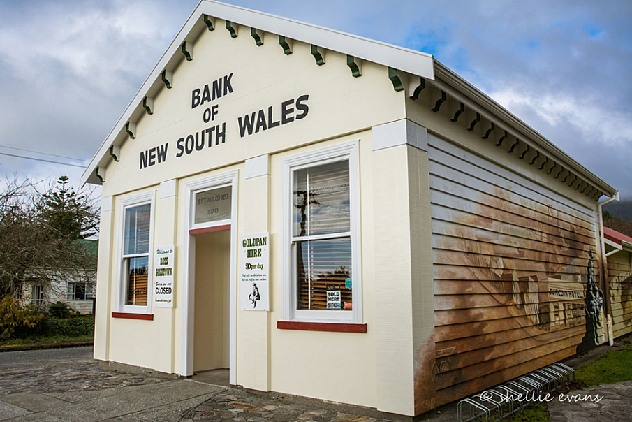
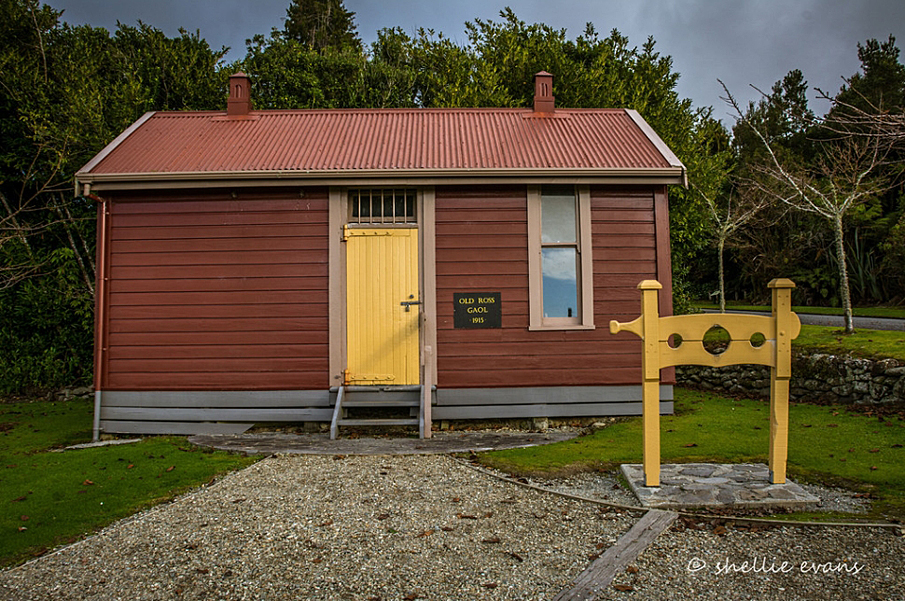
The 'rush' began in earnest from this time with prospectors travelling along the beach from Hokitika and then struggling inland through dense bush to Jones Flat. In August, surveyor John Rochfort marked out allotments on a low terrace beside the creek, with an ensuing great rush for the sections because the great rewards that were being gained here promised a good future. A typical goldfield settlement had grown up as bush was cleared on the higher level of the terrace, with the usual, readily-erected canvas and sapling structures. These were rapidly replaced by more robust timber buildings - dwellings, shops, business premises and most essentially, hotels, to provide liquor and entertainment for diggers with sudden wealth. George-town was the initial name given, soon replaced by Rosstown and then abbreviated to Ross, using the surname of the Canterbury Provincial Treasurer. This locale had never been settled and was only rarely visited by Maori, who had not named it. The population of the diggings area around Ross rose in the weeks following August from around 250 to nearly 4,000. A resident Warden, Justin Aylmer was appointed in early October. On 21 February 1866 he drew a sketch map of the township showing the recently completed courthouse, police station, lockup and survey office beside Bond Street on which a close grouping of many shops and businesses are shown. Among them, the first Bank of New South Wales is identified. The town's centre around Bond, Bold and St James Streets and extending further up to Park Terrace, was at the edge of the Jones's Flat area where intense mining activity was taking place. The first prospectors had quick success panning the alluvial gold from gravels in stream beds and then soon began sluicing to wash out the rich gold bearing strata along terraces. Initially they simply shovelled material into sluice boxes and then used flows of water of increasingly high pressure to wash out the terrace faces. By September 1865 the systems that had been used at the Ballarat Gold Field were beginning to come into use. The name 'Ballarat of Westland' was coined for Ross as similarities were noted and the potential of this alluvial gold field was realised. Many prospectors had come here from Australia with knowledge and skills to undertake sinking and tunnelling for more effective access to deposits. Shafts were first sunk to shallow levels worked by hand windlasses. As the need for deeper penetration became apparent, groups of miners worked together to undertake more elaborate systems and programmes beyond the means of an individual, some forming companies. 'Deep sinking' to lower levels required greater power for raising and lowering the cage inside the shaft. Horse whims were widely used to provide this power, until the Scandinavian Company decided to employ steam. By January 1867 the company had obtained a steam engine from Melbourne and successfully brought it to Jones's Flat where it began operations over a 38 metre shaft, powering both the lifting and pumping. Other groups soon followed this system with Jones's Flat rapidly covered by various hauling systems and poppet heads. To assist sluicing activities, companies also provided capital to fund construction of lengthy water races which often included extensive fluming to cross deep gullies. The intense mining activity was undertaken by great numbers of prospectors crowding the sites. In the period between 1865 and 1870 population peaked at 3,500 with some 47 hotels operating. Life for Ross residents was accompanied by continuous noise as the shafts were worked around the clock. Unlike most other alluvial gold fields, there was a sense of permanence at Ross as the many successful operations that extended widely around the town regularly produced a rewarding output. In 1870 it had a population of 2,400 and was New Zealand's most stable and productive field. Although this stability prevailed, from the first years of the 1870s individuals were beginning to be attracted away to quartz fields in Reefton, Thames and the Coromandel. Also, the difficulty of pumping water from the Jones's Flat deep shafts was becoming more acute, despite the construction of an underground drainage tunnel. In March 1876 Jones's Creek flooded disastrously, causing havoc in the tunnels and shafts and sealing the closure of deep mines on the flat. This coincided with increased use of sluicing methods used around the area by both small groups and larger companies, resulting in the character of Jones's Flat changing as piles of tailings appeared around the deep excavations. These were created by hydraulic sluicing with both elevators and incline trams bringing tailings to the surface. Output continued at a satisfactory level to handsomely reward the various companies, but the amount of activity had reduced. By 1880 the population of the area was 1,800 and this gradual decline continued as prospectors seeking easier pickings departed. In this year the Ross United Mining Company was formed. For seven years they successfully worked a new deep shaft by draining a section of the underground works, using pumps powered by an overshot water wheel. They had laid claim to a large area of Jones's Flat which was mined hydraulically. The plant was able to work day and night with electric lighting. The whole area was worked over by 1898 when the company ceased operating and went into liquidation. This was the end of 33 years continuous mining on Jones's Flat, which became totally overgrown again in the following decades. The centre of the town was beginning to develop along Moorhouse Street and the reduction of the Bold, Bond and St James Streets' importance continued until most historic features had gone. In 1889 the Ross Borough had 320 regular miners; this reduced by 1906 to less than 30. Several companies continued profitably with improved technology, including the hydraulic mine on Mont d'Or, which rises at the north-west edge of the town. This mine, working Ross's 'mountain of gold', operated for several decades and was given individual mention in the 1906 Cyclopaedia as the 'celebrated, dividend paying mine'. Plans were initiated in 1898 to dewater the deep levels under Ross Flat by providing a water generated power system for electric lighting for Ross and to operate pumps and winches. This came to fruition in 1909 under the management of the Ross Goldfields Company and was opened with grand ceremony on 8 September. The famed 'Roddy Nugget' a huge piece of coarse gold weighing 99 ounces (2.73 kilograms) caused even greater excitement when it was discovered by fossickers in Jones's Creek two days later. It was named after the Honourable Roderick McKenzie, Minister of Mines, and was eventually purchased by the New Zealand Government and sent to King George V to mark the occasion of his coronation on 22 June 1911. Another big event for Ross in April 1909 was the completion of the rail link between Ross and Hokitika. The pumping out of underground water had only limited and short term success for the mining company through the twentieth century's first decade. The high cost of pumping and the minimal yields of gold that were discovered led to the company abandoning this mining venture in 1916. Remaining companies followed suit. After the First World War mining for the alluvial gold that remained around Ross was no longer economically viable. Timber milling, farming and limestone quarrying replaced gold mining for the Ross labour force. Phillip Ross May, the historian who was born and brought up in Ross, noted in 1969 the unique qualities of this historic gold town, containing: the gold mining world in miniature...The deep ground at Ross was a piece of Victoria, the high gravels of Mont d'Or a little California, the dredging claims [on nearby rivers] Otago, and the bush and the rain - those ubiquitous elements which governed local mining - were peculiarly Westland. There was a brief resurgence of interest during the Depression years. No great schemes were carried out, though several were proposed at odd intervals. Ross remained quiet, uninterrupted by the continuous machinery noise of the past half century. In October 1988 Birchfields Ross Mining Ltd began opencast mining of the Ross Flat with modern technology allowing successful pumping of water from the mine's base at 100 litres a second. Gold still lay in sufficient quantities at the deep levels that the early miners gave up trying to access. In 1988 it was a viable enterprise to mine to a depth of 90 metres across a 400 metre site. At this date it was the largest opencast alluvial gold mine in the Southern Hemisphere. Since the mining finished the site has been restored, with creation of a lake encircled by paths and planting. In 2007, with a population of 291 recently recorded, Ross appears to those who drive directly through it as a typical country town. A visit to the Registered Historic Area within the Goldfields Historic Reserve and Heritage Area allows for full understanding of the town's remarkable past when from 1865 to 1914 this place at Ross was the most productive alluvial gold field in New Zealand.
Physical Description and Analysis: Land included in the Registration: The Ross Historic Area is centred on the triangle formed by Bond, Bold and St James Streets. It includes the Historic Reserve Land which extends to Simpson Street east of Bold Street at the point where St James Street becomes Aylmer Street. Historic Places on Land included in the Registration: The names of the historic places are: St Patrick's Catholic Church (Record number 1693, Category II historic place); Presbytery (Former); de Bakker Cottage; Jail (Former); Fire Brigade Bell Tower, (reconstructed); Grimmond House, Former Bank of New South Wales, (reconstructed). The Department of Conservation has displayed within the area a number of items of mining machinery which contribute to the historic values of the area. They are interpreted on notice boards featuring historic photos. The items of machinery are included in the registration. Relationship between Historic Places: This area is the historic centre of the original mining activity which led to the establishment of the goldfield's settlement at Ross. Historic photos demonstrate that the streets here once formed the hub of the town with shops, banks and hotels. The area is largely an historic reserve and is the nucleus of visitor attraction. St Patrick's Church and the former Presbytery are on private land, adjacent to the reserve. The buildings all illustrate aspects of the mining history of the early settlement when Ross developed into a thriving town as floods of prospectors swelled the population. All are constructed of timber and demonstrate the need for quickly erected structures, mostly using readily available materials. The Catholic Church, built in 1866, is Ross's only surviving example of the simple early churches built to serve the spiritual needs of the itinerant gold diggers. It demonstrates the high proportion of Catholic Irishmen among the prospectors. The Presbytery was built circa 1870 when there was need for a priest to be permanently based here. Banks were keen to secure the very profitable business with prospectors and the Bank of New South Wales promptly set up an agency in the town centre. By 1870 a more imposing and secure building was required. The Classical-style bank closed in 1876 and was purchased for use as a residence by Joseph Grimmond, a successful miner, business man and local dignitary. Strenuous efforts were made by NZHPT and local people through the 1970s and 80s to ensure the building's retention, but its seriously decayed state prevented this. It was finally decided that it had such significance in Ross's history that it must be reconstructed. A very different and more typical miner's dwelling is the de Bakker cottage, moved to its present site from its original location a short distance further up St James Street. In this congested early settlement, fire in the timber buildings was an ever present risk. The reconstructed bell tower containing the Ross Fire Brigade's bell represents the role this voluntary group had in the town. On a gold field there were frequent incidents of crime and disorder in varying degree of seriousness and the former jail restrained many an offender. Grouped together at this site, the buildings in the area represent founding features of Ross. Key Elements of the Historic Area: Ross is located 27 kilometres south of Hokitika on State Highway 6, the main route which continues south to the Glaciers, South Westland and Haast Pass. Approaching Ross from the north, the State Highway makes right angled turn near the town's centre. The historic area is approached by not making this turn but continuing straight ahead along Aylmer Street. From the South the area is reached by making a right turn instead of turning left at the end of the town's main street. A sign post indicates that the Information Centre is in this area. The area is centred on the triangle formed by St James, Bond and Bold Streets in Ross. When Ross first developed in 1865, Bond, Bold and St James Streets formed the hub of the town with mining activity, business premises and dwellings clustered around this key area. The site has a gentle upward slope to the west along St James Street and to the south along Bold Street. At the time mining began and buildings were constructed, the dense enclosing bush was rapidly felled. The bush began to regenerate after 1900 when the importance of this area lessened and today, around parts of the area's boundary, there is considerable secondary growth. St James Street extends down the hill to the flat land where its name changes to Aylmer Street. Aylmer Street then intersects with Moorhouse Street that became the later centre for the town. A good range of historic photographs provide a record of the changing appearance of the historic area over the last 142 years. The photographs displayed on the various notice boards demonstrate that the densely sited mining activities were located in close proximity of the business and residential buildings. A view of the main features of the area can be obtained from a position near the front of Grimmond House, while a walk around the area's perimeter reveals the various elements of mining machinery displayed in bush settings. These expand the understanding of the area's past. St Patrick's Catholic Church is on the northern side of St James Street. The former Presbytery is located behind the church, clearly visible from St James Street but with access from an unformed public road (Petticoat Lane) at the rear. The presbytery is now in private ownership, the church remains as the property of the Catholic Diocese. These two buildings are opposite the Historic Reserve on which the other buildings in the historic area are located. The Fire Brigade Bell Tower is at the corner of St James and Bond Streets, on Reserve 96A. de Bakker Cottage, also on Reserve 96A, is close to the corner of Bold and St James Streets, facing Bold Street from an elevated site. Grimmond House fronts the southern side of St James Street and is sited on Historic Reserve, Section 40, Town of Ross. The Jail, near the east side of Bold Street, faces towards St James Street on Historic Reserve, Section 37, Town of Ross.
Completion Date
12th December 2007
Report Written By
Pamela Wilson
Information Sources
Cyclopedia of New Zealand, 1906
Cyclopedia Company, Industrial, descriptive, historical, biographical facts, figures, illustrations, Wellington, N.Z, 1897-1908, Vol. 5, Nelson, Marlborough, Westland, 1906
Kay, 1960
Rupert A Kay, (ed.). Westland's Golden Century, 1860-1960: an official souvenir of Westland's centenary, Greymouth, Westland Centennial Council, 1960.
May, 1962
Philip Ross May. The West Coast Gold Rushes, 1962.
Nolan, 1976
T. Nolan, Historic Gold Trails of Nelson and Marlborough, 1976
Report Written By
A fully referenced Registration Report is available from the NZHPT Southern Regional Office. Additional Location Information: Ross is located 27 kilometres south of Hokitika on State Highway 6, the main route which continues south to the Glaciers, South Westland and Haast Pass. St Patrick's Catholic Church is on the northern side of St James Street. The former Presbytery is located behind the church, clearly visible from St James Street but with access from an unformed public road at the rear (Petticoat Lane). The presbytery is now in private ownership, the church remains as the property of the Catholic Diocese. These two buildings are opposite the Historic Reserve on which the other buildings in the historic area are located. The Fire Brigade Bell Tower is at the corner of St James and Bond Streets, on Reserve 96A. de Bakker Cottage, also on Reserve 96A, is close to the corner of Bold and St James Streets, facing Bold Street from an elevated site. Grimmond House fronts the southern side of St James Street and is sited on Historic Reserve, Section 40, Town of Ross. The Jail, near the east side of Bold Street, faces towards St James Street on Historic Reserve, Section 37, Town of Ross. Please note that entry on the New Zealand Heritage List/Rarangi Korero identifies only the heritage values of the property concerned, and should not be construed as advice on the state of the property, or as a comment of its soundness or safety, including in regard to earthquake risk, safety in the event of fire, or insanitary conditions.
Current Usages
Uses: Accommodation
Specific Usage: House
Uses: Civic Facilities
Specific Usage: Historic Property
Uses: Civic Facilities
Specific Usage: Information/Visitors Centre
Uses: Religion
Specific Usage: Church
Former Usages
General Usage:: Accommodation
Specific Usage: House
General Usage:: Finance
Specific Usage: Bank
General Usage:: Law Enforcement
Specific Usage: Prison
General Usage:: Religion
Specific Usage: Church
General Usage:: Religion
Specific Usage: Vicarage/Manse/Presbytery/Rectory
General Usage:: Utilities
Specific Usage: Fire Station