The Taranaki region is thought to have been settled by Maori at least 700 years ago. Archaeological evidence suggests that pa were being built in the area which surrounds Mount Taranaki, as early as the fifteenth century. A number of iwi hold mana whenua in the west coast of the region, including Ngati Tama and Ngati Mutunga, Te Atiawa and Taranaki.
Tribes from Waikato raided Taranaki and Whanganui in the late 18th century, and warfare continued until the late 1830s. Also in the early 19th century, other tribes from the north raided Taranaki, armed with muskets, and enslaved some and took them north. The Ngāti Toa tribe of Kāwhia was also under pressure from Waikato tribes, and they migrated to the Kapiti coast and Wellington area around 1822–1824. On passing through the Taranaki region they were joined by some people of the Te Atiawa, Ngati Mutunga and Ngati Tama tribes. These upheavals and the depopulation of the area altered the balance of power. Between 1834 and 1837 Taranaki iwi defeated Waikato iwi in three battles in the area and finally a sacred peace known as ‘Hou-hou-rongo’ was negotiated.
European whalers and trading vessels initially arrived along the Taranaki coast in the first half of the nineteenth century. Organised colonial settlement at Taranaki was first instituted by the Plymouth Company in 1839–1840, who arranged to purchase land from the New Zealand Company for the settlement of immigrants from Devon and Cornwall, although this purchase would be much disputed in the future. The site of the township was chosen and laid out by Chief Surveyor Frederic Carrington in February 1841, and settler ships arrived from England from March 1841 onwards. By this time the Plymouth Company had fallen into financial difficulties, and was formally merged with the New Zealand Company in May 1841. Settler ships continued to arrive, but disputes over the Crown’s role in transferring land out of Maori ownership, and between tangata whenua over who had the authority to transfer land were already evident, affecting all involved.
The series of prolonged conflicts during the 1860s, now commonly known as the New Zealand Wars, were waged between the Crown and Maori in response to Maori uprising against the enforced alienation of their land. These caused widespread deprivation, suffering and loss of life and land for iwi, resulting in the heavy confiscation of tribal land taken by the Crown under the Land Settlement Act of 1863.
The conflicts also affected the fledgling European settler communities, with many residents of outlying areas abandoning their homes and taking refuge in the urban centre of New Plymouth, or leaving the region altogether for a time. As the Waitangi Tribunal report stated, although the period 1860 to 1869 has been given for the Taranaki fighting, conflict was apparent from 1841, and it continued after 1869 – military action on the Government’s part did not end until the invasion of Parihaka in 1881.
Omata
Omata is about seven kilometres south of New Plymouth and is within Taranaki Iwi rohe. The location of the Church lies between three Taranaki Iwi areas of interest: Te Ngahoro; Nga Turi in the north; and Opotikitaua across the valley. This area was in the heart of a stronghold of early Taranaki Iwi Maori settlement. The area in between Omata and Waireka particularly was a popular vantage point and became a hotspot for interaction between the Crown and Maori.
The 12,000 acre Omata block was bought from Taranaki hapu for £400 in 1847. These purchases failed to fully reserve a tenth of the land for native purposes, and the land that was reserved for Maori remained under the ownership of the Crown for future disposal. The two reserves of 381 acres were granted to Maori were Ratapihipihi and Ruataku. The block was opened for purchase in 1848. Among the early Pakeha settlers were the artists John Gully and Georgina Hetley. Gully is best known for his landscapes mainly in watercolour; but in Omata he was at first a farmer and from 1854 a storekeeper, however bankruptcy forced the family to move into New Plymouth in 1858. Georgina Hetley (nee McKellar) is best known for her book on the native flowers of New Zealand – she lived with her mother and siblings at Omata and married in the local church in 1856, but was widowed within a year and moved back to her mother’s house. She noted: 'The town of New Plymouth lay far away in the distance, but we could not see it, it was hidden by the smoke of the burning ’bush’.'
The first St John’s church was built in 1848/9 in Omata Road (now called Waireka Road West) and had a raupo thatched roof. It is said to be the first Anglican church built in rural Taranaki. In 1855/6 the church was moved to another site further along Omata Road (now Waireka Road East). This site was donated by a prominent Anglican layman and was more conveniently located for the people of Omata and for the Minister, Rev. George Bayley, being opposite his house. In 1859, Rev. Henry Brown arrived from England with his wife and nine of their children and began a ministry of 34 years in the area. ‘Parson Brown’, as he was known, had a farm in the area, learnt Te Reo Maori and was known for his generosity. He sometimes conducted up to five services on Sundays; consequently his services were said to be short as he often had another to go to.
By 1860, Omata had three churches – a Primitive Methodist and two Anglican. The Anglican churches were St John’s on the lowland, and St Bride’s located in hill country. St Bride’s was opened on January 6 1860, but by the end of March the settlers were abandoning their houses for the Omata stockade, New Plymouth, or further afield, as the fighting that began the New Zealand Wars spread. The Omata Stockade (NZAA site P19/35) had been recently built on an older Maori site, called Ngaturi. A party of Maori passed over Parson Brown’s land and according to the children’s governess: ‘They encountered one of our men at work in the clearing; on finding that he was working for ‘Brown’, they shook hands with him and passed quietly on. I think now, we shall not be molested as they all respect the Missionaries, and Mr Brown has been very kind to some of their people.’ The notable battle of Waireka took place at Omata on 28 March 1860. By the end of the wars the only buildings left standing in Omata were the three churches, although they had suffered some damage.
It was decided to rebuild Omata village closer to New Plymouth because of the desire for safety. Church services had been held at the Omata Stockade during the conflicts and continued to be until the early 1870s, when the stockade’s impending demolition forced the community to consider rebuilding St John’s at the new town site. Fundraising efforts were made in 1873, including a ladies ‘Fancy Fair’, which raised £130. On 9 August 1873 the old Omata church was to be auctioned in New Plymouth by Mr Yems. Some older sources of information have suggested the old St John’s church may have been re-erected in 1875 on the new site, but this is not the case. Tenders for the erection of a new church were called for on 17 June 1874, the plans being available for inspection at Mr G Robinson’s residence.
The church was opened on 14 February 1875 with Archdeacon Govett conducting the service. The Taranaki Herald reported at length on the opening, including: ‘The first church … was homely; but it suited the circumstances of the settlers. But that had gone, and a more seemly building had been erected … The funds at the disposal of the Committee being limited, carving and other embellishments had to be dispensed with; but, nevertheless, the church is an ornament to the district’.
The new church was designed by George Robinson (1796–1876), builder of the first section of St Mary’s Anglican Church in New Plymouth, and supervisor of its Frederick Thatcher-designed second and third additions. The builder of St John’s was Thomas Penwarden (ca. 1846–1921). The first site of the old St John’s Church is now known as the Waireka Historic Cemetery (NZAA site P19/382).
Historian Geoffrey Thornton states that small country churches ‘made a statement that religious belief was important to country folk. Moreover, the country church often became the focus for community activity well before the advent of the community hall.’ Occasions such as church openings and services were important social gatherings, particularly for women who may not have had the same opportunities to meet as many of the men.
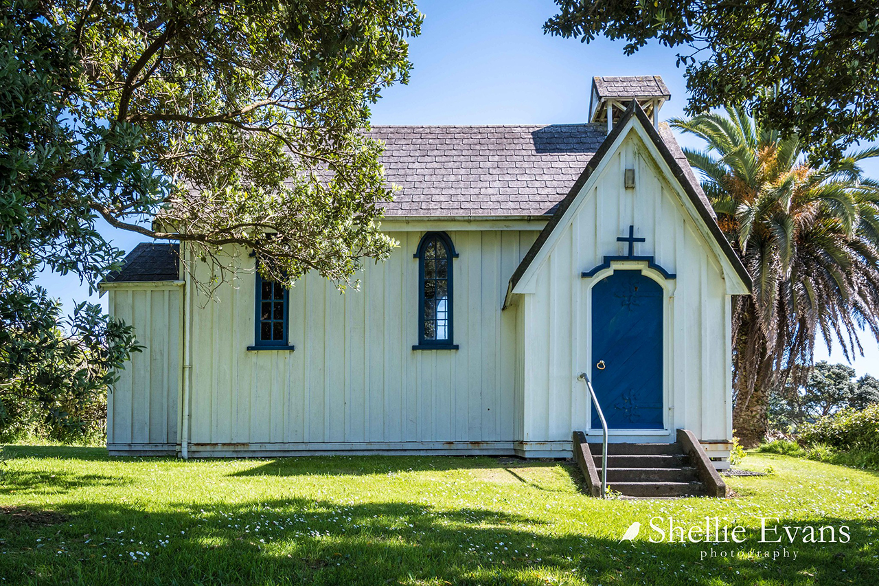
In 1894 an anonymous report in the Taranaki Herald noted the church was ‘fast going to decay. It presents a most dilapidated appearance’. The writer was possibly unaware that the church committee had already let a contract for repairs to be carried out; however in June that year a strong wind knocked the church over. The building was re-erected and opened again in September. However, the damage to the liturgical east end was too great and the re-erected church was considerably smaller. When first built, the newspaper report said the church was 40 feet long by 15 feet wide (12.2 metres x 4.6 metres); it is now 26 feet long (7.9 metres). Seating capacity was reduced from about 100 to around 50.
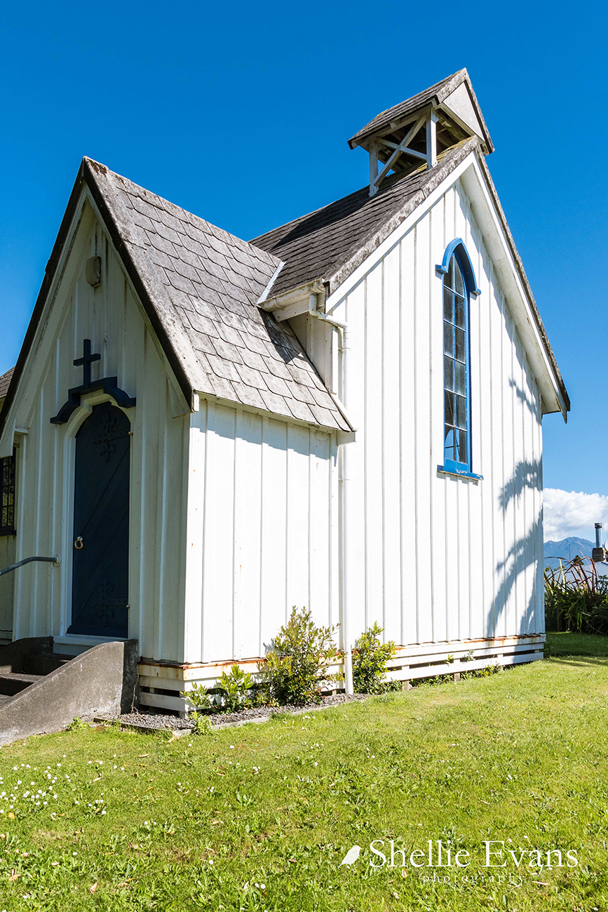
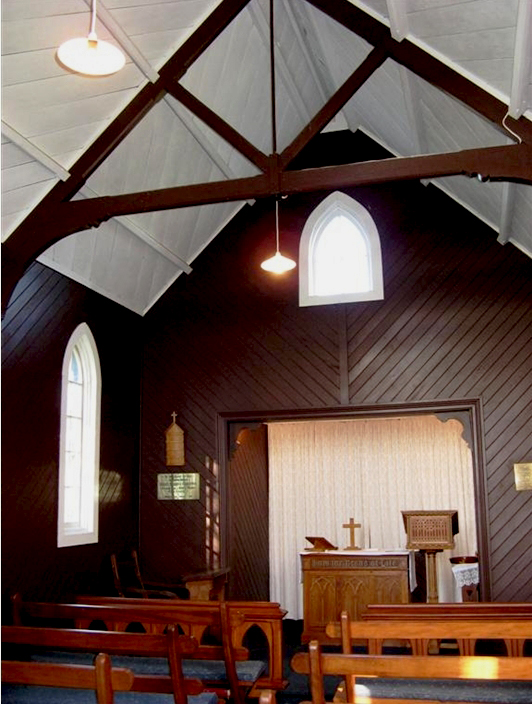
In 1906 a small sanctuary (2.75 metres x 1.56 metres) was added off the liturgical east end of the church; although it has a matching gable roof, the height is lower than the roofline for the nave of the church. At the same time, the whole church was lined with diagonally-laid oiled rimu tongue-and-groove panelling, and the exterior was painted. A small belfry was also added over the west gable.
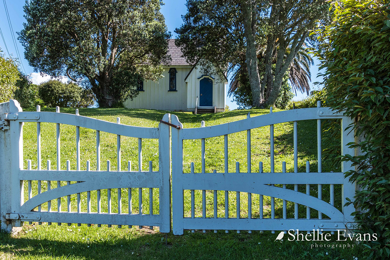
Following the First World War a framed roll of honour was put in the church, with the names of 60 men and one woman (a nurse) who had served from the district; 11 had died. About 1920 a war memorial obelisk was erected outside the gates of the church; the unveiling was attended by a large crowd as can be seen in photographs from the time. This site created a potential access problem for the church, but they were granted a lease in perpetuity giving legal access to their gates. In 1940 the church was repiled with concrete piles. Following the Second World War, two further panels were added to the church with the names of 38 men from the area, four of whom had died in the war. When the war memorial obelisk was re-erected in 1992 after being damaged in a traffic accident, the blessing was performed by the Anglican Archdeacon of Taranaki.
By the 1950s the St John’s Sunday School was meeting in the Omata School and St Bride’s Church had closed. The St Bride’s altar, made in 1888, and lectern were given to St John’s. In 1956 parish boundaries were reorganised and St John’s was transferred from St Mary’s, New Plymouth, to St Chad’s, West New Plymouth and since then the vicar has served both St John’s and St Chad’s. The belfry was removed in 1969 when repairs were needed to the roof, and was replaced in the period between 1975 and 1980, when other repairs were also made. When the church gates were stolen in 1999 a local businessman donated their replacement. In 2003 a comprehensive upgrade of the building was undertaken. This included repiling and replacing timber where necessary, treating the roof with mouldicide, adding drainage, and replacing the vestry entry door with a recycled one of an appropriate age and style. The church was full (47 people) when it re-opened on 12 October 2003 and it continues to be used for services once a month.