Tangata whenua in Te Upoko o Te Ika a Māui
Te Whanganui a Tara has a rich history of Māori occupation, dating back to the arrival of the Polynesian explorer Kupe. Originating from Hawaiki, Kupe and his people were the earliest known group to navigate Aotearoa, exploring Te Ika a Māui and portions of Te Wai Pounamu. Kupe’s exploration focused on South Wairarapa, Raukawa Moana, Te Tai ō Aorere and Te Tai Tokerau, leaving traces of his journey in placenames such as Te Aroaro o Kupe. After Kupe’s return to Hawaiki, the arrival of the Kurahaupō waka on the Māhia Peninsula marked the beginning of the subsequent migration of Māori south into Te Upoko o Te Ika a Māui. Whātonga, a Kurahaupō captain, journeyed south to Raukawa Moana, reaching Te Whanganui a Tara before continuing his travels up the west coast towards Manawatū. There, he met his second wife, Reretua, and had their son Tautoki, later returning to his wife Hotuwaipara and son Tarataraika (also known as Tara) in Heretaunga.
Following Whātonga’s instruction, Tarataraika and Tautoki explored both the east and west coast of the southern regions of Te Ika a Māui. Tautoki settled at Parangāhau (Fitzroy Bay), with his son Tānenui-ā-rangi (also known as Rangitāne, Rangitānenui-a-rangi and Rangitānenui) becoming the eponymous ancestor of the iwi Rangitāne. Tarataraika and his descendants became Ngāi Tara and settled in Te Upoko o Te Ika a Māui. Before 1820, Ngāi Tara, Rangitāne, Ngāti Apa and Muaūpoko were the primary inhabitants of Te Whanganui a Tara, while Rakaiwhakairi and Ngāti Kahukuraawhitia of Ngāti Kahungunu settled in Heretaunga (Hutt Valley).
In the early seventeenth century, a second wave of migration led by Ngāti Ira moved south from Te Matau a Māui (Hawke’s Bay), intermarrying with Ngāi Tara and Rangitāne. Ngāti Ira established settlements from Waiwhetū to Turakirae, Matiu, Mākaro and Tapu Te Ranga, while Rakaiwhakairi and Ngāti Kahukuraawhitia continued to occupy Heretaunga.
The introduction of European muskets in Aotearoa triggered a significant restructuring of iwi in Te Ika a Māui. Between 1819 and 1820, a large tauā (war party), including Ngāti Toa chief Te Rauparaha, moved through the island, reaching Te Whanganui a Tara before returning north. Recognising the advantage of Raukawa Moana for trade, Te Rauparaha returned to Kāwhia and initiated a series of heke (migrations) south to Taranaki in 1821 and then to Te Upoko o Te Ika a Māui in 1822. Te Āti Awa, Ngāti Mutunga, and Ngāti Tama joined Te Rauparaha on this second heke. By the late 1820s, Ngāti Raukawa had accepted an invitation from Ngāti Toa and migrated south from Maungatautari to the Kapiti Coast.
During this time, Ngāti Ira remained the primary inhabitants in Te Whanganui a Tara, and Rakaiwhakairi and Ngāti Kahukuraawhitia in Heretaunga shared areas with Ngāti Mutunga and Ngāti Tama. However, this peaceful arrangement shifted in the late 1820s after Ngāti Mutunga attacked Ngāti Ira settlements between Waiwhetū and Turakirae. This conflict became the catalyst for ‘a series of short sharp clashes and consequent occupation readjustments as Ngāti Ira gradually conceded more territory’.
In the late 1830s, Taranaki iwi had displaced Ngāti Ira, Rakaiwhakairi, and Ngāti Kahukuraawhitia from Te Upoko o Te Ika, initiating their migration over the Remutaka Ranges towards Wairarapa. Te Āti Awa, Taranaki, Ngāti Ruanui, Ngāti Tama and Ngāti Mutunga collectively became Taranaki Whānui ki Te Upoko o Te Ika and have retained ahi kā status from the Mukamuka stream to the east, across to Pipinui Point to the west, and down to the southern coastline of Te Upoko o Te Ika.
Wai-nui-o-mata and environs
Wai-nui-o-mata lies along the eastern boundary of the Taranaki Whānui ki Te Upoko o Te Ika takiwā, encompassing a valley once covered with dense forests and extensive swamplands. This landscape restricted Māori from establishing settlements however, the Wai-nui-o-mata River and nearby Orongorongo River 'were paths for Māori to go birding and fishing for eel/tuna’ and traditional Māori agriculture. The area, including the Orongorongo Valley, represented an agreed natural boundary between Te Āti Awa and Ngāti Kahungunu, also serving as an inland track between Te Whanganui a Tara and Wairarapa.
In 1835 Te Āti Awa people living in Wairarapa under the leadership of Te Wharepōuri were attacked by a taua led by Nuku-Pewapewa of Ngāti Kahungunu and Hoeroa of Ngāi Te Upokoiri. Te Wharepōuri escaped but his wife Te Uamairangi and niece Te Kaipai were captured. In his grief he compared the great waters (wai-nui) streaming down his face (mata) to the river catchment and this became its name. Te Uamairangi was released, allowing for peace between the two peoples. The agreement was that Te Āti Awa would live on the Te Whanganui a Tara side of the Remutaka and Taraua ranges and Ngāti Kahungunu on the Wairarapa side. The peace was sealed with marriages.
After the 1855 earthquake, the landscape in Wai-nui-o-mata and the wider region underwent significant changes, with raised swamplands exposing suitable land for settlement. By this time, the New Zealand Company had arrived in Te Whanganui a Tara, establishing British settlements first at Pito one (Petone) and then at Pipitea (Lambton Harbour). Te Whanganui a Tara became Wellington, named after Arthur Wellesley (1769-1852), the first Duke of Wellington, while Heretaunga became the Hutt Valley, named after the New Zealand Company director, Sir William Hutt (1801-1882). Following the government’s removal of ‘Ngāti Toa aligned Māori’ in 1846, the Hutt Valley shifted from a forested landscape to a heavy farming and horticultural district. This transformation extended into Wai-nui-o-mata until the 1950s, evolving into a residential suburb to accommodate young families after the Second World War. Since then, Wai-nui-o-mata has remained a residential suburb.
Wellington’s water supply
In 1865, New Zealand's Parliament relocated to Wellington, establishing the city as the country's third and final capital. In 1870, the Wellington City Corporation replaced the Borough and Provincial Councils, establishing local government in the region. The late nineteenth century saw significant population growth, prompting a demand for improved municipal services. Councillors concentrated on enhancing infrastructure, prioritising water supply and wastewater management.
In 1867, the Wellington Town Board, operating under the former Provincial Council, initiated the Lower Karori Dam (List no. 7750) scheme to cater to public water needs. Completed in 1878, the scheme faced challenges with water demand surpassing supply due to dry summers, population growth, and higher-than-anticipated usage. This led to city-wide restrictions and water shortages. Responding to the crisis, the Wellington City Council tasked Chief Engineer William Clark and City Engineer James Daniel Baird (1840-1908) with developing a ‘report on the best available means of extending and augmenting the water supply’ for the city. Following a thorough investigation of regional water sources, Baird, guided by Clark’s recommendations, presented two schemes utilising the Karori Stream and Wai-nui-o-mata River.
After a thorough examination, Baird selected the Wai-nui-o-mata River due to the catchment receiving 1,900 millimetres of rainfall annually, compared to the 1,200 millimetres in Karori. In 1880, the Council approved the construction of a 10-meter-high embankment dam across the Wai-nui-o-mata River. Although completed in January 1884, consistent water supply to Wellington was delayed until mid-1884 due to successive flooding events, causing substantial structural damage and expensive repairs.
By 1900, the influx of European immigrants to Wellington led to the expansion of boroughs around the city centre. The growth strained the city’s water supply, forcing the Council to seek alternative solutions. Newly appointed City Engineer Richard Septimus Rounthwaite (1854-1932) investigated the cause, presenting a report to the City Council on 31 May 1900. In his report, he expressed concerns about the public’s water use, noting the ‘unnecessarily large consumption that brings us at times within measurable distance of a water famine.’ Rounthwaite proposed a draft set of water regulations in 1901, suggesting the use of Venturi meters to monitor the quantity of water supplied. Rounthwaite recognised the advantages of the previously recommended Wai-nui-o-mata and Karori catchments and proposed new dams at both however, due to the cost of works and a lack of support from the city’s ratepayers, progress on these improvements were stalled.
William Hobbard Morton
In 1904, William Hobbard Morton (1866 – 1923) assumed the position of city engineer, succeeding Rounthwaite upon his arrival in New Zealand. Morton’s prior role as Chief Engineering Assistant and Assistant City Surveyor in Victoria, coupled with his experience in municipal activities, positioned him well to address the persisting water supply challenges in the region. Described as possessing ‘sterling ability, with a strong personality and character’, Morton successfully influenced ratepayers by proposing the extension of reticulation to the recently absorbed hilltop borough of Melrose. In 1905, with the newfound support of Melrose, ratepayers approved the loan for the Karori and Wai-nui-o-mata dams, pumping stations and required land purchase.
Construction begins
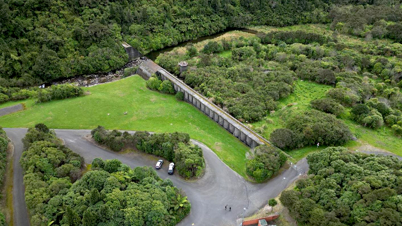
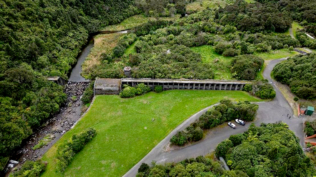
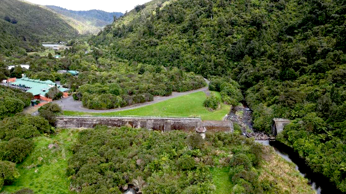
In 1906, the Wellington City Council acquired the Karori catchment and contracted Mitchell & King to complete the works. By March 1908, the Upper Karori Dam was complete, prompting Morton to shift the department’s focus to the Wai-nui-o-mata dam at Solomon’s Knob. In October 1908, tenders for the works opened, and Martin, Hurrell, and Snaddon won the bid with £46,000. Construction commenced the following month on a buttress dam, utilising reinforced concrete in a distinctive Ambursen-type style - a ‘first of its kind in Australasia’.
By February 1909, extensive preparation work, such as felling dense bush, establishing a tramline, constructing a bridge, redirecting George’s Creek, and substantial earthworks, including the removal of the Solomon’s Knob spur, was complete. Initially, Martin, Hurrell and Snaddon engaged 48 men for the project, later increasing the workforce to approximately 70. These workers, often called ‘navvies’, were housed in tents and huts at a camp known as ‘Navy Town’, referencing their background as seamen.
By August 1909, additional auxiliary works were finalised, incorporating an aerial ropeway across the valley and workshops and sheds for carpenters and blacksmiths. Following a January 1910 site visit, Assistant City Engineer James Murray Morice (1861-1930) reported that ‘practically all the difficult or risky work in connection with the construction of Solomon’s Knob has been finished’. Despite an estimated completion date around Christmas, construction extended into the following year due to remediation work on porous sections in the foundation wall. This work concluded by September 1911, and the reservoir was filled with heavy rain the following month, reaching a capacity of 120,000,000 gallons.
The Renaming of Solomon’s Knob Dam
On 14 November 1911, a delegation led by Mayor Thomas Mason Wilford (1870-1939), city councillors, and the engineering department visited the newly finished dam. After a tour and afternoon tea near the lower lake, Wilford congratulated Morton on the project’s success, proposing to ‘call the dam in the future the Morton dam, as a compliment to Mr. Morton, and a token of our appreciation of his work’. The suggestion was met with applause, confirming the renaming of Solomon’s Knob Dam to the Morton Dam. Wilford commended Martin, Hurrell, and Snaddon for their work, particularly noting Hurrell’s commitment shown by his residency on-site for the three years until completion.
Connected in December 1911, the mains from the dam to the city’s reticulation boosted the supply by 1,075 million litres in the first year. The addition to the city’s existing infrastructure allowed for ‘the needs of a city four times the population of Wellington’, earning the capital city the title of ‘cleanest city in the Southern Hemisphere’.
Concerns at Wai-nui-o-mata
Although the Morton Dam experienced initial success, its effectiveness was questioned during Wellington’s driest three years on record when ‘the Wainui dams completely dried out for three days over Easter 1917’. In 1915, Morton gained approval to pipe water from the Orongorongo River to the dam. However, Morton revisited this scheme in 1919 and made adjustments to supply water directly to the lower Karori reservoir instead of Wai-nui-o-mata. The works were completed in 1926, including a weir, intake and the Orongorongo-to-Karori main.
Unfortunately, Morton did not witness the completion of the Orongorongo scheme, passing away in June 1923. His funeral drew hundreds, with a procession described as ‘one of the longest that have been seen in Wellington for many years’. Throughout his tenure as Wellington City Engineer, Morton was pivotal in establishing vital infrastructure amid rapid city and suburban growth. Beyond the Upper Karori Dam and the Morton Dam, his contributions extended to significant enhancements in city transport infrastructure. As the General Manager of Tramways, he was described as ‘a man of great capacity and ability and…of inestimable value to the city’. Morton remained a member of the New Zealand Society of Civil Engineers until a few months before his death, having served as Honorary Secretary from 1920. His contributions were further commemorated in 1933 with a memorial plaque in the Town Hall, recognising his ‘outstanding city works’.
The Decommissioning of the Morton Dam
The Morton Dam is his most notable achievement, playing a crucial role in the city’s original municipal system. At its completion, the water supply was designed for a population of 75,000, however, by 1946, the city’s population had surged to 123,750, prompting the need for additional supplies. Despite its longstanding service, advancements in other water sources, including the Waiwhetū aquifer and Te Marua lakes, rendered the Morton Dam redundant. Concerns regarding earthquake risks, limited flood capacity, and silt accumulation further diminished its suitability as a backup water supply. Consequently, the Greater Wellington Regional Council, who has managed the site since 1980, explored options to decommission in 1987. To restore the river’s natural flow, mitigate structural risk, and preserve its engineering heritage values, the Council removed a section of the spillway, officially decommissioning the dam in 1988 and producing a memorial booklet to commemorate the dam’s contribution. Additional decommissioning works included creating artificial rapids and removing the strainer house and bridge to the valve tower. General public access to the dam (and Wainuomata/Orongorongo Water Collection Area) is closed, with only limited access available through seasonal guided tours and a permit system.