

The first general legislation providing for the establishment and administration of public reserves was the Public Reserves Act 1854. On 25 January 1882, what is now known as the Town Belt was transferred to the Borough of Invercargill, held in trust ‘for purposes connected with the improvement and benefit of the city and to be used for the purpose of public pleasure’.
Invercargill City Council’s Town Belt Management Plan notes that in the early years the Otepuni Gardens were simply known as the “Town Gardens” and the stream was referred to as the “Puni”, or occasionally misspelt “Puny”. The Otepuni Gardens comprise the four blocks bounded by Clyde Street to the west and Ness Street to the east. The current bridge is located in Block II (also known as Block No.2).
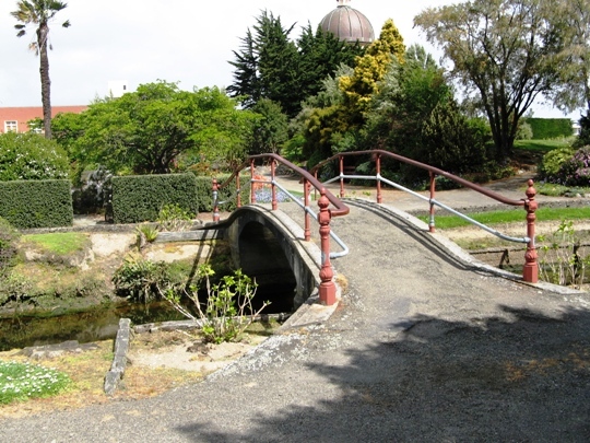
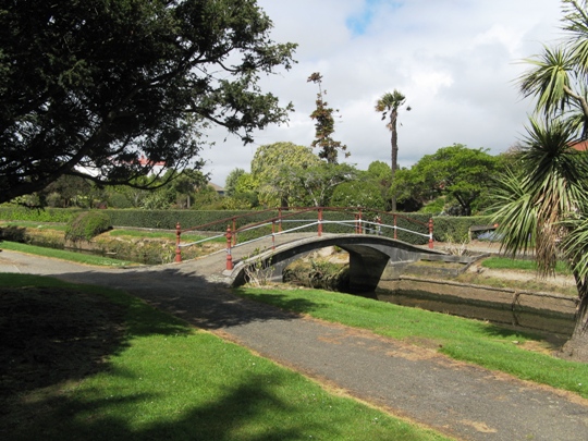
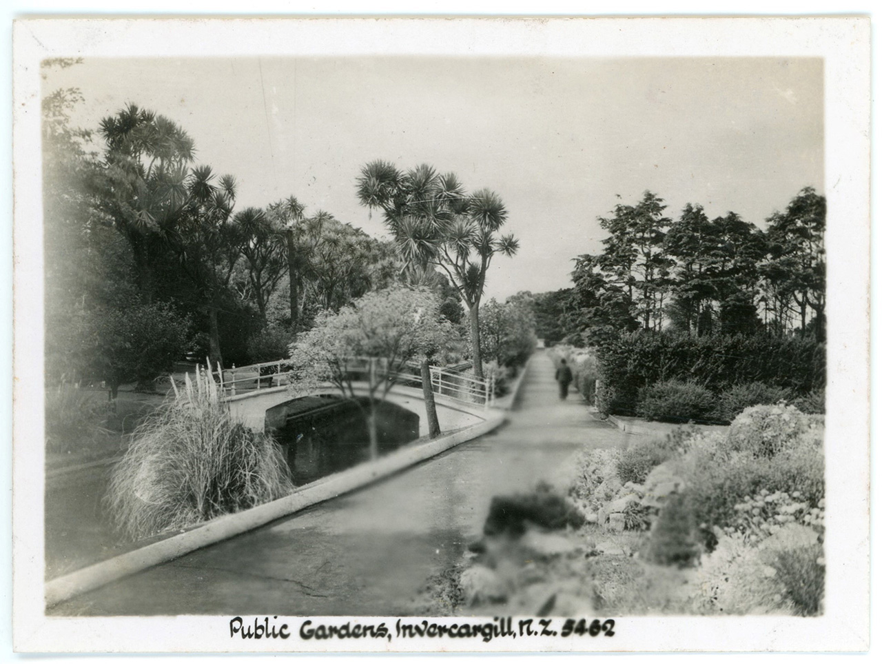
Bridging the stream was an early concern. The earliest bridge in Block 2 was built in 1868, and taken down in 1891 after flood damage. Invercargill Borough Council accounts indicate that a bridge was erected in Block 2 in 1909. Whether or not it is the current single span concrete bridge with ornamental hand rail, it is not possible to tell. Flooding remained a concern into the twentieth century. The concrete retaining walls along the banks of the Otepuni were constructed in 1919 to prevent the gardens from being flooded during periods of high tides. The walls were completed in 1923. In 2018, the bridge remains a significant feature in the Otepuni Gardens.
List Entry Information
Status
Listed
List Entry Status
Historic Place Category 2
Access
Able to Visit
List Number
2464
Date Entered
24th November 1983
Date of Effect
24th November 1983
City/District Council
Invercargill City
Region
Southland Region
Extent of List Entry
Extent includes part of the land described as Lot 18 DP 308320 (RT 722402; NZ Gazette, 2004, p. 2382), Southland Land District, and the footbridge thereon. Refer to the extent map tabled at the Rārangi Kōrero Committee meeting on 26 July 2018.
Legal description
Lot 18 DP 308320 (RT 722402; NZ Gazette, 2004, p. 2382), Southland Land District
Status
Listed
List Entry Status
Historic Place Category 2
Access
Able to Visit
List Number
2464
Date Entered
24th November 1983
Date of Effect
24th November 1983
City/District Council
Invercargill City
Region
Southland Region
Extent of List Entry
Extent includes part of the land described as Lot 18 DP 308320 (RT 722402; NZ Gazette, 2004, p. 2382), Southland Land District, and the footbridge thereon. Refer to the extent map tabled at the Rārangi Kōrero Committee meeting on 26 July 2018.
Legal description
Lot 18 DP 308320 (RT 722402; NZ Gazette, 2004, p. 2382), Southland Land District
Construction Details
Start Year
1909
startYearCirca
Finish Year
1926
finishYearCirca
Type
Original Construction
Construction Details
Start Year
1909
startYearCirca
Finish Year
1926
finishYearCirca
Type
Original Construction
Historical and Associated Iwi / Hapū / Whānau
Completion Date
23rd May 2018
Report Written By
Heather Bauchop
Information Sources
Invercargill City Council
Invercargill City Council
Other Information
This place was identified as significant under previous legislation with different information requirements. It remains significant under the current legislation. There is opportunity under our legislation and policies to add to this information. Further information about this place may be available from the Otago/Southland Office of Heritage New Zealand Pouhere Taonga. Please note that entry on the New Zealand Heritage List/Rarangi Korero identifies only the heritage values of the property concerned, and should not be construed as advice on the state of the property, or as a comment of its soundness or safety, including in regard to earthquake risk, safety in the event of fire, or insanitary conditions. A fully referenced upgrade report is available on request from the Otago/Southland Area Office of Heritage New Zealand.
Historical and Associated Iwi / Hapū / Whānau
Completion Date
23rd May 2018
Report Written By
Heather Bauchop
Information Sources
Invercargill City Council
Invercargill City Council
Other Information
This place was identified as significant under previous legislation with different information requirements. It remains significant under the current legislation. There is opportunity under our legislation and policies to add to this information. Further information about this place may be available from the Otago/Southland Office of Heritage New Zealand Pouhere Taonga. Please note that entry on the New Zealand Heritage List/Rarangi Korero identifies only the heritage values of the property concerned, and should not be construed as advice on the state of the property, or as a comment of its soundness or safety, including in regard to earthquake risk, safety in the event of fire, or insanitary conditions. A fully referenced upgrade report is available on request from the Otago/Southland Area Office of Heritage New Zealand.
Current Usages
Uses: Transport
Specific Usage: Bridge/ Viaduct
Former Usages
General Usage: Transport
Specific Usage: Bridge/ Viaduct
Current Usages
Uses: Transport
Specific Usage: Bridge/ Viaduct
Former Usages
General Usage: Transport
Specific Usage: Bridge/ Viaduct
Location
Sign up to hear more
Get the latest heritage news, features and events delivered
straight to your inbox.
