

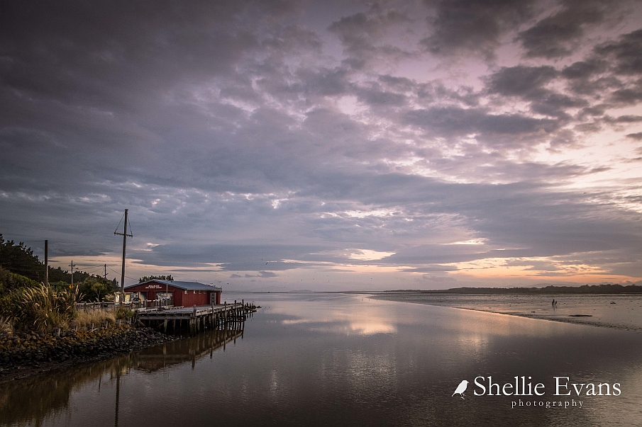
The New River Estuary is the largest in Murihiku / Southland; a large tidal lagoon type of estuary. The estuary is the confluence of the Waihopai and Ōreti Rivers. The Ōreti, formerly known as the New River, has its headwaters close to the Mavora Lakes between Te Anau and Whakatipu Waimāori / Lake Wakatipu and was a traditional travel route, providing access for coastal settlements into the interior of Te Waipounamu. The history of this place extends back to Maui who is said to have spent a year at Ōmāui (the mouth of the New River Estuary) during which time he claimed the South Island. Ōue and Ōmāui were principal settlements in Murihiku at the mouth of the Ōreti in the New River Estuary in the 19th Century. The New River Estuary was the site of the earliest port to serve Invercargill and was the major port south of Dunedin, prior to the establishment of a port at Campbell Town (Bluff). The mouth of the estuary was known for its bar which also necessitated the establishment of a pilot station overlooking the channel between Ōmāui and Tārere-ki-whenua-uta (Steep Head). A tender for a jetty and a pilot’s house on the New River Estuary were advertised late in 1859. The contract was awarded in 1860 at a rate of £1000 ($121,160). A population boom largely due to the goldrush resulted in further investment in the jetty. In 1862 additions were made to the jetty and the dolphins were probably installed at this time. The original jetty once ran as far as Stead Street (formerly Tweed Street) creating a link to the city.
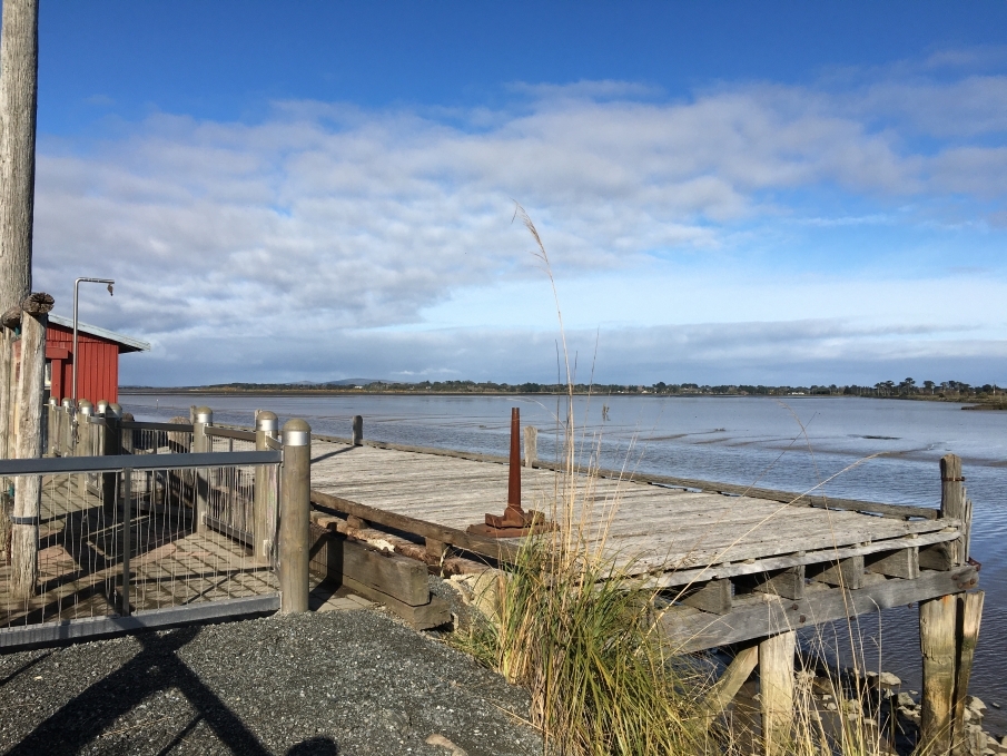
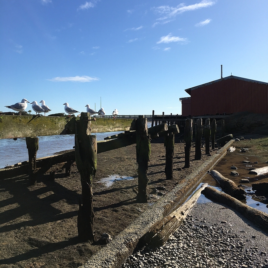
Despite its recent completion, in 1862 there were complaints that the jetty was ill positioned, and should be extended or rebuilt further south as it didn’t accommodate the larger vessels that were able to berth in Bluff. A lack of tide beacons resulted in a number of ship wrecks. From 1863 a 300m wooden tramway conveyed the Lady Barkly, New Zealand’s first steam-powered locomotive, along the jetty. It was not an uncommon sight at this time to see twenty to fifty vessels of 600 and 700 tons capacity lying at anchor at the Lower and Upper Pools, as the two chief anchorages were named, or alongside the jetty. Reclamation of land began from 1865 and continued for years; this has complicated the reading of the site. The railway link through to Bluff in 1867 proved to be the beginning of the end for the Port of Invercargill. In 1882 stone training walls were installed to create a deeper channel and allow for ships with a deeper draft to dock. Ships with at least 9’ (2.7 metres) draft were able to reach the wharf in the early 1900’s. The jetty saw much in the way of fishing, oystering and carrying cargo and farm produce from the 1890s through to the 1940s. The embankment that was constructed in 1913 linked the T end of the jetty with the mainland, and featured a number of sheds and a boatshed on the reclaimed land. In 1916 a new jetty was completed with the T end of the old jetty incorporated into its structure. In In 1926 a concrete wall on top of the stone retaining walls raised the height. In 2000, as part of the archaeological authority process, archaeologist Peter Petchey discovered parts of an earlier structure beneath the Sea Scouts Hall (which is built on piles) adjacent to the jetty. Petchey described the wharf at that time as a ‘dilapidated timber structure’. Following the redevelopment of the site, ‘part of the existing wharf has been dismantled, with the recovered material being used to restore the remaining section of the structure.’ While the jetty has substantially reduced in size and function over the years, the wharf piles, dolphins, retaining walls, and jetty remain. As part of the Stead Street Reserve, some access was provided to the jetty and is, ‘an enduring reminder of Invercargill’s maritime and railroad history.’ A replica of New Zealand’s first steam locomotive, Lady Barkly, is available to see on site today adjacent to the Sea Scouts Hall. In 2016 the wharf was closed to the public due to the poor state of the timber planks. In 2020 it remains inaccessible to the public.
List Entry Information
Status
Listed
List Entry Status
Historic Place Category 2
Access
Private/No Public Access
List Number
3261
Date Entered
24th November 1983
Date of Effect
24th November 1983
City/District Council
Invercargill City
Region
Southland Region
Extent of List Entry
Extent includes part of the land described as Seabed and the land described as Lot 6 DP 384782, Southland Land District and the structure known as the Port of Invercargill Jetty, wharf piles and retaining walls thereon. Refer to the extent map tabled at the Heritage List/ Rārangi Kōrero Committee meeting on 4 June 2020.
Legal description
Seabed; Lot 6 DP 384782, Southland Land District
Construction Details
Start Year
1863
Type
Addition
Description
Tenders for double line of tramway on the jetty, building goods warehouse and constructing roadways (Southland Times 1863)
Start Year
1881
Type
Addition
Description
Stone tide training walls constructed (stone)
Start Year
1913
Type
Addition
Description
Embankment completed connecting jetty with Stead Street
Start Year
1916
Type
Addition
Description
New Jetty completed with T end of old jetty incorporated
Start Year
2000
Type
Modification
Description
Development of a beach area, rip rap stone retaining wall. Part of wharf dismantled and used to restore remaining structure.
Start Year
1861
Type
Original Construction
Start Year
1862
Type
Addition
Description
Additions to jetty, likely dolphins installed
Historical and Associated Iwi / Hapū / Whānau
Public NZAA Number
E46/48
Completion Date
14th April 2020
Report Written By
Sarah Gallagher
Information Sources
Invercargill City Council
Invercargill City Council
Invercargill City Council
Invercargill City Council
Petchey, 2001
Petchey, P.G., Stead Street Wharf Development, Invercargill Report on archaeological monitoring of site during excavation. May 2001.
Other Information
This place was identified as significant under previous legislation with different information requirements. It remains significant under the current legislation. There is opportunity under our legislation and policies to add to this information. Further information about this place may be available from the Otago/Southland Office of Heritage New Zealand Pouhere Taonga. Please note that entry on the New Zealand Heritage List/Rarangi Korero identifies only the heritage values of the property concerned, and should not be construed as advice on the state of the property, or as a comment of its soundness or safety, including in regard to earthquake risk, safety in the event of fire, or insanitary conditions. A fully referenced upgrade report is available on request from the Otago/Southland Office of Heritage New Zealand.
Former Usages
General Usage: Transport
Specific Usage: Wharf/Dock/ Pier/ Jetty
Former Usages
General Usage: Transport
Specific Usage: Wharf/Dock/ Pier/ Jetty
Location
Sign up to hear more
Get the latest heritage news, features and events delivered
straight to your inbox.
