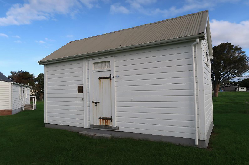
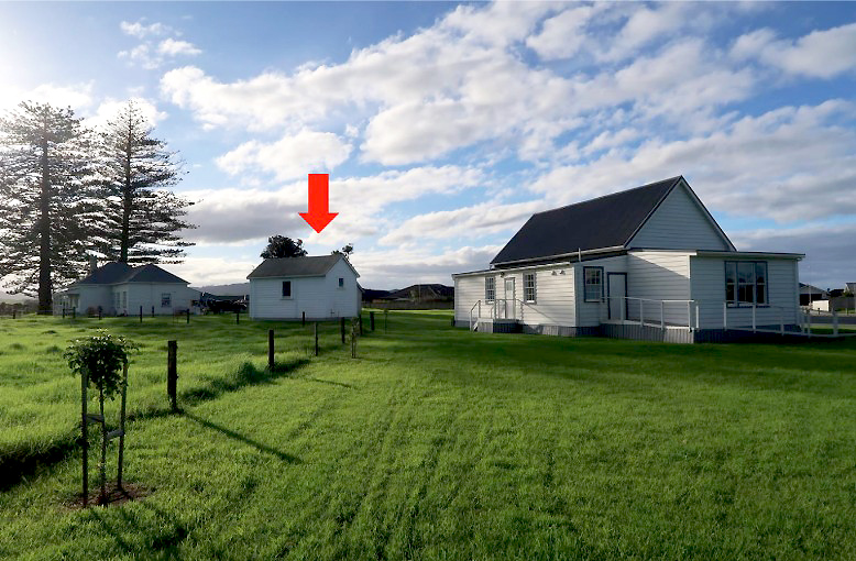
The Cell Block is significant for its historical associations with law and order in Waipū, and the evolution of local policing in late-nineteenth and twentieth-century Northland. Currently situated on former Presbyterian glebe land, the small timber building was initially erected as a single-cell lockup elsewhere in Waipū township, possibly as early as 1896, and expanded with an additional cell in 1912 as part of a newly built police station on Cove Road. Established as a ‘special settlement’ of Gaelic-speaking migrants from Nova Scotia in the 1850s, Waipū had not initially contained a purpose-built structure for incarceration. It acquired such facilities before the turn of the century as central government administration including law and order expanded in the town, and connections between the local community and rest of the country became more integrated. The Cell Block remained part of an active police complex on Cove Road until 1989, when it was moved a short distance to the Waipū Museum due to fears that it might be demolished. In 2019, it was repositioned within land managed by the museum, alongside other buildings that promote public knowledge about local history and Waipū’s historical evolution.
The area south of Whangārei is associated with many iwi and hapū. Situated west of Paepae-o-Tū (Bream Bay), Waipū lies within the rohe of Patuharakeke. Traditional settlement in the locality is evidenced by numerous pā and other sites, including midden on the river flats in what is now Waipū township. Although activity was disrupted during the inter-tribal taua (conflicts) or Musket Wars of the 1820s and 1830s, the area remained in Māori occupation in 1854 when the British Crown acquired large blocks of land for Gaelic-speaking migrants from Nova Scotia in present-day Canada. Sustained by strong kinship networks and shared cultural values - including adherence to a strict form of Calvinism promoted by the religious leader Reverend Norman McLeod - the new settlers created a largely self-sufficient, farming community. When initially required, law and order was administered by Justices of the Peace drawn from the local community, supplemented in more severe cases by government officials based in Whangārei. As the settlement began to change socially and economically in the later nineteenth century, however, local calls emerged for government-funded constabulary to be stationed in the township, leading to a small police station being created there in 1888. A lockup, used for temporarily incarcerating transgressors, was in existence by 1892.
In 1896, a new lockup was under construction. Plans for a replacement were advertised for tender in 1902, although it is unclear if this was ever built. In mid-1911, an initial part of the current Cell Block building existed on land beside Cove Road that had been purchased by the government two years earlier for a new police station alongside other civic facilities. Consisting of a freestanding timber structure with a corrugated iron roof, this lockup contained a single cell measuring some 3.66 x 2.74 metres (12 x 9 feet) with an associated entrance hall or lobby at one end. This building was enlarged in 1912 when additional police facilities, including stabling and a combined station and residence, were also erected on the property – collectively reflecting the wider commitment of the first Liberal Government (1891-1912) to improving national state infrastructure. Positioned a short distance to the rear of the new police office, the expanded lockup incorporated two cells of identical size, each with a built-in bench, a roof ventilator and a small, barred window high up in the gable. Both spaces were directly accessed from the original lobby, which now formed a central hallway containing a built-in desk at its far end for record-keeping, above which was a double-hung window, also barred. According to architectural plans prepared by A. G. Duncan and signed by District Engineer J. A Wilson of the Public Works Department, remodelling also included a 400-gallon water tank attached to the cell block exterior. The alterations were evidently undertaken by Walter J. Rowsell of Maungaturoto as part of the wider police station contract, completed by mid-August 1912.
Subsequent changes to the lockup likely included removal of the water tank by 1961. The building remained on Cove Road until 1989, when its site was being considered for subdivision from the main station property by the Police Department. Regarded as being at risk of demolition, the Cell Block was initially relocated to a nearby property in The Centre used by the Waipū Scottish Migration Museum, where it was open for exhibition. In 2019, the building was moved to a permanent position within the reserve managed by the museum. It has since remained part of the Waipū Heritage Trail.