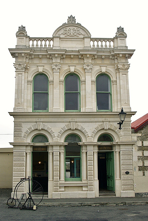
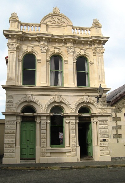
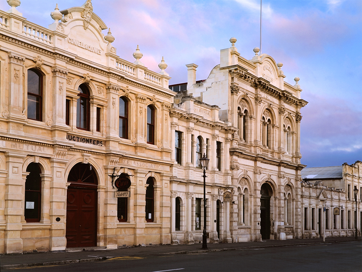
Designed by architect Thomas Forrester (1838-1907), this example of the Venetian Renaissance building style has been the anchor of the Harbour Street aesthetic since its construction in 1876. Built at a time when Ōamaru’s star was on the rise, much like the canal-side palazzos of Venice, it speaks of the wealth that the port was bringing to the region. As such, it has outstanding historic and architectural heritage significance.
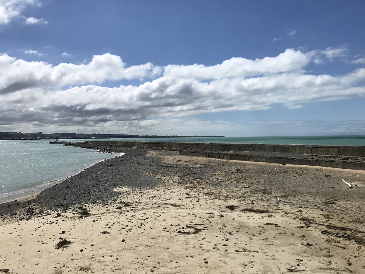
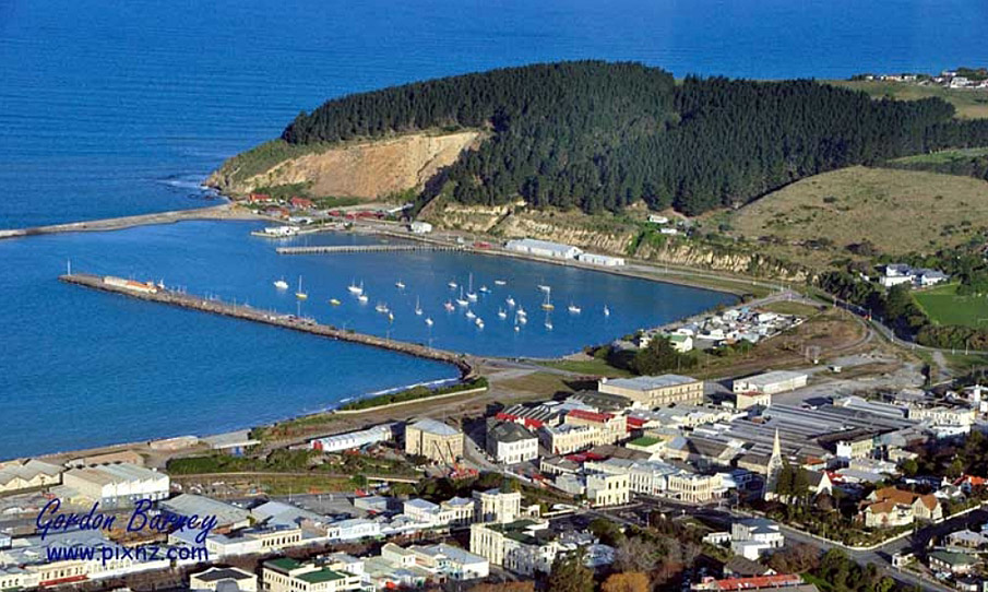
The Waitaki area is traditionally associated with the Kāhui-tipua, Te Rapuwai, Waitaha and Kāti Māmoe peoples. The Waitaki River was an ara tawhito (traditional travel route) for Kāi Tahu into the interior of Te Wai Pounamu and there are many kāika nohoka (seasonal settlements) and kāika mahika kai (food gathering sites) along the river. The land around the Waitaki River mouth shows evidence of extensive settlement, while Moeraki was one of the early cradles of knowledge for Waitaha and Kāti Māmoe histories. Key coastal settlements were at Makotukutuku (Cape Wanbrow), Moeraki, Matakaea (Shag Point), Waikouaiti, and Huriawa (the Karitane Peninsula). Following the arrival of Pākehā in number, Māori were alienated from the land. Soon afterwards, in 1858, the town was surveyed, and the first sections were opened for sale the following year. From the 1860s, as the town grew, many older buildings were replaced by the stone structures that survive today. By the early-1870s, a modern harbour was deemed necessary – the passing of the Oamaru Harbour Board Land Act, in 1874, gave the Harbour Board the necessary land, and a firm financial basis. The area that now contains Harbour Street was an aera of foreshore to the south of the Oamaru Creek inlet; this area was then surveyed and subdivided into 32 land parcels, and the roads through them established. Prior to the new office’s construction, the Harbour Board had been operating out of temporary offices on Tyne Street. In November 1875, it was decided that the Board should build its own office at the top of Harbour Street. A plan, ‘prepared by Mr Forrester’, for the building was submitted to the Board in January of 1876, with tenders called for that March.
In May, the Oamaru Mail reported on a preview they had been given of the designs:
The style of the edifice is Venetian, the lower story [sic] consisting of an arcade with three bays, rusticated quoins and arch stones, the openings flanked by Doric columns. The upper story [sic] is filled in…with cantilever cornice, the whole being surmounted by pierced balustrades. The Harbour Department consists of front and back office, 15ft. by 15ft. and 15ft. by 12ft. respectively. The Board-room is situated on the upper floor and is approached by a handsome staircase…The Board room is 15ft. by 22ft.
Certain aspects of the design of the building, such as the ‘repetition of the composite pilasters on the corners of the first floor, in which one pilaster appears to have been placed over another’ have been described as recalling Baroque architecture. The first meetings of the Harbour Board at their new office occurred at some date between late-September and late-October 1876.
The Harbour Board operated out of this building for the rest of its existence. However, by the 1960s, the trend in the decline of the use of shipping led to the closure of the Oamaru Customs Office in 1964; Oamaru ceased to be a port of entry in 1966, and by 1974, only seven ships called in at the port. The Harbour Board Office became the property of the Oamaru Borough Council when the Board was dissolved in 1978. By the late--1980s, the building had deteriorated somewhat, which included the removal of the original balustraded parapet and tympanum. By August 2005, the leasehold of the building had been acquired by the Whitestone Civic Trust, who had set about a renovation of the building, which included the reconstruction of its façade. In 2023, the former Harbour Board Office Building remains one of the outstanding heritage buildings of Ōamaru.
The Waitaki area is traditionally associated with the Kāhui-tipua, Te Rapuwai, Waitaha and Kāti Māmoe peoples. The Waitaki River was an ara tawhito (traditional travel route) for Kāi Tahu into the interior of Te Wai Pounamu and there are many kāika nohoka (seasonal settlements) and kāika mahika kai (food gathering sites) along the river. The land around the Waitaki River mouth shows evidence of extensive settlement, while Moeraki was one of the early cradles of knowledge for Waitaha and Kāti Māmoe histories. Key coastal settlements were at Makotukutuku (Cape Wanbrow), Moeraki, Matakaea (Shag Point), Waikouaiti, and Huriawa (the Karitane Peninsula). Following the arrival of Pākehā in number, Māori were alienated from the land. Soon afterwards, in 1858, the town was surveyed, and the first sections were opened for sale the following year. From the 1860s, as the town grew, many older buildings were replaced by the stone structures that survive today. By the early-1870s, a modern harbour was deemed necessary – the passing of the Oamaru Harbour Board Land Act, in 1874, gave the Harbour Board the necessary land, and a firm financial basis. The area that now contains Harbour Street was an aera of foreshore to the south of the Oamaru Creek inlet; this area was then surveyed and subdivided into 32 land parcels, and the roads through them established. Prior to the new office’s construction, the Harbour Board had been operating out of temporary offices on Tyne Street. In November 1875, it was decided that the Board should build its own office at the top of Harbour Street. A plan, ‘prepared by Mr Forrester’, for the building was submitted to the Board in January of 1876, with tenders called for that March.
In May, the Oamaru Mail reported on a preview they had been given of the designs:
The style of the edifice is Venetian, the lower story [sic] consisting of an arcade with three bays, rusticated quoins and arch stones, the openings flanked by Doric columns. The upper story [sic] is filled in…with cantilever cornice, the whole being surmounted by pierced balustrades. The Harbour Department consists of front and back office, 15ft. by 15ft. and 15ft. by 12ft. respectively. The Board-room is situated on the upper floor and is approached by a handsome staircase…The Board room is 15ft. by 22ft.
Certain aspects of the design of the building, such as the ‘repetition of the composite pilasters on the corners of the first floor, in which one pilaster appears to have been placed over another’ have been described as recalling Baroque architecture. The first meetings of the Harbour Board at their new office occurred at some date between late-September and late-October 1876.
The Harbour Board operated out of this building for the rest of its existence. However, by the 1960s, the trend in the decline of the use of shipping led to the closure of the Oamaru Customs Office in 1964; Oamaru ceased to be a port of entry in 1966, and by 1974, only seven ships called in at the port. The Harbour Board Office became the property of the Oamaru Borough Council when the Board was dissolved in 1978. By the late--1980s, the building had deteriorated somewhat, which included the removal of the original balustraded parapet and tympanum. By August 2005, the leasehold of the building had been acquired by the Whitestone Civic Trust, who had set about a renovation of the building, which included the reconstruction of its façade. In 2023, the former Harbour Board Office Building remains one of the outstanding heritage buildings of Ōamaru.