

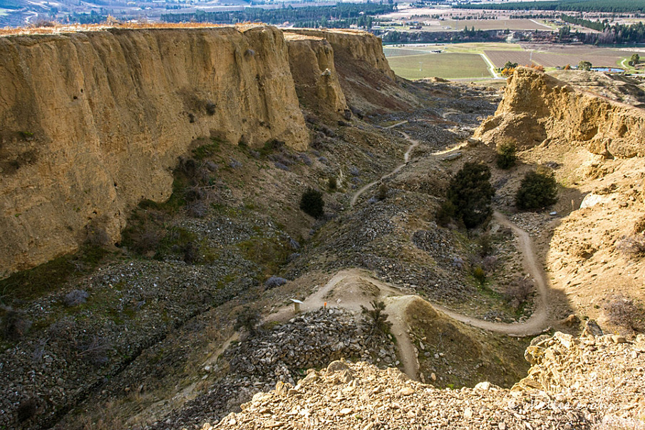
On the river terrace overlooking the Kawarau River, approximately a square kilometre of river terrace has been sluiced away to allow miners to get to the gold-bearing gravels lying beneath. Miners used both ground-sluicing and hydraulic sluicing technologies, as well as some tunnelling. Ground sluicing involves directing the flow of ground water over the ground miners want to wash away, using a water race. In hydraulic sluicing, miners direct water under high pressure through a nozzle at the sluice face. In each case, the gold is caught in a tray as the sluiced material is passed through a riffle box or similar. A tail race that leads away from the sluice face carries waste material away, except for heavy stones which are stacked into tailings.
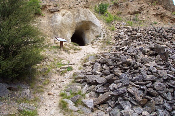
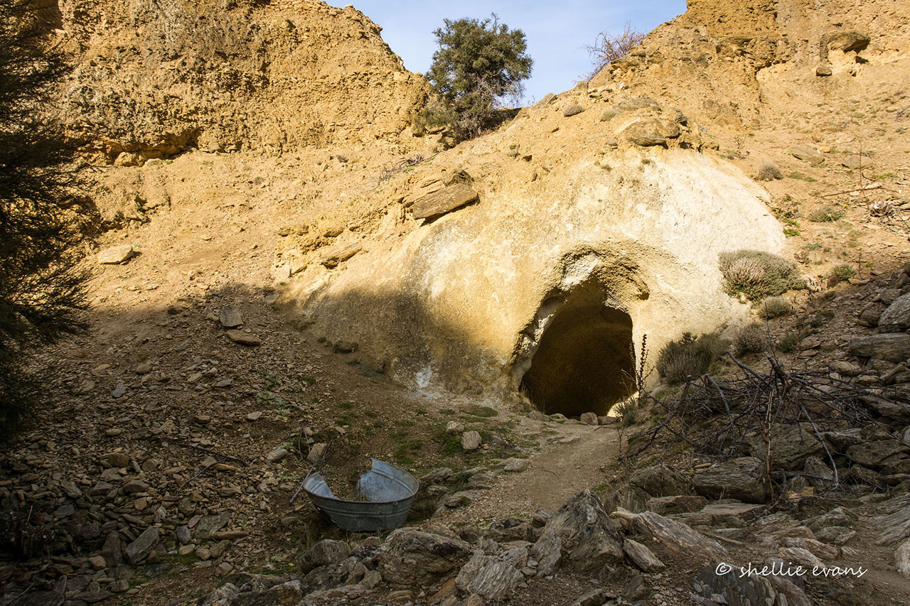
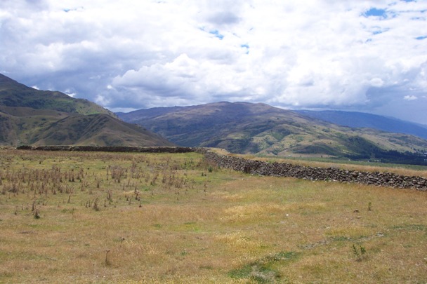
The Bannockburn Sluicings comprise an extensive area of sluiced waste land, covered with heaps of tailings, and with tailings-filled gullies around the margins. The head races, fed from Menzies Dam, above, lead out to the tops of the gullies. The sides of the gullies are the sluice faces that were left when mining ended, and the floors of the gullies contain tail races and carefully stacked stone tailings. Some of the gullies have tunnels where the miners tried to get at pay dirt more quickly than by sluicing. The water races that fed the sluicings reach out into the landscape up into the Carrick Range.
The land was included in the Bannockburn Sluicings Historic Reserve gazetted in 2000. In 2015, the Bannockburn Sluicings remain part of the Otago Goldfields Park, and a well signposted walk through them takes about 1.5 hours and includes the related sites - Menzies Dam (Record No. 5611) and Stewart Town (Record No. 5610).

List Entry Information
Status
Listed
List Entry Status
Historic Place Category 2
Access
Able to Visit
List Number
5612
Date Entered
10th April 1985
Date of Effect
10th April 1985
City/District Council
Central Otago District
Region
Otago Region
Extent of List Entry
Extent includes part of the land described as Pt Lot 1 DP 26776 (OT18D/464), Otago Land District, and the archaeological sites associated with the Bannockburn sluicings. Refer to the extent map tabled at the Heritage New Zealand Board meeting on 30 April 2015.
Legal description
Pt Lot 1 DP 26776 (OT18D/464), Otago Land District
Construction Details
Type
Other
Description
Hydraulic sluicing begins at Bannockburn
Period
1870s
Construction Details
Type
Other
Description
Hydraulic sluicing begins at Bannockburn
Period
1870s
Historical and Associated Iwi / Hapū / Whānau
Public NZAA Number
F41/404
Completion Date
9th February 2015
Report Written By
Heather Bauchop
Information Sources
Department of Conservation
Department of Conservation
Stephenson, 2004
Janet Stephenson, Heather Bauchop and Peter Petchey, 'Bannockburn Heritage Landscape Study', Department of Conservation, Science and Research Unit, Wellington 2004
Hamel, 2001
Jill Hamel, The Archaeology of Otago, Department of Conservation, Wellington, 2001
Other Information
This place was identified as significant under previous legislation with different information requirements. It remains significant under the current legislation. There is opportunity under our legislation and policies to add to this information. Further information about this place may be available from the Otago/Southland Office of Heritage New Zealand Pouhere Taonga. Please note that entry on the New Zealand Heritage List/Rarangi Korero identifies only the heritage values of the property concerned, and should not be construed as advice on the state of the property, or as a comment of its soundness or safety, including in regard to earthquake risk, safety in the event of fire, or insanitary conditions. A fully referenced upgrade report is available on request from the Otago/Southland Office of Heritage New Zealand
Current Usages
Uses: Civic Facilities
Specific Usage: Historic Property
Uses: Cultural Landscape
Specific Usage: Historic Landscape
Uses: Cultural Landscape
Specific Usage: Industrial/mining landscape
Former Usages
General Usage: Mining
Specific Usage: Mine Tailings
General Usage: Mining
Specific Usage: Mine Water Race/ Water Race cuttings/tunnels etc
General Usage: Mining
Specific Usage: Sluicing Hole/Area
Stay up to date with Heritage this month
