

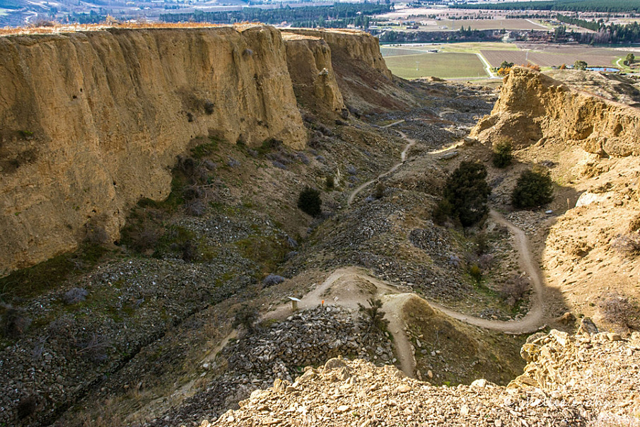
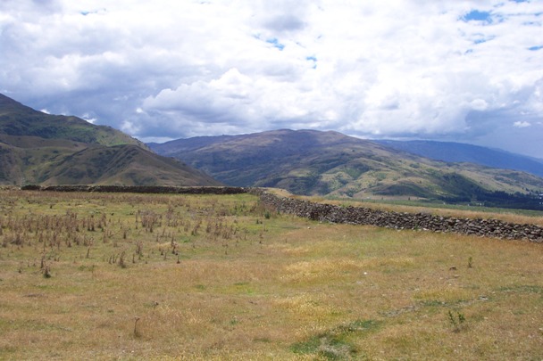
Stewart Town sits on a terrace close to Menzies Dam and overlooks the spectacular sluicing faces of Pipe Clay Gully. The land on the south bank of the Kawarau River, stretching up to the Carrick Range, was subject to extensive mining, particularly hydraulic sluicing (Bannockburn Sluicings, List Entry No. 5612). Stewart Town was not a town rather a cluster of buildings, that existed because of the residents’ control and sale of water to miners. It is named for miner and entrepreneur David Stewart who secured the water right from Long Gully, cut a race and built a dam to store water, which he sold to miners. Access to water allowed previously unworkable areas to be mined.
Stone mason David Stewart, and miner John Downie Menzies lived in a stone building close to their reservoir (Menzies Dam, List Entry No. 5611). Menzies died in 1894 and his house, race, claims and effects were sold. Stewart Town was occupied from about 1865 until the early twentieth century. Menzies and Stewart were in Bannockburn by the mid-1860s and there is a record of an application for a residence area in both their names in 1873. David Stewart died in 1883. William Roy mined with David Stewart and John Menzies from the 1870s. In 1913, Roy’s residence area was located next to the orchard section. William Roy died in 1923. As mining declined, the land around Stewart Town became part of the landscape of small holdings and allotments characteristic of the subdivisions between Bannockburn and the Kawarau River.
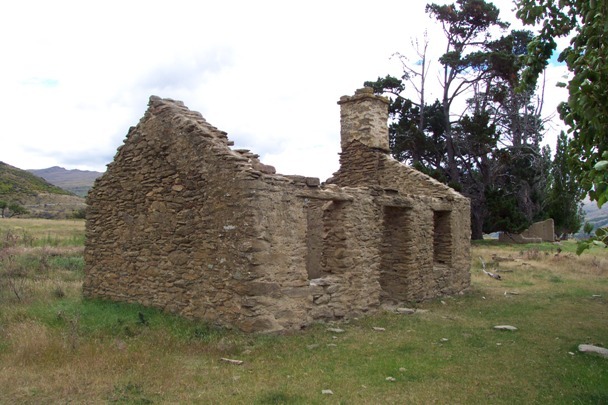
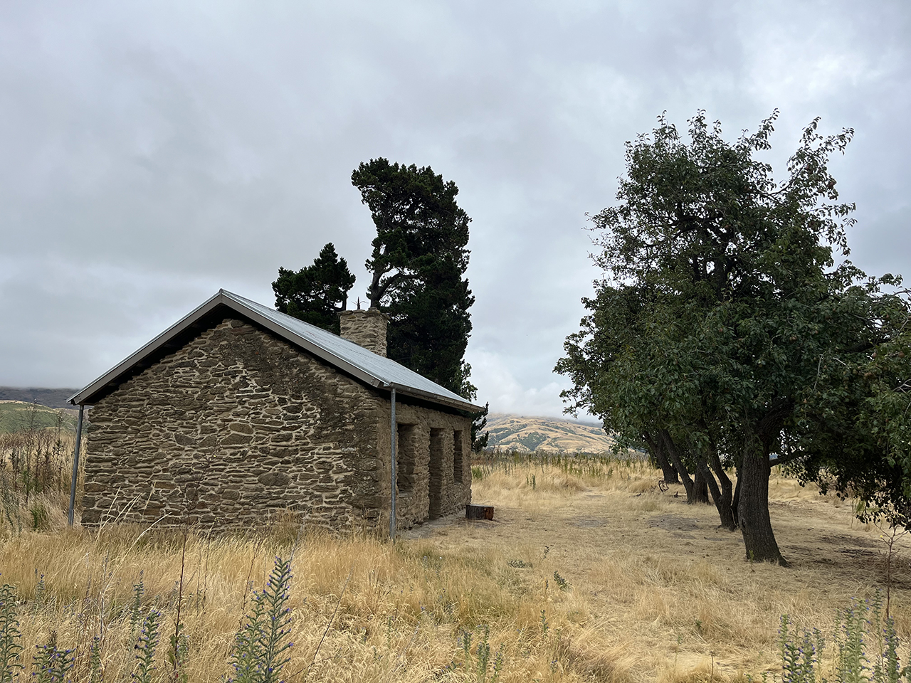
Stewart Town is a collection of nine earth and stone structures centred around one stone house (the Lind house). The stone house is constructed of split schist with mud mortar, with a mud brick extension at the north end. There are traces of cement plaster on the inside. The doors, windows and fireplace have large schist slabs over them. There is a small mud-walled area adjacent to the extension that was reportedly a dairy. There appear to have been at least two compounds surrounded with mud brick walls, a small section of which remains. A race runs through the back compound, and then to a dam. In front of the Lind House is an orchard containing fruiting apple, pear and apricot trees.
The land on which Stewart Town stands was included in the Bannockburn Sluicings Historic Reserve gazetted in 2000. In 2014, Stewart Town remains part of the Bannockburn Sluicings Historic Reserve.
List Entry Information
Status
Listed
List Entry Status
Historic Place Category 2
Access
Able to Visit
List Number
5610
Date Entered
10th April 1985
Date of Effect
10th April 1985
City/District Council
Central Otago District
Region
Otago Region
Extent of List Entry
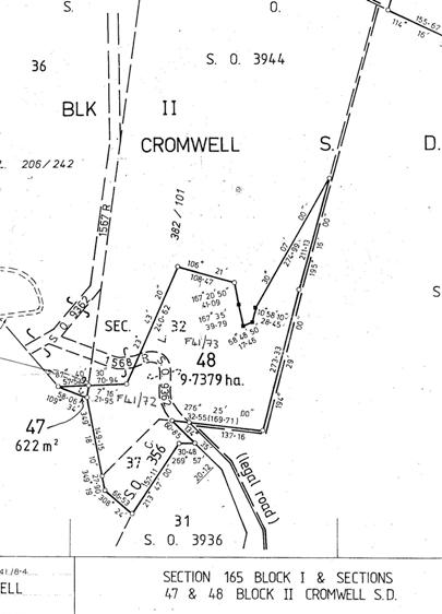
Extent includes part of the land described as Pt Lot 1 DP 26776 (RT OT18D/464), Otago Land District, and the archaeological sites associated with Stewart Town. Refer to the extent map tabled at the Heritage New Zealand Board meeting on 30 April 2015.
Legal description
Pt Lot 1 DP 26776 (OT18D/464), Otago Land District
Status
Listed
List Entry Status
Historic Place Category 2
Access
Able to Visit
List Number
5610
Date Entered
10th April 1985
Date of Effect
10th April 1985
City/District Council
Central Otago District
Region
Otago Region
Extent of List Entry
Extent includes part of the land described as Pt Lot 1 DP 26776 (RT OT18D/464), Otago Land District, and the archaeological sites associated with Stewart Town. Refer to the extent map tabled at the Heritage New Zealand Board meeting on 30 April 2015.
Legal description
Pt Lot 1 DP 26776 (OT18D/464), Otago Land District
Construction Details
Start Year
1865
startYearCirca
Type
Original Construction
Construction Details
Start Year
1865
startYearCirca
Type
Original Construction
Historical and Associated Iwi / Hapū / Whānau
Public NZAA Number
F41/72
Completion Date
11th February 2015
Report Written By
Heather Bauchop
Information Sources
Otago Goldfields, n.d.
Otago Goldfields Park pamphlet
Stephenson, 2004
Janet Stephenson, Heather Bauchop and Peter Petchey, 'Bannockburn Heritage Landscape Study', Department of Conservation, Science and Research Unit, Wellington 2004
Other Information
This place was identified as significant under previous legislation with different information requirements. It remains significant under the current legislation. There is opportunity under our legislation and policies to add to this information. Further information about this place may be available from the Otago/Southland Office of Heritage New Zealand Pouhere Taonga. Please note that entry on the New Zealand Heritage List/Rarangi Korero identifies only the heritage values of the property concerned, and should not be construed as advice on the state of the property, or as a comment of its soundness or safety, including in regard to earthquake risk, safety in the event of fire, or insanitary conditions. A fully referenced upgrade report is available on request from Otago-Southland Office of Heritage New Zealand
Current Usages
Uses: Civic Facilities
Specific Usage: Historic or recreation reserve
Uses: Cultural Landscape
Specific Usage: Historic Landscape
Former Usages
General Usage: Accommodation
Specific Usage: House
General Usage: Agriculture
Specific Usage: Orchard
General Usage: Mining
Specific Usage: Mine Water Race/ Water Race cuttings/tunnels etc
Location
Related listings
Stay up to date with Heritage this month
