Archaeological Features: A ditch lies on the north-east-facing ridge leading from the coastal strip to Puramahoi ‘A’ (M25/36). The interior of the pa consists of indistinct terraces lying on a mild slope facing to the north-east; the circumference of the plateau to the west, south and east is ringed with rectangular pits (16 in total). Brailsford (1981:86) has noted ovens 'on the plateau.
The coastal strip between the mouth of the Pariwhakaoho River on the lower slopes of this pa, and the lower slopes of .Puramahoi ‘B’ (M25/13), contains 3 sites (M25/37-39) probably continuous in extent, although this cannot be confirmed on present evidence.
Supporting Evidence: Date of occupation is not known, although traditions suggest late occupation. This site was probably attacked and defeated by Te Puoho in his 1828 progression through the South Island. M25/39 on the coastal strip below Puramahoi ‘B’ is reported to be a source of many fossicked greenstone artefacts, assumed to be late in date.
Assessment: Puramahoi ‘A’ (M25/36) exemplifies the naturally defended pa sites of Golden Bay. Three other examples are known, one of them heavily bulldozed (Te Rangihaeata Headland pa, N25/35). The clear association of the pa with a large volume or horticultural storage is notable. Taken as a complex with Puramahoi "B" pa and the sites of the linking coastal strip the site is the most important earthwork site in Golden Bay.
List Entry Information
Status
Listed
List Entry Status
Historic Place Category 2
Access
Private/No Public Access
List Number
5732
Date Entered
21st December 1983
Date of Effect
21st December 1983
City/District Council
Tasman District
Region
Tasman Region
Extent of List Entry
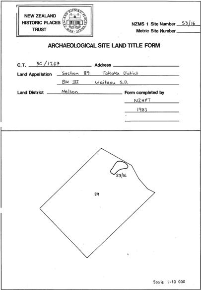
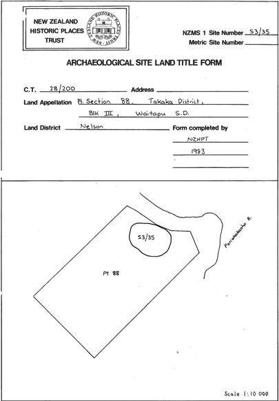
Extent includes part of the land comprised in the land described as Lot 1 DP 18437 (RT NL13C/113), Nelson Land District and the archaeological site known as Pa (M25/36). (Refer to the map on the Archaeological Site Land Title Form for more information).
Legal description
Lot 1 DP 18437 (RT NL13C/113), Nelson Land District
Status
Listed
List Entry Status
Historic Place Category 2
Access
Private/No Public Access
List Number
5732
Date Entered
21st December 1983
Date of Effect
21st December 1983
City/District Council
Tasman District
Region
Tasman Region
Extent of List Entry
Extent includes part of the land comprised in the land described as Lot 1 DP 18437 (RT NL13C/113), Nelson Land District and the archaeological site known as Pa (M25/36). (Refer to the map on the Archaeological Site Land Title Form for more information).
Legal description
Lot 1 DP 18437 (RT NL13C/113), Nelson Land District
Historical and Associated Iwi / Hapū / Whānau
Public NZAA Number
M25/36
Completion Date
21st April 1982
Report Written By
Kevin Jones
Information Sources
Brailsford, 1981
B Brailsford, The Tattooed Land - The Southern Frontiers of the Pa Maori, A H & A W Reed, Wellington 1981
Jones, 1981
K. Jones, 'Archaeological Inspections: Golden Bay', Report to the Department of Lands and Survey, 1981
Other Information
This place was identified as significant under previous legislation with different information requirements. It remains significant under the current legislation. There is opportunity under our legislation and policies to add to this information. Further information about this place may be available from the Central Regional Office of Heritage New Zealand Pouhere Taonga. Information in this report is from the citation prepared for the NZHPT Archaeology Committee at the time of the registration. Please note that entry on the New Zealand Heritage List/Rarangi Korero identifies only the heritage values of the property concerned, and should not be construed as advice on the state of the property, or as a comment of its soundness or safety, including in regard to earthquake risk, safety in the event of fire, or insanitary conditions.
Historical and Associated Iwi / Hapū / Whānau
Public NZAA Number
M25/36
Completion Date
21st April 1982
Report Written By
Kevin Jones
Information Sources
Brailsford, 1981
B Brailsford, The Tattooed Land - The Southern Frontiers of the Pa Maori, A H & A W Reed, Wellington 1981
Jones, 1981
K. Jones, 'Archaeological Inspections: Golden Bay', Report to the Department of Lands and Survey, 1981
Other Information
This place was identified as significant under previous legislation with different information requirements. It remains significant under the current legislation. There is opportunity under our legislation and policies to add to this information. Further information about this place may be available from the Central Regional Office of Heritage New Zealand Pouhere Taonga. Information in this report is from the citation prepared for the NZHPT Archaeology Committee at the time of the registration. Please note that entry on the New Zealand Heritage List/Rarangi Korero identifies only the heritage values of the property concerned, and should not be construed as advice on the state of the property, or as a comment of its soundness or safety, including in regard to earthquake risk, safety in the event of fire, or insanitary conditions.
Former Usages
General Usage: Maori
Specific Usage: Pā
Themes
Archaeological Site (HPA 1980)
Of Significance to Maori
Former Usages
General Usage: Maori
Specific Usage: Pā
Themes
Archaeological Site (HPA 1980)
Of Significance to Maori