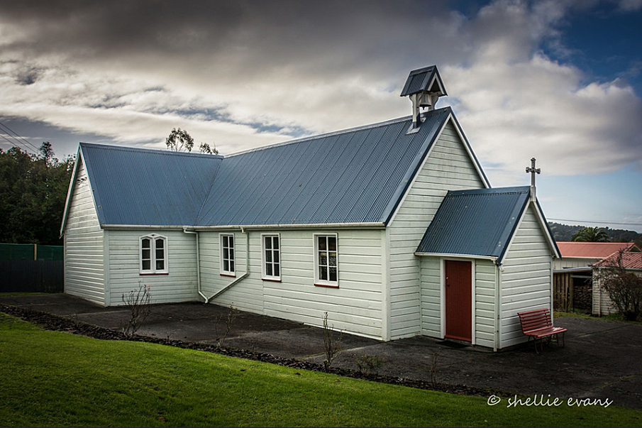
The Ross Historic Area is the centre of the mining town of Ross on the West Coast (32 kilometres south of Hokitika). The town was established in 1865 with the discovery of payable quantities of gold at Jones's Creek and the Mikonui and Totara Rivers. The quantity of alluvial gold sustained large numbers of miners for several decades, so that the town did not continue as a temporary settlement like many of the West Coast places of gold discovery.
[Nearby to Ross, Maori knew the Totara Lagoon as Paiari, a place abundant with bird and fish]. The town of Ross was promptly surveyed as the 1865 rush began and named after Canterbury Provincial Council's Treasurer, Donald Ross.
Between 1865 and 1875 the mining population rapidly grew to at least 3,500. Jones's Flat was the richest piece of gold bearing ground in New Zealand, with work concentrated on a compact block of land only approximately five kilometres square. Ross township, in its earliest years, was typical of other gold field towns with structures rapidly built of saplings and canvas. It grew on a terrace overlooking Jones's Flat, the centre of mining activity, resulting in chimneys and poppet heads of the mines towering over the buildings of the town. The majority of the gold bearing layers in this field were deep underground, so companies were formed to finance the sinking of shafts. These shafts were operated by horsepower and later (1867) by the steam engine which opened up a new era in mining. With the prospect of several steady years of work ahead, more permanent timber buildings were erected in the township.
By the turn of the century, the population had considerably diminished to approximately 600. Today the township's population is even smaller and the few surviving historic buildings are the principal indication of its mining past and once thriving community. The heritage structures, remnants of mining machinery and detailed interpretation panels in the Historic Area are sited in what was the town's centre during the goldfield's early, most productive decades. They provide an important understanding of the place's unique past. The site alone has important heritage and archaeological values. These values are enhanced by the six structures - St Patrick's Church, 1866; Catholic Presbytery, 1870s (now in private ownership); de Bakker Cottage, 1885; Former Jail, 1890s; Fire Brigade Tower, c.1874 (reconstructed 1977); and Grimmond House, 1870,(reconstructed 1990).
The Ross Goldfield Historic Reserve, managed by the Department of Conservation, covers a large portion of the Historic Area and the Information Centre, with walkway leaflets available, is located here.
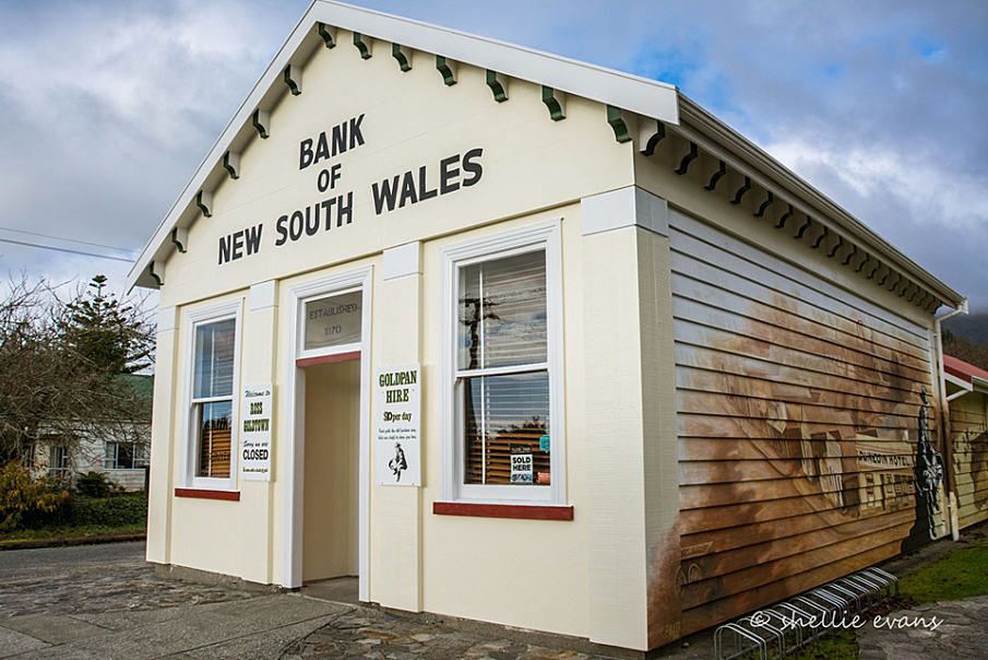
Ross Historic Area. Bank of New South Wales building later known as Grimmond House. Image courtesy of www.flickr.com | Shellie Evans – flyingkiwigirl | 16/06/2016 | Shellie Evans
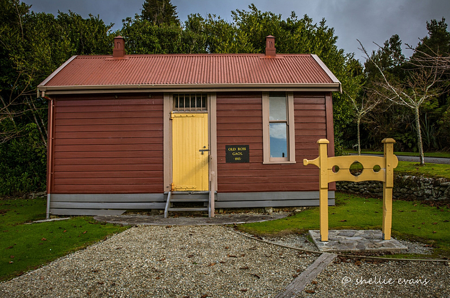
Ross Historic Area. Former Gaol. Image courtesy of www.flickr.com | Shellie Evans – flyingkiwigirl | 16/06/2016 | Shellie Evans
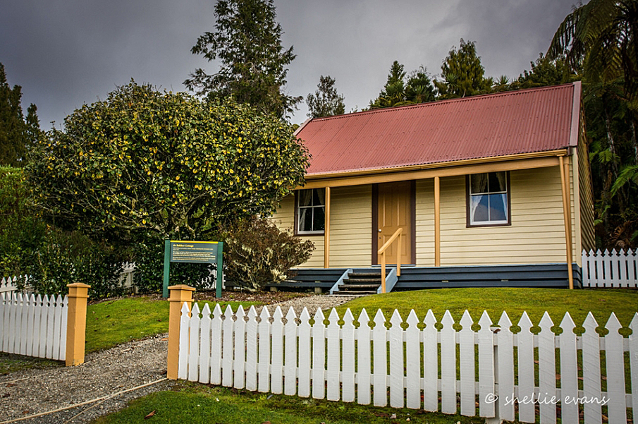
Ross Historic Area. De Bakker Cottage. Image courtesy of www.flickr.com | Shellie Evans – flyingkiwigirl | 16/06/2016 | Shellie Evans
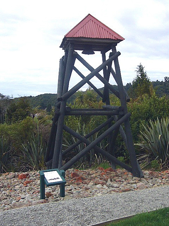
Ross Historic Area. Fire Brigade Bell Tower | Pam Wilson | 07/09/2007 | Heritage New Zealand Pouhere Taonga
Ross Historic Area. Bank of New South Wales building later known as Grimmond House. Image courtesy of www.flickr.com | Shellie Evans – flyingkiwigirl | 16/06/2016 | Shellie Evans
Ross Historic Area. Former Gaol. Image courtesy of www.flickr.com | Shellie Evans – flyingkiwigirl | 16/06/2016 | Shellie Evans
Ross Historic Area. De Bakker Cottage. Image courtesy of www.flickr.com | Shellie Evans – flyingkiwigirl | 16/06/2016 | Shellie Evans
Ross Historic Area. Fire Brigade Bell Tower | Pam Wilson | 07/09/2007 | Heritage New Zealand Pouhere Taonga