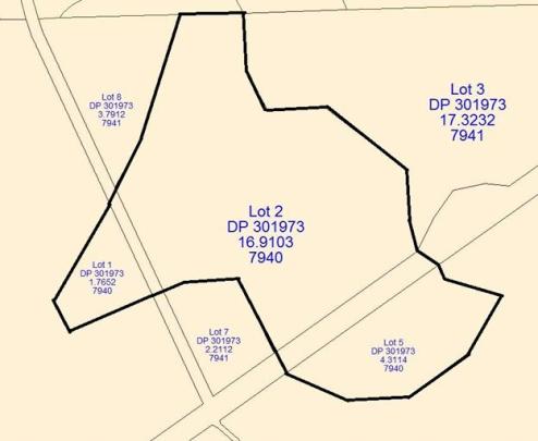
The Golden Point historic area is made up of a variety of mining features and structures associated with both alluvial and hard rock mining in Otago. The features and structures are associated with the Golden Point and Maritana mines, and include surface features, and sub-surface workings.
Gold was discovered near Macraes in May 1862, and this resulted in a series of small rushes around tributaries of the Shag River including Deepdell Creek, which is at the centre of the proposed area. The first miners in the area worked the gravels at the bottom of Deepdell Creek, which has resulted in alluvial tailings along the creek. Most knowledge of this period of mining comes from archaeological evidence.
The Golden Point mine, situated in Deepdell Creek was wryly called Poverty Point when it was first opened in 1889 by the Morrin Brothers and J Wrigley. It shortly after became the property of the Golden Point Mining Company, who built a battery and went into liquidation within a year. The stone work of this first battery can still be seen. The claim, water rights and battery were bought by the Donaldson Brothers who ran the operation very successfully until they sold it in 1912 to a Christchurch syndicate. The Donaldsons mining operation included extracting both alluvial gold from old gravels on the hillside and quartz from shallow tunnels run into the surface of the reef. They built a waterwheel driven from a water race as their main power source. They mined well up the hillside towards round Hill and built an aerial tramway to bring the ore down the hill. After the Donaldsons sold out their battery worked successfully until about 1930.
Initially small open cast pits were worked but miners in the district began tunnelling as well around the turn of the century. The Donaldsons also began mining scheelite in the late 1890s, but it was not until this century that scheelite became a major income earner, and prices soared during both World Wars (tungsten from the scheelite was used to build the armour plating and heavy guns used in both wars).
Another battery was operating near the Donaldsons by 1905. This was named the Golden Point Battery. Between 1930 and 1937 it was worked by the Golden Point Gold and Scheelite Company. This and the Donaldsons battery were located on the east side of Deepdell Creek.
On the west side of Deepdell Creek the Maritana Company, which was formed in 1889, built two batteries. Their first battery, now known as 1st Maritana, was located at a site a little downstream of their second battery, now known as Callery's battery. The Maritana Company had many problems including low grade ore and a shortage of water. It ceased operation in 1906 and the battery lay idle until about 1911. Scheelite mining became lucrative and many parties used the Maritana battery to crush the scheelite ore, including the Callery Brothers who were mining on Round Hill. The Callerys took over the battery in the late 1920s, and it now carries their name. Callerys battery continued to work intermittently for local miners through the 1950s, with most crushing from the 1940s being for scheelite.
Golden Point is considered to be one of the two or three large underground gold mines in Otago. It was the largest in terms of the area worked; however the returns were not as great as Bendigo mine. It was more significant as one of the three major scheelite mines in New Zealand. It was approximately the largest in production and was certainly the largest in area explored.
The proposed area is also noteworthy for the presence of the only working ore crushing battery site in Otago, which is one of three operating in New Zealand. While the other two batteries, both on the West Coast, are water powered, Callery's battery is powered by a kerosene fired stationary engine.
Extant Features:
Many features still to be seen in the area have been noted above.
Golden Point area is unusual in that all major forms of mining occurred there - alluvial mining and then quartz mining, first through the amalgamation method and then through the cyanide process. It is a complex and largely intact archaeological and historical landscape, with many of the features associated with the activity described above still being visible and intact.
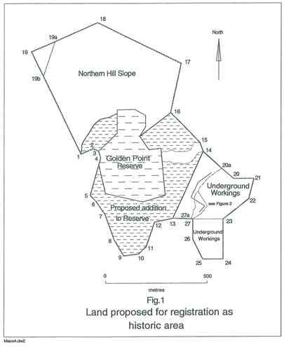
There are two underground mines located within the proposed area: Golden Point and Maritana. Maritana mine is much smaller than Golden Point, but it is unusual due to the presence of prospecting drives every 6 to 8 metres. These were usually removed as the mine was worked.
Tailings from early alluvial mining can be seen on the valley floor. The hillside to the east of the site, near Round Hill, is modified by evidence of quartz and scheelite mining. These include adits, small pits and many disorganised mullock heaps.
The site of the Donaldson brothers first battery is now marked only by concrete foundations and stone walling. The site of the Golden Point Battery still exists up on the terrace across Battery Creek. The last 30 metres of Battery Creek have been altered by creation of channels.
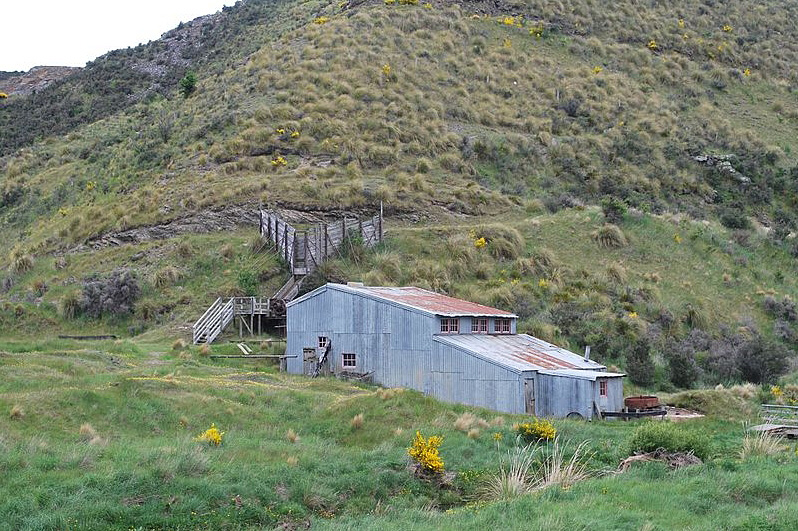
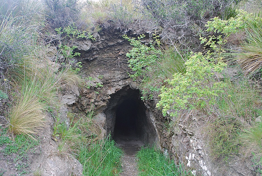
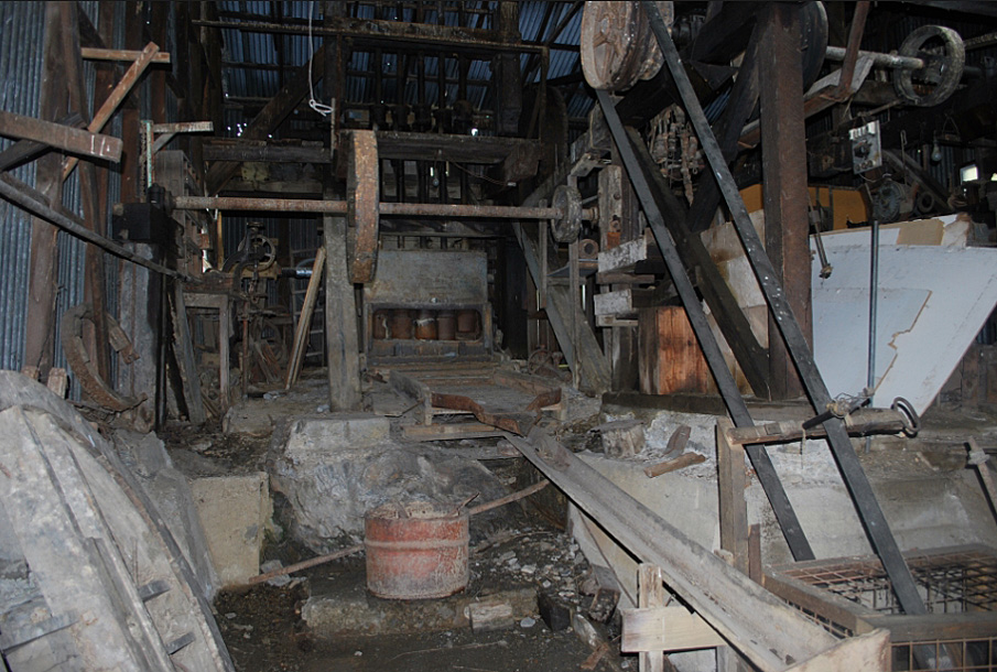
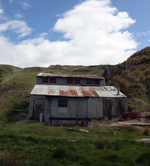
A corrugated iron shed encloses all the equipment which is the remains of Callerys battery. A well beside the shed is all that remains of the original battery, built prior to Callerys. An adit is hidden in the tussock a short way away and this is probably the original Maritana Mine. The site of the original Maritana Battery can be seen a short way downstream.
Several water races wind around the hillsides. The wooden house occupied by the Callery Brothers is still in good order on the site, and there are two other mudbrick dwellings and their associated outhouses are nearby.
Gold was discovered near Macraes in May 1862, and this resulted in a series of small rushes around tributaries of the Shag River including Deepdell Creek, which is at the centre of the proposed area. The first miners in the area worked the gravels at the bottom of Deepdell Creek, which has resulted in alluvial tailings along the creek. Most knowledge of this period of mining comes from archaeological evidence.
The Golden Point mine, situated in Deepdell Creek was wryly called Poverty Point when it was first opened in 1889 by the Morrin Brothers and J Wrigley. It shortly after became the property of the Golden Point Mining Company, who built a battery and went into liquidation within a year. The stone work of this first battery can still be seen. The claim, water rights and battery were bought by the Donaldson Brothers who ran the operation very successfully until they sold it in 1912 to a Christchurch syndicate. The Donaldsons mining operation included extracting both alluvial gold from old gravels on the hillside and quartz from shallow tunnels run into the surface of the reef. They built a waterwheel driven from a water race as their main power source. They mined well up the hillside towards round Hill and built an aerial tramway to bring the ore down the hill. After the Donaldsons sold out their battery worked successfully until about 1930.
Initially small open cast pits were worked but miners in the district began tunnelling as well around the turn of the century. The Donaldsons also began mining scheelite in the late 1890s, but it was not until this century that scheelite became a major income earner, and prices soared during both World Wars (tungsten from the scheelite was used to build the armour plating and heavy guns used in both wars).
Another battery was operating near the Donaldsons by 1905. This was named the Golden Point Battery. Between 1930 and 1937 it was worked by the Golden Point Gold and Scheelite Company. This and the Donaldsons battery were located on the east side of Deepdell Creek.
On the west side of Deepdell Creek the Maritana Company, which was formed in 1889, built two batteries. Their first battery, now known as 1st Maritana, was located at a site a little downstream of their second battery, now known as Callery's battery. The Maritana Company had many problems including low grade ore and a shortage of water. It ceased operation in 1906 and the battery lay idle until about 1911. Scheelite mining became lucrative and many parties used the Maritana battery to crush the scheelite ore, including the Callery Brothers who were mining on Round Hill. The Callerys took over the battery in the late 1920s, and it now carries their name. Callerys battery continued to work intermittently for local miners through the 1950s, with most crushing from the 1940s being for scheelite.
Golden Point is considered to be one of the two or three large underground gold mines in Otago. It was the largest in terms of the area worked; however the returns were not as great as Bendigo mine. It was more significant as one of the three major scheelite mines in New Zealand. It was approximately the largest in production and was certainly the largest in area explored.
The proposed area is also noteworthy for the presence of the only working ore crushing battery site in Otago, which is one of three operating in New Zealand. While the other two batteries, both on the West Coast, are water powered, Callery's battery is powered by a kerosene fired stationary engine.
Extant Features:
Many features still to be seen in the area have been noted above.
Golden Point area is unusual in that all major forms of mining occurred there - alluvial mining and then quartz mining, first through the amalgamation method and then through the cyanide process. It is a complex and largely intact archaeological and historical landscape, with many of the features associated with the activity described above still being visible and intact.
There are two underground mines located within the proposed area: Golden Point and Maritana. Maritana mine is much smaller than Golden Point, but it is unusual due to the presence of prospecting drives every 6 to 8 metres. These were usually removed as the mine was worked.
Tailings from early alluvial mining can be seen on the valley floor. The hillside to the east of the site, near Round Hill, is modified by evidence of quartz and scheelite mining. These include adits, small pits and many disorganised mullock heaps.
The site of the Donaldson brothers first battery is now marked only by concrete foundations and stone walling. The site of the Golden Point Battery still exists up on the terrace across Battery Creek. The last 30 metres of Battery Creek have been altered by creation of channels.
A corrugated iron shed encloses all the equipment which is the remains of Callerys battery. A well beside the shed is all that remains of the original battery, built prior to Callerys. An adit is hidden in the tussock a short way away and this is probably the original Maritana Mine. The site of the original Maritana Battery can be seen a short way downstream.
Several water races wind around the hillsides. The wooden house occupied by the Callery Brothers is still in good order on the site, and there are two other mudbrick dwellings and their associated outhouses are nearby.