This historic place was registered under the Historic Places Act 1993. The following text is the original citation considered by the NZHPT Board at the time of registration. Information in square brackets indicates modifications made after the paper was considered by the NZHPT Board.
The relative inaccessibility of the upper Wainuioru valley, about 20 kilometres east of Masterton on what is now the Masterton-Stronvar Road, had discouraged occupation of Crown land there until William Beetham and John [Henry Corrie] (or Jack) Hutton took up a leasehold run there in 1856. Several years before that, Hutton had visited the valley, probably with his [uncle] Reverend T. B. Hutton, missionary who visited Wairarapa Maori from 1852 to 1854 from his base in Naenae (Lower Hutt), where William Beetham had also settled. Jack described Wainuioru to his friends the Beethams as "very beautiful," leading to further investigation in 1856.
William Beetham (1809-1888) was a successful Yorkshire-born artist, portrait painter, and member of the Royal Academy, who arrived in Wellington in 1855, seeking a better future for his family of six sons and three daughters. Jack Hutton and the eldest Beetham son, Richmond, set off in August 1856 to investigate Wainuioru, a trip that then involved an arduous trek in from the coast at Castlepoint, travelling via the Whareama River valley and rough bush tracks. They liked what they found and convinced their fathers to take up a lease of a vacant Crown run of 4,000 hectares in September 1856.
The lease of the land may have lain open since the Crown land purchase commissioner Donald McLean acquired the land from a few local rangatira in December 1853, but Wainuioru was far from vacant. When Jack Hutton and the Beetham brothers (Richmond (or Dick), William Henry, George, and Hugh Horsley Beetham) arrived with their first 500 sheep in late 1856 to start breaking in their 4,000 hectare leasehold run they found that although much of the land remained heavily forested, the heart of what was to become Brancepeth had been cleared by fairly recent Maori fires. In the early years they shared the land with its erstwhile Maori owners, who continued to cultivate and hunt on the large areas not being actively cleared or farmed by the Beethams.
The land had a long history of occupation by Rangitane hapu, as well as later arrivals such as Ngai Tahu and Ngati Ira and the many hapu of Ngati Kahungunu that came to dominate much of Wairarapa in the eighteenth and early nineteenth centuries. Migrations and marriages resulted in many hapu having a complex web of whakapapa and political alliances that confound a blunt iwi categorisation. Much of this history has been lost since Maori ownership of land was ended in the rush of hastily-prepared Crown land deeds in 1853-1854, followed by the later loss of the few reserves to local farmers. Some occupants have left behind little more than place names: for instance, the Ngaipu block (acquired for Brancepeth in the 1890s) was shortened from Te Iringa o Nga Ipu o Hinetuatahi, or 'the place where Hinetuatahi hung up her calabashes in a tree'. Hinetuatahi was the daughter of Mahanga, a Ngati Ira tupuna who led his people into the Maungaraki area (between Wainuioru and Gladstone) in the late seventeenth century.
Other tupuna associated with Wainuioru include Rangitawhanga of Ngati Kahukuraawhitia hapu, but also linked to Ngai Tahu and Ngati Ira. He migrated south from Heretaunga (Hawke's Bay) with his people in the late seventeenth century and sought land from his whanaunga (relation) Te Rerewa of Rangitane. As Te Rerewa wished to migrate to the Wairau valley, Marlborough, he was prepared to enter into a tukuwhenua (a gift exchange of land), and agreed to exchange four waka (canoes) with Rangitawhanga for land at Papawai and Ahikouka (near Greytown). The four waka were felled and made by Rangitawhanga and his people at Wainuioru.
Ngati Hikawera (whose leaders during the colonial period included the influential Mahupuku whanau), were later gifted land by another Rangitane rangatira Turangatahi. This tukuwhenua included the Ngaipu block and Kourarau land, and followed a battle in which Turangatahi was captured by Poari and his Ngati Kahungunu forces in battle. After his life and those of his Rangitane people were spared, they gifted the land. Hapu linked to Ngati Kahukuraawhitia, such as Ngati Kaipaoe, also maintained links to Wainuioru and held significant interests in the Upokongaruru block, from which the core lands of Brancepeth were derived after the Upokongaruru deed was arranged by McLean in December 1853.
Hakikino (or Hakakino) was an important pa within Brancepeth, on the Wainuioru River, and was occupied by Ngati Hika Rahui. According to one local history it was the site of a great battle in about 1795, at which a rangatira associated with the early years of Brancepeth, Piripi, was said to have been present, as a child. When the Beethams found a great many bones some distance from the pa they named the spot Golgotha, and it has been assumed that the bones were the remains of those killed at Hakikino.
The Amiowhenua taua (war party) and other northern taua of the 1820s and 1830s devastated the Wainuioru area and much of Wairarapa, forcing most of the tangata whenua to retreat deep into the bush or to migrate north to shelter at Mahia during the 1830s. When they returned in 1840-1843, pa such as Hakikino and Rauatahunga (another Wainuioru pa) were not reoccupied, as the Maori population was concentrated in the open central valley and at coastal kainga, particularly after these areas became the focus for early settlement by Pakeha runholders from 1844. Even so, the forest at Wainuioru and Maungaraki was highly valued for its rich resources, including mahinga kai (food-gathering areas), birds, kiore (native rats), and wild pigs. Fertile valley floors were also cleared by fire for seasonal cultivation while the bush on some poorer land on higher slopes was burned off as part of the customary cultivation of rarauhe (bracken fern).
The beginning of the end of Maori occupation of Upokongaruru and other Brancepeth lands came with the Crown land deeds of 1853 and later waves of Crown land purchasing up to 1863 that saw over three-quarters of Wairarapa land wrested from Maori. The first deed arranged in this area was Waihora, an area between the Taueru (or Tauweru or Tauheru) and Wainuioru Rivers estimated to contain 5,000 hectares for which £300 was paid in November 1853. No reserves were made. The Upokongaruru block, estimated to comprise 20,000 hectares, was acquired by the Crown in December 1853, the nine vendors being paid £487 and a horse. No reserves were set aside. The vendors included Piripi Tuapa, who appears to be the Piripi referred to so often by the Beethams during their early years at Brancepeth. The land had actually been set aside for purchase by the Crown in October 1853, when Te Hapuku (a controversial land-selling rangatira of Heretaunga (Hawke's Bay) favoured by the Crown) accepted nearly half the purchase payment as an advance from McLean.
Another area alienated from Maori ownership in these early years that is of relevance to Brancepeth is Tupurupuru, a large area on the western bank of the Wainuioru, extending as far as Gladstone and comprising 17,000 hectares. This was acquired in 1859 from 37 vendors who were paid the more substantial sum of £1,910 (still remarkably cheap for such a quantity of land). They also secured four reserves, including one in southern Wainuioru.
The Crown's rushed and chaotic land dealings did not form an entirely secure basis for the occupation of the Beetham and Hutton run. One difficulty arising out of the Crown's hasty negotiation for the Upokongaruru deed emerged on 22 April 1857, when Piripi, 'Matihaka' (probably Matiaha), Tamati Wiremu, and another man approached Richmond (1836-1912) and William Henry Beetham (1837-1925) at their first whare. They forcefully told the brothers that the land was still theirs, struck the whare, and threatened to burn it down. The Crown had wrongly dealt for their land with Te Hapuku, who had no right to deal with Wainuioru. William had already acquired some ability with te reo Maori from Reverend Hutton in Naenae, and succeeded in calming the four men until he and his brother could consult their distant neighbours about this dispute.
By 28 April 1857, a hui appears to have been convened to discuss the matter, after which William noted that the boundary of the run had been altered, the Maori claimants, "taking off home hill and the whare." While the outcome is not apparent from the available sources, William did not appear overly troubled; the main concern expressed in his diary was that these Maori guests, who remained on the land for some days, had not brought any food with them, which was 'a great nuisance'. It is not entirely clear from the record which whare and which land was the subject of this early Maori protest, nor how permanent this adjustment of the boundaries was. Given that the establishment of the Beetham station continued at what is now the Brancepeth Homestead, it is possible that the whare referred to was an outlying one put up for temporary habitation, rather than the main whare at Brancepeth.
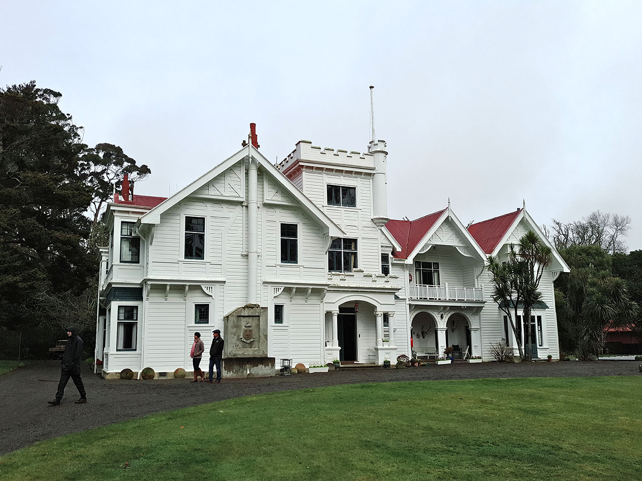
It was an incident that occurred during the erection of the Beethams' first whare in late 1856 or early 1857 that gave the station its name. The bush at Upokongaruru was full of wild pigs and one day, while two of the Beetham brothers worked in the rafters of their first rough whare (which still stands beside the main 1905 homestead), a huge boar came out of the bush and walked around their camp, silently observed by the pair, before it retired unchallenged. The name Brancepeth was then suggested, being derived from 'boar's path', or 'brawn's path' in the Beethams' northern England dialect. The brothers were aware of Brancepeth castle near Durham (named from its location on a boar's path), not far from their father's birthplace.
Interestingly, William Henry Beetham's detailed (if, at times, scarcely legible) journal for 1856-1858 does not appear to mention the incident or of the name Brancepeth. Possibly, the incident occurred while he was away from the station, or the name originated later than is generally assumed. Nonetheless, the frontispiece for his 1857 journal features a sketch of a very large boar, while another boar is drawn in the entry for 13 November 1858, when the Beethams were hard at work at the saw pit near their whare, apparently preparing to build the large homestead that replaced the first whare. William noted that it was "two years to the day" since he had arrived at Wainuioru in preparation for his new life on the land. "I little thought," he wrote, "last year at this time [that] we should be beginning a whare to live in, we never do half [what] we set out [to do]."
In the decades following the building of the first homestead the Beethams did rather more than half what most runholders set out to do. Many outlying stations such as Brancepeth struggled to get established in late 1850s in the face of numerous obstacles: their small flocks were at risk from wild dogs, or nibbled on poisonous tutu; there was a lack of fencing; capital was short, and; ongoing bush clearing hindered rapid growth. Enduring place names reflect some of these difficulties, such as Wild Dog Hill, where the Beethams first encountered a large pack of the wild dogs that were to ravage their sheep for some years.
Despite such difficulties, the future of Brancepeth was more secure when, in 1858, Anne Beetham, William's eldest daughter, married Thomas C. Williams (1825-1912) son of Reverend Henry Williams. Williams brought with him the capital to not only freehold the run's 4,000 hectare lease but, with his brothers-in-law, to extend Brancepeth. By 1870, it comprised 8,000 hectares to which was added more land acquired directly from Maori from 1869 onwards, including the Mauripo, Ngaipu, Ngutokoko, Oruatamore, Patukawa, Umukereru, Waipapa, and other blocks. Such land was acquired through the government's Native Land Court system, which ensured that the vast bulk of what little land remained for Wairarapa Maori was alienated by 1900.
The fate of the Ngutukoko block of 900 hectares indicates how such land was lost. One-third of the block was sold to the Beethams in 1869, largely to clear the costs of surveying the land and putting it through the costly Native Land Court. The residue was leased to Williams and Beetham for £38 per annum, but by 1882 the interests of several owners had been acquired, enabling the purchase of a further 570 hectares for £2,330. The Court further divided the interests of the numerous remaining owners until the titles were of such minimal value and unwieldy a shape as to make sale to Beetham and Williams the only sensible option. The last remaining interest, that of the indebted Rina Riwai, was a "long narrow strip sandwiched in amongst land owned by Beetham," so the 17 hectares was sold for £168. As this rendered Rina landless, the government insisted that £100 of this sum be devoted to the purchase of other land. Other reserves, such as the adjacent Waipapa block, were too small to ever be economically viable on their own. They were thus leased for long terms to neighbouring farmers such as the Beethams. As the numbers of owners increased with the generations and advances from the tenant built up, the sale of the block became inevitable, as occurred with Waipapa in 1909.
This was not the future that either the Beethams or their Maori neighbours had envisaged or desired when Wainuioru land had earlier been opened up for settlement. Other than the initial misunderstanding in 1857 (see above), the Beethams generally enjoyed remarkably good relations with local Maori, and at times devoted some effort to those relations. William and his son William Henry were interested in the tangata whenua and their history, learning Maori from Reverend Hutton while the two families lived at Naenae in 1855. Hugh Beetham is also said to have been a good speaker of te reo Maori. William's career as an artist continued in Wellington and he painted the portraits of a number of local Te Ati Awa rangatira, including Te Puni and Wi Tako Ngatata, as well as the Ngati Toa rangatira Te Rauparaha. The strength of this relationship with local Maori is indicated by the history of the Nuku Tewha-Tewha pataka, now held at the Dowse Art Museum.
Over the Rimutakas at Brancepeth, William Henry Beetham put his te reo Maori to use, frequently using Maori phrases, and even lengthy sentences in Maori, in the detailed journal he kept of the first two years of his time at Brancepeth. Several local Maori were employed during the establishment phase of the station, doing casual work such as timber-felling, sawing, and rail splitting. The names "Nairi," "Herini," "Rawiri," and others appear in the early journals for 1856-1858. Piripi, the local rangatira during the early years, used to sleep on the couch made by the Beethams for their first whare, preferring this to the bed they offered him during his stays at Brancepeth.
Another of William Beetham's sons, George (1840-1915), was the local Member of Parliament from 1877 to 1890, and sought to engage with Wairarapa Maori. Known to them as Hori Pitama, he undertook to assist them in putting their many land grievances to Parliament and sought to encourage their efforts for Maori education. The Beethams' connections to the tangata whenua endured even after Maori land was purchased for their expanding station. Another local rangatira Hori Te Huki - himself a farmer - became a familiar figure at Brancepeth, and was invited to Beetham family occasions such as the 1915 wedding of Hugh's eldest daughter. Hori gifted the taiaha and mere (of pounamu and whalebone) displayed at Brancepeth. The children of Hugh and Ruth Beetham are said to have each been given a Maori middle name in formal Maori christening ceremonies; Oren Beetham's Maori name, Huki, was clearly in honour of Hori Te Huki.
Although the original run had been selected in William Beetham's name, it was his sons who broke in the land and laid the foundations for Brancepeth. Richmond took a leading role in occupying the run but soon shifted his attentions to the law. Brancepeth was then managed by three of the Beetham brothers - William Henry, George, and Hugh Horsley - and their brother-in-law T. C. Williams. George then took up a political career (see above) and withdrew from an active role in the management of Brancepeth in the 1870s. After retiring from politics he returned 'home' to England in 1898.
William Henry also entered politics, being active at the local body level as well as in acclimatisation matters (particularly trout). He later shifted to a nearby Kourarau property (east of Gladstone) where he led the way in the early use of the Kourarau Stream for hydro-electric purposes. His education and interest in France led to his marriage to Zelie Frere during a trip 'home' that included a visit to France. This French connection led to the establishment of his pioneering vineyard at Lansdowne, just east of Masterton, using Picardy vines. The vineyard seems to have fallen victim to the Masterton area being declared 'dry' from 1909. The prohibitionists were, ironically, led by C. E. Daniell, the builder of the 1905 Brancepeth Homestead.
It fell to Hugh Beetham to take the lead in the management of Brancepeth, building it to its peak in the late 1880s and through the 1890s. During these years the station employed hundreds of workers and while some were seasonal workers, such as shearers, many were permanent staff based not only around the main homestead but also at the 'outstations' established on more distant parts of the run. At the Station's peak at the end of the nineteenth century, up to 400 workers would be on the payroll during a single year. The more-or-less permanent population of Brancepeth was recorded in 1889 as 100, larger than many of the small settlements dotting Wairarapa. An 1890 visitor observed that the station, with its many outbuildings, "looked like a small village," one that had its own school for about 25 years.
By 1890, Brancepeth covered 17,000 hectares of land valued at £133,000, with a further £54,000 in improvements (particularly sown pasture and costly rabbit-proof fencing), making it the most valuable station in Wairarapa. By 1901, it was also the largest station in the district; its 24,000 hectares extending from what is now Ngaumu forest in the south (towards Te Wharau) to the Taueru River in the north, and as far west as Kourarau. Brancepeth was then carrying 70,000 sheep, but other flocks were also run on the land and 100,000 sheep were reputed to have passed through the pens in 1901. A far less common farm animal did not appear in such statistics; red deer had been introduced to Brancepeth in the 1870s, and were carefully protected from hunters with the result that three herds were built up and maintained for more than a century.
There were new challenges to face during these decades of expansion, mainly from the unwanted flora. The wild dogs of the early years were soon dispatched through hunting and poisoning, but the wild pigs - which killed many lambs - proved harder to control because the farm population was continually replenished from the adjacent bush. Rabbits were the worst problem and from the 1870s Wairarapa farmers turned to increasingly desperate and - to modern eyes - damaging solutions; in the early 1890s ferrets and stoats were released at many stations, including Brancepeth. It also adopted a more innovative strategy, albeit one no less damaging and rather less successful than the mustelids. The station paid a bounty to Wellington youths for stray cats, 900 of which were rounded up and let loose upon the rabbits. Costly rabbit-proof fences built in the late 1890s turned out to be the not-quite final solution; these not only trapped Brancepeth's massive rabbit population for extermination, they also trapped the pigs, and prevented further incursions from beyond the boundaries. Rabbiting cost up to £7,000 per annum in the 1890s but after the fence went up the annual cost dropped to a mere £800, at least for a time.
At the dawn of a new century, the Liberal Government's drive for the closer settlement of land led to the "busting up" of great estates such as Brancepeth. Under the Land For Settlements Act 1894 large stations attracted disproportionately higher land taxes, with Brancepeth facing an annual bill of up to £1,000 if it was not broken up. Rather than face a government-imposed division of the run, the Beethams and Williams divided the station themselves in 1905. The Williams retained one group of blocks as Te Parae station, as well as the Annedale, Westmere, Mamaku, Rawhiti, Poroporo, and Longridge stations. William Henry Beetham remained at Kourarau and Hugh Beetham retained the core Brancepeth lands, of about 5,300 hectares. Even so, Premier Seddon criticised the division, claiming that the land had been cut up, "to defeat the law by dividing it amongst relatives," but despite his bluster, no action was taken and the division stood.
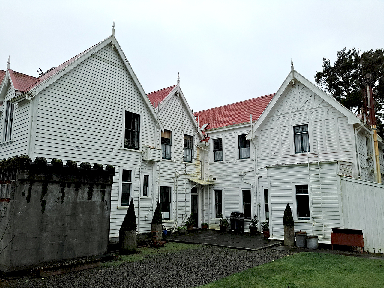
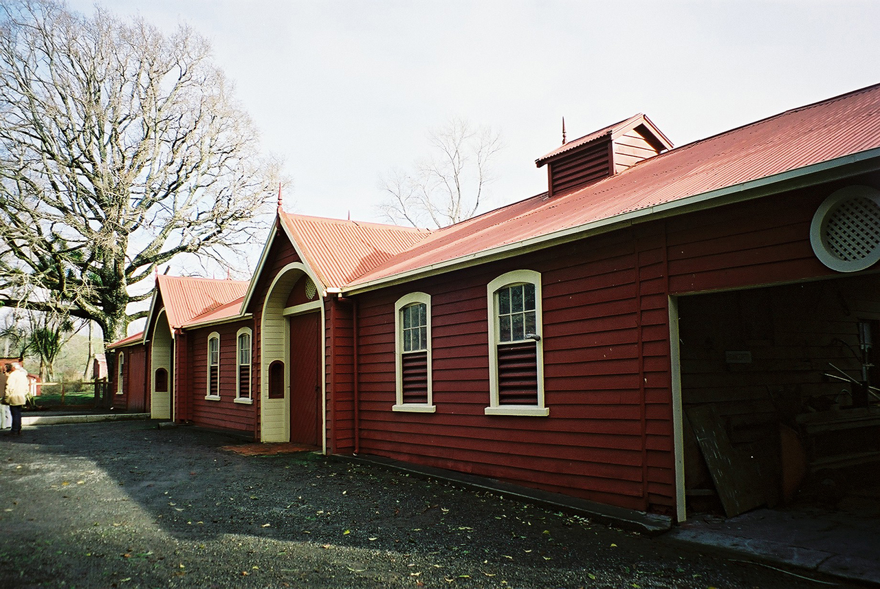
The much-reduced Brancepeth was further broken up by a government-imposed purchase of over 2,200 hectares in 1914. Further reductions after World War II mean that the Brancepeth of today - more like a farm than the substantial station it once was - comprises less than 1,500 acres, while the vast area once covered by that name takes in more than 45 farms. Although much-reduced, the farm remains with the Beetham family, whose management has ensured that the colonial grandeur of the Brancepeth Homestead and its outbuildings continues to be maintained.