Gold mining is one of the major themes in New Zealand’s history, and Bendigo illustrates the importance of gold mining, and particularly bedrock quartz mining in nineteenth century Otago. Within Bendigo Quartz Reefs Historic Area, men mined the alluvial gravels and quartz bedrock, peppering the landscape with the evidence of their work. It was at Bendigo that Otago’s most significant and successful quartz mining syndicate was born in 1868 – the Cromwell Quartz Mining Company, the returns from the rich lode allowed the company’s founders to retire rich men.
Quartz mining has a boom and bust history and Bendigo is littered with the remains of both successful and unsuccessful claims. Quartz mining required money, men and equipment – the rock had to be mined, crushed, and treated to extract the gold. Such processing required large plants and buildings, as well as motive power such as water power and steam power using coal as fuel. Both alluvial mining and quartz bedrock mining left characteristic landscape effects: alluvial mining left its logical sequence of water races, reservoirs, sluicing faces, tailings and tail races, while quartz mining left shafts and adits, mullock heaps and battery sites. At Bendigo Reefs where there is a historic reserve, visitors can see the remains of alluvial mining and bedrock quartz mining, as well as the ruins of the associated townships, roads and residences.
The Bendigo Reefs Historic Area comprises the large Bendigo Historic Reserve and an area of land in private ownership. The historic reserve takes in the main cluster of quartz mining sites, while the area in private ownership includes the archaeological sites associated with the Rise and Shine alluvial sluicing claim.
In 2014, the Bendigo Historic Reserve is a popular attraction for heritage tourists, and along with the wider Bendigo Reefs Historic Area, provides interpretation and understanding of the importance of bedrock quartz mining in Otago’s golden history.


List Entry Information
Status
Listed
List Entry Status
Historic Area
Access
Able to Visit
List Number
9097
Date Entered
26th February 2015
Date of Effect
27th March 2015
City/District Council
Central Otago District
Region
Otago Region
Extent of List Entry
This historic area consists of an area of land that contains a group of inter-related historic places. The identified historic places that contribute to the values in this historic area include Logantown, Welshtown, Bendigo Quartz Reefs and the associated archaeological sites, Rise and Shine claim and associated archaeological sites, Come In Time battery and associated archaeological sites. The area of land that encompasses these historic places includes part of the land described as Sec 12 SO 24641 (RT 417678), the land described as Secs 10, 21, 25, 31 SO 24641 (RT 201479, NZ Gazette 2000, p.4000) and Sec 32 Blk III Wakefield SD (NZ Gazette 1997, p.1785), and part of the land described as Legal Road, Otago Land District. (Refer to map in Appendix 1 and the full list of archaeological sites in Appendix 4 of the List entry report for further information).
Legal description
Sec 12 SO 24641 (RT 417678), Secs 10, 21, 25, 31 SO 24641 (RT 201479, NZ Gazette 2000, p.4000), Sec 32 Blk III Wakefield SD (NZ Gazette 1997, p.1785), Legal Road, Otago Land District
Location Description
Access to Bendigo Historic Reserve is off an extension of York Street, Bendigo. Turn off State Highway 8 onto Bendigo Loop Road, and then follow signposting to Bendigo Historic Reserve. Access to the Come In Time Battery and the Rise and Shine workings is via Thomson’s Gorge Road. This is a four wheel drive road and should not be attempted in winter or in adverse conditions.
Status
Listed
List Entry Status
Historic Area
Access
Able to Visit
List Number
9097
Date Entered
26th February 2015
Date of Effect
27th March 2015
City/District Council
Central Otago District
Region
Otago Region
Extent of List Entry
This historic area consists of an area of land that contains a group of inter-related historic places. The identified historic places that contribute to the values in this historic area include Logantown, Welshtown, Bendigo Quartz Reefs and the associated archaeological sites, Rise and Shine claim and associated archaeological sites, Come In Time battery and associated archaeological sites. The area of land that encompasses these historic places includes part of the land described as Sec 12 SO 24641 (RT 417678), the land described as Secs 10, 21, 25, 31 SO 24641 (RT 201479, NZ Gazette 2000, p.4000) and Sec 32 Blk III Wakefield SD (NZ Gazette 1997, p.1785), and part of the land described as Legal Road, Otago Land District. (Refer to map in Appendix 1 and the full list of archaeological sites in Appendix 4 of the List entry report for further information).
Legal description
Sec 12 SO 24641 (RT 417678), Secs 10, 21, 25, 31 SO 24641 (RT 201479, NZ Gazette 2000, p.4000), Sec 32 Blk III Wakefield SD (NZ Gazette 1997, p.1785), Legal Road, Otago Land District
Location Description
Access to Bendigo Historic Reserve is off an extension of York Street, Bendigo. Turn off State Highway 8 onto Bendigo Loop Road, and then follow signposting to Bendigo Historic Reserve. Access to the Come In Time Battery and the Rise and Shine workings is via Thomson’s Gorge Road. This is a four wheel drive road and should not be attempted in winter or in adverse conditions.
Why is this place significant?
Historic Significance
Historical Significance or Value Bendigo Quartz Reefs Historic Area has historical significance as the preeminent quartz mining area in Otago, and as an area that tells the story of 1860s alluvial mining through to the Depression mining of the 1930s. Gold mining is one of the major themes in New Zealand’s history and has had a great impact on the New Zealand landscape. Central Otago was one of the principal areas of mining (along with the West Coast and the Coromandel). The history of the area plays out the initial optimism of the 1860s and the enthusiasm for quartz mining in the 1870s. The mining strike of 1881 is a significant moment in the labour history of New Zealand.
Physical Significance
Aesthetic Significance or Value The Bendigo Quartz Reefs Historic Area is located on the lower slopes of the northern face of the Dunstan Range with panoramic views to the Upper Clutha Valley to the mountain ranges beyond Lakes Hawea and Wanaka. The historic area is set in the stony outcrops and semi-alpine landscape. The location is not only scenic but gives a strong feeling of isolation, emphasising the ‘ghost town’ feeling of the reserve. All these factors give the Bendigo Quartz Reefs Historic Area special aesthetic significance. Archaeological Significance or Value The Bendigo Quartz Reefs Historic Area has archaeological significance. Contained within its boundary are scores of sites which illustrate almost the entire mining history of Bendigo – the sites represent alluvial mining, sluicing, quartz mining, residence sites and mining townships. The numerous stone building ruins within the Bendigo Reefs Historic Area provide evidence of nineteenth century vernacular stone construction methods. The sites have the potential to yield valuable archaeological information on the lifeways of miners and their families. This is one of the best and most accessible sites in Otago that illustrates quartz mining archaeology. Technological Significance or Value The Bendigo Quartz Reefs Historic Area has technological significance. The mining remains illustrate most stages of nineteenth century quartz mining technologies – prospecting on reefs, open costeens (surface trenches), shallow workings and deep shafts, as well as water races and reservoirs for the water power necessary to power the batteries. The historic area includes battery sites – including the restored Come In Time battery, that show the technology associated with hard rock quartz mining. This is the best and most accessible example of quartz reef mining in Otago and provides insight into the mining technologies.
Why is this place significant?
Historic Significance
Historical Significance or Value Bendigo Quartz Reefs Historic Area has historical significance as the preeminent quartz mining area in Otago, and as an area that tells the story of 1860s alluvial mining through to the Depression mining of the 1930s. Gold mining is one of the major themes in New Zealand’s history and has had a great impact on the New Zealand landscape. Central Otago was one of the principal areas of mining (along with the West Coast and the Coromandel). The history of the area plays out the initial optimism of the 1860s and the enthusiasm for quartz mining in the 1870s. The mining strike of 1881 is a significant moment in the labour history of New Zealand.
Physical Significance
Aesthetic Significance or Value The Bendigo Quartz Reefs Historic Area is located on the lower slopes of the northern face of the Dunstan Range with panoramic views to the Upper Clutha Valley to the mountain ranges beyond Lakes Hawea and Wanaka. The historic area is set in the stony outcrops and semi-alpine landscape. The location is not only scenic but gives a strong feeling of isolation, emphasising the ‘ghost town’ feeling of the reserve. All these factors give the Bendigo Quartz Reefs Historic Area special aesthetic significance. Archaeological Significance or Value The Bendigo Quartz Reefs Historic Area has archaeological significance. Contained within its boundary are scores of sites which illustrate almost the entire mining history of Bendigo – the sites represent alluvial mining, sluicing, quartz mining, residence sites and mining townships. The numerous stone building ruins within the Bendigo Reefs Historic Area provide evidence of nineteenth century vernacular stone construction methods. The sites have the potential to yield valuable archaeological information on the lifeways of miners and their families. This is one of the best and most accessible sites in Otago that illustrates quartz mining archaeology. Technological Significance or Value The Bendigo Quartz Reefs Historic Area has technological significance. The mining remains illustrate most stages of nineteenth century quartz mining technologies – prospecting on reefs, open costeens (surface trenches), shallow workings and deep shafts, as well as water races and reservoirs for the water power necessary to power the batteries. The historic area includes battery sites – including the restored Come In Time battery, that show the technology associated with hard rock quartz mining. This is the best and most accessible example of quartz reef mining in Otago and provides insight into the mining technologies.
Construction Details
Start Year
1864
Type
Original Construction
Description
Rise and Shine Company’s claim at Rise and Shine Creek
Start Year
1868
Type
Original Construction
Description
Cromwell Quartz Mining Company’s claim registered
Start Year
1869
Type
Original Construction
Description
Logantown established
Start Year
1871
Type
Other
Description
Aurora, Colclough and Alta claims abandoned or worked on tribute
Start Year
1875
Type
Original Construction
Description
Welshtown established
Start Year
1910
Type
Other
Description
Cromwell Gold Mines Development Company formed and mines briefly
Type
Other
Description
Charles Todd mines at Specimen Gully
Period
1930s
Construction Materials
Schist, iron, timber
Construction Details
Start Year
1864
Type
Original Construction
Description
Rise and Shine Company’s claim at Rise and Shine Creek
Start Year
1868
Type
Original Construction
Description
Cromwell Quartz Mining Company’s claim registered
Start Year
1869
Type
Original Construction
Description
Logantown established
Start Year
1871
Type
Other
Description
Aurora, Colclough and Alta claims abandoned or worked on tribute
Start Year
1875
Type
Original Construction
Description
Welshtown established
Start Year
1910
Type
Other
Description
Cromwell Gold Mines Development Company formed and mines briefly
Type
Other
Description
Charles Todd mines at Specimen Gully
Period
1930s
Construction Materials
Schist, iron, timber
The Bendigo area, located high on the arid Dunstan Range in Central Otago, was not an inviting place to live. Bendigo was not used as a significant camping area or as a source of food by Maori greenstone parties heading to and from the main pounamu areas of Wakatipu and the West Coast from Moeraki. According to the Department of Conservation, however, when William Rees bought the first flock of sheep over what would later be called 'Thomsons Pass', he followed an established Maori trail. It is likely that this was a 'back up' route used when the Clutha was in flood and the Gorge became impassable. Gold mining is one of the major themes in New Zealand’s history and has a ‘great impact on New Zealand landscape.’ Central Otago was one of the principal areas of mining (along with the West Coast and the Coromandel). Mining took two forms – alluvial gravels and quartz bedrock mining. In Central Otago, one of the most important areas of quartz bedrock mining was at the Bendigo reefs, nearby modern day Cromwell. Quartz mining required money, men and equipment – the rock had to be mined, crushed, and treated to extract the gold. Such processing required large plants and buildings, as well as motive power such as water power and steam power using coal as fuel. Both alluvial mining and quartz bedrock mining left characteristic landscape effects: alluvial mining left its logical sequence of water races, reservoirs, sluicing faces, tailings and tail races, while quartz mining left shafts and adits, mullock heaps and battery sites. At Bendigo Reefs where there is a historic reserve, visitors can see the remains of alluvial mining and bedrock quartz mining, as well as the ruins of the associated townships, roads and residences. Alluvial and Quartz Mining at Bendigo Mining at Bendigo followed on from the rush to Cromwell Gorge in 1862 that saw prospectors swarming the hills and gullies looking for gold. Historian Lloyd Carpenter writes that the find caused ‘some miners to coalesce into a restless mass, swarming across the province, flitting from one field to the next. Whole towns of tin and canvas were dismantled or erected ‘according to the collective whim of this mob.’ Miners explored the foothills, gullies and ridges of the Dunstan Range and surrounding countryside looking for the dream of El Dorado – one of these areas was the rocky barren Dunstan foothills that became known as Bendigo after the Bendigo goldfields in Victoria, Australia. The first references to mining in this general area were at Rocky Point and Amisfield Burn around September 1863, but the field at what became Bendigo seems to date from late 1864. Bendigo is close to the Rocky Point Ferry, established to allow safe passage for miners coming inland from the port of Oamaru via the Lindis Pass. It was also alongside the Thomson Pass between the Maniototo and the Upper Clutha. The earliest primary source reference to ‘Bendigo Gully’ is in the police Occurrences Book in September 1864, while the earliest newspaper reference is February 1865. Water and gold shaped the landscape – all mining needed water: alluvial mining and sluicing brought water to claims to wash out the gold bearing gravels, while the later hard rock miners needed water to power their stamper mills that crushed the ore. Water consequently allowed the field at Bendigo to be opened up. In the headwaters of Bendigo Creek, at Rise and Shine Creek, a group of Scandinavian sluicers set up a claim and built a race that would bring water to Bendigo. In December 1864, Christian Hansen and his Swedish compatriots known as the Rise and Shine Company, applied to bring 12 heads of water westwards into the headwaters of Bendigo Creek. The increase in flow meant that downstream and through the hills at Bendigo claims could be worked that would have defeated earlier miners – this was crucial to the development of quartz mining at the Bendigo Reefs. While linked to Bendigo by gold and by water, the Rise and Shine Company’s claim was isolated on the pass between the Maniototo and the Upper Clutha. This was a long lasting and successful claim that gave rise to its own settled community. The Otago Witness reported in 1881 that ‘The Rise and Shine sluicing party have been at work for many years in their claim nearly at the summit of the Dunstan Range. Their claim has always and is now paying good wages, and a more isolated and better-contented party of miners cannot be found in New Zealand. With their wives and families they form a small, select, and happy community.’ This was one of the longest running sluicing claims in Otago. The claim finally wound up in the 1890s after sluicing magnate John Ewing purchased a share in the claim and took over most of the water right. The Rise and Shine Company’s claim has left a cluster of stone residences, sluicing faces, dams and water races on the landscape, a reminder of this significant undertaking that opened up the Bendigo reefs to other miners. Down Bendigo Creek at the rocky outcrops overlooking the Clutha River, surveyor Coates made his first official report on the Bendigo quartz reefs in 1865, where over 100 miners worked. By 1866, most of the easily won alluvial gold had been won, and groups of miners worked together to work the harder ground – syndicates such as the Aurora, that built another race to bring water in from Devil’s Creek. Other miners left, drawn by the call of gold to other fields such as the West Coast. From the river gravels, miners looked to the rocky outcrops of the Bendigo hills, turning their eyes to the gold contained in quartz. Quartz bedrock mining was expensive, requiring substantial investments of time and money. Syndicates were formed to prospect Bendigo’s quartz reefs. Early efforts were not successful - the first quartz mining company, the Bendigo Quartz Mining Company formed by a group of Dunedin businessmen, applied for a 16 ½ acre (6.7 hectare) lease, but failed to find a payable reef. Prospectors Thomas Logan and Jack Garrett were to have more luck. Logan, who had mined at Ballarat and Bendigo in Victoria, had followed the call of gold to the Cromwell area in 1863, working on the river terraces of Clutha, Lowburn and Kawarau. He also prospected for auriferous quartz in Tinkers, Blacks and Thompson’s Gully, before arriving in Bendigo in mid-1866. He found a promising reef and invited Jack Garrett to develop his claim, and the pair registered their quartz claim in July 1866. The pair lived on the edge of financial ruin and on the beneficence of the storekeeper, until joined by another partner, Brian Hebden. Hebden’s extra money allowed the company to develop the claim. Prospecting the area, they knew they had found good stone. Another serious investor was needed to take the next step, to buy a quartz stamper mill, the water rights to drive it, men to run it and to build a road to the claim. Canadian George Goodger was just the man. Experienced in goldfields in California and Victoria, he had moved to Cromwell in 1862, where he had continued mining, became involved in local politics and indulged his entrepreneurial spirit. The Cromwell Quartz Mining Company The new company, the ‘Cromwell Quartz Mining Company’ (‘Cromwell Company’) was registered in July 1868. They bought a stamper battery and water wheel from Hindon and moved it to Bendigo, then started to process stone. Rumours of great wealth began circulating shortly afterwards – followed by Vincent Pyke’s announcement that ten day’s crushing had yielded triple the most profitable yield per ton previously declared by any Otago quartz enterprise. When the Aurora Syndicate found a reef parallel and to the north of the Cromwell Company reef, more prospectors came to Bendigo. The Cromwell Company’s Bendigo mine ‘proved to be the richest in Otago.’ The three surviving shareholders (Garrett died in 1869) retired wealthy men. By 1869-70, Bendigo had become ‘famous as a quartz mining area.’ Logantown and Welshtown By 1869, a bustling town had grown up on the flat ground between Logan’s and Colclough’s reefs. The town became known as Logantown, after resident Thomas Logan. There were stores, hotels, a butcher and a baker, as well as a clothier and a blacksmith. Five hotels were open by 1871. Another population centre, known as Welshtown, developed further up the hill. McKay’s 1876 map of the Bendigo Reef shows Welshtown with its houses, gardens, and huts and stables. By the end of the 1870s, all residents were directly or indirectly dependent on the Cromwell Mining Company’s operations. The early 1870s hinted at the declining returns that would mark the later years of the nineteenth century and the early twentieth century. In 1871, with the exception of the Cromwell Quartz Mining Company, the local quartz companies reported poor returns, rising development costs and demands from shareholders. In the face of such threats to profitability, the company dropped wages. The miners at the four main companies (Aurora, Colclough, Aurora and Alta) expressed their concern and threatened to strike, but in the end capitulated and accepted the reduced rate. The money saving efforts did not rescue the companies from falling returns, and with the exception of the Cromwell Quartz Mining Company, each claim was abandoned or worked on tribute (working the mine for a percentage of the value of the ore raised) by the end of 1871. In 1876, the Cromwell Quartz Mining Company was registered as a public company, with 12,800 shares of £6 each. The major shareholders were Borthwick Baird (who had purchased Hebden’s holding), Goodger and Logan, with Dunedin businessmen making up the remaining shareholders. The mining operation was also reorganised, the Aurora battery (sold by the defunct Aurora Company) was moved to the main shaft, where two houses were built nearby – an office and residence of the manager and a store. Charles Todd was appointed as the new manager. The company erected another steam-powered battery in June 1878, and it was operating in early December, the company employing seventy men by early 1880. Shortly, though, falling gold returns would affect operations. In March 1880, the Cromwell Argus reported that the company was planning to raise less stone, and concentrate on milling selected stone nearby, aiming to maintain returns while reducing production costs – the company laid off 40 men, and then, failing to find good stone, reduced the miners’ wages. The miners went out on strike in June 1881. By July 1881, the dispute was bitter, and the manager issued trespass notices to all miners who had dwellings built on the company’s mining lease. If the dwellings were not moved, miners who remained on the land would pay rent equivalent to a day’s wages. Miners received a hand-delivered letter instructing them to move their house within six days – the company’s lease was over half the settlement of Welshtown. One miner A. McKenzie wrote to the Dunedin Herald, ‘Few of us had any means of paying rent for the privilege of living in our own houses, and were compelled to pull them down, and carry the timber and iron thereof elsewhere. Many of these cottages were substantial structures. While the work of demolition was going on, a most sickening spectacle met my gaze. In one of the doomed tenements resided a very delicate young mother, with a little firstborn babe, who had to gather up her little all while her husband’s mates carry the roof of his comfortable house and placed it on other walls for the poor invalid’s reception. The sight made many shudder… and yet with barefaced impudence the Cromwell Company asked for and obtained police protection while they carry on the work of spoliation… Such conduct as the above should make the company stink in the nostrils of miners so long as it has an existence…these facts will help throw Irish evictions and landlord terrorism in the shade.’ The strike ended in August 1881, with the company agreeing to retain the 10 shillings a day wage for miners working at the mine face, with other workers forced to accept a cut to 9 shillings a day. The strike left a legacy of ill feeling, and signalled the ultimate demise of mining at Bendigo. Historian Lloyd Carpenter writes that the strike ‘tore the small Central Otago community apart, featuring scenes reminiscent of Highland Clearance and Irish Land League struggles, with armed police, the destruction of houses and the eviction of families.’ This was not the first miner’s strike (there was a struggle between coal miners and employers in Kaitangata in 1873), but Carpenter writes, that at ‘over nine weeks in length, it was the longest and arguably the most bitter mining strike in nineteenth century Otago.’ He argues that it was significant ‘for the way nineteenth-century tensions between landowner and tenant reminiscent of an earlier British era were suddenly and cruelly manifest in the new gold-made colonial Otago. The events shocked everyone with their suddenness, brutality and the extremity of the positions adopted by all sides.’ For many years, the subject was painful for local people, the descendants of both the strikers and the employers, and it is only recently that more than a passing account has been written. In the timeline of New Zealand’s labour relations history, it is significant that the 1881 strike at Bendigo was ten years before the gold miners at Thames and Waihi first organised a union, three years before the West Coast coal miners were organised, and nine years before the seminal Maritime Strike of 1890. Returns fell and gold production was relatively low in the following years. There was not the money to open up new areas for development. Share values fell and in January 1884, the Cromwell Company went into receivership. The company was sold in December 1884, with the plant, lease, water rights and races, and buildings sold to a Dunedin syndicate for only £1,075, less than the cost of a second-hand quartz battery. The company was restructured again in 1898 as the Cromwell Proprietary Mining Company, but was not successful and the mine closed in 1900. At the end of 1901, the mine was let on tribute. The rights of the Matilda battery tailings were sold to the Bendigo Tailings Syndicate, who intended to treat the tailings using the cyanide process. By 1903, both the work in the mine, and the work at the tailings had ceased. In 1904, the Cromwell Mine Syndicate let the mine out again, and then sold it to J. Stevenson of the Dunedin Engineering Works who intended to use the water right and races to sluice the terraces along Bendigo Creek. Sluicing continued until 1907. In the early years of the twentieth century, the Cromwell Mining Company ran out of rich stone, and the mine was abandoned, as were the settlements of Logantown and Welshtown. The townspeople dismantled and shifted the hotels. Anything of value was removed; buildings were left as stone shells. In 1910, the Cromwell Gold Mines Development Company was formed, with the intention of driving low level adits to intersect with the existing shaft. In the end this company also failed, and the mine and plant were offered for sale in 1913. Charles Todd, son of the mine manager from 1878-1883 – and a founding member of the Todd motoring dynasty, revived the mining in the early 1930s. Todd drove horizontally from Specimen Gully into the Cromwell Company Mine, completing a 2,300 foot (701 metre) adit, with the assistance of a Government Unemployment Board subsidy. But, ultimately, mining ended at Bendigo, leaving the traces on the landscape recalling the work and lives of the miners and companies on their alluvial and quartz bedrock claims. The mining sites (with their hazardous adits) were absorbed into Bendigo Station until the tenure review process began in the 1980s that identified the historic values of the area, and land was set aside in recognition of the mining history. The importance of the Bendigo reefs and its rich wealth of history was recognised when the area was gazetted as a historic reserve in 1997, and further expanded in 2000. The initial boundaries of the reserve were influenced by the Mines Inspector of the day who would not let the Lands and Surveys Department have areas that he believed still had good gold deposits. In recent years, the area has attracted a different visitor – people interested in the golden history of the Bendigo reefs. Carpenter writes that Bendigo (as a gold mining location) is ‘iconic’ in both New Zealand and Australia, and ‘unique to the pioneer ‘goldfields narratives’’ of both countries as a place where ‘tough and manly miners created a viable community under the twin pressures of a harsh environment and oppressive officialdom.’ In New Zealand, Bendigo in Central Otago was more a talisman, as Carpenter writes, a ‘touchstone for good fortune’. Walking tracks guide visitors through the dramatic landscape, and clear of the many mining shafts, dotted amidst the rocks and vegetation. In 2014, Bendigo Reefs Historic Area is a site of dramatic beauty, and remains an attraction to those interested in goldfields history.
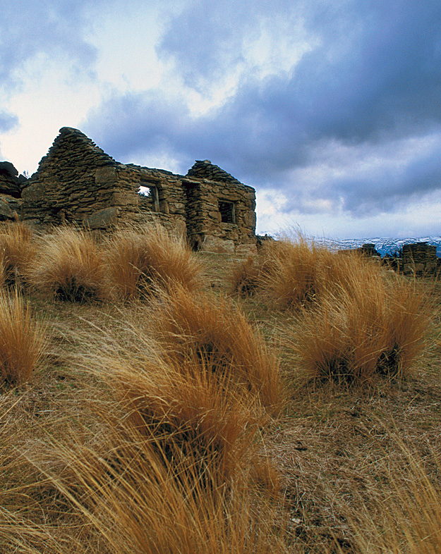
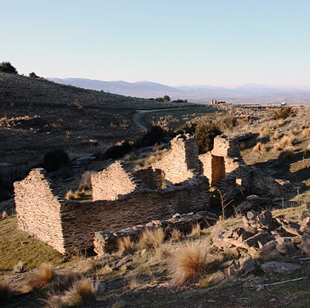
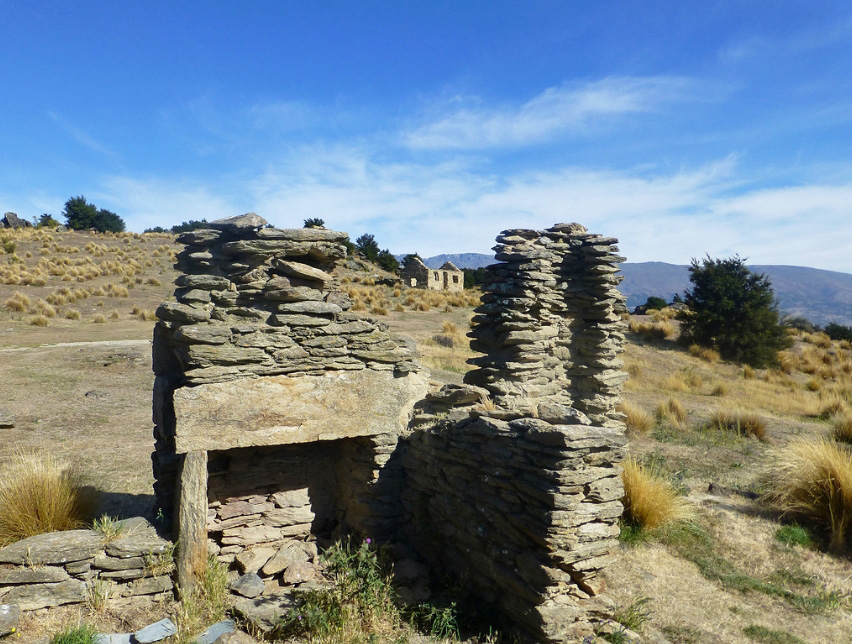
Current Description Setting Bendigo Quartz Reefs Historic Area is situated on the north side of Dunstan Range overlooking the upper Clutha Valley and Lake Dunstan. The Dunstan Range is characterised by its rocky outcrops that make it a spectacular landscape. The Dunstan Range is recognised by Central Otago District Council as an outstanding natural landscape. The elevated areas at Bendigo are recognised as ‘a ‘distinctive feature of the upper portion of Lake Dunstan’ The ‘rock landscape’ with its ‘semi-arid schist outcrops provide visual context for future development in this locality.’ Lloyd Carpenter writes that the Bendigo Historic Reserve ‘is a spectacularly beautiful place of stone ruins, abandoned cottages and mining detritus scattered across a quintessential Central Otago landscape.’ He believes the landscape is ‘significant in terms of its archaeology, history and its important position in the Central Otago gold rush narrative. The location of the richest quartz mine in nineteenth-century Otago, its relative ease of access by car, the number and variety of well-preserved standing structures, the size of the reserve and its enduring appeal to photographers and heritage tourists all make Bendigo important in terms of the region’s golden past. Stone house ruins, rock shelters, hotel sites, adits, shafts, mullock piles and quartz battery foundations are scattered across the 1,085 hectare reserve all testifying to the work of alluvial and quartz miners, sluicers and dredgemen from 1862 to the 1930s.’ The Historic Area The historic area comprises the large Bendigo Historic Reserve and an area in private ownership. The historic reserve takes in the main cluster of quartz mining sites, while the area in private ownership includes the archaeological sites associated with the Rise and Shine claim. The plan below shows the location of the historic reserve and other associated historic sites. The boundaries of the Bendigo Quartz Reefs Historic Area reflect the historic mining activity. The historic area includes the sites associated with the Rise and Shine claim. These sit in the catchment of the Rise and Shine Creek close to Thomson Gorge Road. Following down Rise and Shine Creek, are the battery and mining sites associated with the Eureka, Alta and Come In Time operations. Rise and Shine Creek joins Bendigo Creek, which provided water for the Bendigo Reefs claims. The densest cluster of archaeological sites is around the reef systems close to Logantown and Welshtown where the majority of quartz mining companies had their claims. Listed in Appendix 4 are the recorded archaeological sites in the historic area. Because of the complexity of the sites, it is not possible to detail them all. The main sites and representative examples of the type of remains associated with Bendigo mining are described below. Historic Places The many archaeological sites associated with gold mining around the Bendigo Reefs cluster around the mining claims. They are a mix of quartz mining sites (battery sites, shafts, adits, talus heaps), building remains (including hut sites, rock shelters, business sites, mining buildings, and rock enclosures), and alluvial mining sites (including water races, sluicing faces, dams and paddocking). The nature of the mining has meant that these sites are somewhat mixed together and it can be difficult to identify what site is related to what claim or activity, particularly in the main cluster of sites close to Logantown and Welshtown. The descriptions that follow identify the types of sites associated with Bendigo Reefs, rather than providing definitive descriptions of the many sites. The settlements: Welshtown and Logantown Welshtown and Logantown were never surveyed townships but informal settlements built to service the gold miners located close to the claims that were working. Logantown sits on a larger level plateau, with the site marked by the archaeological remains of the commercial structures and residences of the township shown by the building outlines, foundations and depressions. Sites such as stone enclosures show miners fencing in areas of land for gardening or animal keeping. By 1869, it was a thriving town. The first business erected was James Beare’s store, followed by other stores, hotels, a butcher and a baker. There were seven hotels by early 1870. Pioneering prospector Thomas Logan lived there, giving his name to the settlement. This was Logantown at its heyday; thereafter it declined and by 1878 consisted of a hotel, butchery and a few huts. Welshtown is the higher of the two settlements, sitting on a level plateau amidst the rocky outcrops close to the Cromwell Quartz Mining Company’s main workings. By 1875, it was the main population centre – with houses, gardens, huts, and stables. The location is marked by a number of stone cottage ruins, among the most photographed ruins in Otago’s goldfield sites. The roofless stone ruins give an idea of the residence sites of the miners and their families. Other sites, such as the ruins of Pengelly’s House, show the more substantial miner’s accommodation. Cromwell Quartz Mining Company Sites There are a large number of sites associated with the Cromwell Quartz Mining Company’s operations at the Bendigo Reefs. These include the mining operations – the shafts, adits, battery sites and talus heaps; buildings associated with the operations – including the remains of the company office, the manager’s residence, explosives magazines; and structures such as forges. The plan below shows the complexity of the mining system (Figure 7). The Cromwell Quartz Mining Company’s claim was the only profitable claim at Bendigo. Theirs was the only reef system that was consistently remunerative and it was this mine that was, as archaeologist Peter Bristow wrote, ‘almost the sole source of encouragement for quartz mining at Bendigo.’ The 1895 Mines Statement reported that this was the only Otago mine that paid significant dividends to its shareholders –it was believed that as much as £400,000 was paid out. As the average wage was only £200, this was a ‘phenomenal’ income. But ultimately, this too failed. The Cromwell Quartz Mining Company’s claim covered 16 acres, so there are many mining remains associated with the claim. Among the most notable are the remains of the company’s office and manager’s house site, and the main mining shaft. The office is a stone ruin sitting at the edge of the dray road that wound through the claim, beside it are steps built into the hillside. The manager’s house was downhill from the office, but located on an elevated platform, overlooking the main shaft. The main shaft, battery sites, mullock heaps, and associated other mining remains sit below the manager’s house. There are many other stone ruins, including explosive magazines, adits, forges and revetted road. Hand drill holes for blasting are also evident in the rock. Mining Sites around the Aurora Creek Catchment The Aurora Creek area, located east of Logantown, saw both alluvial and quartz bedrock mining. There are the remains of alluvial mining – paddocking with its bumps and hollows as the creek widens out of its rocky gorge. These alluvial tailings from ‘paddocking’ are located close to Aurora Creek. Paddocking meant working a claim systematically through a series of shallow pits. The topography and the form of the Aurora reef govern the pattern of mining, and the associated archaeological remains. According to Geoffrey Duff, the Aurora Reef was discovered by Edward Barnes and party in 1866. With John Perriam of Lowburn, Barnes and party formed the Aurora Company to work the reef, but it was not until 1870 that crushing could begin. The company bought a six head stamper mill from Arrowtown and constructed a race to bring water across from Devil’s Creek. The Aurora operated successfully for four years before the good stone began to run out, and was let on tribute for a period after this. The company went into liquidation and its assets were sold to Cromwell Quartz Mining Company. Photographs below show some of the Aurora sites. Near to the Aurora claim is the Lucknow Reef. Charles Colclough discovered the Lucknow reef in 1869. It is some 275 metres north of the Aurora. In 1870, a small company was formed to work the reef. A battery was erected, but returns were disappointing. Exploratory mining continued until around 1877, when work ceased and the plant was closed. The remains of Colclough’s stamper mill site can be seen as well as an adit, typical of quartz mining sites. Roads and Water The Bendigo Reefs are located in steep country – riven with gullies and scattered with rocky outcrops. This made the ordinary need for transporting equipment and ore around the fields even more difficult. Dray roads were important, providing access to battery sites and claims. Companies, such as the Hit or Miss Company, constructed their own roads to their claims. Below is a photograph of the Hit or Miss Company’s road, notable for its revetting and for its stone bridge over the creek. Water storage was also vitally important for mining operations at Bendigo Reefs. Water races and dams provided water for the claims. Below is a photo of a stone dam close to Pengelly’s Hotel ruin. Rise and Shine Creek and Bendigo Creek Mining Sites With quartz bedrock mining battery sites were the centre of mining operations. For such heavy equipment, batteries moved surprisingly often – they were moved to new claims or new sites, or sold and removed when the good rock ran out. There are several battery sites within the Bendigo Quartz Reefs Historic Area. Below is a plan showing the battery sites around the Rise and Shine and Bendigo Creek regions at the north end of the historic area. The Come In Time battery sits in a steep gully through which runs Rise and Shine Creek. Two other battery sites are nearby – the Eureka and the Alta. The Eureka site is a terrace, left by the battery installation. A revetted road, tramway and water race are associated with the Eureka battery. The five-stamp Eureka battery was moved to the Come In Time site in 1880. It was fed with ore via a tramway and a steel rope from the drive on the hill. In 1902, the battery was shifted back to the Alta claim on Bendigo Creek. There are shafts and adits associated with the Alta battery, as well as a forge, and hut remains. The Come In Time battery has two separate water systems and two sets of drives, and has probably had batteries erected twice on the same foundations. One water system was a race on the true right of Shepherds Creek, the other from the old Eureka race. Further up the Rise and Shine Creek are the alluvial mining sites associated with the Rise and Shine claim. It was this claim, and the water it brought into the headwaters of Bendigo Creek, that enabled the more intensive mining at the Bendigo Reefs. The alluvial workings at Rise and Shine include ground sluicing faces and areas of amorphous tailings. Water races and associated dams provide further evidence of the mining systems associated with the claim. Hydraulic sluicing produces its own landscape revealing the mining process, showing, as archaeologist Kevin Jones describes the ‘headwaters collection and reticulation to the work face; the sluicing face itself; and methods for disposing of the sluiced water, the gravels it contained and the boulders that the sluice water could not shift.’ The earliest method was ground sluicing where water flooded the surface of a terrace, and it was broken up with a pick and shovel, and the silt and gold transported to races and riffle boxes. Archaeologist Jill Hamel states that virtually all of the alluvial workings date from the 1860s. The ruins of stone cottages also remain, providing evidence of the life of miners in this isolated place.
Historical and Associated Iwi / Hapū / Whānau
Public NZAA Number
G41/165
Completion Date
11th February 2015
Report Written By
Heather Bauchop
Information Sources
Bristow, 1997
Peter Bristow, ‘A Brief History of Mining at the Bendigo Historic Reserve’, Unpublished report, Department of Conservation, August 1997
Hamel, 1993
Jill Hamel, ‘The Rich Fields of Bendigo’, February 1993, Unpublished report. Copy held Heritage New Zealand Otago/Southland Area Office
Other Information
A fully referenced New Zealand Heritage List report is available on request from the Otago Southland Office of Heritage New Zealand. Please note that entry on the New Zealand Heritage List/Rārangi Kōrero identifies only the heritage values of the property concerned, and should not be construed as advice on the state of the property, or as a comment of its soundness or safety, including in regard to earthquake risk, safety in the event of fire, or insanitary conditions.
Historical and Associated Iwi / Hapū / Whānau
Public NZAA Number
G41/165
Completion Date
11th February 2015
Report Written By
Heather Bauchop
Information Sources
Bristow, 1997
Peter Bristow, ‘A Brief History of Mining at the Bendigo Historic Reserve’, Unpublished report, Department of Conservation, August 1997
Hamel, 1993
Jill Hamel, ‘The Rich Fields of Bendigo’, February 1993, Unpublished report. Copy held Heritage New Zealand Otago/Southland Area Office
Other Information
A fully referenced New Zealand Heritage List report is available on request from the Otago Southland Office of Heritage New Zealand. Please note that entry on the New Zealand Heritage List/Rārangi Kōrero identifies only the heritage values of the property concerned, and should not be construed as advice on the state of the property, or as a comment of its soundness or safety, including in regard to earthquake risk, safety in the event of fire, or insanitary conditions.
Current Usages
Uses: Civic Facilities
Specific Usage: Historic or recreation reserve
Uses: Cultural Landscape
Specific Usage: Industrial/mining landscape
Former Usages
General Usage: Accommodation
Specific Usage: Cave/rock shelter
General Usage: Accommodation
Specific Usage: Hotel
General Usage: Accommodation
Specific Usage: Hut/shack
General Usage: Accommodation
Specific Usage: Stables - Residential out-building
General Usage: Accommodation
Specific Usage: Wall/Fence
General Usage: Agriculture
Specific Usage: Wall/Fence
General Usage: Maori
Specific Usage: Ara - pathway connecting tribal areas and resource sites
General Usage: Mining
Specific Usage: Alluvial Workings
General Usage: Mining
Specific Usage: Battery/Crusher
General Usage: Mining
Specific Usage: Mine - Adit
General Usage: Mining
Specific Usage: Mine - Open Cut
General Usage: Mining
Specific Usage: Mine - Shaft
General Usage: Mining
Specific Usage: Mine - Underground
General Usage: Mining
Specific Usage: Mine buildings
General Usage: Mining
Specific Usage: Mine reservoir/ dam
General Usage: Mining
Specific Usage: Mine road/ track
General Usage: Mining
Specific Usage: Mine Tailings
General Usage: Mining
Specific Usage: Mine Water Race/ Water Race cuttings/tunnels etc
General Usage: Mining
Specific Usage: Mining & Mineral Processing - other
General Usage: Mining
Specific Usage: Mining camp/settlement/housing
General Usage: Mining
Specific Usage: Mullock heap
General Usage: Mining
Specific Usage: Sluicing Hole/Area
General Usage: Transport
Specific Usage: Bullock/dray track
Current Usages
Uses: Civic Facilities
Specific Usage: Historic or recreation reserve
Uses: Cultural Landscape
Specific Usage: Industrial/mining landscape
Former Usages
General Usage: Accommodation
Specific Usage: Cave/rock shelter
General Usage: Accommodation
Specific Usage: Hotel
General Usage: Accommodation
Specific Usage: Hut/shack
General Usage: Accommodation
Specific Usage: Stables - Residential out-building
General Usage: Accommodation
Specific Usage: Wall/Fence
General Usage: Agriculture
Specific Usage: Wall/Fence
General Usage: Maori
Specific Usage: Ara - pathway connecting tribal areas and resource sites
General Usage: Mining
Specific Usage: Alluvial Workings
General Usage: Mining
Specific Usage: Battery/Crusher
General Usage: Mining
Specific Usage: Mine - Adit
General Usage: Mining
Specific Usage: Mine - Open Cut
General Usage: Mining
Specific Usage: Mine - Shaft
General Usage: Mining
Specific Usage: Mine - Underground
General Usage: Mining
Specific Usage: Mine buildings
General Usage: Mining
Specific Usage: Mine reservoir/ dam
General Usage: Mining
Specific Usage: Mine road/ track
General Usage: Mining
Specific Usage: Mine Tailings
General Usage: Mining
Specific Usage: Mine Water Race/ Water Race cuttings/tunnels etc
General Usage: Mining
Specific Usage: Mining & Mineral Processing - other
General Usage: Mining
Specific Usage: Mining camp/settlement/housing
General Usage: Mining
Specific Usage: Mullock heap
General Usage: Mining
Specific Usage: Sluicing Hole/Area
General Usage: Transport
Specific Usage: Bullock/dray track
Location
Sign up to hear more
Get the latest heritage news, features and events delivered
straight to your inbox.