Tangata Whenua
Ōrua-pouanui, near the entrance of Te Whanganui-a-Tara, the great harbour of Tara, commemorates the den or retreat (‘rua’) of Pouanui. There is a cave in the rockface below the present-day lighthouse which may be Pouanui’s refuge and the landmark whose name was later used to describe the entire headland. Tribal narratives describe the great Polynesian explorer Kupe as the first person to visit Aotearoa New Zealand and he spent time in what became the Wellington region, naming places in and around the harbour before returning home to Hawaiki.
Following permanent settlement, the harbour was named after the rangatira Tara, son of Whātonga, the captain of the migratory waka Kurahaupō. Tara and his brother Tautoki travelled down the east coast of Te-Ika-a-Māui from Māhia, past Rangiwhakaoma (Castlepoint) and round Ōkoriwa (Palliser Bay) to reach Parangarahu (Fitzroy Bay) and Te Whanganui-a-Tara (Wellington). Tara’s people were known as Ngāi Tara and they occupied the east and south coast of Wellington, while Tautoki and his people settled around Upper Hutt and east into Wairarapa. His descendants were known as Rangitanē after his son of this name. Tautoki is associated with Parangarahu, a pā located on the plateau above present-day Fitzroy Bay a little north of Ōrua-pouanui. From Parangarahu a watch could be kept on the harbour and the pā was close to kaimoana and the eel lagoons of inland lakes Kōhangapiripiri and Kōhangatera.
In the seventeenth century Ngāti Ira migrated south from Hawke’s Bay and intermarried with Ngāi Tara and Rangitanē to become the dominant iwi. Ngāti Kahungunu also had a presence in the area. Ngāti Ira was supplanted in the 1820s and 1830s by Te Ātiawa, Ngāti Tama and Ngāti Mutunga, all of whom who came south from Taranaki during a period of great upheaval associated with the introduction of Pākehā muskets into te ao Māori. Ngāti Mutunga first settled in Waikanae on the Kāpiti coast, while Ngāti Tama kept travelling south and established themselves at Tiakiwai (in present-day Thorndon). Ngāti Mutunga joined them, inhabiting the western side of the harbour. Together, they established the people of Taranaki in Te Whanganui-a-Tara. At first, they lived alongside Ngāti Ira but a battle between Ngāti Mutunga and Ngāti Ira in the late 1820s resulted in the latter’s gradual ejection from Te Whanganui-a-Tara.
Waikato and Ngāti Maniapoto incursions into Taranaki in the early 1830s promoted a further wave of migration south. The 1831 invasion of Pukerangiora Pā on the Waitara River was disastrous for Te Ātiawa and many people left Taranaki in the migration Te Heke Tamateuaua. Te Ātiawa first settled at Waikanae and were then invited to join Ngāti Mutunga at Pito-one (Petone). The Ngāti Mutunga rangatira Putukawenga gifted Waiwhetu, the land east of Heretaunga (Hutt River), and Whiorau (Lowry Bay) to Te Ātiawa. This allowed Te Ātiawa to form a strong base in Te Whanganui-a-Tara. When Ngāti Mutunga and Ngāti Tama people migrated to Rēkohu (Chatham Islands) in 1835, their land rights around the harbour were transferred to Te Ātiawa. In 1839 Te Ātiawa and Ngāti Kahungunu made peace, with Ngāti Kahungunu occupying Wairarapa and Te Ātiawa Te Whanganui-a-Tara.
Occupation of Ōrua-pouanui and environs
Ōrua-pouanui itself is unlikely to have been permanently settled but it was close to the kāinga of Parangarahu, located on the coast in Fitzroy Bay below the ancient pā of the same name. Pouanui’s cave, which extends into the headland by around 30 metres, was used as a shelter during food gathering expeditions along the coast. On the edge of the cliff above the cave was a burial site, reputedly that of a woman, who had been covered with rocks and boulders.
Parangarahu was a seasonal fishing village, and its inhabitants were also horticulturalists, building stone walls to protect crops. Following organised Pākehā settlement, Māori were ‘active participants in rural industry’ - wheat was grown, and the stone walls may have been extended as the amount of land under cultivation increased to supply the Pākehā market, including in New South Wales, Australia.
Ōrua-pouanui was initially claimed as a public reserve by the British Crown following the New Zealand Company’s much disputed 1839 purchase of Te Whanganui-a-Tara. However, it was included within the 4,700 acre Parangarahu Block (also known as Wainuiomata) awarded to Te Ātiawa in 1847 by William McCleverty, who had been appointed to convince Māori to exhange their cultivations for other land after the New Zealand Company sold land under cultivation to Pākehā settlers. Pākehā settlement also brought another name for Ōrua-pouanui - William Wakefield of colonising firm the New Zealand Company named it Baring Head, after one of the company’s directors Francis Baring. The traditional name was officially restored in 2009 by the Taranaki Whānui ki Te Upoko o Te Ika Deed of Settlement.
Baring Head/Ōrua-pouanui remained in Te Ātiawa ownership until the early decades of the twentieth century, though was leased to Pākehā farmers for most of that period. Henare Te Puni and Mawene Hohua of Petone ran sheep in the area in the late 1860s. In 1913, 198 acres of the Parangarahu 1A block was apportioned to Rangiwhaia te Puni and immediately transmitted to her children, as she had passed away. The land was leased to her daughter Ema Te Puni and her Pākehā husband Frederick Morrison, and Ema inherited the entire block as whānau passed away. Ema herself died in May 1920; not long prior she sold the land to William Cruickshank, a sheep farmer of Masterton.
Lighthouse Complex
In 1859 the country’s first lighthouse was opened at nearby Pencarrow Head. In 1930 the government announced that Pencarrow was to be replaced with a new lighthouse at Baring Head, which was at a higher elevation outside the main dangers of the harbour and thus more visible to ships approaching these hazards. Pencarrow was often swathed in fog and by this period its fixed light was dulled by night-time light pollution from Wellington city across the harbour.
William Cruickshank owned the land until 1940 but appears to have informally sold it to runholder Eric Riddiford years earlier, as Riddiford was publicly lauded for gifting the land for the new lighthouse. He was repaid by the construction of a government-funded bridge to his land over the Wainuiomata River. While it was first thought that it would be possible to access the site from the sea, the steep cliffs surrounding the site made that impossible and instead an overland route from Wainuiomata was formed. The road and bridge were constructed between 1931 and 1932.
While the bridge and access road made it possible to construct the lighthouse, it also meant that supplies and equipment for the future running of the lighthouse could be supplied by road rather than sea, as had been the case at Pencarrow. In the decades that followed their construction, the road and bridge were the subject of regular correspondence about their physical condition. The road was frequently damaged by weather events and needed repair, including regular grading and metalling. The bridge also required regular repairs. On one occasion, in 1956, the bridge was entirely submerged by a flood. Barely a year went by in the post-Second World War period when either the road or bridge did not need attention.
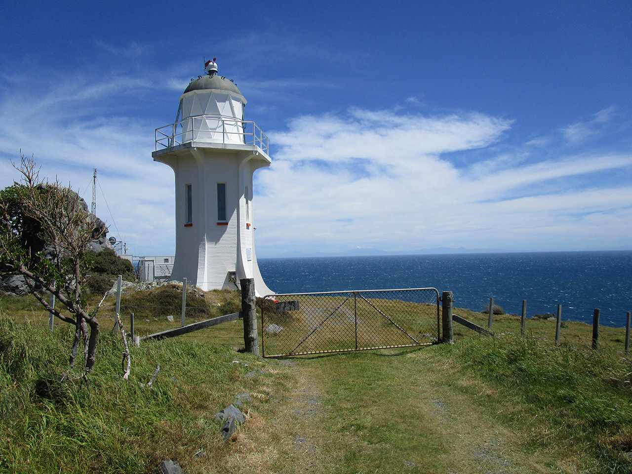
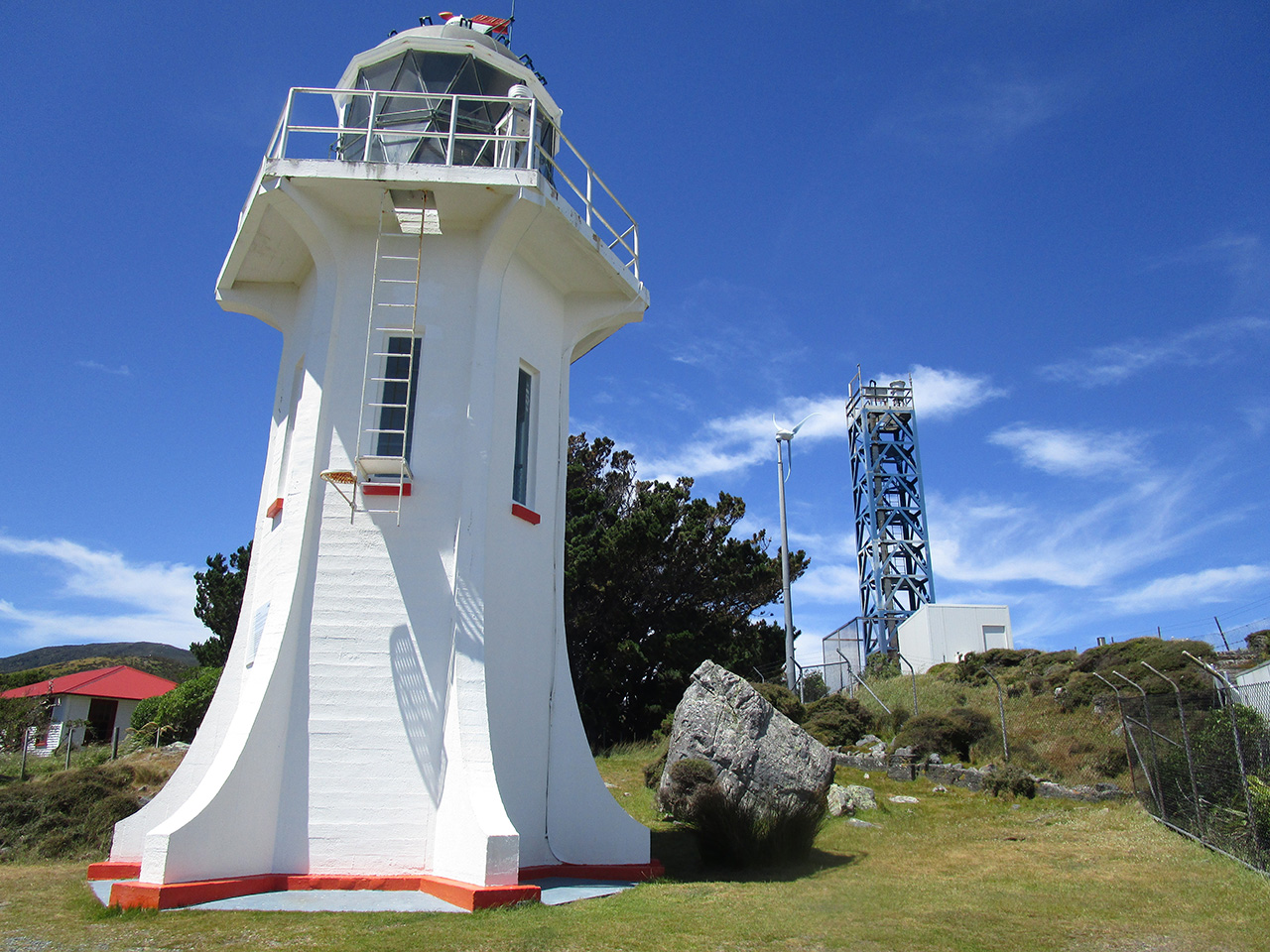
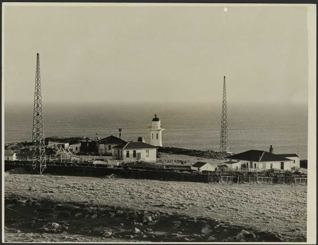
Baring Head was the country’s first fully electrified lighthouse and was powered by diesel-generated electricity. It was to be a ‘much more up-to-date affair’ than its predecessor at Pencarrow. The 12-metre-high tower was made of reinforced concrete and sat 85 metres above sea level. Construction began in 1934. Stability was a paramount consideration, and the final site was slightly east of the original planned location after solid foundations could not be found on digging 2.5 metres down. Work temporarily ceased in the winter of 1934 because the wind was so strong, the contractor J. Jackson stating ‘I have known times when you could hardly stand up again the wind they get out here, and there is no chance to work in such conditions’.
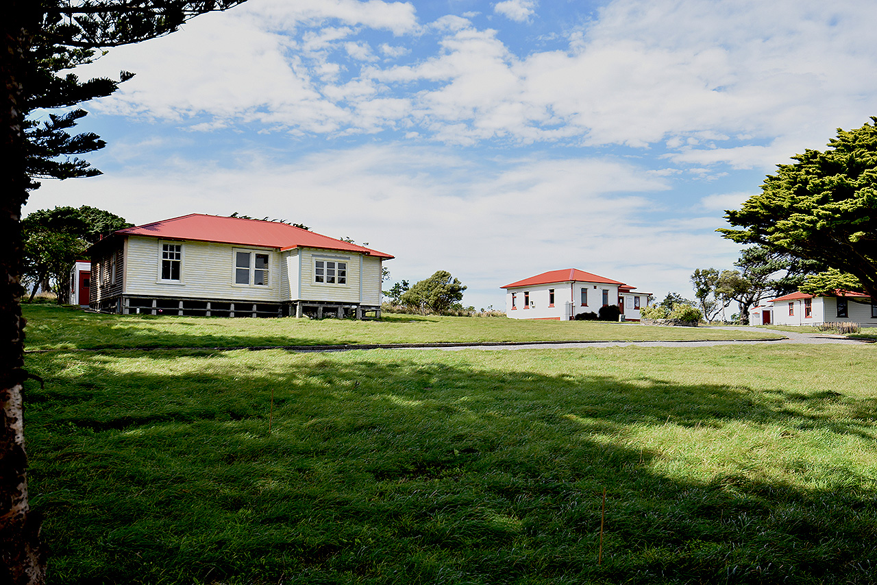
As well as the lighthouse, the complex consisted of two timber keepers’ houses in the typical state house style of the era with outbuildings (1934) for the head and assistant keepers and their families, a concrete powerhouse containing the diesel generator (1935), a garage and outbuildings. The keepers’ houses were identical, each having three bedrooms and a living room, drawing room, scullery, bathroom, washhouse and outhouse. The interiors were ‘tastefully papered and panelled and a number of built in cupboards and wardrobes [lent] an atmosphere of compact comfort to the buildings’. The powerhouse was designed in a domestic rather than utilitarian style, which contributed to the village-like appearance of the lighthouse complex. Two diesel engines were installed in the powerhouse in April 1935 which generated power for the lighthouse, the keepers’ houses and a radio beacon. The first principal keeper Bob Wilson spent many hours planting a shelter belt around the complex and built a rockery in front of the powerhouse.
The lighthouse was first lit on 17 June 1935. Unlike Pencarrow, with its fixed light ‘which does not conform to the best modern practice’, Baring Head’s light flashed, making it more recognisable as a maritime safety light. The lighthouse radio beacon was the second to be installed in the country and enabled ships with the necessary equipment to locate their position when out of sight of the light and during foggy conditions. On the same day Baring Head was lit, the light at Pencarrow was extinguished. Baring Head was the second-to-last lighthouse built in the country and was followed by Cape Rēinga in 1941.
Lighthouse Keeping
Baring Head was different to most other lighthouse stations in its proximity to urban areas and relatively easy accessibility by land. Electrification meant keepers were not required to keep a 24-hour watch on the light, as was the case with kerosene-powered lighthouses, making the job less onerous. The powerhouse was equipped with two diesel generators, the second of which started automatically in the event of the first one breaking down. The head and assistant keepers tested, monitored and cleaned the lighthouse equipment, undertook regular maintenance on the complex, including the houses, and operated the radio beacon. Assistant keeper Thomas Smith, who was stationed at Baring Head from 1945-1947 wrote ‘with no night watches or weather reporting Baring Head was an easy station: apart from routine powerhouse and tower duties, most of our time was spent outdoors and we deplored the fact we were, in the main, groundsmen, not Lighthouse keepers!’ From 1951 there was only one keeper at Baring Head.
A school was briefly established at the station in 1950, with seven pupils enrolled at the time. However, this arrangement only lasted that year, and the children of keepers were sent to school in Wainuiomata. They walked to the Wainuiomata Coast Road, where they would be picked up by the school bus. Despite Baring Head’s proximity to civilisation, an emphasis was placed on self-sufficiency, as was the norm at other stations. Land adjacent to the station was set aside – and fenced – for cows (for milking) plus a few sheep.
The lighthouse’s closeness to Wellington also made it attractive to visitors. In the early 1960s keeper Bill Kemp regularly took ‘school groups, trampers, rock climbers and people interested in our way of life’ around the complex. In his words, ‘when head office [of the Marine Department] had any VIPs to show a lighthouse to they would invariably come to Baring Head. It happened quite often so the station had to be up to scratch’. Participating in maritime safety operations was another regular task. The last lighthouse keeper Steve O’Neill (keeper from 1976-1989) took part in 86 search and rescues during his 12-year career at Baring Head.
Since Baring Head ‘first demonstrated the efficiencies of electrification’ in 1935, a nationwide process of lighthouse automation and ‘demanning’ of stations had been in train. At the end of the Second World War there were 61 lightkeepers; this declined to 51 in 1955 and 39 in 1969. From the early 1970s technological developments reduced the ‘once-critical importance of lighthouses’, and lighthouse equipment was increasingly monitored remotely. By 1981 there were 21 keepers, including at Baring Head. The lighthouse was remotely automated and demanned in October 1988 and Steve O’Neill and family, the last of the lightkeepers, left in January 1989.
Second World War
Baring Head/Ōrua-pouanui became part of the country’s coastal defence network in 1935 when a concrete observation post and small concrete barracks were built 500 metres inland from the lighthouse and 166 metres above sea level. They were associated with the Palmer Head Battery west of Baring Head/Ōrua-pouanui on the other side of Wellington Harbour, which was part of a nationwide effort to upgrade coastal defences in main centres against a backdrop of rising tensions in Europe.
The observation post was seldom used until the outbreak of the Second World War (1940-1945), when it was brought into constant service. The existing barracks was too small, so in 1941 this was converted into a wireless room and a larger timber barracks was built nearby, as was an ablutions block. Another small concrete building, probably an engine room that powered the wireless room, was constructed next to this. A pump house was built on the Wainuiomata River and supplied water to a concrete storage tank near the barracks and wireless room. Members of the Women’s Auxiliary Army Corps (WAAC) staffed a naval signal station in front of the lighthouse and were housed nearby in a purpose-built timber barracks.
The military complex was staffed for the duration of the war. The observation post barracks were dismantled in 1946, leaving only the concrete foundations and chimney, and the WAAC barracks was similarly dismantled. The Department of Scientific and Industrial Research took over the main naval signal station building in 1946 and used it for an experimental radar station. From 1954 it was used by the Royal New Zealand Airforce before being sold for removal to the Wainuiomata Girl Guides in 1960.
Clean Air Station
In 1972, Dave Lowe of the Institute of Nuclear Sciences set up an atmospheric carbon dioxide (CO2) monitoring station at Baring Head Ōrua-pouanui. He had been taking samples at Makara on Wellington’s west coast since 1970 but his samples were contaminated by the photosynthesis of local vegetation, and he needed a cleaner site. One-third of Baring Head’s wind came from the south and had not recently crossed land, making it a more suitable location. Lighthouse keeper Alan Martin showed him a small concrete building in front of the lighthouse near the edge of the cliff that was a surviving component of the naval signal station. The building had mains power and was ideally situated for southerly winds.
As early as 1973 it was clear that Baring Head/Ōrua-pouanui was an excellent location for CO2 monitoring, Lowe writing ‘during [that] winter there were a lot of southerly gales with an exceptional amount of baseline data…This baseline CO2 data was the gold standard we were aiming for….’ Lowe conducted pioneering work from the station, ‘making the first ever continuous baseline atmospheric carbon dioxide (CO2) measurements in the southern hemisphere’ (and the second in the world) and confirming the negative impact of human activity on the climate. He was a lead contributor to the Intergovernmental Panel on Climate Change, which won the Nobel Peace Prize in 2007. The station remains in operation and contributes vital data to global studies on climate change.
Regional Park
In 1979 public land in the vicinity of Baring Head/Ōrua-pouanui was formed into what became known as the East Harbour Regional Park. Following the final automation of the lighthouse, the Greater Wellington Regional Council (Greater Wellington) took over management of the keepers’ houses in 1992, hoping to use them as park ranger accommodation, but accessing the houses through private land proved difficult and they remained unoccupied for years. In 2010, following a public campaign, a consortium consisting of the Greater Wellington, the Department of Conservation, the Hutt City Council, the Nature Heritage Fund and a private benefactor purchased 284.6 hectares adjacent to the lighthouse complex, land which included the Second World War observation post and associated buildings and the pumphouse. This purchase provided access to the lighthouse complex but Greater Wellington proposed demolishing the houses due to maintenance and security costs. Former lighthouse keepers Bill Kemp and Steve O’Neill advocated for their retention, with Kemp arguing ‘the [ex]keepers I have spoken to are all in favour of [the complex] being retained…and renovated.’
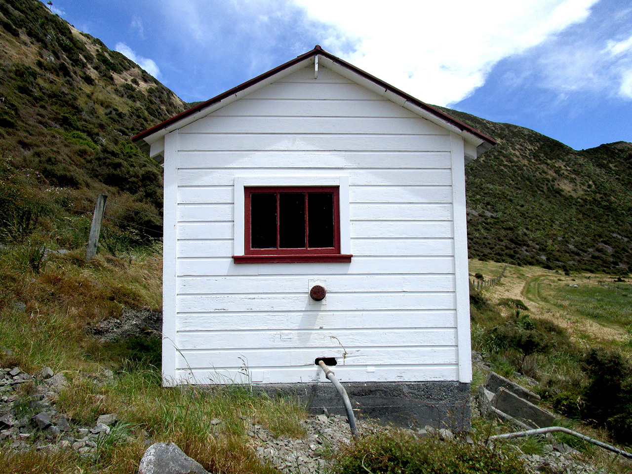
In 2011 the Friends of Baring Head Charitable Trust was created to support the GWRC’s stewardship of Baring Head Ōrua-pouanui. The tourism potential of the lighthouse complex was increasingly recognised, and this helped to secure the future of the keepers’ houses. That year the 284.6-hectare block was declared a scenic reserve and Baring Head/Ōrua-pouanui (excluding the lighthouse and the NIWA station) became part of the East Harbour Regional Park in 2012. The Friends of Baring Head restored the Second World War pumphouse in 2012-13. The group undertook weed management and ecological restoration in the broader park and were involved in subsequent building restoration work, with Friends member Colin Ryder spearheading fundraising campaigns supported by a Greater Wellington project team.
Greater Wellington commissioned a heritage strategy, landscape plan and other building-related studies. In 2017 the powerhouse roof was replaced, followed by the house roofs in 2018. Some of the buildings were painted in 2019-2020. After considerable fundraising led by Colin Ryder, grants were obtained to research, develop and install interpretation in the powerhouse. This culminated in the opening of the Story Hub visitors centre in the restored powerhouse in February 2021. In line with Greater Wellington’s Toitū Te Whenua Parks Network Plan, the landscape around the lighthouse complex will be progressively restored with native vegetation, with features of historic value such as the rock garden succulents retained, while bookable overnight accommodation is planned for the station buildings. The lighthouse itself remains in service.