

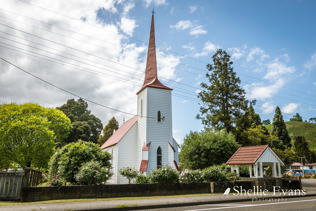
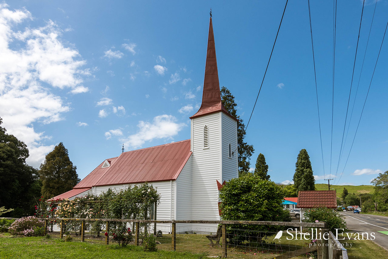
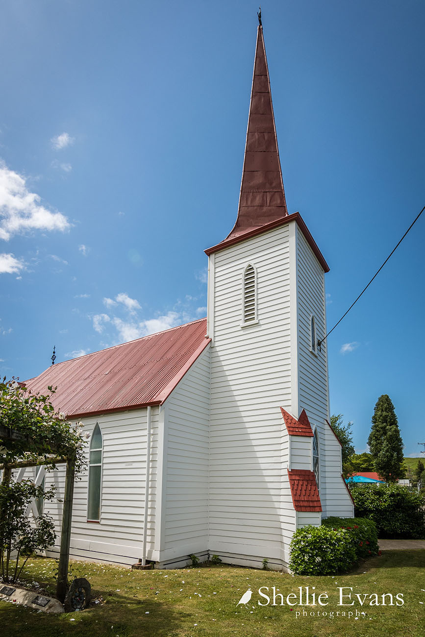
Among the many endowments are three stained glass windows imported from England by Mr & Mrs H. Montgomery in memory of their son, Archibald, who was drowned when the 'Avalanche' sank in the English Channel in 1877. The distinctive feature of St Mary's is its unusual spire which is designed to rise from four corners at the base to three giving the impression that the spire is leaning.
The church in its rural setting overlooking the Wanganui River is a landmark and a symbol of pioneer faith.
List Entry Information
Status
Listed
List Entry Status
Historic Place Category 1
Access
Private/No Public Access
List Number
163
Date Entered
22nd November 1984
Date of Effect
22nd November 1984
City/District Council
Whanganui District
Region
Horizons (Manawatū-Whanganui) Region
Extent of List Entry
Extent includes part of the land described as Pt Sec 163 Left Bank Wanganui River (RT WN349/278), Wellington Land District, the building known as St Mary’s Church (Anglican) and the lych gate thereon. Refer to the extent map tabled at the Board meeting on 27 June 2019.
Legal description
Pt Sec 163 Left Bank Wanganui River (RT WN349/278), Wellington Land District
Construction Details
Start Year
1877
Type
Original Construction
Construction Details
Start Year
1877
Type
Original Construction
Historical and Associated Iwi / Hapū / Whānau
Other Information
This place was identified as significant under previous legislation with different information requirements. It remains significant under the current legislation. There is opportunity under our legislation and policies to add to this information. Further information about this place may be available from the Central Regional Office of Heritage New Zealand Pouhere Taonga. Please note that entry on the New Zealand Heritage List/Rarangi Korero identifies only the heritage values of the property concerned, and should not be construed as advice on the state of the property, or as a comment of its soundness or safety, including in regard to earthquake risk, safety in the event of fire, or insanitary conditions. This historic place was registered under the Historic Places Act 1980. The following text is the original citation considered by the NZHPT Board at the time of registration. Information in square brackets indicate modifications made after the paper was considered by the NZHPT Board.
Current Usages
Uses: Religion
Specific Usage: Church
Former Usages
General Usage: Religion
Specific Usage: Church
Current Usages
Uses: Religion
Specific Usage: Church
Former Usages
General Usage: Religion
Specific Usage: Church
Location
Sign up to hear more
Get the latest heritage news, features and events delivered
straight to your inbox.
