

Tangata whenua settled in what is now Hawke’s Bay around 1250-1300 AD, particularly along its coast and inland waterways. The people who became known as Ngāti Kahungunu arrived in the 1500s. The Heretaunga plains comprised a system of wetlands, swamps and lakes, which, along with coastal fisheries and bush, provided rich sources of food, medicine and materials. Pākehā established whaling and trading stations in the region from the 1830s, and the government started purchasing land in the 1850s, most of which was leased or sold to settlers who established sheep or cattle stations. By 1859 almost 1.5 million acres of Hawke’s Bay’s land had been purchased from Ngāti Kahungunu.
In 1864 Hēnare Tomoana, a Ngāti Kahungunu and Ngāti Te Whatu-i-āpiti leader, leased the Heretaunga block of over 17,000 acres to Thomas Tanner. Tanner led a group known as the Twelve Apostles, which was found to have first illegally leased the land and then purchased it through persuasion and force in 1870. Ormond had acquired a share in this land, comprising 1,200 acres, and it became Karamu, one of 117 early Hawke’s Bay stations and regarded as ‘one of the best known racing studs in Australasia’.
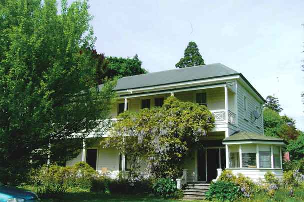
Hannah Richardson married Ormond in 1860 and Hannah wished to stay in town, leading to the construction of the family home Tintagel in Napier. It has been claimed that Hannah spent one night at Karamu and refused to spend another. Ormond, by contrast, spent his final years at both Tintagel and Karamu, visiting the latter on alternate days.
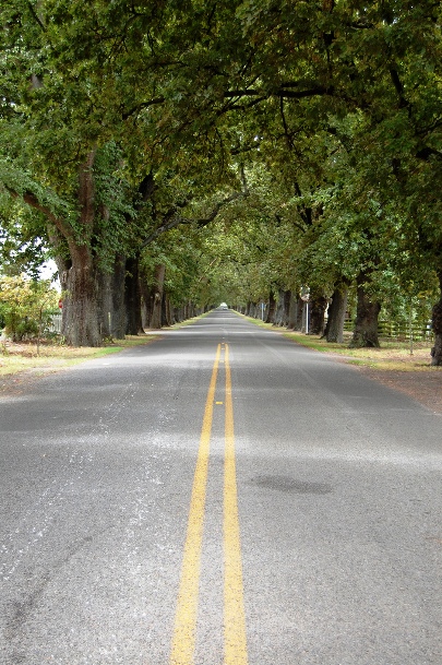
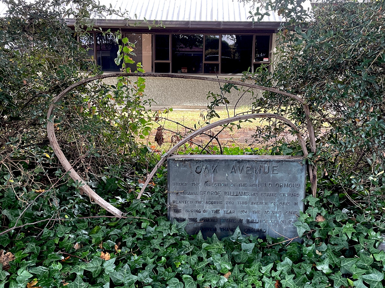
Early Pākehā settlers regarded the transformation of a wilderness into civilised land as progress, replacing native bush with farmland and English trees. In the spring of 1874, George Williams, Ormond’s estate steward, planted rows of oak trees along the driveway of Karamu; the acorns were from the Ormond estate at Wallingford on the River Thames, England. Planted amongst the more than 200 oaks were a smaller number of trees of other species.
It is not known when the Karamu driveway was deeded to the county council as an accessway but part of Karamu estate, including the land on either side of Oak Avenue, was subdivided in 1929 for two of Ormond’s sons, George Canning and John Davies. Most of the property had been sold in 1920, three years after Ormond’s death, and the farm, homestead and stables were left in the possession of Ormond’s son Francis (known as Frank).
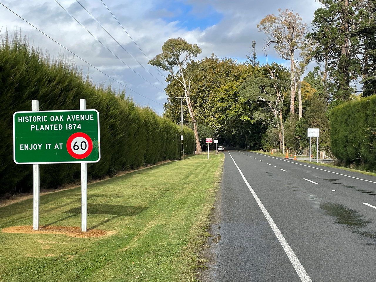
The avenue was tar-sealed and some of the oak trees were uprooted by a severe gale in 1939. Otherwise, Oak Avenue is little altered. As at mid-1985, the length of Oak Avenue was 1.4 kilometres and it comprised 211 English oak trees, interspersed with 41 elm trees, forty plane trees, three lime trees, four cedrus and three redwoods. In 1974 a plaque was erected to mark the centenary of the planting of the trees. In 1991 the condition of the trees raised concerns, leading residents to petition Hastings District Council to ban heavy traffic from the road; drought conditions were also blamed. A speed limit of 60 kilometres per hour was imposed. Considered to be ‘one of the most magnificent plantings of its sort in the country’, Oak Avenue is often advertised as a tourist destination
List Entry Information
Status
Listed
List Entry Status
Historic Area
Access
Able to Visit
List Number
7021
Date Entered
5th September 1985
Date of Effect
5th September 1985
City/District Council
Hastings District
Region
Hawke's Bay Region
Extent of List Entry
Extent includes part of the land described as Lot 21 DP 5268 (RT HB85/201), Hawkes Bay Land District, and the trees that form Oak Avenue thereon, extending 1.4 kilometres from the intersection with Omahu Road and 20 metres in width.
Legal description
Lot 21 DP 5268 (RT HB85/201), Hawkes Bay Land District
Construction Professional
Name
Williams, George
Type
Builder
Biography
Construction Details
Start Year
1874
Type
Other
Description
Original Planting
Start Year
1939
Type
Other
Description
Some trees uprooted by severe weather event
Start Year
1974
Type
Modification
Description
Plaque erected to mark centenary
Historical and Associated Iwi / Hapū / Whānau
Completion Date
29th April 2024
Report Written By
Natalie Marshall
Information Sources
MacGregor, 1970
Miriam MacGregor, Early Stations of Hawke's Bay, A.H. & A.W. Reed, Wellington, 1970
Boyd, 1990
Mary Boyd. ‘Ormond, John Davies’, Dictionary of New Zealand Biography, first published in 1990. Te Ara - the Encyclopedia of New Zealand, https://teara.govt.nz/en/biographies/105/ormond-john-davies
Rolleston, 1980
Rosamond Rolleston, The Master: J D Ormond of Wallingford: A Family Portrait, Reed Publishing, Wellington, 1980
Other Information
This place was identified as significant under previous legislation with different information requirements. It remains significant under the current legislation. There is opportunity under our legislation and policies to add to this information. Further information about this place may be available from the Central Regional Office of Heritage New Zealand Pouhere Taonga. A fully referenced copy of the Upgrade Report is available upon request from the Central Regional Office of Heritage New Zealand Pouhere Taonga Disclaimer Please note that entry on the New Zealand Heritage List/Rarangi Korero identifies only the heritage values of the property concerned, and should not be construed as advice on the state of the property, or as a comment of its soundness or safety, including in regard to earthquake risk, safety in the event of fire, or insanitary conditions. Archaeological sites are protected by the Heritage New Zealand Pouhere Taonga Act 2014, regardless of whether they are entered on the New Zealand Heritage List/Rarangi Korero or not. Archaeological sites include ‘places associated with pre-1900 human activity, where there may be evidence relating to the history of New Zealand’. This List entry report should not be read as a statement on whether or not the archaeological provisions of the Act apply to the property (s) concerned. Please contact your local Heritage New Zealand office for archaeological advice. Please note that entry on the New Zealand Heritage List/Rarangi Korero identifies only the heritage values of the property concerned, and should not be construed as advice on the state of the property, or as a comment of its soundness or safety, including in regard to earthquake risk, safety in the event of fire, or insanitary conditions.
Current Usages
Uses: Transport
Specific Usage: Road
Current Usages
Uses: Transport
Specific Usage: Road
Location
Sign up to hear more
Get the latest heritage news, features and events delivered
straight to your inbox.
