

Run 28 in the Waitaki Valley was leased to Samuel Pike in 1854, its original boundaries being Kurow and Otekaike Creek as far back as the Saint Mary Range. By 1855 Pike had transferred the run to John Parkin Taylor (1812-1875). Taylor sold the run to William Dansey. William Henry Dansey, youngest son of a scholarly rector, was educated at Exeter College, Oxford. He arrived in Port Chalmers in December 1854 and after visiting Port Nicholson and Nelson came to the Waitaki valley. Dansey had a house on Run 28 by early 1859. An 1861 survey plan shows a 92 acre block with house, stable and futtah, and an adjacent 11 acre block with ‘men’s house’ and woolshed.’ An 1865 sale notice provides more detail about the buildings: stone house, separate servants’ quarters, stone stable, carriage house, gardener’s cottage, two acres of garden, store, stockyards and next door a further 11 acres pre-emptive right with ‘a large well-built men’s stone HUT, with good dairy and coal-sheds’ and a ‘WEATHERBOARD WOOL-SHED, about 45 x 40 feet, with iron roof, and yards to work 10,000 sheep.’ Dansey’s efforts laid the foundation for the next runholder who would make the property one of the most significant in New Zealand.
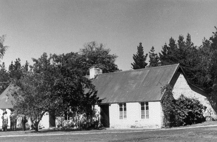
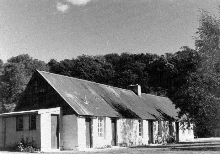
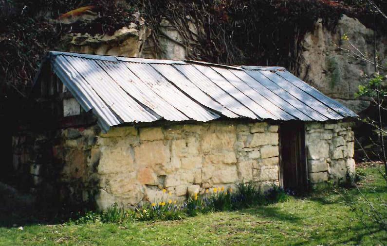
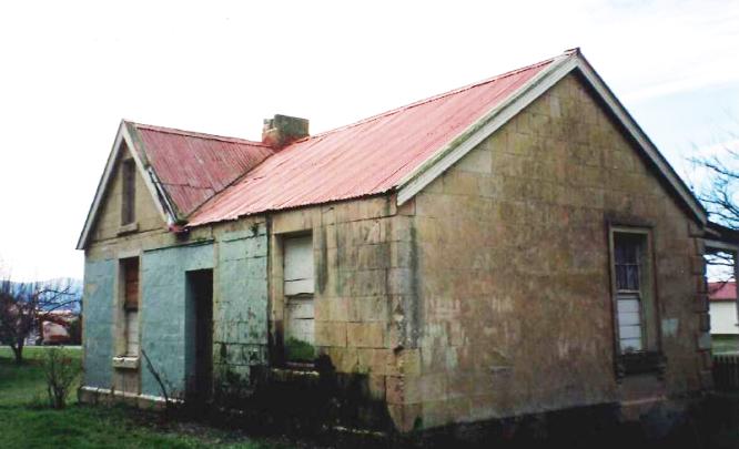
The descriptions match the existing building – so we presume that the ‘men’s house’ is that described in 1861, and that it is the same building as the ‘large well-built men’s stone HUT.’ Architect and historian Geoffrey Thornton describes the building as a ‘most pleasing example’ of the early use of limestone. The elongated single storey structure is built with locally quarried stone, and has a corrugated iron roof.
The property was sold to Robert Campbell in March 1865. Campbell was the Eton-educated son of a wealthy gentleman. Campbell also owned Galloway Station in Central Otago, Benmore Station near Omarama, and three Southland runs, and was a member of the House of Representatives. Campbell employed managers to look after the daily running of the station. W.H. Ostler was probably the first manager. Ostler was replaced by William Gilbert Rees at the end of 1868. Rees is a significant figure in Otago’s pastoral history, earlier being a partner of a huge station near what would become Queenstown, a large part of which was declared a Goldfield, to Rees’ disadvantage. Rees became a manager, first at Otekaieke and then across the Waitaki River at Station Peak. Malcolm McKellar became manager at Otekaieke in 1871.
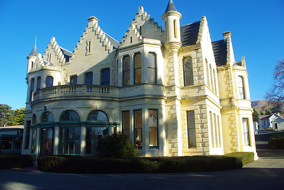
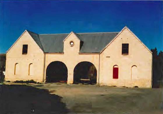
In the early years of the twentieth century Otekaieke Station was subdivided into seven small grazing runs, thirty seven farms and twelve smallholdings. Four properties were allocated as ‘preferential blocks’ and allocated to former employees of Robert Campbell and Sons Limited. Dickson (Dick) Jardine (the Company’s manager) was granted the homestead block – with the ‘large stone house, woolshed, scouring shed, blacksmith’s shop, men’s hut, cook house, two small cottages and a slaughter house. The adjoining grand homestead, stables and other buildings along with 342 acres of land was handed over the Education Department as a special school for boys.
Jardine sold the 5008 hectare property to William Munro in 1913. When Munro died in 1922 Otekaieke was run by his widow Jeannie and her foster son J. George McDonald, whose descendants still own the station. The lease specified the improvements – a dwelling, shearers’ quarters, tool shed; men’s quarters, woolshed, stable and barn, old shed, huts, yards, sheep-dip and fencing. In 2016, the Cookshop and Men’s Quarters remain a significant building on this historic pastoral property.
List Entry Information
Status
Listed
List Entry Status
Historic Place Category 2
Access
Private/No Public Access
List Number
2426
Date Entered
7th April 1983
Date of Effect
7th April 1983
City/District Council
Waitaki District
Region
Canterbury Region
Extent of List Entry
Extent includes part of the land described as Sec 117A Otekaieke Settlement (RT OT8A/800) Otago Land District, and the building known as the Otekaike Station Cookshop and Men’s Quarters, thereon, as shown in the extent map tabled at the Rarangi Korero Committee meeting on 9 March 2017.
Legal description
Sec 117A Otekaieke Settlement (RT OT8A/800), Otago Land District
Status
Listed
List Entry Status
Historic Place Category 2
Access
Private/No Public Access
List Number
2426
Date Entered
7th April 1983
Date of Effect
7th April 1983
City/District Council
Waitaki District
Region
Canterbury Region
Extent of List Entry
Extent includes part of the land described as Sec 117A Otekaieke Settlement (RT OT8A/800) Otago Land District, and the building known as the Otekaike Station Cookshop and Men’s Quarters, thereon, as shown in the extent map tabled at the Rarangi Korero Committee meeting on 9 March 2017.
Legal description
Sec 117A Otekaieke Settlement (RT OT8A/800), Otago Land District
Construction Details
Start Year
1860
startYearCirca
Type
Original Construction
Construction Details
Start Year
1860
startYearCirca
Type
Original Construction
Historical and Associated Iwi / Hapū / Whānau
Completion Date
13th December 2016
Report Written By
Heather Bauchop
Information Sources
Dictionary of New Zealand Biography
Dictionary of New Zealand Biography
McDonald, 1962
K C McDonald, 'White Stone Country', Oamaru, 1962
New Zealand Journal of History
New Zealand Journal of History
Pinney, 1981
R. Pinney, Early Northern Otago Runs, Auckland, 1981
Thornton, 1986
Geoffrey Thornton, The New Zealand Heritage of Farm Buildings, Auckland, 1986
Petchey, 2003
Peter Petchey, ‘Campbell Park Heritage Assessment: History and archaeology of Otekaieke Estate, grounds and gardens’, 2003
Other Information
This place was identified as significant under previous legislation with different information requirements. It remains significant under the current legislation. There is opportunity under our legislation and policies to add to this information. Further information about this place may be available from the Otago/Southland Office of Heritage New Zealand Pouhere Taonga. Please note that entry on the New Zealand Heritage List/Rarangi Korero identifies only the heritage values of the property concerned, and should not be construed as advice on the state of the property, or as a comment of its soundness or safety, including in regard to earthquake risk, safety in the event of fire, or insanitary conditions. A fully referenced upgrade report is available on request from the Otago/Southland Area Office of Heritage New Zealand.
Historical and Associated Iwi / Hapū / Whānau
Completion Date
13th December 2016
Report Written By
Heather Bauchop
Information Sources
Dictionary of New Zealand Biography
Dictionary of New Zealand Biography
McDonald, 1962
K C McDonald, 'White Stone Country', Oamaru, 1962
New Zealand Journal of History
New Zealand Journal of History
Pinney, 1981
R. Pinney, Early Northern Otago Runs, Auckland, 1981
Thornton, 1986
Geoffrey Thornton, The New Zealand Heritage of Farm Buildings, Auckland, 1986
Petchey, 2003
Peter Petchey, ‘Campbell Park Heritage Assessment: History and archaeology of Otekaieke Estate, grounds and gardens’, 2003
Other Information
This place was identified as significant under previous legislation with different information requirements. It remains significant under the current legislation. There is opportunity under our legislation and policies to add to this information. Further information about this place may be available from the Otago/Southland Office of Heritage New Zealand Pouhere Taonga. Please note that entry on the New Zealand Heritage List/Rarangi Korero identifies only the heritage values of the property concerned, and should not be construed as advice on the state of the property, or as a comment of its soundness or safety, including in regard to earthquake risk, safety in the event of fire, or insanitary conditions. A fully referenced upgrade report is available on request from the Otago/Southland Area Office of Heritage New Zealand.
Former Usages
General Usage: Accommodation
Specific Usage: Cookhouse
General Usage: Agriculture
Specific Usage: Staff/ Workers' Quarters
Former Usages
General Usage: Accommodation
Specific Usage: Cookhouse
General Usage: Agriculture
Specific Usage: Staff/ Workers' Quarters
Location
Related listings
Sign up to hear more
Get the latest heritage news, features and events delivered
straight to your inbox.
