

Te Tai Poutini - the West Coast - features prominently in the early Māori history of occupation in Aotearoa/New Zealand. Nohoanga, mahinga kai and mahinga toi were dotted along rivers and plains although only a few permanent kāinga were established at the western terminus of these long travel routes. When Pākehā began arriving in the area in nineteenth century, Māori played a key role in assisting newcomers with surveying, exploration and gold mining.
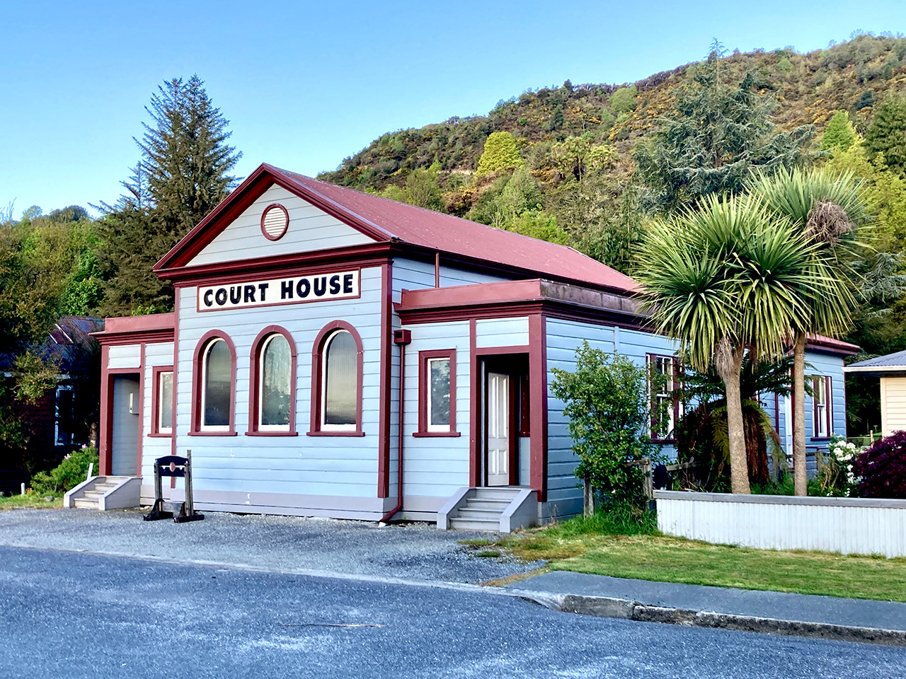
The gold rushes on the West Coast began in 1865 with quartz lodes or reefs being discovered in the Inangahua district in 1870. At the centre of this district was Reefton (the ‘Reef Town’), growing rapidly from the early 1870s. The district surveyor, George Woolley, laid out the town’s roads and drew up detailed plans of the various mine sites. In 1872 a Court House was built on the Camp Reserve of the newly formed Bridge Street. Next door, a dwelling house and Survey Office was constructed, possibly in two phases. The Survey Office component, at least, designed by Colonial Architect, W. H. Clayton, was constructed in late 1877. Just when the Clerk of the Court became associated with the building is not certain – it may have been from the start as Reefton had a Clerk of the Court from the early 1870s. However, various accounts suggest that it was the surveyor’s residence and that Woolley lived there.
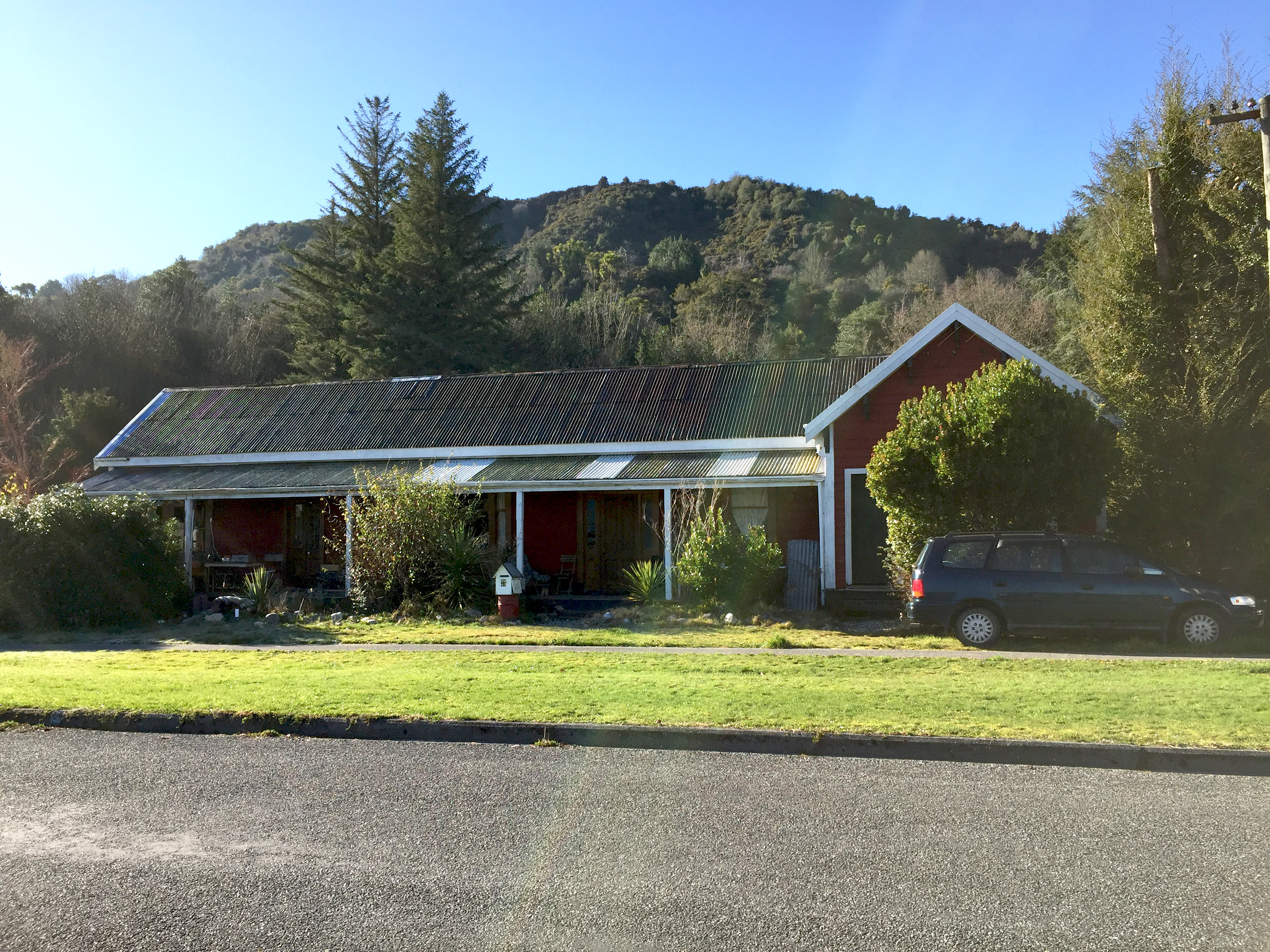
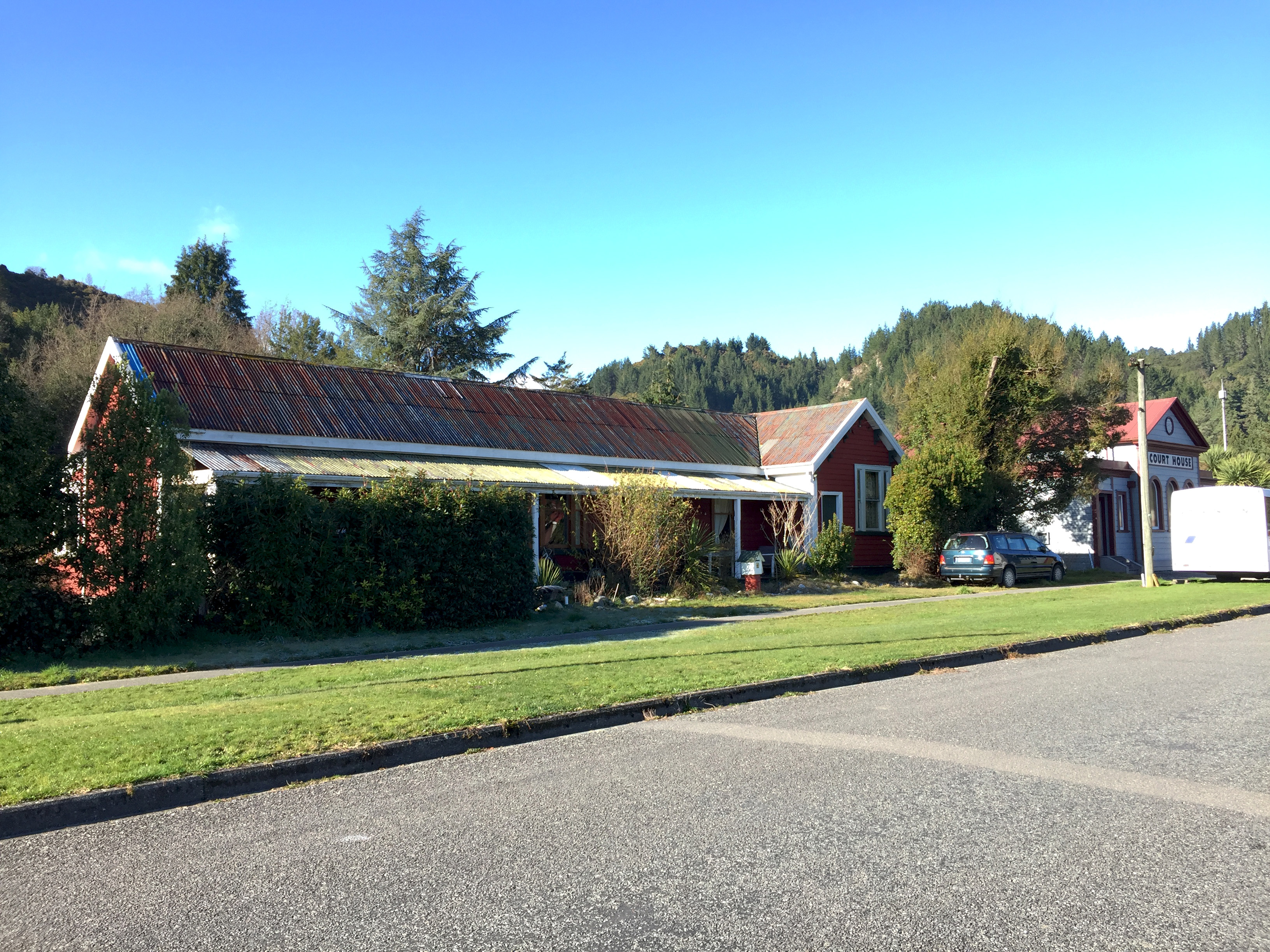
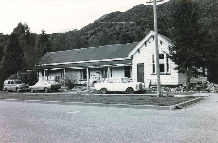
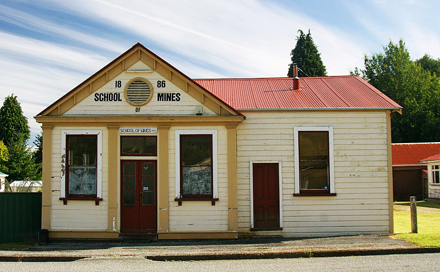
The single storeyed building is T-shaped in plan and has lapped weatherboard construction and a corrugated iron roof. It comprises a long wing with gable roof running north to south and a shorter wing aligned east to west with its gable facing the street. The short wing was the survey office and contains an entrance door off-set to the north, a three-light sash window, and decorative corbels beneath the eaves of the gable that bear similarity to the corbels on the gable of the later School of Mines building nearby on Shiel Street. The front elevation of the main long wing contains two entrance doors and three sets of windows, along with a long verandah fronting Bridge Street. At the east (rear) of the dwelling wing is a lean-to.
By the late 1870s, John Ainsley Montgomerie had replaced Woolley as the district surveyor. He resided there with his family even after his retirement in around 1909, providing advice to the cadet who kept the office open for the public, until Montgomerie’s death by accident in 1911. In the mid-twentieth century, the former Survey Office component of the building was occupied by the New Zealand Forest Service. Changes made to the building over time include the removal of decorative brackets from the verandah and lowering or removal of chimneys. An early photograph showed the building had a picket fence in front of the dwelling portion of the building – this has since been removed. The building is now a private residence.
List Entry Information
Status
Listed
List Entry Status
Historic Place Category 2
Access
Private/No Public Access
List Number
5068
Date Entered
21st September 1989
Date of Effect
21st September 1989
City/District Council
Buller District
Region
West Coast Region
Extent of List Entry
Extent includes the land described as Lot 1 DP 5876 (RT NL154/97), Nelson Land District, and the building known as Clerk of the Court and Survey Office House (Former) thereon.
Legal description
Lot 1 DP 5876 (RT NL154/97), Nelson Land District
Construction Professional
Name
Clayton, William Henry
Type
Architect
Biography
Born in Tasmania, Clayton (1823-1877) travelled to Europe with his family in 1842. He studied architecture in Brussells and was then articled to Sir John Rennie, engineer to the Admiralty, in London. He returned to Tasmania in 1848 and worked in private practice until he was appointed Government Surveyor in 1852. He resumed private practice in 1855 and was involved with surveying in the Launceston area. In 1857 he was elected an alderman on the Launceston Municipal Council. By the time Clayton immigrated to Dunedin in 1863 he had been responsible for the design of many buildings including churches, banks, a mechanics' institute, a theatre, steam and water mills, breweries, bridges, mansions and villas, in addition to being a land surveyor and road engineer. In 1864 he entered partnership with William Mason. Mason and Clayton were responsible for some important buildings in Dunedin including All Saints Church (1865) and The Exchange (former Post Office) (1865) as well as the Colonial Museum, Wellington (1865). These were two of the most prominent architects of their day in New Zealand. In 1869 Clayton became the first and only Colonial Architect and was responsible for the design of Post and Telegraph offices, courthouses, customhouses, Government department offices and ministerial residences. His acknowledged masterpiece is Government Buildings, Wellington (1876) a stone-simulated wooden building and the largest timber framed building in the Southern Hemisphere. Clayton was a prolific and highly accomplished architect both within the Public Service and in private practice, in New Zealand and Australia. See https://teara.govt.nz/en/biographies/2c20/clayton-william-henry
Historical and Associated Iwi / Hapū / Whānau
Completion Date
16th March 2021
Report Written By
Robyn Burgess
Other Information
This place was identified as significant under previous legislation with different information requirements. It remains significant under the current legislation. There is opportunity under our legislation and policies to add to this information. Further information about this place may be available from the Southern Regional Office of Heritage New Zealand Pouhere Taonga. A fully referenced upgrade report is available on request from the Canterbury/West Coast Area Office of Heritage New Zealand Please note that entry on the New Zealand Heritage List/Rarangi Korero identifies only the heritage values of the property concerned, and should not be construed as advice on the state of the property, or as a comment of its soundness or safety, including in regard to earthquake risk, safety in the event of fire, or insanitary conditions.
Former Usages
General Usage: Exploration
Specific Usage: Exploration and Survey - other
General Usage: Government
Specific Usage: Government office building
General Usage: Law Enforcement
Specific Usage: Staff Accommodation
General Usage: Trade
Specific Usage: Office building/Offices
Former Usages
General Usage: Exploration
Specific Usage: Exploration and Survey - other
General Usage: Government
Specific Usage: Government office building
General Usage: Law Enforcement
Specific Usage: Staff Accommodation
General Usage: Trade
Specific Usage: Office building/Offices
Location
Related listings
Sign up to hear more
Get the latest heritage news, features and events delivered
straight to your inbox.
