Quick links


Quick links
Quick links
Quick links
Quick links
Quick links
Tongariro National Park, OHAKUNE and HOROPITO
Public
Historic Place Category 1
List No. 7271


List Entry Information
Status
Listed
List Entry Status
Historic Place Category 1
Access
Able to Visit
List Number
7271
Date Entered
27th October 1995
Date of Effect
27th October 1995
City/District Council
Ruapehu District
Region
Horizons (Manawatū-Whanganui) Region
Extent of List Entry
Extent includes part of the land described as Sec 8 SO 393634 (RT 519049), Wellington Land District, and the structure known as the Hapuawhenua Viaduct thereon, including its abutments, as shown in the extent map tabled at the Rarangi Korero Committee meeting on 29 September 2016.
Legal description
Sec 8 SO 393634 (RT 519049), Wellington Land District.
Location Description
The structure can be accessed from the Ohakune to Horopito Coach Road starting from its southern terminus on Marshalls Road, Ohakune.
Why is this place significant?
Cultural Significance
This historic place was registered under the Historic Places Act 1993. The following text is from the original Recommendation for Registration considered by the NZHPT Board at the time of registration. Social: The North Island Main Trunk Line was opened in February 1909 and the central section of the line is significant not only in transportation but more importantly in communication and the opening up of the North Island.
Historic Significance
Historical Significance or Value This historic place was registered under the Historic Places Act 1993. The following text is from the original Recommendation for Registration considered by the NZHPT Board at the time of registration. The construction of the Hapuawhenua Viaduct was fundamental to the success of the central plateau route of the North Island Main Trunk Line.
Physical Significance
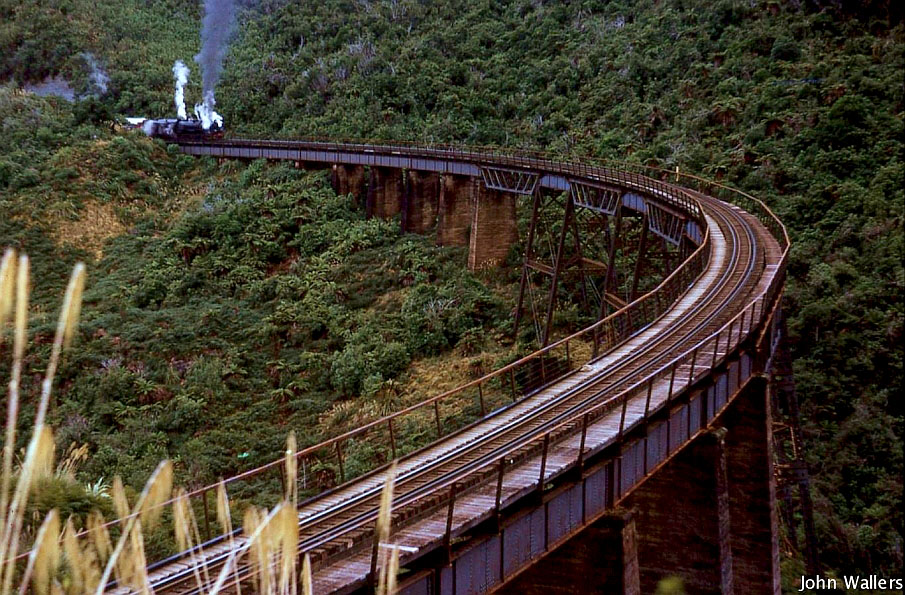
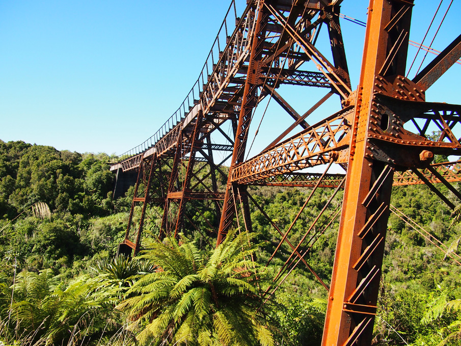
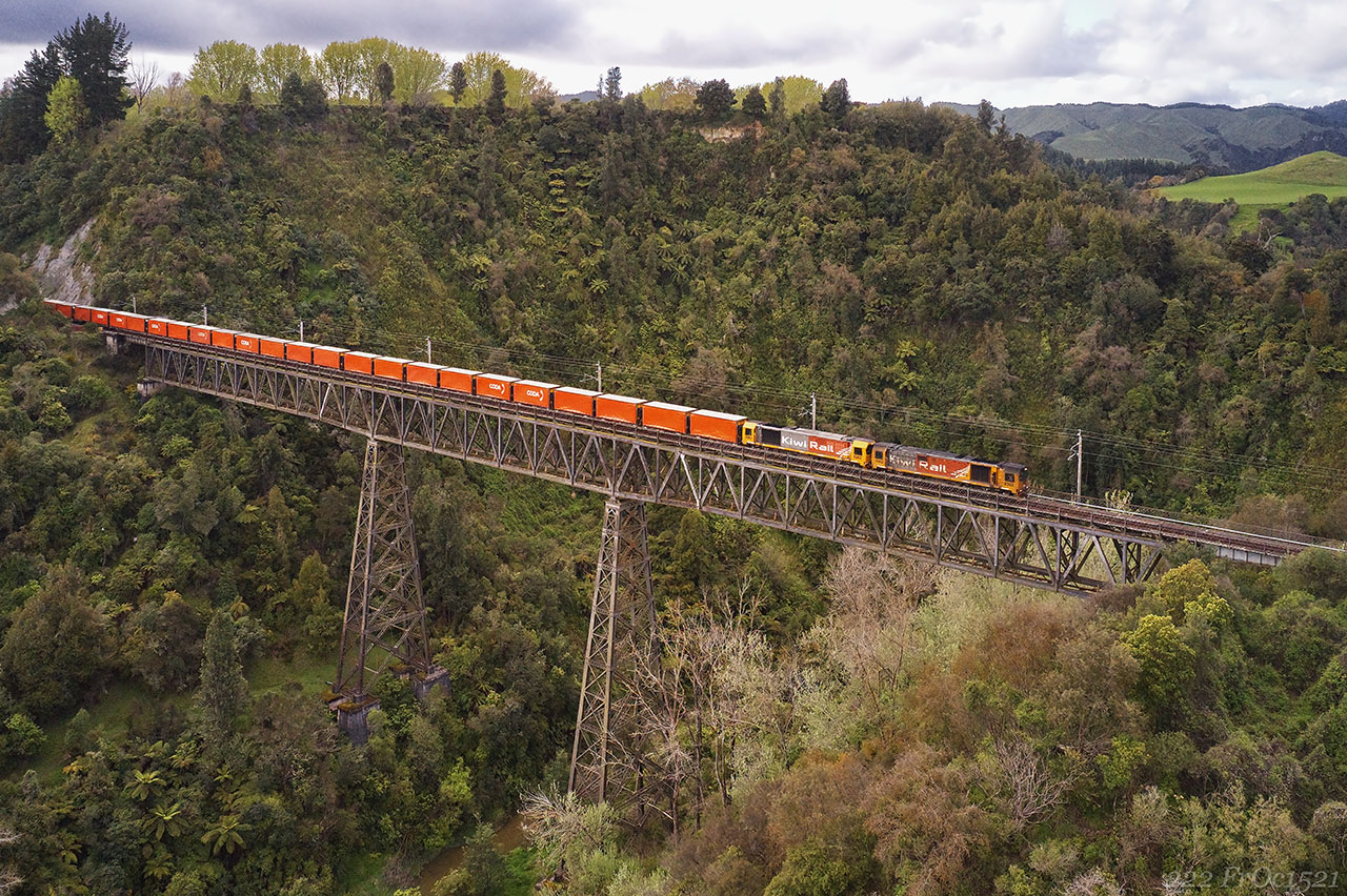
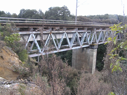
This historic place was registered under the Historic Places Act 1993. The following text is from the original Recommendation for Registration considered by the NZHPT Board at the time of registration. Aesthetic: The 10 chain radius curve of the Hapuawhenua Viaduct distinguishes this viaduct as an impressive piece of construction because of the elegance with which the curve is handled in an otherwise massive engineering structure. The contrast with this curve with the bush and mountain site of the viaduct, emphasises the adaptability of an engineering structure to conform to the requirements of natural land forms. Architectural: This trestle viaduct is constructed of steel and is 284m (932 feet) in length with a 10 chain radius curve and 45.5m (149 feet) above the valley floor. It is one of the largest viaducts on the North Island Main Trunk Line and one of only two that were curved. Technological: The Hapuawhenua Viaduct is an excellent example of the form Engineer Peter Seton Hay standardised for such steel viaducts using steel braced trestle piers with pier heads having curved plate girders, and deck trusses for the main spans. At each end there are shorter plate girder spans supported on concrete piers. This design was technologically important at the time.
Why is this place Category 1 / Category 2?
Detail Of Assessed Criteria
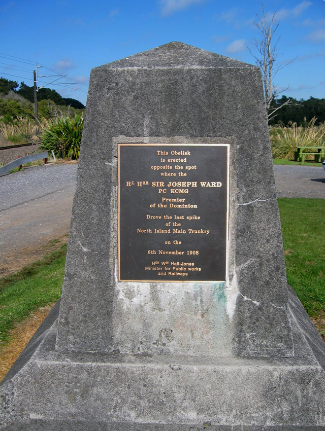
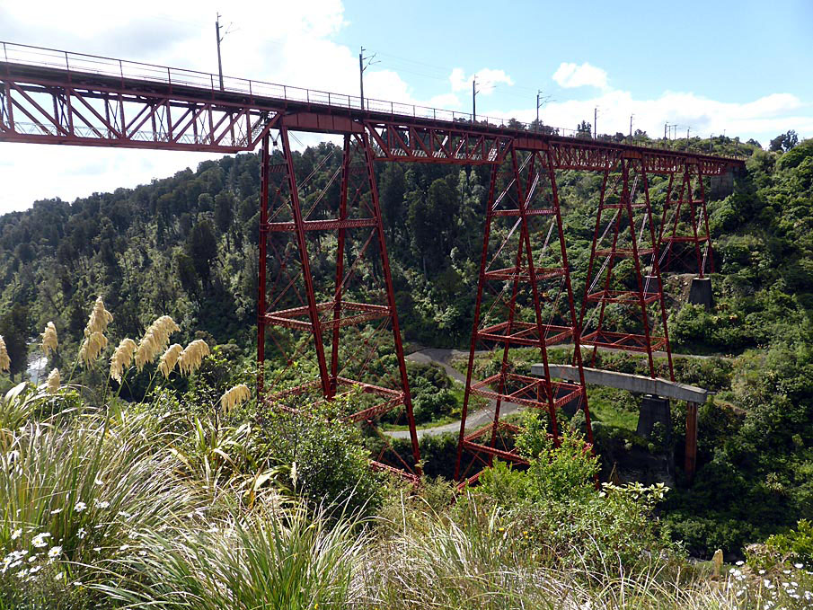
This historic place was registered under the Historic Places Act 1993. The following text is from the original Recommendation for Registration considered by the NZHPT Board at the time of registration. The following comments are made in relation to the criteria identified under S.23(2) of the Historic Places Act 1993. a) The extent to which the place reflects important or representative aspects of New Zealand history: The Hapuawhenua Viaduct is physical evidence of the importance of New Zealand transport and communication history. In a broader sense it can be seen to be part of a political process that began with the public works policies of Vogel, and which were carried on by the Liberals under Seddon and Ward. In this case the process culminated in the historic completion of the difficult central section of the North Island Trunk Line in 1908-09. The construction of the middle section of the North Island Main Trunk Line was fraught with difficulties and it was some years before the decision was made to use the central plateau route rather than one through Taranaki. On F.W. Furket's recommendation, it was decided to take the central route through very rough country which was heavily bushclad and without easy access. It involved the construction of two large steel viaducts, four substantial bridges, a tunnel, some very heavy cuttings in difficult ground and some equally large fillings, all in the space of 19km. g) The technical accomplishment or value, or design of the place: The Hapuawhenua Viaduct was designed in 1907, completed in 1908 and was the longest on the North Island Main Trunk Line with a length of 284 m. It is 45m high and has a curve radius of 210m having been designed by Peter Seton Hay, a brilliant engineer in the Public Works Department who later became Engineer-in-Chief. This viaduct can be compared to the Makohine Viaduct at Ohingaiti (Category I). Several distinctions can be drawn between them, although the two structures are comparable in quality. While both are part of the middle section of the North Island Main Trunk Line, Makohine Viaduct was built and completed some nine to six years before the Hapuawhenua Viaduct. Thus it is an earlier example of the engineering expertise of the Public Works Department and the experience gained as a result of its design and construction would have been invaluable in the realisation of the Hapuawhenua Viaduct. At 72.5m, the Makohine Viaduct is considerably (27m or 60%) higher than the Hapuawhenua Viaduct. The Makohine Viaduct still functions as part of the Main Trunk Line while the Hapuawhenua Viaduct has been modified to form part of a walkway. With the opening of the new deviation and viaduct in 1987, the tracks were removed from the original viaduct and replaced with a timber board walk. Hand rails were also added. Conclusion: Hapuawhenua Viaduct, Ohakune, is recommended for registration as a Category I as a place of special and outstanding historical and cultural heritage significance and value. The Viaduct is a magnificent piece of engineering designed by Peter Seton Hay and is evidence of the importance of New Zealand transport and communication history.
Construction Professional
Name
Hay, Peter Seton
Type
Engineer
Biography
Peter Seton Hay (1852/1853? - 1907) was born in Glasgow, Scotland, probably in 1852 or 1853, the son of Janet (Jessie) Dalziel and her husband, James Johnston Hay, a journeyman engineer. When Peter was a child the family emigrated to New Zealand, arriving at Port Chalmers on the Storm Cloud in April 1860. Educated in Dunedin, he was the first graduate of the newly established University of Otago, obtaining a BA in 1877 and an MA with first-class honours in mathematics in 1878. In June 1875 on the advice of a university teacher he had joined the Public Works Department as an engineering cadet. After completing his studies he was engaged in railway surveys and construction for the lines from Dunedin to Moeraki and Clinton. In the early 1880s he was employed on Central Otago railway surveys from Rough Ridge to Hawea, in the Cromwell district, and from Balclutha to the Catlins River. Hay's reputation as a brilliant young engineer was established in these Otago days. Stories were told of his prodigious mental calculations when he was working in the field without the usual aids such as logarithm tables. In 1884 Hay was transferred to the head office of the Public Works Department in Wellington. He began his steady progress through the ranks of the department, and two years later was promoted to resident engineer. In 1896 he was promoted to superintending engineer, equivalent to assistant engineer-in-chief. By then the construction of the North Island main trunk rail link was the foremost Public Works Department project. Hay helped plan most of the important railway works of the central North Island section and was responsible for the primary design of the Makohine, Mangaweka, Hapuawhenua, Taonui, Manganui-a-te-ao and Makatote viaducts. By any standards the viaducts were great works of engineering. Much of the credit for their construction must be attributed to Peter Hay. Hay succeeded W. H. Hales as engineer-in-chief of the Public Works Department in 1906, only to die in office on 19 March 1907. He suffered the effects of exposure while inspecting the main trunk railway works near Waiouru, and subsequently died from pleurisy at his home in Wadestown, Wellington. He was aged 54. One of Hay's major achievements was his investigation and report on the proposed Southern Alps rail crossing by the Midland railway in 1903. The scheme recommended by the government's American advisory engineer, Virgil Gay Bogue, required a 3½-mile tunnel and a steep gradient incline track. Hay's scheme, which was ultimately adopted, avoided expensive grading and track work but required a tunnel over five miles long. This tunnel, at Otira, was completed in 1923, long after Hay's death. Equally important was Hay's contribution to the development of hydroelectric power generation in New Zealand. Peter Seton Hay married Mary Clarke at Wairuna, Otago, on 22 April 1879 and they had four sons and one daughter. His wife and children survived him. Hay was the first New Zealand-trained engineer to rise to the rank of engineer-in-chief. He died at the height of his powers and before many of his projects had been completed. Although his life was relatively brief, his works endured. Lowe, Peter. 'Hay, Peter Seton 1852/1853? - 1907'. Dictionary of New Zealand Biography, updated 16 December 2003 URL: http://www.dnzb.govt.nz/
Construction Details
Start Year
1987
Type
Other
Description
Horopito Deviation completed
Start Year
1988
Type
Other
Description
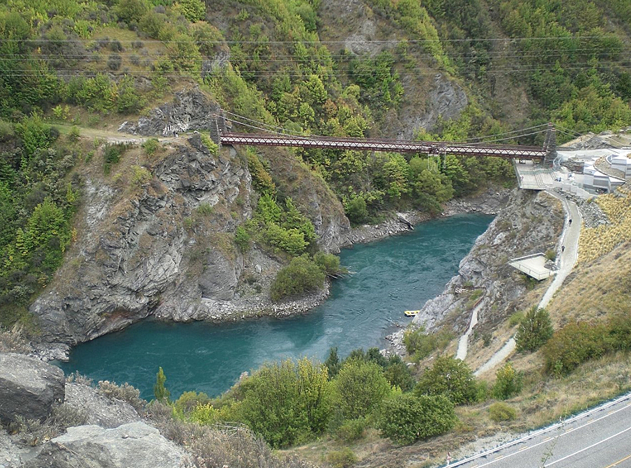
Bungy jumping operates off of the viaduct
Start Year
2008
Finish Year
2009
Type
Other
Description
Hapuawhenua Viaduct conservation project
Start Year
2009
Type
Other
Description
Hapuawhenua Viaduct open to the public (14 February)
Start Year
1907
Type
Other
Description
Excavations for footings is begun (August)
Start Year
1907
Type
Other
Description
December 1907. Concrete piers complete. Construction of steel piers is begun
Start Year
1908
Type
Other
Description
Piers are completed (January)
Start Year
1908
Type
Original Construction
Description
Viaduct completed (April)
Start Year
1964
Type
Other
Description
Viaduct painted
Start Year
1970
Finish Year
1971
Type
Modification
Description
Viaduct strengthened
Start Year
1984
Type
Other
Description
Horopito Deviation begun (June)
Start Year
1907
Type
Other
Description
Site preparation and temporary line from Ohakune built
Historical and Associated Iwi / Hapū / Whānau
Completion Date
5th March 2009
Report Written By
Karen Astwood
Information Sources
Appendices to the Journals of the House of Representatives (AJHR)
Appendices to the Journals of the House of Representatives
Alexander Turnbull Library
Alexander Turnbull Library, Wellington
Archives New Zealand (Wgtn)
Archives New Zealand (Wellington)
Department of Conservation
Department of Conservation
Evening Post
Evening Post, 27 Jun 1919, p.7.
Otago Witness
Otago Witness
Progress
Progress
Thornton, 2001
Geoffrey Thornton, Bridging the Gap, Early Bridges in New Zealand 1830-1939, Auckland, 2001
Wanganui Herald
Wanganui Herald
Pierre, 1981
Pierre, W. 1981. North Island Main Trunk: An Illustrated History, Christchurch
Troyano, 2003
L F Troyano., Bridge Engineering: A Global Perspective, London, 2003
Other Information
A fully referenced upgrade report is available from the NZHPT Central region office Please note that entry on the New Zealand Heritage List/Rarangi Korero identifies only the heritage values of the property concerned, and should not be construed as advice on the state of the property, or as a comment of its soundness or safety, including in regard to earthquake risk, safety in the event of fire, or insanitary conditions.
Current Usages
Uses: Civic Facilities
Specific Usage: Historic Property
Uses: Transport
Specific Usage: Bridge/ Viaduct
Former Usages
General Usage: Transport
Specific Usage: Bridge/ Viaduct
Themes
North Island Main Trunk Line
Current Usages
Uses: Civic Facilities
Specific Usage: Historic Property
Uses: Transport
Specific Usage: Bridge/ Viaduct
Former Usages
General Usage: Transport
Specific Usage: Bridge/ Viaduct
Themes
North Island Main Trunk Line
Location
Get the latest heritage news, features and events delivered
straight to your inbox.
