Agriculture is without a doubt the major industry responsible for the development of New Zealand. Irrigation ranks extremely highly among all the advances which have taken place in New Zealand's farming history, the only comparable examples being the introduction of the tractor in 1904 and of aerial topdressing after World War Two. The Pipe Shed at Methven stands as a representative of the Rangitata-Rakaia Diversion Race (RDR), a huge irrigation scheme begun in 1937, which when completed in 1945, provided water to 500 farms, covering 64,000 hectares or 32% of Mid-Canterbury. The RDR was not the first irrigation scheme on the dry plains, but it remains the most significant and one of the largest.
The Canterbury Plains, an extensive area of flat land in the middle of the South Island, crossed by braided rivers, has proved both potentially valuable but difficult to farm. Water, either the lack of it, or ironically too much of it, has been a major problem for farmers in the area. From the mid-1860s some individual land owners diverted water from the rivers for their farms and households. Charles Reed is thought to be the first person to build a system of open water races, taking water from the Ashburton River over five miles to Westfield . A public meeting in 1878 asked the Ashburton County Council to irrigate the land between the Rakaia and Ashburton Rivers. Although this did not occur for nearly seventy years, the Council did provide a system of water races, designed by their engineer, William Baxter and constructed between 1880 and 1881. The initial race running from an intake at Pudding Hill to Dundas proved highly successful and is still operational. Over the next two years, water races were constructed throughout the Rakaia-Ashburton Plains and Baxter also designed water races, taking water from the South Ashburton River to provide water to the plains south of Ashburton. These water races were primarily to provide drinking water for stock, not to irrigate the land for crops . In order to provide enough water for crops the races and intakes would have had to be made larger, control systems introduced and all of this was expensive. By 1894 the Ashburton County Council had constructed 1050 miles (1690 kilometres) of water race and by 1915 there was 1800 miles (2900 kilometres) wending throughout the county, providing water to 586,000 acres (237,150 hectares) .
A trial irrigation scheme was begun in 1887-1888 at Wakanui between Ashburton and the coast where the land was dry, shingly and barren. Half the land was irrigated and although it proved to be a wet season, there was still a clear difference in the quality of the clover and oats grown on the irrigated part. Baxter continued to push for a council-organised irrigation scheme, and, again, individual landowners experimented with their own irrigation. Around 1900 the government was also approached about subsidising irrigation schemes but nothing substantial occurred until the 1930s when the Lands & Survey Department, which had acquired farmland in the Ashburton area, began experimenting with irrigation in conjunction with the D.S.I.R, the Department of Agriculture and the Canterbury Agricultural College, Lincoln. The farm also provided work for the unemployed during the 1930s and from 1932 was used to demonstrate the benefits and methods of irrigation. Water for this farm was provided via a county water race. The results of these experiments showed that irrigated land increased all crop yields and could carry five to six lambs per acre, whereas no stock could be carried on non-irrigated land. This encouraged further more ambitious plans to be made to water greater areas of the Ashburton plains .
THE RANGITATA DIVERSION RACE
In 1936 the Ashburton-Lyndhurst irrigation scheme began. Fed from the South Ashburton River it was to provide 125 miles (201 kilometres) of irrigation race constructed by men from a Public Works Department camp established at Winchmore. At the end of that same year government approval was given for the RDR and work started on 2nd April, 1937. This was the largest engineering project ever undertaken in New Zealand at the time, and its statistics are still impressive today. An intake at Klondyke in the Rangitata Gorge directed water through a 42 mile canal (67 kilometres) north across the plains to discharge into the Rakaia River at Highbank. Water is drawn off from this main open race and irrigates around 420,000 acres (167,000 hectares.) The Ashburton-Lyndhurst scheme was eventually linked to the RDR and it also supplied the hydro station erected at Highbank ensuring the water could be used to provide power during the winter when demand for irrigation would be low. The RDR was planned to provide work for around 200 unemployed men, an important consideration for the government during the 1930s .
Work began with pick, shovel and wheelbarrow wielded by men on the dole. Later, with the influence of Bob Semple (1873-1955), Minister of Public Works in the 1936-49 Labour Government, the scheme was noted for its use of heavy earth moving machinery and the huge concrete pipes needed to carry the water along the 1,100 foot (335 metres) contour, under rivers and streams and around hills. Semple is remembered for making the dramatic gesture of driving one of the huge new machines over a wheelbarrow to symbolise the change to mechanism .
Work was delayed because of the Second World War, which redirected the manpower and led to a shortage of materials . However, water finally ran from the Rangitata to the Rakaia in October 1944, and the system was formally opened on 16 June 1945. It fed three irrigation schemes, the Mayfield-Hinds, Valetta - Tinwald and the Ashburton-Lyndhurst, all fully operational by the 1950s.
Experiments in irrigation continued after the government purchased land at Winchmore in 1946 and established an Irrigation Research Station to investigate the best systems for water application as well as the most suitable crops. The RDR continues to supply water to around one third of the farmed land in Mid Canterbury. The scheme has enabled diversification in farming, from sheep and wheat to dairying, mixed cropping, horticulture and deer by the 1970s .
The engineer who prepared the plan and was in charge initially was the Public Works Department's Thomas George Gordon Beck (1900-1948). Beck had spent two years from 1931-1933, studying irrigation, drainage and river control overseas, primarily in the United States. In 1940 he was transferred to become District Engineer, Christchurch and in 1942 he moved to Wellington as Acting Inspecting Engineer, eventually becoming Deputy Commissioner of Works from July 1946. He is particularly noted for his engineering work in Mid-Canterbury, where his expertise in drainage, irrigation and river control was vital for the various schemes established there during the 1930s-1940s.
THE PIPES
It was necessary for the RDR to cross seven rivers or streams, as well as negotiating a particularly unstable piece of land around Surrey Hills. Large siphons were created to carry the water underground. The siphons were made from huge concrete pipes constructed at an outdoor factory and workshop established at The Birches, near the Surrey Hills in 1940.
Two sizes of round pre-cast, reinforced concrete pipes were made. For the Ashburton River crossings there were pipes eleven feet (3.65 metres) in diameter, nine inches (228 mm) thick and weighing 18 tons (18.288 tonnes.) Pipes twelve feet (3.65 metres) in diameter and the same length were required for the one and a half miles (2.4 kilometres) around the Surrey Hills and these had 10 inch (254 mm) thick shells and weighed 28 tons (28.450 tonnes.) They were strengthened and joined by steel cylinders, made in Temuka, which were welded to the steel reinforcing in the concrete. It took one man eight hours to weld a single joint. Special machinery had to be imported and erected to be able to move the pipes. Contemporary newspaper reports made much of the fact that these were the largest pipes to be constructed in New Zealand and some of the largest in the world. Larger pipes had only been used in the United States, as part of the Colorado River scheme, where some of the pipes were 12ft 8inches in diameter and also the Boston water supply where some of the pipes were 6 inches bigger than those used at Surrey Hills.
The pipes were constructed by concrete being poured into moulds and left to set for two days. They were then steam-cured and lifted and placed on a bed of sand where they stayed for another fortnight being sprayed with water to finish the curing process. At this time there were 24 pouring bases established at the 'factory'. Cranes were used to lift the pipe moulds and the steel reinforcing cages while specially constructed gantries moved the 28 ton (28.450 tonnes) pipes themselves. Eight of the giant pipes were made at the factory each day, each using 90 bags of cement and huge reinforcing cages.
The first pipe of the Surrey Hills siphon was laid on Saturday 19 October 1940 and was an occasion for great celebration. Around 400 people turned up to the ceremony, and Bob Semple, Minister of Works, indulged his genius for publicity by posing with his Wolseley car inside the pipe, to demonstrate its size. (Attached, p.20)
HISTORY OF THE SITE
The land on which the Pipe Shed stands belonged to the Mount Hutt Roads Board from 1879 although a certificate of title was only issued in 1881. Known as Section 142 it was once part of Rural Section 24548, a rural section delineated as part of the original survey of the township. The role of the Roads Board was taken over in 1939 by the Ashburton County which had held title to the land since 1881.
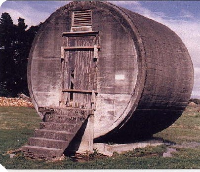
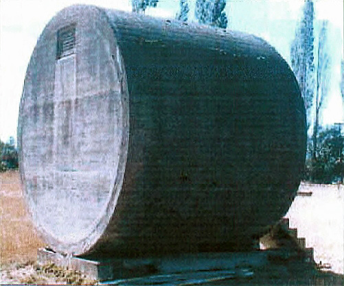
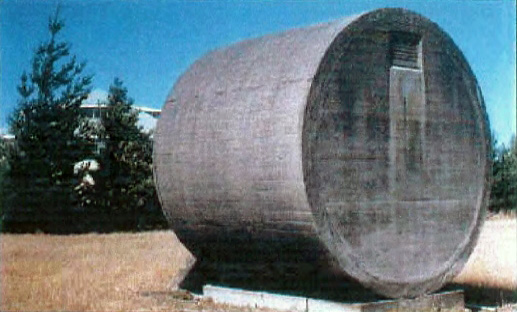
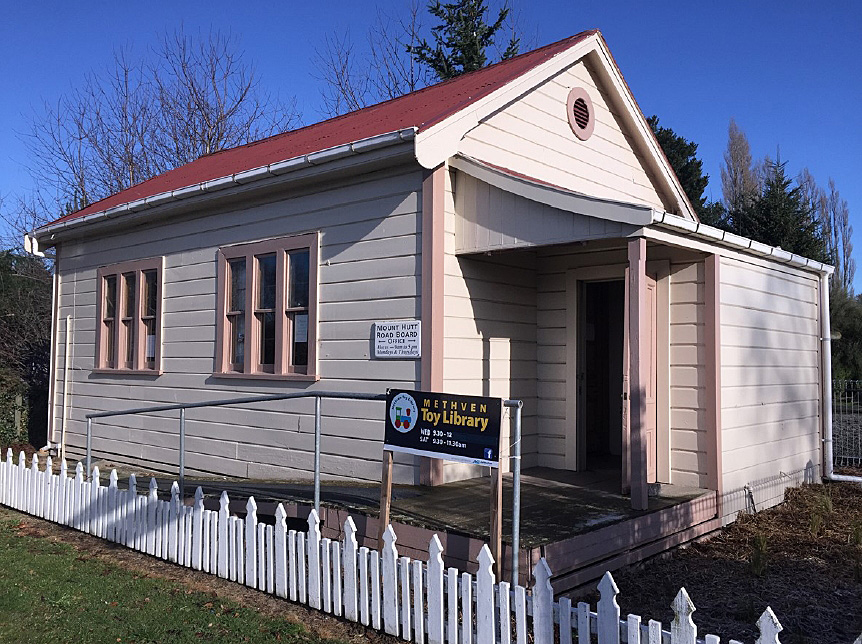
The Public Works Department established a number of accommodation camps and work depots for the project throughout the region, one of these being on the former Roads Board land at Methven. The Pipe Shed explosives store (1940) was one of the facilities at the Methven work depot. An administration office was also established at Methven in 1940 after a re-organisation of the irrigation work had created the need for a Public Works headquarters for the district. The Council owned land was seen as suitable for the purpose because it was close to the railway and had both water and sewerage services available. A mutually agreeable lease arrangement was reached. The Methven office controlled all of the Mid-Canterbury irrigations schemes and staff from Christchurch and Temuka were transferred there.
By 1955 the Public Works Department transferred their staff into Ashburton and the lease of the Methven land was terminated on 11 July 1957. At this date the site was described as cleared of all buildings except those purchased by the Council in 1956 and three further buildings purchased by members of the public. None of these remain on the site. In 1985 some of the original land was subdivided and sold leaving the current section Lot 2 DP 48204. When local bodies were amalgamated in 1989 the land became the property of the Ashburton District Council.
From this date the Pipe Shed building has been used for storage by the council or by others with council authority. It is centrally located on land which the council currently has no use for and its future is uncertain.
In terms of rarity, the Pipe Shed is an unusual example of adaptive reuse; the traditional kiwi propensity to 'make do' and utilize whatever materials are to hand. There are no known examples of buildings being constructed of concrete pipes elsewhere in New Zealand.