

Ngai Tahu korero records that the fiords represent the raised sides of Te Waka o Aoraki (the canoe of Aoraki) which foundered, its occupants turning to stone. Generations later, the southern fiords were hacked out of the waka by Tu Te Rakiwhanoa, to create a place to live, safe havens on the wild coastline, stocked with fish and birds and forests which would sustain travellers. Maori seasonally occupied the fiords and travelled the rugged coastline for over six hundred years prior to Europeans first venturing to their islands.
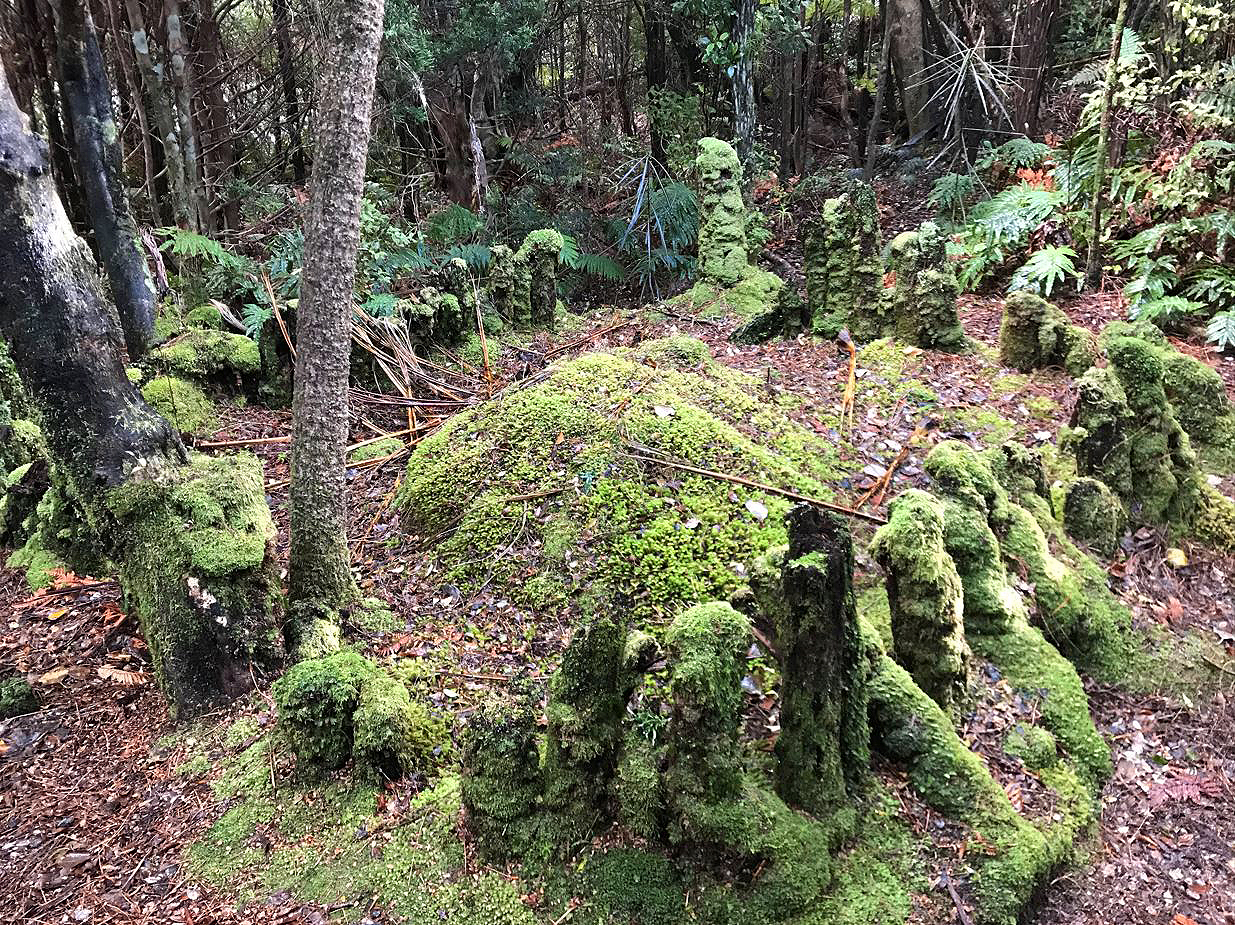
Early European history in New Zealand is evident in Tamatea/Dusky Sound – names bestowed by Captain Cook in 1770 and in 1773 dot the islands and coves of the sound. In 1773 Cook spent three months moored in Tamatea/Dusky Sound while astronomer William Wales established the longitude and latitude of New Zealand, tree stumps marking the site of the observatory. Cook’s ship, the Resolution was repaired and refitted. In another first, a European sealing gang landed at Luncheon Cove in 1792, building the first European vessel and first European dwelling in New Zealand, with the physical remnants providing evidence of these activities. Off-shore whalers sought refuge from the southern oceans in the fiords from the late 1700s and into the 1800s.
In the wake of the sealers and whalers’ near decimation of the marine populations, came concern about the plight of New Zealand’s unique flightless birds. Even in remote Tamatea/Dusky Sound, introduced stoats and ferrets were killing birds. By the close of the nineteenth century, the Government began to recognise the need to protect vulnerable species such as kiwi and kakapo. At Tamatea/Dusky Sound several islands (notably Resolution Island) were set aside as reserves in the 1890s. Richard Treacy Henry (1845-1929) was appointed as New Zealand’s first Government Ranger of Crown Lands, and curator of Resolution Island. Henry was charged with protecting indigenous bird populations by transferring birds from the mainland to Resolution Island, his house site and bird pen showing where this work was carried out. This was internationally pioneering conservation work.
In the twentieth century, Tamatea/Dusky Sound has been recognised as a haven for commercial fishing, including lobster fishing since the 1950s, and as a World Heritage Site. In 1986, Westland/Tai Poutini, Aoraki/Mt Cook and Fiordland National Parks were included on the World Heritage List for their natural values.
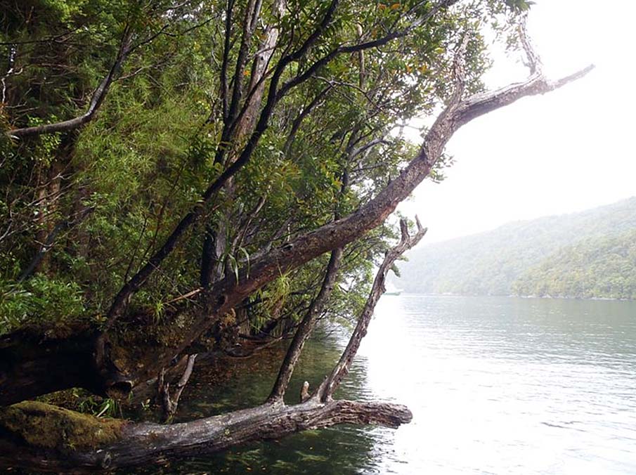
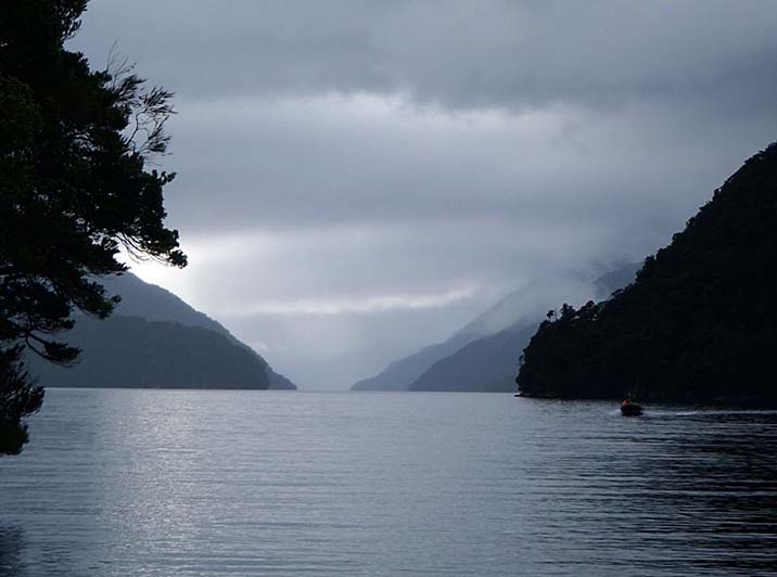
In 2015 Tamatea/Dusky Sound remains a remote wilderness where visitors can get a sense of the isolation and rugged spirit of past voyagers to this wild and awe-inspiring area.
List Entry Information
Status
Listed
List Entry Status
Historic Area
Access
Able to Visit
List Number
9046
Date Entered
25th June 2015
Date of Effect
24th July 2015
City/District Council
Southland District
Region
Southland Region
Extent of List Entry
This historic area consists of an area of land and sea that contains a group of inter-related historic places. The area of land that encompasses this group of historic places includes part of the Fiordland National Park and part of the Fiordland Marine Area, being the area described as Tamatea/Dusky Sound Historic Area that extends from Five Fingers Point to Woodhen Cove, back to Mt Roa to Porpoise Point, then to Mt Evans, past the head of Cascade Cove to South Point and back to Five Fingers Point. (Refer to map in Appendix 1 of the registration report for further information). The identified historic places that contribute to the values in this historic area are Astronomer Point and Cook Creek at Pickersgill Harbour, Facile Harbour and the Wreck of the Endeavour, Resolution Island, Indian Island, Luncheon Cove, Anchor Island, Richard Henry’s House Site and Bird Pen (Category 1 Register No. 7171), The Wreck of the ss Waikare and other associated archaeological sites A44/9 Historic hut site; A44/10 Ovens; A44/11 Occupation site; A44/12 Ovens; A44/14 Hut site; A44/15 Possible trypot site; A44/16 Shipwreck; A44/17 House site; A44/18 Burial; A44/19 Fireplaces; A44/2 Shipwreck; A44/20 Historic camp; A44/22 Barked totaras; A44/23 Historic landing; A44/25 Historic camp; A44/26 House terrace; A44/27 Historic hut site; A44/28 Historic hut site; A44/29 Historic terrace; A44/3 Hut sites; A44/30 Historic terrace; A44/4 Shipbuilding site; A44/5 Maori hut site ; A44/6 Maori hut site; A44/7 Maori huts; A44/8 Maori hut; A44/9 Occupation site; B44/1 Rockshelter; B44/10 Maori campsite; B44/11 Observatory site; B44/14 Rockshelter with midden; B44/16 Pits; B44/26 Overhang and midden ; B44/27 Overhang and midden; B44/28 Historic hut; B44/29 Historic hut; B44/3 Midden; B44/34 Cave with midden; B44/35 Rock shelter; B44/36 Barked totara; B44/37 Watering place; B44/4 Midden; B44/5 Barked totara; B44/6 Possible ovens; B44/7 Brewery; B44/8 Historic location; B44/9 Maori huts; B45/1 Rockshelter; B45/2 Hut sites; B45/28 Cave with midden; B45/3 Sealing camp etc. (Refer to maps in Appendix 1 of the List entry report for further information).
Legal description
Fiordland National Park
Status
Listed
List Entry Status
Historic Area
Access
Able to Visit
List Number
9046
Date Entered
25th June 2015
Date of Effect
24th July 2015
City/District Council
Southland District
Region
Southland Region
Extent of List Entry
This historic area consists of an area of land and sea that contains a group of inter-related historic places. The area of land that encompasses this group of historic places includes part of the Fiordland National Park and part of the Fiordland Marine Area, being the area described as Tamatea/Dusky Sound Historic Area that extends from Five Fingers Point to Woodhen Cove, back to Mt Roa to Porpoise Point, then to Mt Evans, past the head of Cascade Cove to South Point and back to Five Fingers Point. (Refer to map in Appendix 1 of the registration report for further information). The identified historic places that contribute to the values in this historic area are Astronomer Point and Cook Creek at Pickersgill Harbour, Facile Harbour and the Wreck of the Endeavour, Resolution Island, Indian Island, Luncheon Cove, Anchor Island, Richard Henry’s House Site and Bird Pen (Category 1 Register No. 7171), The Wreck of the ss Waikare and other associated archaeological sites A44/9 Historic hut site; A44/10 Ovens; A44/11 Occupation site; A44/12 Ovens; A44/14 Hut site; A44/15 Possible trypot site; A44/16 Shipwreck; A44/17 House site; A44/18 Burial; A44/19 Fireplaces; A44/2 Shipwreck; A44/20 Historic camp; A44/22 Barked totaras; A44/23 Historic landing; A44/25 Historic camp; A44/26 House terrace; A44/27 Historic hut site; A44/28 Historic hut site; A44/29 Historic terrace; A44/3 Hut sites; A44/30 Historic terrace; A44/4 Shipbuilding site; A44/5 Maori hut site ; A44/6 Maori hut site; A44/7 Maori huts; A44/8 Maori hut; A44/9 Occupation site; B44/1 Rockshelter; B44/10 Maori campsite; B44/11 Observatory site; B44/14 Rockshelter with midden; B44/16 Pits; B44/26 Overhang and midden ; B44/27 Overhang and midden; B44/28 Historic hut; B44/29 Historic hut; B44/3 Midden; B44/34 Cave with midden; B44/35 Rock shelter; B44/36 Barked totara; B44/37 Watering place; B44/4 Midden; B44/5 Barked totara; B44/6 Possible ovens; B44/7 Brewery; B44/8 Historic location; B44/9 Maori huts; B45/1 Rockshelter; B45/2 Hut sites; B45/28 Cave with midden; B45/3 Sealing camp etc. (Refer to maps in Appendix 1 of the List entry report for further information).
Legal description
Fiordland National Park
Why is this place significant?
Cultural Significance
Cultural Significance or Value Ngai Tahu korero records that the fiords represent the raised sides of Te Waka o Aoraki (the canoe of Aoraki) which foundered, its occupants turning to stone. Generations later, the southern fiords were carved out of the waka by Tu Te Rakiwhanoa to create a place to live, safe havens on the wild coastline, stocked with fish and birds and forests that would sustain travellers. Tamatea has special cultural significance for Ngai Tahu. As a place where Maori seasonally occupied the fiords and travelled the rugged coastline for over six hundred years prior to Europeans first venturing to their islands, Tamatea is also a repository of the material culture remaining from that period - the New Zealand Archaeological association has recorded a large number of Maori sites. Internationally, Tamatea is included in Te Wahipounamu (South West New Zealand World Heritage Area) that recognises the value placed on its natural history. Spiritual Significance or Value The history of Tamatea/Dusky Sound is entwined with the heritage of the Waitaha, Ngati Mamoe and Ngai Tahu peoples. Te Rua o te Moko/Fiordland more widely is a highly important place in their ancestral landscape.
Historic Significance
Historical Significance or Value Tamatea/Dusky Sound has outstanding significance as the location of early contact between Maori and European explorers, and the site of the first European occupation in New Zealand. Tamatea/Dusky Sound provides histories of both Maori and European lives in this isolated area, as well as recording the contact between the two cultures. Maori names and occupation sites provide physical evidence of the Maori life. Tamatea/Dusky Sound also has a special history as the location of early contact between European explorers and Maori – recorded in Captain Cook’s journals and in the art of William Hodge. Astronomer Point, where Cook set up his observatory to plot New Zealand’s latitude and longitude is an iconic site in New Zealand’s history. Tamatea/Dusky Sound is the site of several outstandingly significant firsts - New Zealand’s first shipwreck, the first sealing base; Cook visited on his first (and second) voyages, and the site of the first conservation efforts to save New Zealand’s flightless birds. Scientific Significance or Value Tamatea/Dusky Sound has scientific significance as the place where Cook’s shore party established New Zealand’s longitude and latitude. Tamatea/Dusky Sound also has scientific significance as the first place in New Zealand where active conservation management was carried out. Richard Henry’s appointment as New Zealand’s first wildlife ranger in 1894 saw him make detailed observations of bird behaviour that laid the foundations for later conservation work to save threatened species, particularly kakapo and kiwi. He was an international pioneer in live bird transfer, foreshadowing the work of twentieth century conservationists.
Physical Significance
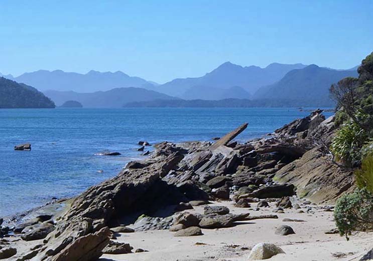
Aesthetic Significance or Value Tamatea/Dusky Sound is an area of great scenic beauty. It is part of the World Heritage Area of Fiordland National Park. It is a largely untouched wilderness, retaining its aesthetic appearance from Maori and early European times, giving a sense of the wild and isolated nature of New Zealand. Its isolation, rugged coastline and extreme weather help visitors understand the lives of Maori and early European residents of the sound. Archaeological Significance or Value Both Maori and early European activity have left archaeological evidence in Tamatea/Dusky Sound. The European archaeological sites relate to Captain Cook’s exploration and are historically and culturally iconic coastal archaeological sites of national importance. Some archaeological investigation and excavations have taken place in Tamatea/Dusky Sound giving knowledge of Maori lives there. Maori visited Tamatea/Dusky Sound regularly up to the mid-nineteenth century for food gathering. One such site is Indian Island, which is a Maori occupation site, and has an association with Captain Cook’s visit in 1773. There is further potential for archaeological investigation to provide understanding of both Maori and European sites.
Why is this place significant?
Cultural Significance
Cultural Significance or Value Ngai Tahu korero records that the fiords represent the raised sides of Te Waka o Aoraki (the canoe of Aoraki) which foundered, its occupants turning to stone. Generations later, the southern fiords were carved out of the waka by Tu Te Rakiwhanoa to create a place to live, safe havens on the wild coastline, stocked with fish and birds and forests that would sustain travellers. Tamatea has special cultural significance for Ngai Tahu. As a place where Maori seasonally occupied the fiords and travelled the rugged coastline for over six hundred years prior to Europeans first venturing to their islands, Tamatea is also a repository of the material culture remaining from that period - the New Zealand Archaeological association has recorded a large number of Maori sites. Internationally, Tamatea is included in Te Wahipounamu (South West New Zealand World Heritage Area) that recognises the value placed on its natural history. Spiritual Significance or Value The history of Tamatea/Dusky Sound is entwined with the heritage of the Waitaha, Ngati Mamoe and Ngai Tahu peoples. Te Rua o te Moko/Fiordland more widely is a highly important place in their ancestral landscape.
Historic Significance
Historical Significance or Value Tamatea/Dusky Sound has outstanding significance as the location of early contact between Maori and European explorers, and the site of the first European occupation in New Zealand. Tamatea/Dusky Sound provides histories of both Maori and European lives in this isolated area, as well as recording the contact between the two cultures. Maori names and occupation sites provide physical evidence of the Maori life. Tamatea/Dusky Sound also has a special history as the location of early contact between European explorers and Maori – recorded in Captain Cook’s journals and in the art of William Hodge. Astronomer Point, where Cook set up his observatory to plot New Zealand’s latitude and longitude is an iconic site in New Zealand’s history. Tamatea/Dusky Sound is the site of several outstandingly significant firsts - New Zealand’s first shipwreck, the first sealing base; Cook visited on his first (and second) voyages, and the site of the first conservation efforts to save New Zealand’s flightless birds. Scientific Significance or Value Tamatea/Dusky Sound has scientific significance as the place where Cook’s shore party established New Zealand’s longitude and latitude. Tamatea/Dusky Sound also has scientific significance as the first place in New Zealand where active conservation management was carried out. Richard Henry’s appointment as New Zealand’s first wildlife ranger in 1894 saw him make detailed observations of bird behaviour that laid the foundations for later conservation work to save threatened species, particularly kakapo and kiwi. He was an international pioneer in live bird transfer, foreshadowing the work of twentieth century conservationists.
Physical Significance
Aesthetic Significance or Value Tamatea/Dusky Sound is an area of great scenic beauty. It is part of the World Heritage Area of Fiordland National Park. It is a largely untouched wilderness, retaining its aesthetic appearance from Maori and early European times, giving a sense of the wild and isolated nature of New Zealand. Its isolation, rugged coastline and extreme weather help visitors understand the lives of Maori and early European residents of the sound. Archaeological Significance or Value Both Maori and early European activity have left archaeological evidence in Tamatea/Dusky Sound. The European archaeological sites relate to Captain Cook’s exploration and are historically and culturally iconic coastal archaeological sites of national importance. Some archaeological investigation and excavations have taken place in Tamatea/Dusky Sound giving knowledge of Maori lives there. Maori visited Tamatea/Dusky Sound regularly up to the mid-nineteenth century for food gathering. One such site is Indian Island, which is a Maori occupation site, and has an association with Captain Cook’s visit in 1773. There is further potential for archaeological investigation to provide understanding of both Maori and European sites.
Construction Details
Start Year
1773
Type
Other
Description
Mar-Apr Cook moors at Astronomer Point and clears area for observations
Start Year
1792
Type
Addition
Description
Sealers’ base at Luncheon Cove
Start Year
1795
Type
Other
Description
Wreck of the Endeavour at Facile Harbour
Start Year
1894
startYearCirca
Type
Additional building added to site
Description
Richard Henry constructs bird pen at Pigeon Island
Start Year
1910
Type
Other
Description
ss Waikare wrecked at Stop Island
Construction Details
Start Year
1773
Type
Other
Description
Mar-Apr Cook moors at Astronomer Point and clears area for observations
Start Year
1792
Type
Addition
Description
Sealers’ base at Luncheon Cove
Start Year
1795
Type
Other
Description
Wreck of the Endeavour at Facile Harbour
Start Year
1894
startYearCirca
Type
Additional building added to site
Description
Richard Henry constructs bird pen at Pigeon Island
Start Year
1910
Type
Other
Description
ss Waikare wrecked at Stop Island
Origins In Ngai Tahu tradition the fiords of Te Mimi o Tu Te Rakiwhanoa (Fiordland) are the raised sides of Te Waka o Aoraki. The tipua Aoraki, along with his brothers Raraki and Rakiroa, came to visit their step-mother Papatuanuku and became stranded when their waka overturned as a result of Aoraki reciting an incorrect karakia before their return to the heavens. The waka foundered and its passengers were turned to stone: Aoraki and his brothers, Raraki and Rakiroa stand sentinel as the highest peaks of Ka Tiritiri o te Moana (the Southern Alps). Another tipua, Tu Te Rakiwhanoa, carved out the fiords with his ko, with one foot on Ka Tu Waewae o Tu (Secretary Island at the entrance of Doubtful Sound) and the other on Mauikatau (Resolution Island at the entrance to Dusky Sound). Later still, the great Maori explorer Tamatea, travelling aboard the waka Takitimu, named the broken land ‘Te Rua-o-te-moko’, after the deep gouges etched into the cliffs which resemble the face of a tattooed chief. In the traditional practice of Taunaha Korero (place-naming) Tamatea’s name was conferred on one of the fiords (later replaced by the name Dusky Sound several hundred years later by the European explorer Cook). Ngati Mamoe first visited and lived in the fiords with Ngai Tahu following several generations later. Over time, landscape features, pa sites, battles sites and urupa carried the names of tupuna (ancestors) and resources in common with the traditional place-naming practices. Two main ara tawhito (traditional travelling routes) link Fiordland with Te Wai Pounamu/South Island. A sea route linked Piopiotahi/Milford Sound to Murihiku. The pre-eminent pounamu, Koko-takiwai (variety of greenstone), was carried by this route. The terrain, while rugged, still had places where pa and mahinga kai were established. Sea passage needed safe landing places and tauranga waka/landing places are found up and down the coastline. Islands and coves in Tamatea/Dusky Sound had many names bestowed by early Maori, a number of which described the resources to be found there. Where there were landing places there were nohoanga (living places), fishing grounds and food gathering places. Notable pa and nohoanga occurred in many areas on the Fiordland coast. While prominent headlands were useful for defence, Te Rua o te Moko was primarily visited seasonally to harvest the rich resources found in the many fiords. The rugged topography, the (at times) tempestuous sailing conditions and the remoteness of the fiords did not deter seasonal visits to harvest and process terrestrial and marine kai. Kekeno (seals) were dispatched by the expedient method of hitting them on the nose several times with a patu (club); kakapo were speared or caught in snares; paua (abalone) and koura (crayfish) were harvested by hand or in poraka (pots) and a wealth of fish varieties from hapuka (grouper) to inaka (whitebait) were harvested from the nutrient rich seas of the fiords. These practices occurred for centuries prior to the first visits by Europeans. During early contact periods with Europeans, contact was made at most significant sites within Tamatea/Dusky Sound including ‘Indian’/Mamaku Island (named so by Cook at his first sighting of Maori living on the Island). Europeans: Seals, Whales, Land Fiordland’s first European visitor was Captain James Cook, a key figure in the history of New Zealand. On his first voyage, he mapped the coast, while botanists on board recorded the country’s natural history. Cook’s first voyage provided Europe with its first substantial knowledge of the Maori people. Cook’s own observations, and those of others on the Endeavour, are still valuable sources of information about Maori life at the time of first European contact. In 1770, Cook was the first to write about Fiordland, though he did not make landfall. From the Endeavour Cook described the fiords, drew the first map and assigned the first European names – ‘Dusky Bay’, West Cape and ‘Doubtfull Harbour’. Three years later, on his way home from the Antarctic, Cook returned, and among his most significant achievements was the charting of Dusky Sound. This time, aboard the Resolution, Cook entered Dusky Sound, anchoring off the eastern tip of Anchor Island. Cook moored alongside Astronomer Point in Ship Cove, where the expedition conducted important scientific experiments to chart the location of New Zealand. Cook’s expedition named places that were important to them – names that told of what happened. Cook superimposed several place names on the landscape – an historic tracery which recalls Cook’s journey. The names give a sense of life aboard ship – Supper Cove, Luncheon Cove – and what they saw – Goose Cove, Woodhen Cove – and what happened to them – Detention Cove (where the ship was becalmed). Cook met a group of Maori inhabitants in Dusky Sound, startling them at what he named Alarm River (now Seaforth River). Cook’s Tahitian interpreter, Tupaia, could not understand the southern dialect used by the Maori they met in Southland creating a ripple in the otherwise harmonious relationship they held. On 29 April 1773, the Resolution left to make her way up the West Coast. Eighteen years later, in 1791, the next recorded European visitor, George Vancouver, arrived. Vancouver had previously been to Dusky Sound with Cook, and decided to revisit the site to give his men a rest. His expedition had been charting the Australian coastline. Vancouver visited many of the coves charted by Cook and filled some gaps in the charts. Though Vancouver’s expedition came across several places where Maori had lived, they did not see anyone living in the sound. European explorers noted huts and people at Acheron Passage in 1792, huts at Woodhen Cove in 1791 and 1793, huts at Earshell Cove in 1791, people at Pickersgill Harbour, signs that Maori had lived at Indian Cove, Cascade Cove and Supper Cove, but no other European explorers met Maori living in Dusky Sound. The first Europeans to kill seals were those on Cook’s Resolution, when seals provided both fuel and food. The first sealing gang in New Zealand landed at Dusky Sound in 1792, marking the beginning of the sealing industry on New Zealand shores. Sealers and whalers were the first Europeans to stay in Fiordland for more than a brief stop and took New Zealand into the trading world. These sealers began the seal slaughter in the south. New South Wales labour regulations in 1805 effectively banned sealing south of Banks Peninsula. Captain William Raven sailed the Britannia into Dusky Sound and left the sealing gang on Anchor Island. The slaughter began although it was not in sufficient numbers for the sealing trader who was apparently disappointed with the 4,500-sealskin tally accumulated over seven months in Dusky Sound. Sealing did not last long because by 1820 sealers had all but exterminated New Zealand’s seal populations. In the late 1820s, whalers turned their eyes to Fiordland. Port Bunn, one of New Zealand’s first shore whaling stations was established in Preservation Inlet in 1829 on land acquired through negotiations between the Murihiku rangataria, Te Whakatapuka and Peter Williams, an agent for owner George Bunn and Company. Williams’ land deal was also the first documentary land arrangement with Maori in the South Island. Williams’ 1829 arrangement was for tenure in return for muskets and gunpowder. There is no record of his thoughts regarding the protection he received as an accepted European under the protection of Te Whakataupuka, the principle rangatira of the Murihiku region. He was in the enviable position of being permitted to stay at Port Bunn without interference from any of the Ngai Tahu hapu; competition from other whaling companies or threat from other iwi. Te Whakataupuka received the muskets and gunpowder in 1838 and they would play a vital part in Te Whakataupuka’s successor, Tuhawaiki’s, later defeat of Te Rauparaha. Tuhawaiki later drew and confirmed the boundaries of the agreement for the 1843 Land Sales Commission that investigated the pre-Treaty of Waitangi land sales. In the early 1850s, Captain Stokes and his crew aboard the HMS Acheron surveyed Preservation Inlet and Dusky Sound. With the signing of the Treaty of Waitangi in 1840, the Crown set about regularising land transactions and completing further land sales with Maori. Fiordland was part of the Crown’s 1853 Murihiku purchase, though it remained isolated and largely undisturbed. The boundary extended from Piopiotahi (Milford Sound) east to Kaihiku and Tokata on the east coast – the whole of the land south of a line from Milford Sound to Tokata or Nugget Point (the southern point of the Otakou purchase). Ngai Tahu disputed aspects of this purchase for over 130 years before resolution of their claim in 1995. Other Visitors: Pests, Nature Conservationists and Tourists People have been drawn to the wild beauty of Fiordland since its discovery by Europeans. Explorers wrote of the grandeur, artists painted the fiords – John Buchanan’s 1863 painting of Milford Sound is an iconic image of New Zealand. Milford, over 160 kilometres away from Tamatea/Dusky Sound, was a star attraction by the 1880s. Summer cruises on the Union Steam Ship Company’s ships ran between 1877 and 1910. Cruises stopped abruptly in 1910 when the ss Waikare hit an uncharted rock near Stop Island in Dusky Sound. Regular cruises did not begin again until the late 1920s. In the 1890s, Fiordland’s isolation was breached in a more destructive manner. The origins of the problem lay in Southland, where in the mid-1880s, in an effort to curb the rabbit plague, mustelids (stoats, ferrets, weasels and the like) were introduced. Opponents warned of the potentially devastating effects on New Zealand’s birds. By 1888, the impact of mustelids on birdlife was evident. By the 1890s, the predators moved beyond Lake Te Anau into Fiordland. The numbers of kiwi, kakapo and whio (blue duck) went into a sharp decline. The Government put forward the idea of nature reserves, identifying Resolution Island in Dusky Sound as one potential native flora and fauna reserve in 1891. Resolution Island, along with most of the small islands of the West Coast Sounds, was gazetted as a flora and fauna reserve in 1891, leading the world in such conservation efforts. In January 1894, the Government appointed Richard Henry as caretaker and curator of Resolution Island. Henry lived on nearby Pigeon Island with an assistant and a specially trained dog. Henry transferred birds from the mainland to Resolution Island, again a pioneering effort in conservation. He built a pen near his house to keep the birds until they were moved to Resolution Island (Richard Henry’s Bird Pen, Category 1, List No. 7171). Henry’s pioneering photographs and detailed notes are significant early records of bird behaviour and conservation in New Zealand. Tragedy came in 1898 when visitors to Facile Harbour reported seeing a weasel (probably actually a stoat) on the beach. Henry himself spotted one on Resolution Island in 1900. Resolution Island was no longer a haven: there was no point transferring more birds there. Henry later moved to Kapiti Island, a bird sanctuary near Wellington, to act as curator there. Fiordland became a national reserve in 1904, the largest such reserve in the country. The reserve was administered under the Scenery Preservation Act and the Tourist and Health Resorts Control Act, and later by the Department of Lands and Survey. The 1952 National Parks Act formally created Fiordland National Park, administered by its own park board, under the National Parks Authority and the Department of Lands and Survey. The Department of Conservation took over the management of National Parks in 1987. In the twentieth century, Tamatea/Dusky Sound has provided a fishing ground as well as a haven for commercial fishing. In the 1950s, there was a boom in lobster fishing in Fiordland. Many commercial operators fished the area, with a peak catch of 6,000 tons. Blue cod was the main fishery until the end of the 1940s, with the lobster fisheries developing in the 1950s. The marine biodiversity areas were recognised in 2005 when the Fiordland (Te Moana o Atawhenua) Marine Management Act gazetted eight new marine reserves (building on the existing two) between Milford Sound in the north and Preservation Inlet in the south. These were marked by carved pou. Another boom has been tourism, with operators providing charter trips to the sounds out of Doubtful Sound, and overseas cruise ships providing passengers with a view of the remote wonders of Fiordland. World Heritage In 1986 Westland/Tai Poutini, Aoraki/Mt Cook and Fiordland National Parks were included on the World Heritage List. In December 1990 the listing for Te Wahipounamu (South West New Zealand World Heritage Area) was widened to include Mt Aspiring National Park and all the intervening and adjacent significant natural areas in recognition of the area’s outstanding natural values. In 2013 Tamatea/Dusky Sound remains an awe-inspiring wilderness with the signs of human contact providing a glimpse into the area’s special past. In the 2000s some 40,000 people travel through Fiordland each summer on the annual cruise ship run. A further 2500 people also travel around the sound each year with small Fiordland operators and on private boats.
Origins In Ngai Tahu tradition the fiords of Te Mimi o Tu Te Rakiwhanoa (Fiordland) are the raised sides of Te Waka o Aoraki. The tipua Aoraki, along with his brothers Raraki and Rakiroa, came to visit their step-mother Papatuanuku and became stranded when their waka overturned as a result of Aoraki reciting an incorrect karakia before their return to the heavens. The waka foundered and its passengers were turned to stone: Aoraki and his brothers, Raraki and Rakiroa stand sentinel as the highest peaks of Ka Tiritiri o te Moana (the Southern Alps). Another tipua, Tu Te Rakiwhanoa, carved out the fiords with his ko, with one foot on Ka Tu Waewae o Tu (Secretary Island at the entrance of Doubtful Sound) and the other on Mauikatau (Resolution Island at the entrance to Dusky Sound). Later still, the great Maori explorer Tamatea, travelling aboard the waka Takitimu, named the broken land ‘Te Rua-o-te-moko’, after the deep gouges etched into the cliffs which resemble the face of a tattooed chief. In the traditional practice of Taunaha Korero (place-naming) Tamatea’s name was conferred on one of the fiords (later replaced by the name Dusky Sound several hundred years later by the European explorer Cook). Ngati Mamoe first visited and lived in the fiords with Ngai Tahu following several generations later. Over time, landscape features, pa sites, battles sites and urupa carried the names of tupuna (ancestors) and resources in common with the traditional place-naming practices. Two main ara tawhito (traditional travelling routes) link Fiordland with Te Wai Pounamu/South Island. A sea route linked Piopiotahi/Milford Sound to Murihiku. The pre-eminent pounamu, Koko-takiwai (variety of greenstone), was carried by this route. The terrain, while rugged, still had places where pa and mahinga kai were established. Sea passage needed safe landing places and tauranga waka/landing places are found up and down the coastline. Islands and coves in Tamatea/Dusky Sound had many names bestowed by early Maori, a number of which described the resources to be found there. Where there were landing places there were nohoanga (living places), fishing grounds and food gathering places. Notable pa and nohoanga occurred in many areas on the Fiordland coast. While prominent headlands were useful for defence, Te Rua o te Moko was primarily visited seasonally to harvest the rich resources found in the many fiords. The rugged topography, the (at times) tempestuous sailing conditions and the remoteness of the fiords did not deter seasonal visits to harvest and process terrestrial and marine kai. Kekeno (seals) were dispatched by the expedient method of hitting them on the nose several times with a patu (club); kakapo were speared or caught in snares; paua (abalone) and koura (crayfish) were harvested by hand or in poraka (pots) and a wealth of fish varieties from hapuka (grouper) to inaka (whitebait) were harvested from the nutrient rich seas of the fiords. These practices occurred for centuries prior to the first visits by Europeans. During early contact periods with Europeans, contact was made at most significant sites within Tamatea/Dusky Sound including ‘Indian’/Mamaku Island (named so by Cook at his first sighting of Maori living on the Island). Europeans: Seals, Whales, Land Fiordland’s first European visitor was Captain James Cook, a key figure in the history of New Zealand. On his first voyage, he mapped the coast, while botanists on board recorded the country’s natural history. Cook’s first voyage provided Europe with its first substantial knowledge of the Maori people. Cook’s own observations, and those of others on the Endeavour, are still valuable sources of information about Maori life at the time of first European contact. In 1770, Cook was the first to write about Fiordland, though he did not make landfall. From the Endeavour Cook described the fiords, drew the first map and assigned the first European names – ‘Dusky Bay’, West Cape and ‘Doubtfull Harbour’. Three years later, on his way home from the Antarctic, Cook returned, and among his most significant achievements was the charting of Dusky Sound. This time, aboard the Resolution, Cook entered Dusky Sound, anchoring off the eastern tip of Anchor Island. Cook moored alongside Astronomer Point in Ship Cove, where the expedition conducted important scientific experiments to chart the location of New Zealand. Cook’s expedition named places that were important to them – names that told of what happened. Cook superimposed several place names on the landscape – an historic tracery which recalls Cook’s journey. The names give a sense of life aboard ship – Supper Cove, Luncheon Cove – and what they saw – Goose Cove, Woodhen Cove – and what happened to them – Detention Cove (where the ship was becalmed). Cook met a group of Maori inhabitants in Dusky Sound, startling them at what he named Alarm River (now Seaforth River). Cook’s Tahitian interpreter, Tupaia, could not understand the southern dialect used by the Maori they met in Southland creating a ripple in the otherwise harmonious relationship they held. On 29 April 1773, the Resolution left to make her way up the West Coast. Eighteen years later, in 1791, the next recorded European visitor, George Vancouver, arrived. Vancouver had previously been to Dusky Sound with Cook, and decided to revisit the site to give his men a rest. His expedition had been charting the Australian coastline. Vancouver visited many of the coves charted by Cook and filled some gaps in the charts. Though Vancouver’s expedition came across several places where Maori had lived, they did not see anyone living in the sound. European explorers noted huts and people at Acheron Passage in 1792, huts at Woodhen Cove in 1791 and 1793, huts at Earshell Cove in 1791, people at Pickersgill Harbour, signs that Maori had lived at Indian Cove, Cascade Cove and Supper Cove, but no other European explorers met Maori living in Dusky Sound. The first Europeans to kill seals were those on Cook’s Resolution, when seals provided both fuel and food. The first sealing gang in New Zealand landed at Dusky Sound in 1792, marking the beginning of the sealing industry on New Zealand shores. Sealers and whalers were the first Europeans to stay in Fiordland for more than a brief stop and took New Zealand into the trading world. These sealers began the seal slaughter in the south. New South Wales labour regulations in 1805 effectively banned sealing south of Banks Peninsula. Captain William Raven sailed the Britannia into Dusky Sound and left the sealing gang on Anchor Island. The slaughter began although it was not in sufficient numbers for the sealing trader who was apparently disappointed with the 4,500-sealskin tally accumulated over seven months in Dusky Sound. Sealing did not last long because by 1820 sealers had all but exterminated New Zealand’s seal populations. In the late 1820s, whalers turned their eyes to Fiordland. Port Bunn, one of New Zealand’s first shore whaling stations was established in Preservation Inlet in 1829 on land acquired through negotiations between the Murihiku rangataria, Te Whakatapuka and Peter Williams, an agent for owner George Bunn and Company. Williams’ land deal was also the first documentary land arrangement with Maori in the South Island. Williams’ 1829 arrangement was for tenure in return for muskets and gunpowder. There is no record of his thoughts regarding the protection he received as an accepted European under the protection of Te Whakataupuka, the principle rangatira of the Murihiku region. He was in the enviable position of being permitted to stay at Port Bunn without interference from any of the Ngai Tahu hapu; competition from other whaling companies or threat from other iwi. Te Whakataupuka received the muskets and gunpowder in 1838 and they would play a vital part in Te Whakataupuka’s successor, Tuhawaiki’s, later defeat of Te Rauparaha. Tuhawaiki later drew and confirmed the boundaries of the agreement for the 1843 Land Sales Commission that investigated the pre-Treaty of Waitangi land sales. In the early 1850s, Captain Stokes and his crew aboard the HMS Acheron surveyed Preservation Inlet and Dusky Sound. With the signing of the Treaty of Waitangi in 1840, the Crown set about regularising land transactions and completing further land sales with Maori. Fiordland was part of the Crown’s 1853 Murihiku purchase, though it remained isolated and largely undisturbed. The boundary extended from Piopiotahi (Milford Sound) east to Kaihiku and Tokata on the east coast – the whole of the land south of a line from Milford Sound to Tokata or Nugget Point (the southern point of the Otakou purchase). Ngai Tahu disputed aspects of this purchase for over 130 years before resolution of their claim in 1995. Other Visitors: Pests, Nature Conservationists and Tourists People have been drawn to the wild beauty of Fiordland since its discovery by Europeans. Explorers wrote of the grandeur, artists painted the fiords – John Buchanan’s 1863 painting of Milford Sound is an iconic image of New Zealand. Milford, over 160 kilometres away from Tamatea/Dusky Sound, was a star attraction by the 1880s. Summer cruises on the Union Steam Ship Company’s ships ran between 1877 and 1910. Cruises stopped abruptly in 1910 when the ss Waikare hit an uncharted rock near Stop Island in Dusky Sound. Regular cruises did not begin again until the late 1920s. In the 1890s, Fiordland’s isolation was breached in a more destructive manner. The origins of the problem lay in Southland, where in the mid-1880s, in an effort to curb the rabbit plague, mustelids (stoats, ferrets, weasels and the like) were introduced. Opponents warned of the potentially devastating effects on New Zealand’s birds. By 1888, the impact of mustelids on birdlife was evident. By the 1890s, the predators moved beyond Lake Te Anau into Fiordland. The numbers of kiwi, kakapo and whio (blue duck) went into a sharp decline. The Government put forward the idea of nature reserves, identifying Resolution Island in Dusky Sound as one potential native flora and fauna reserve in 1891. Resolution Island, along with most of the small islands of the West Coast Sounds, was gazetted as a flora and fauna reserve in 1891, leading the world in such conservation efforts. In January 1894, the Government appointed Richard Henry as caretaker and curator of Resolution Island. Henry lived on nearby Pigeon Island with an assistant and a specially trained dog. Henry transferred birds from the mainland to Resolution Island, again a pioneering effort in conservation. He built a pen near his house to keep the birds until they were moved to Resolution Island (Richard Henry’s Bird Pen, Category 1, List No. 7171). Henry’s pioneering photographs and detailed notes are significant early records of bird behaviour and conservation in New Zealand. Tragedy came in 1898 when visitors to Facile Harbour reported seeing a weasel (probably actually a stoat) on the beach. Henry himself spotted one on Resolution Island in 1900. Resolution Island was no longer a haven: there was no point transferring more birds there. Henry later moved to Kapiti Island, a bird sanctuary near Wellington, to act as curator there. Fiordland became a national reserve in 1904, the largest such reserve in the country. The reserve was administered under the Scenery Preservation Act and the Tourist and Health Resorts Control Act, and later by the Department of Lands and Survey. The 1952 National Parks Act formally created Fiordland National Park, administered by its own park board, under the National Parks Authority and the Department of Lands and Survey. The Department of Conservation took over the management of National Parks in 1987. In the twentieth century, Tamatea/Dusky Sound has provided a fishing ground as well as a haven for commercial fishing. In the 1950s, there was a boom in lobster fishing in Fiordland. Many commercial operators fished the area, with a peak catch of 6,000 tons. Blue cod was the main fishery until the end of the 1940s, with the lobster fisheries developing in the 1950s. The marine biodiversity areas were recognised in 2005 when the Fiordland (Te Moana o Atawhenua) Marine Management Act gazetted eight new marine reserves (building on the existing two) between Milford Sound in the north and Preservation Inlet in the south. These were marked by carved pou. Another boom has been tourism, with operators providing charter trips to the sounds out of Doubtful Sound, and overseas cruise ships providing passengers with a view of the remote wonders of Fiordland. World Heritage In 1986 Westland/Tai Poutini, Aoraki/Mt Cook and Fiordland National Parks were included on the World Heritage List. In December 1990 the listing for Te Wahipounamu (South West New Zealand World Heritage Area) was widened to include Mt Aspiring National Park and all the intervening and adjacent significant natural areas in recognition of the area’s outstanding natural values. In 2013 Tamatea/Dusky Sound remains an awe-inspiring wilderness with the signs of human contact providing a glimpse into the area’s special past. In the 2000s some 40,000 people travel through Fiordland each summer on the annual cruise ship run. A further 2500 people also travel around the sound each year with small Fiordland operators and on private boats.
Current Description Tamatea/Dusky Sound is at the south west of Fiordland. This is the remotest and wildest part of mainland New Zealand. The landscape limited where people could live and what they could do. The few places where people could live are hemmed in by towering cliffs and dense bush. Tamatea/Dusky Sound has no permanent residents. As Neville Peat writes ‘human imprints are relatively few and far between.’ However, what imprints there are, are significant. There are many sites where Maori lived. Europeans have also left their own traces – visible in the Cook landing sites, and the sites associated with Richard Henry. Many of these places are recorded by the New Zealand Archaeological Association (NZAA). Settlement was close to the coast, the dense bush and steep country discouraging people from living inland. The historic places described below represent the main themes of human occupation in Tamatea/Dusky Sound. These sites are all located at the western end of Tamatea/Dusky Sound. Maori sites are vulnerable to vandalism or fossicking and so are not described in detail. The Maori sites contribute significantly to the historic area, providing a physical record of where Maori lived. The registration boundary includes the main areas of human activity. The places described below represent the main themes of activity – sites where Maori lived, sites visited by early explorers and sealers. There are recorded archaeological sites within the historic area boundary and these are all included in the registration.
Current Description Tamatea/Dusky Sound is at the south west of Fiordland. This is the remotest and wildest part of mainland New Zealand. The landscape limited where people could live and what they could do. The few places where people could live are hemmed in by towering cliffs and dense bush. Tamatea/Dusky Sound has no permanent residents. As Neville Peat writes ‘human imprints are relatively few and far between.’ However, what imprints there are, are significant. There are many sites where Maori lived. Europeans have also left their own traces – visible in the Cook landing sites, and the sites associated with Richard Henry. Many of these places are recorded by the New Zealand Archaeological Association (NZAA). Settlement was close to the coast, the dense bush and steep country discouraging people from living inland. The historic places described below represent the main themes of human occupation in Tamatea/Dusky Sound. These sites are all located at the western end of Tamatea/Dusky Sound. Maori sites are vulnerable to vandalism or fossicking and so are not described in detail. The Maori sites contribute significantly to the historic area, providing a physical record of where Maori lived. The registration boundary includes the main areas of human activity. The places described below represent the main themes of activity – sites where Maori lived, sites visited by early explorers and sealers. There are recorded archaeological sites within the historic area boundary and these are all included in the registration.
Historical and Associated Iwi / Hapū / Whānau
Public NZAA Number
A44/10
Completion Date
17th June 2015
Report Written By
Heather Bauchop, Ken Bradley and Huia Pacey
Information Sources
Evison, 1993
Te Wai Pounamu, The Greenstone Island, Wellington, Aoraki Press
Hill, 1987
Susanne and John Hill, Richard Henry of Resolution Island, Dunedin, 1987
Taylor, 1952
W A Taylor, Lore and History of the South Island Maori, Christchurch, 1952
Tau and Anderson, 2008
Tau, Te Maire, and Anderson, Atholl (Eds) ‘Ngai Tahu: A Migration History – The Carrington Text’, Bridget Williams Books Ltd, Wellington 2008.
Begg, 1966
Begg, A.C. and N.C., Dusky Bay, Whitcomb and Tomes, Dunedin, 1966.
Evison, 1997
Evison, H.C., The Long Dispute, Maori Land Rights and European Colonisation in Southern New Zealand, Canterbury University Press, Christchurch, 1997.
Hall-Jones, 2002
Hall-Jones, John, The Fjords of Fiordland, Craig Printing, Invercargill, 2002.
McNab, 1909
McNab, Robert, Murihiku: A History of the South Island of New Zealand and the Islands Adjacent and Lying to the South, from 1642 to 1835, Whitcombe and Tombs Limited, 1909, Wellington.
Peat, 2007
Peat, Neville, New Zealand’s Fiord Heritage: A Guide to the Historic Sites of Coastal Fiordland, Department of Conservation, Invercargill, 2007.
Reed, 1951
Reed, A.H. and A.W., Captain Cook in New Zealand, Reed Publishing, 1951.
Other Information
A fully referenced New Zealand Heritage List report is available on request from the Otago Southland Area Office of Heritage New Zealand. Please note that entry on the New Zealand Heritage List/Rarangi Korero identifies only the heritage values of the property concerned, and should not be construed as advice on the state of the property, or as a comment of its soundness or safety, including in regard to earthquake risk, safety in the event of fire, or insanitary conditions.
Historical and Associated Iwi / Hapū / Whānau
Public NZAA Number
A44/10
Completion Date
17th June 2015
Report Written By
Heather Bauchop, Ken Bradley and Huia Pacey
Information Sources
Evison, 1993
Te Wai Pounamu, The Greenstone Island, Wellington, Aoraki Press
Hill, 1987
Susanne and John Hill, Richard Henry of Resolution Island, Dunedin, 1987
Taylor, 1952
W A Taylor, Lore and History of the South Island Maori, Christchurch, 1952
Tau and Anderson, 2008
Tau, Te Maire, and Anderson, Atholl (Eds) ‘Ngai Tahu: A Migration History – The Carrington Text’, Bridget Williams Books Ltd, Wellington 2008.
Begg, 1966
Begg, A.C. and N.C., Dusky Bay, Whitcomb and Tomes, Dunedin, 1966.
Evison, 1997
Evison, H.C., The Long Dispute, Maori Land Rights and European Colonisation in Southern New Zealand, Canterbury University Press, Christchurch, 1997.
Hall-Jones, 2002
Hall-Jones, John, The Fjords of Fiordland, Craig Printing, Invercargill, 2002.
McNab, 1909
McNab, Robert, Murihiku: A History of the South Island of New Zealand and the Islands Adjacent and Lying to the South, from 1642 to 1835, Whitcombe and Tombs Limited, 1909, Wellington.
Peat, 2007
Peat, Neville, New Zealand’s Fiord Heritage: A Guide to the Historic Sites of Coastal Fiordland, Department of Conservation, Invercargill, 2007.
Reed, 1951
Reed, A.H. and A.W., Captain Cook in New Zealand, Reed Publishing, 1951.
Other Information
A fully referenced New Zealand Heritage List report is available on request from the Otago Southland Area Office of Heritage New Zealand. Please note that entry on the New Zealand Heritage List/Rarangi Korero identifies only the heritage values of the property concerned, and should not be construed as advice on the state of the property, or as a comment of its soundness or safety, including in regard to earthquake risk, safety in the event of fire, or insanitary conditions.
Current Usages
Uses: Civic Facilities
Specific Usage: National park
Uses: Commemoration
Specific Usage: Landing Site - Exploration/ settlement
Uses: Cultural Landscape
Specific Usage: Ancestral landscape
Uses: Cultural Landscape
Specific Usage: Geographic/natural historic landscape
Uses: Cultural Landscape
Specific Usage: Historic Landscape
Former Usages
General Usage: Accommodation
Specific Usage: House
General Usage: Exploration
Specific Usage: Exploration Route
General Usage: Exploration
Specific Usage: Explorer's Campsite
General Usage: Manufacturing
Specific Usage: Sealing Station/ site
General Usage: Maori
Specific Usage: Cave/ rock shelter
General Usage: Maori
Specific Usage: Mahinga kai - food, forest and mineral resource site
General Usage: Maori
Specific Usage: Occupational site - temporary
General Usage: Maori
Specific Usage: Site of mythological event/ traditional or cultural importance
General Usage: Maori
Specific Usage: Tauranga ika - fishing ground and associated landscape features
General Usage: Research
Specific Usage: Observatory
General Usage: Research
Specific Usage: Scientific Facilities - other
General Usage: Transport
Specific Usage: Shipwreck
General Usage: Transport
Specific Usage: Wharf/Dock/ Pier/ Jetty
Themes
Of Significance to Maori
Current Usages
Uses: Civic Facilities
Specific Usage: National park
Uses: Commemoration
Specific Usage: Landing Site - Exploration/ settlement
Uses: Cultural Landscape
Specific Usage: Ancestral landscape
Uses: Cultural Landscape
Specific Usage: Geographic/natural historic landscape
Uses: Cultural Landscape
Specific Usage: Historic Landscape
Former Usages
General Usage: Accommodation
Specific Usage: House
General Usage: Exploration
Specific Usage: Exploration Route
General Usage: Exploration
Specific Usage: Explorer's Campsite
General Usage: Manufacturing
Specific Usage: Sealing Station/ site
General Usage: Maori
Specific Usage: Cave/ rock shelter
General Usage: Maori
Specific Usage: Mahinga kai - food, forest and mineral resource site
General Usage: Maori
Specific Usage: Occupational site - temporary
General Usage: Maori
Specific Usage: Site of mythological event/ traditional or cultural importance
General Usage: Maori
Specific Usage: Tauranga ika - fishing ground and associated landscape features
General Usage: Research
Specific Usage: Observatory
General Usage: Research
Specific Usage: Scientific Facilities - other
General Usage: Transport
Specific Usage: Shipwreck
General Usage: Transport
Specific Usage: Wharf/Dock/ Pier/ Jetty
Themes
Of Significance to Maori
Location
Sign up to hear more
Get the latest heritage news, features and events delivered
straight to your inbox.
